Property Information
mobile view
| Serial Number: 53:015:0005 |
Serial Life: 1981... |
|
|
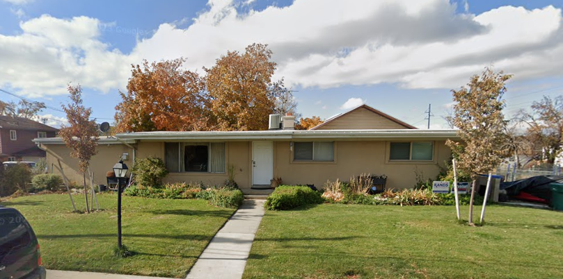 Total Photos: 1
|
| |
|
|
| Property Address: 1089 N 900 WEST - OREM |
|
| Mailing Address: 1089 N 900 W OREM, UT 84057-3062 |
|
| Acreage: 0.43 |
|
| Last Document:
33762-2009
|
|
| Subdivision Map Filing |
|
| Taxing Description:
COM S 89-45'23" ALONG SEC LINE 688.60 FT & S 766.10 FT FR NE COR SEC 9, T6S, R2E, SLM; S 11'39"E 16 FT; N 89-38'24"E 9.55 FT; S 41'37"E 93.96 FT; S 89-18'29"W 198.72 FT; N 11'39"W 111.03 FT; N 89-37"E ALONG PLAT A, SOFFE SUB 188.35 FT TO BEG. AREA .43 ACRE.
*Taxing description NOT FOR LEGAL DOCUMENTS
|
|
- Owner Names
- Value History
- Tax History
- Location
- Photos
- Documents
- Aerial Image
| 2010... |
|
WEBB, GARY L |
|
| 2010... |
|
WEBB, SHELLEY J |
|
| 2010NV |
|
WEBB, GARY L |
|
| 2010NV |
|
WEBB, SHELLEY J |
|
| 2009 |
|
WEBB, GARY L |
|
| 2009 |
|
WEBB, SHELLEY J |
|
| 1995-2008 |
|
WEBB, GARY LLOYD |
|
| 1995-2008 |
|
WEBB, SHELLEY J |
|
| 1988-1994 |
|
SOFFE, DIANE FINCH |
|
| 1988-1994 |
|
SOFFE, MARK S |
|
| 1987 |
|
SOFFE, KENNETH S |
|
| 1987 |
|
SOFFE, MARGARET R |
|
| 1981-1986 |
|
SOFFE, KENNETH S |
|
| 1981-1986 |
|
SOFFE, MARGARET R |
|
| |
----- Real Estate Values ----- |
---Improvements--- |
---Greenbelt--- |
Total |
| Year |
Com |
Res |
Agr |
Tot |
Com |
Res |
Agr |
Tot |
Land |
Homesite |
Tot |
Market Value |
| 2024 |
$0 |
$221,500 |
$0 |
$221,500 |
$0 |
$275,700 |
$0 |
$275,700 |
$0 |
$0 |
$0 |
$497,200 |
| 2023 |
$0 |
$221,400 |
$0 |
$221,400 |
$0 |
$283,100 |
$0 |
$283,100 |
$0 |
$0 |
$0 |
$504,500 |
| 2022 |
$0 |
$236,100 |
$0 |
$236,100 |
$0 |
$241,200 |
$0 |
$241,200 |
$0 |
$0 |
$0 |
$477,300 |
| 2021 |
$0 |
$181,600 |
$0 |
$181,600 |
$0 |
$188,400 |
$0 |
$188,400 |
$0 |
$0 |
$0 |
$370,000 |
| 2020 |
$0 |
$145,300 |
$0 |
$145,300 |
$0 |
$184,700 |
$0 |
$184,700 |
$0 |
$0 |
$0 |
$330,000 |
| 2019 |
$0 |
$145,300 |
$0 |
$145,300 |
$0 |
$163,000 |
$0 |
$163,000 |
$0 |
$0 |
$0 |
$308,300 |
| 2018 |
$0 |
$132,900 |
$0 |
$132,900 |
$0 |
$158,000 |
$0 |
$158,000 |
$0 |
$0 |
$0 |
$290,900 |
| 2017 |
$0 |
$124,600 |
$0 |
$124,600 |
$0 |
$155,900 |
$0 |
$155,900 |
$0 |
$0 |
$0 |
$280,500 |
| 2016 |
$0 |
$99,700 |
$0 |
$99,700 |
$0 |
$151,600 |
$0 |
$151,600 |
$0 |
$0 |
$0 |
$251,300 |
| 2015 |
$0 |
$87,200 |
$0 |
$87,200 |
$0 |
$137,000 |
$0 |
$137,000 |
$0 |
$0 |
$0 |
$224,200 |
| 2014 |
$0 |
$80,600 |
$0 |
$80,600 |
$0 |
$137,000 |
$0 |
$137,000 |
$0 |
$0 |
$0 |
$217,600 |
| 2013 |
$0 |
$55,900 |
$0 |
$55,900 |
$0 |
$137,000 |
$0 |
$137,000 |
$0 |
$0 |
$0 |
$192,900 |
| 2012 |
$0 |
$58,300 |
$0 |
$58,300 |
$0 |
$115,700 |
$0 |
$115,700 |
$0 |
$0 |
$0 |
$174,000 |
| 2011 |
$0 |
$62,000 |
$0 |
$62,000 |
$0 |
$117,400 |
$0 |
$117,400 |
$0 |
$0 |
$0 |
$179,400 |
| 2010 |
$0 |
$68,953 |
$0 |
$68,953 |
$0 |
$121,691 |
$0 |
$121,691 |
$0 |
$0 |
$0 |
$190,644 |
| 2009 |
$0 |
$80,800 |
$0 |
$80,800 |
$0 |
$115,700 |
$0 |
$115,700 |
$0 |
$0 |
$0 |
$196,500 |
| 2008 |
$0 |
$106,300 |
$0 |
$106,300 |
$0 |
$114,500 |
$0 |
$114,500 |
$0 |
$0 |
$0 |
$220,800 |
| 2007 |
$0 |
$110,700 |
$0 |
$110,700 |
$0 |
$156,500 |
$0 |
$156,500 |
$0 |
$0 |
$0 |
$267,200 |
| 2006 |
$0 |
$55,900 |
$0 |
$55,900 |
$0 |
$119,900 |
$0 |
$119,900 |
$0 |
$0 |
$0 |
$175,800 |
| 2005 |
$0 |
$53,231 |
$0 |
$53,231 |
$0 |
$114,220 |
$0 |
$114,220 |
$0 |
$0 |
$0 |
$167,451 |
| 2004 |
$0 |
$53,231 |
$0 |
$53,231 |
$0 |
$114,220 |
$0 |
$114,220 |
$0 |
$0 |
$0 |
$167,451 |
| 2003 |
$0 |
$53,231 |
$0 |
$53,231 |
$0 |
$114,220 |
$0 |
$114,220 |
$0 |
$0 |
$0 |
$167,451 |
| 2002 |
$0 |
$53,231 |
$0 |
$53,231 |
$0 |
$114,220 |
$0 |
$114,220 |
$0 |
$0 |
$0 |
$167,451 |
| 2001 |
$0 |
$53,231 |
$0 |
$53,231 |
$0 |
$114,220 |
$0 |
$114,220 |
$0 |
$0 |
$0 |
$167,451 |
| 2000 |
$0 |
$49,749 |
$0 |
$49,749 |
$0 |
$106,798 |
$0 |
$106,798 |
$0 |
$0 |
$0 |
$156,547 |
| 1999 |
$0 |
$46,494 |
$0 |
$46,494 |
$0 |
$99,811 |
$0 |
$99,811 |
$0 |
$0 |
$0 |
$146,305 |
| 1998 |
$0 |
$46,494 |
$0 |
$46,494 |
$0 |
$99,811 |
$0 |
$99,811 |
$0 |
$0 |
$0 |
$146,305 |
| 1997 |
$0 |
$46,494 |
$0 |
$46,494 |
$0 |
$99,811 |
$0 |
$99,811 |
$0 |
$0 |
$0 |
$146,305 |
| 1996 |
$0 |
$40,770 |
$0 |
$40,770 |
$0 |
$87,523 |
$0 |
$87,523 |
$0 |
$0 |
$0 |
$128,293 |
| 1995 |
$0 |
$37,064 |
$0 |
$37,064 |
$0 |
$87,523 |
$0 |
$87,523 |
$0 |
$0 |
$0 |
$124,587 |
| 1994 |
$0 |
$21,675 |
$0 |
$21,675 |
$0 |
$70,583 |
$0 |
$70,583 |
$0 |
$0 |
$0 |
$92,258 |
| 1993 |
$0 |
$21,675 |
$0 |
$21,675 |
$0 |
$70,583 |
$0 |
$70,583 |
$0 |
$0 |
$0 |
$92,258 |
| 1992 |
$0 |
$19,885 |
$0 |
$19,885 |
$0 |
$64,755 |
$0 |
$64,755 |
$0 |
$0 |
$0 |
$84,640 |
| 1991 |
$0 |
$17,443 |
$0 |
$17,443 |
$0 |
$58,959 |
$0 |
$58,959 |
$0 |
$0 |
$0 |
$76,402 |
| 1990 |
$0 |
$17,443 |
$0 |
$17,443 |
$0 |
$58,959 |
$0 |
$58,959 |
$0 |
$0 |
$0 |
$76,402 |
| 1989 |
$0 |
$17,443 |
$0 |
$17,443 |
$0 |
$58,959 |
$0 |
$58,959 |
$0 |
$0 |
$0 |
$76,402 |
| 1988 |
$0 |
$17,443 |
$0 |
$17,443 |
$0 |
$61,950 |
$0 |
$61,950 |
$0 |
$0 |
$0 |
$79,393 |
| 1987 |
$0 |
$17,983 |
$0 |
$17,983 |
$0 |
$63,867 |
$0 |
$63,867 |
$0 |
$0 |
$0 |
$81,850 |
| 1986 |
$0 |
$17,984 |
$0 |
$17,984 |
$0 |
$46,143 |
$0 |
$46,143 |
$0 |
$0 |
$0 |
$64,127 |
| 1985 |
$0 |
$17,983 |
$0 |
$17,983 |
$0 |
$46,141 |
$0 |
$46,141 |
$0 |
$0 |
$0 |
$64,124 |
| 1984 |
$0 |
$18,167 |
$0 |
$18,167 |
$0 |
$46,608 |
$0 |
$46,608 |
$0 |
$0 |
$0 |
$64,775 |
| Year |
General Taxes |
Adjustments |
Net Taxes |
Fees |
Payments |
Tax Balance* |
Balance Due |
Tax District |
| 2025 |
$0.00 |
$0.00 |
$0.00 |
$0.00 |
|
$0.00
|
$0.00 |
090 - OREM CITY |
| 2024 |
$2,236.36 |
$0.00 |
$2,236.36 |
$0.00 |
|
$0.00
|
$0.00 |
090 - OREM CITY |
| 2023 |
$2,111.31 |
$0.00 |
$2,111.31 |
$0.00 |
|
$0.00
|
$0.00 |
090 - OREM CITY |
| 2022 |
$2,061.79 |
$0.00 |
$2,061.79 |
$0.00 |
|
$0.00
|
$0.00 |
090 - OREM CITY |
| 2021 |
$1,918.60 |
$0.00 |
$1,918.60 |
$0.00 |
|
$0.00
|
$0.00 |
090 - OREM CITY |
| 2020 |
$1,741.13 |
$0.00 |
$1,741.13 |
$0.00 |
|
$0.00
|
$0.00 |
090 - OREM CITY |
| 2019 |
$1,564.24 |
$0.00 |
$1,564.24 |
$0.00 |
|
$0.00
|
$0.00 |
090 - OREM CITY |
| 2018 |
$1,544.75 |
$0.00 |
$1,544.75 |
$0.00 |
|
$0.00
|
$0.00 |
090 - OREM CITY |
| 2017 |
$1,529.33 |
$0.00 |
$1,529.33 |
$0.00 |
|
$0.00
|
$0.00 |
090 - OREM CITY |
| 2016 |
$1,485.81 |
$0.00 |
$1,485.81 |
$0.00 |
|
$0.00
|
$0.00 |
090 - OREM CITY |
| 2015 |
$1,401.66 |
$0.00 |
$1,401.66 |
$0.00 |
|
$0.00
|
$0.00 |
090 - OREM CITY |
| 2014 |
$1,366.63 |
$0.00 |
$1,366.63 |
$0.00 |
|
$0.00
|
$0.00 |
090 - OREM CITY |
| 2013 |
$1,306.45 |
$0.00 |
$1,306.45 |
$0.00 |
|
$0.00
|
$0.00 |
090 - OREM CITY |
| 2012 |
$1,202.76 |
$0.00 |
$1,202.76 |
$0.00 |
|
$0.00
|
$0.00 |
090 - OREM CITY |
| 2011 |
$1,234.16 |
$0.00 |
$1,234.16 |
$0.00 |
|
$0.00
|
$0.00 |
090 - OREM CITY |
| 2010 |
$1,227.84 |
$0.00 |
$1,227.84 |
$0.00 |
|
$0.00
|
$0.00 |
090 - OREM CITY |
| 2009 |
$1,173.15 |
$0.00 |
$1,173.15 |
$0.00 |
|
$0.00
|
$0.00 |
090 - OREM CITY |
| 2008 |
$1,221.56 |
$0.00 |
$1,221.56 |
$0.00 |
|
$0.00
|
$0.00 |
090 - OREM CITY |
| 2007 |
$1,461.37 |
($203.45) |
$1,257.92 |
$0.00 |
|
$0.00
|
$0.00 |
090 - OREM CITY |
| 2006 |
$1,023.85 |
$0.00 |
$1,023.85 |
$0.00 |
|
$0.00
|
$0.00 |
090 - OREM CITY |
| 2005 |
$1,100.76 |
$0.00 |
$1,100.76 |
$0.00 |
|
$0.00
|
$0.00 |
090 - OREM CITY |
| 2004 |
$1,081.23 |
$0.00 |
$1,081.23 |
$0.00 |
|
$0.00
|
$0.00 |
090 - OREM CITY |
| 2003 |
$1,049.18 |
$0.00 |
$1,049.18 |
$0.00 |
|
$0.00
|
$0.00 |
090 - OREM CITY |
| 2002 |
$958.83 |
$0.00 |
$958.83 |
$0.00 |
|
$0.00
|
$0.00 |
090 - OREM CITY |
| 2001 |
$949.62 |
$0.00 |
$949.62 |
$0.00 |
|
$0.00
|
$0.00 |
090 - OREM CITY |
| 2000 |
$917.92 |
$0.00 |
$917.92 |
$0.00 |
|
$0.00
|
$0.00 |
090 - OREM CITY |
| 1999 |
$883.22 |
$0.00 |
$883.22 |
$0.00 |
|
$0.00
|
$0.00 |
090 - OREM CITY |
| 1998 |
$833.97 |
$0.00 |
$833.97 |
$0.00 |
|
$0.00
|
$0.00 |
090 - OREM CITY |
| 1997 |
$830.51 |
$0.00 |
$830.51 |
$0.00 |
|
$0.00
|
$0.00 |
090 - OREM CITY |
| 1996 |
$665.33 |
$0.00 |
$665.33 |
$0.00 |
|
$0.00
|
$0.00 |
090 - OREM CITY |
| 1995 |
$731.14 |
$0.00 |
$731.14 |
$0.00 |
|
$0.00
|
$0.00 |
090 - OREM CITY |
| 1994 |
$862.61 |
$0.00 |
$862.61 |
$0.00 |
|
$0.00
|
$0.00 |
090 - OREM CITY |
| 1993 |
$763.42 |
$0.00 |
$763.42 |
$0.00 |
|
$0.00
|
$0.00 |
090 - OREM CITY |
| 1992 |
$706.14 |
$0.00 |
$706.14 |
$0.00 |
|
$0.00
|
$0.00 |
090 - OREM CITY |
| 1991 |
$666.43 |
$0.00 |
$666.43 |
$0.00 |
|
$0.00
|
$0.00 |
090 - OREM CITY |
| 1990 |
$640.63 |
$0.00 |
$640.63 |
$0.00 |
|
$0.00
|
$0.00 |
090 - OREM CITY |
| 1989 |
$652.91 |
$0.00 |
$652.91 |
$0.00 |
|
$0.00
|
$0.00 |
090 - OREM CITY |
| 1988 |
$676.86 |
$0.00 |
$676.86 |
$0.00 |
|
$0.00
|
$0.00 |
090 - OREM CITY |
| 1987 |
$686.26 |
$0.00 |
$686.26 |
$0.00 |
|
$0.00
|
$0.00 |
090 - OREM CITY |
| 1986 |
$530.42 |
$0.00 |
$530.42 |
$0.00 |
|
$0.00
|
$0.00 |
090 - OREM CITY |
| 1985 |
$533.57 |
$0.00 |
$533.57 |
$0.00 |
|
$0.00
|
$0.00 |
090 - OREM CITY |
| 1984 |
$528.64 |
$0.00 |
$528.64 |
$0.00 |
|
$0.00
|
$0.00 |
090 - OREM CITY |
* Note: Original tax amount (Does not include applicable interest and/or fees).
| Entry # |
Date |
Recorded |
Type |
Party1 (Grantor) |
Party2 (Grantee) |
| 62504-2021 |
04/01/2021 |
04/02/2021 |
RSUBTEE |
MORTGAGE ELECTRONIC REGISTRATION SYSTEMS INC (ET AL) |
WEBB, GARY L & SHELLEY J |
| 66425-2014 |
09/16/2014 |
09/17/2014 |
WD |
BALLEW, KARA |
ZOOBIE INVESTMENTS LLC |
| 105334-2013 |
10/22/2013 |
11/14/2013 |
AS |
MORTGAGE ELECTRONIC REGISTRATION SYSTEMS INC |
U S BANK NATIONAL ASSOCIATION |
| 101779-2012 |
11/16/2012 |
11/20/2012 |
D TR |
BALLEW, KARA & JEFFREY D |
U S BANK |
| 78565-2009 |
06/30/2009 |
07/17/2009 |
REC |
RIVERS, ROD TEE |
WEBB, GARY LLOYD & SHELLEY J |
| 78564-2009 |
06/11/2009 |
07/17/2009 |
SUB TEE |
CITICORP TRUST BANK |
RIVERS, ROD SUCTEE |
| 33764-2009 |
03/26/2009 |
03/31/2009 |
SP WD |
WEBB, GARY L & SHELLEY J |
WEBB, GARY L & SHELLEY J TEE |
| 33763-2009 |
03/26/2009 |
03/31/2009 |
D TR |
WEBB, GARY L & SHELLEY J |
PROVIDENT FUNDING ASSOCIATES LP |
| 33762-2009 |
03/26/2009 |
03/31/2009 |
SP WD |
WEBB, GARY L & SHELLEY J TEE (ET AL) |
WEBB, GARY L & SHELLEY J |
| 23242-2008 |
02/22/2008 |
02/28/2008 |
WD |
WEBB, GARY LLOYD & SHELLEY J |
WEBB, GARY L & SHELLEY J TEE |
| 39040-2005 |
03/07/2005 |
04/13/2005 |
EAS |
DUNN, CARRIE |
CITY OF OREM |
| 39039-2005 |
03/07/2005 |
04/13/2005 |
QCD |
DUNN, CARRIE |
CITY OF OREM THE |
| 172155-2003 |
08/27/2003 |
10/27/2003 |
REC |
ZIONS FIRST NATIONAL BANK TEE |
WEBB, GARY LLOYD & SHELLEY J |
| 156678-2003 |
09/02/2003 |
09/25/2003 |
RSUBTEE |
CHASE MANHATTAN MORTGAGE CORPORATION (ET AL) |
WEBB, GARY LLOYD & SHELLEY J |
| 122743-2003 |
07/31/2003 |
08/05/2003 |
D TR |
WEBB, GARY LLOYD & SHELLEY J |
CITICORP TRUST BANK |
| 109881-2002 |
09/09/2002 |
09/19/2002 |
REC |
FIDELITY NATIONAL TITLE INSURANCE CO TEE |
GLEASON, BETTY O |
| 109880-2002 |
08/27/2002 |
09/19/2002 |
SUB TEE |
FLEET NATIONAL BANK |
FIDELITY NATIONAL TITLE INSURANCE CO SUCTEE |
| 87527-2001 |
07/19/2001 |
08/30/2001 |
REC |
WELLS FARGO FINANCIAL NATIONAL BANK TEE |
GLEASON, TOM A & BETTY O |
| 87526-2001 |
07/19/2001 |
08/30/2001 |
SUB TEE |
FIRST SECURITY BANK |
WELLS FARGO FINANCIAL NATIONAL BANK SUCTEE |
| 30207-2001 |
03/16/2001 |
04/02/2001 |
D TR |
WEBB, GARY LLOYD & SHELLEY J |
ZIONS FIRST NATIONAL BANK |
| 52214-1999 |
02/08/1999 |
05/05/1999 |
AS |
IRWIN MORTGAGE CORPORATION FKA (ET AL) |
CHASE MANHATTAN MORTGAGE CORPORATION |
| 89780-1998 |
08/26/1998 |
09/03/1998 |
REC |
ROBINSON, BRYAN C TEE |
WEBB, GARY LLOYD & SHELLEY J |
| 89779-1998 |
08/13/1998 |
09/03/1998 |
SUB TEE |
HOMESIDE LENDING INC SUC TO (ET AL) |
ROBINSON, BRYAN C SUCTEE |
| 75889-1998 |
07/16/1998 |
07/30/1998 |
REC |
BANK ONE FKA (ET AL) |
WEBB, GARY LLOYD & SHELLEY J |
| 68831-1998 |
07/02/1998 |
07/09/1998 |
D TR |
WEBB, GARY LLOYD & SHELLEY J |
IRWIN MORTGAGE CORPORATION |
| 26048-1998 |
03/13/1998 |
03/18/1998 |
REC |
MOUNTAIN WEST TITLE CO TEE |
SOFFE, MARK S & DIANE F |
| 26047-1998 |
03/05/1998 |
03/18/1998 |
SUB TEE |
NEBO CREDIT UNION |
MOUNTAIN WEST TITLE CO SUCTEE |
| 14407-1995 |
08/15/1994 |
03/09/1995 |
AS |
MEDALLION MORTGAGE COMPANY INC |
BANCPLUS MORTGAGE CORP |
| 96034-1994 |
11/23/1994 |
12/22/1994 |
RC |
BANK ONE |
WHOM OF INTEREST |
| 93316-1994 |
11/17/1994 |
12/09/1994 |
D TR |
WEBB, GARY LLOYD & SHELLY J |
BANK ONE |
| 50238-1994 |
05/09/1994 |
06/16/1994 |
REC |
ZIONS FIRST NATIONAL BANK TEE |
SOFFE, MARK S & DIANE FINCH |
| 30193-1994 |
04/08/1994 |
04/11/1994 |
D TR |
WEBB, GARY LLOYD & SHELLEY J |
MEDALLION MORTGAGE COMPANY |
| 30192-1994 |
04/11/1994 |
04/11/1994 |
WD |
SOFFE, MARK S & DIANE FINCH |
WEBB, GARY LLOYD & SHELLEY J |
| 38848-1992 |
07/29/1992 |
08/03/1992 |
D TR |
SOFFE, MARK S & DIANE FINCH |
ZIONS FIRST NATIONAL BANK |
| 14218-1991 |
04/19/1991 |
04/19/1991 |
REC |
VALLEY TITLE COMPANY BY (ET AL) |
SOFFE, MARK S & DIANE F (ET AL) |
| 14217-1991 |
04/15/1991 |
04/19/1991 |
TR D |
SOFFE, DIANE F & MARK S |
NEBO CREDIT UNION |
| 33684-1989 |
10/24/1989 |
11/06/1989 |
TR D |
SOFFE, DIANE F & MARK S |
NEBO CREDIT UNION |
| 38819-1988 |
12/20/1988 |
12/21/1988 |
REC |
VALLEY TITLE COMPANY BY (ET AL) |
SOFFE, MARK S & DIANE FINCH |
| 21620-1988 |
10/23/1986 |
07/27/1988 |
QCD |
SOFFE, KENNETH S & MARGARET R TEE (ET AL) |
SOFFE, MARGARET R TEE |
| 17483-1987 |
04/28/1987 |
05/05/1987 |
TR D |
SOFFE, MARK S & DIANE FINCH |
NEBO CREDIT UNION |
| 17482-1987 |
04/28/1987 |
05/05/1987 |
WD |
SOFFE, KENNETH S & MARGARET R TEE |
SOFFE, MARK S & DIANE FINCH |
| 15888-1987 |
04/24/1987 |
04/24/1987 |
QCD |
JOHNSON BROTHERS CONSTRUCTION CO BY (ET AL) |
SOFFE, KENNETH S & MARGARET TEE |
| 3457-1987 |
01/28/1987 |
01/29/1987 |
D TR |
HARWARD, JUD & MARSHA J |
CENTRAL BANK & TRUST COMPANY |
| 36176-1986 |
10/20/1986 |
10/22/1986 |
QCD |
SOFFE, KENNETH S & MARGARET R |
SOFFE, KENNETH S & MARGARET R TEE |
| 20238-1985 |
07/17/1985 |
07/17/1985 |
QCD |
SOFFE, MARK S & DIANE F |
SOFFE, KENNETH S & MARGARET R |
| 6353-1983 |
08/01/1981 |
03/08/1983 |
CN |
SOFFE, KENNETH S & MARGARET R |
SOFFE, MARK S & DIANE F |
| 10312-1982 |
03/31/1982 |
04/26/1982 |
REC |
BANK OF AMERICAN FORK TEE |
SOFFE, KENNETH S & MARGARET R (ET AL) |
| 27197-1981 |
09/11/1981 |
09/16/1981 |
TR D |
SOFFE, KENNETH S & MARGARET R (ET AL) |
BANK OF AMERICAN FORK |
| 25584-1981 |
08/27/1981 |
09/01/1981 |
REC |
WASATCH BANK TEE |
MC DERMOTT, THOMAS P & HELEN M |
| 22017-1981 |
07/28/1981 |
07/30/1981 |
REC |
WASATCH BANK TEE |
MC DERMOTT, THOMAS P & HELEN M |
| 44716-1980 |
12/30/1980 |
12/31/1980 |
WD |
SOFFE, KENNETH S & MARGARET R |
SOFFE, KENNETH S & MARGARET R |
| 44715-1980 |
11/26/1980 |
12/31/1980 |
QCD |
MC DERMOTT, THOMAS P & HELEN M |
SOFFE, KENNETH S & MARGARET R |
| 38665-1980 |
10/06/1980 |
11/06/1980 |
TR D |
MC DERMOTT, THOMAS P & HELEN M |
WASATCH BANK |
| 38664-1980 |
10/08/1980 |
11/06/1980 |
WD |
SOFFE, KENNETH S & MARGARET R |
MCDERMOTT, THOMAS P & HELEN M |
| 38663-1980 |
10/08/1980 |
11/06/1980 |
QCD |
JOHNSON, ROBERT N & RICHARD J (ET AL) |
SOFFE, KENNETH S & MARGARET |
| 37966-1980 |
05/27/1980 |
10/31/1980 |
S PLAT |
SOFFE, KENNETH S & MARGARET R (ET AL) |
POPLAR WOODS PLAT A |
Main Menu Comments or Concerns on Value/Appraisal - Assessor's Office
Documents/Owner/Parcel information - Recorder's Office
Address Change for Tax Notice
This page was created on 4/23/2025 2:03:59 PM |