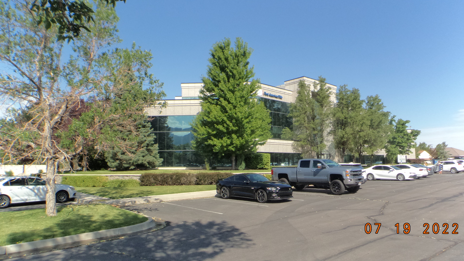
Property Information
mobile view
| Serial Number: 53:478:0101 |
Serial Life: 2013... |
|
|
 Total Photos: 7
|
| |
|
|
| Property Address: 578 S STATE ST - OREM |
|
| Mailing Address: 733 NORTHAMPTON DR PALO ALTO, CA 94303 |
|
| Acreage: 0.107246 |
|
| Last Document:
35615-2016
|
|
| Subdivision Map Filing |
|
| Taxing Description:
UNIT 101, TROON PARK OFFICE CONDOS. AREA 0.107 AC.
*Taxing description NOT FOR LEGAL DOCUMENTS
|
|
- Owner Names
- Value History
- Tax History
- Location
- Photos
- Documents
- Aerial Image
| |
----- Real Estate Values ----- |
---Improvements--- |
---Greenbelt--- |
Total |
| Year |
Com |
Res |
Agr |
Tot |
Com |
Res |
Agr |
Tot |
Land |
Homesite |
Tot |
Market Value |
| 2024 |
$167,400 |
$0 |
$0 |
$167,400 |
$932,100 |
$0 |
$0 |
$932,100 |
$0 |
$0 |
$0 |
$1,099,500 |
| 2023 |
$164,100 |
$0 |
$0 |
$164,100 |
$913,800 |
$0 |
$0 |
$913,800 |
$0 |
$0 |
$0 |
$1,077,900 |
| 2022 |
$164,100 |
$0 |
$0 |
$164,100 |
$698,200 |
$0 |
$0 |
$698,200 |
$0 |
$0 |
$0 |
$862,300 |
| 2021 |
$164,100 |
$0 |
$0 |
$164,100 |
$698,200 |
$0 |
$0 |
$698,200 |
$0 |
$0 |
$0 |
$862,300 |
| 2020 |
$164,100 |
$0 |
$0 |
$164,100 |
$698,200 |
$0 |
$0 |
$698,200 |
$0 |
$0 |
$0 |
$862,300 |
| 2019 |
$164,100 |
$0 |
$0 |
$164,100 |
$698,200 |
$0 |
$0 |
$698,200 |
$0 |
$0 |
$0 |
$862,300 |
| 2018 |
$164,100 |
$0 |
$0 |
$164,100 |
$698,200 |
$0 |
$0 |
$698,200 |
$0 |
$0 |
$0 |
$862,300 |
| 2017 |
$164,100 |
$0 |
$0 |
$164,100 |
$698,200 |
$0 |
$0 |
$698,200 |
$0 |
$0 |
$0 |
$862,300 |
| 2016 |
$164,100 |
$0 |
$0 |
$164,100 |
$671,300 |
$0 |
$0 |
$671,300 |
$0 |
$0 |
$0 |
$835,400 |
| 2015 |
$164,100 |
$0 |
$0 |
$164,100 |
$671,300 |
$0 |
$0 |
$671,300 |
$0 |
$0 |
$0 |
$835,400 |
| 2014 |
$164,100 |
$0 |
$0 |
$164,100 |
$644,300 |
$0 |
$0 |
$644,300 |
$0 |
$0 |
$0 |
$808,400 |
| 2013 |
$164,100 |
$0 |
$0 |
$164,100 |
$482,600 |
$0 |
$0 |
$482,600 |
$0 |
$0 |
$0 |
$646,700 |
| Year |
General Taxes |
Adjustments |
Net Taxes |
Fees |
Payments |
Tax Balance* |
Balance Due |
Tax District |
| 2025 |
$0.00 |
$0.00 |
$0.00 |
$0.00 |
|
$0.00
|
$0.00 |
090 - OREM CITY |
| 2024 |
$8,991.71 |
$0.00 |
$8,991.71 |
$0.00 |
|
$0.00
|
$0.00 |
090 - OREM CITY |
| 2023 |
$8,201.74 |
$0.00 |
$8,201.74 |
$0.00 |
|
$0.00
|
$0.00 |
090 - OREM CITY |
| 2022 |
$6,772.50 |
$0.00 |
$6,772.50 |
$0.00 |
|
$0.00
|
$0.00 |
090 - OREM CITY |
| 2021 |
$8,129.76 |
$0.00 |
$8,129.76 |
$0.00 |
|
$0.00
|
$0.00 |
090 - OREM CITY |
| 2020 |
$8,272.04 |
$0.00 |
$8,272.04 |
$0.00 |
|
$0.00
|
$0.00 |
090 - OREM CITY |
| 2019 |
$7,954.72 |
$0.00 |
$7,954.72 |
$0.00 |
|
$0.00
|
$0.00 |
090 - OREM CITY |
| 2018 |
$8,325.51 |
$0.00 |
$8,325.51 |
$0.00 |
|
$0.00
|
$0.00 |
090 - OREM CITY |
| 2017 |
$8,547.98 |
$0.00 |
$8,547.98 |
$0.00 |
|
$0.00
|
$0.00 |
090 - OREM CITY |
| 2016 |
$8,980.55 |
$0.00 |
$8,980.55 |
$0.00 |
|
$0.00
|
$0.00 |
090 - OREM CITY |
| 2015 |
$9,495.99 |
$0.00 |
$9,495.99 |
$0.00 |
|
$0.00
|
$0.00 |
090 - OREM CITY |
| 2014 |
$9,231.12 |
$0.00 |
$9,231.12 |
$0.00 |
|
$0.00
|
$0.00 |
090 - OREM CITY |
| 2013 |
$7,963.46 |
$0.00 |
$7,963.46 |
$0.00 |
|
$0.00
|
$0.00 |
090 - OREM CITY |
* Note: Original tax amount (Does not include applicable interest and/or fees).
| Entry # |
Date |
Recorded |
Type |
Party1 (Grantor) |
Party2 (Grantee) |
| 35615-2016 |
04/19/2016 |
04/25/2016 |
WD |
JESSUP OREM REALTY LLC |
HESSUP, HOLDEN D & ADELE K TEE (ET AL) |
| 108293-2015 |
12/01/2015 |
12/02/2015 |
D TR |
JESSUP OREM REALTY LLC (ET AL) |
WELLS FARGO BANK |
| 108292-2015 |
12/02/2015 |
12/02/2015 |
WD |
BANKHEAD LEAVER LC |
JESSUP OREM REALTY LLC 60%INT (ET AL) |
| 40344-2012 |
03/09/2012 |
05/15/2012 |
DECLCON |
BANKHEAD LEAVER LC |
WHOM OF INTEREST |
| 40343-2012 |
04/24/2012 |
05/15/2012 |
C PLAT |
BANKHEAD LEAVER LC |
TROON PARK OFFICE CONDOMINIUMS |
Main Menu Comments or Concerns on Value/Appraisal - Assessor's Office
Documents/Owner/Parcel information - Recorder's Office
Address Change for Tax Notice
This page was created on 12/22/2024 3:07:07 PM |
