Property Information
mobile view
| Serial Number: 55:306:0001 |
Serial Life: 1995NV |
|
|
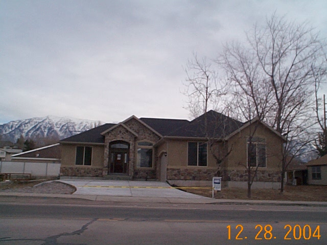
Total Photos: 1
|
| |
|
|
| Property Address: 355 S 1200 WEST - OREM |
|
| Mailing Address: 1194 W 400 S OREM, UT 84058-5838 |
|
| Acreage: 0.448 |
|
| Last Document:
10000-1994
|
|
| Subdivision Map Filing |
|
| Taxing Description:
LOT 1, PLAT G, WESTLAKE SUBDV. AREA 0.448 AC.
*Taxing description NOT FOR LEGAL DOCUMENTS
|
|
- Owner Names
- Value History
- Tax History
- Location
- Photos
- Documents
- Aerial Image
Main Menu Comments or Concerns on Value/Appraisal - Assessor's Office
Documents/Owner/Parcel information - Recorder's Office
Address Change for Tax Notice
This page was created on 7/23/2024 9:14:15 PM |