Property Information
mobile view
| Serial Number: 55:687:0014 |
Serial Life: 2008... |
|
|
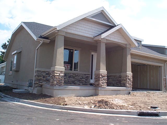 Total Photos: 1
|
| |
|
|
| Property Address: 1573 S 705 EAST - OREM |
|
| Mailing Address: 1049 E 590 S OREM, UT 84097-6679 |
|
| Acreage: 0.051 |
|
| Last Document:
22839-2023
|
|
| Subdivision Map Filing |
|
| Taxing Description:
LOT 14, PLAT B, WHISTLER RIDGE PRD SUBDV. AREA 0.051 AC.
*Taxing description NOT FOR LEGAL DOCUMENTS
|
|
- Owner Names
- Value History
- Tax History
- Location
- Photos
- Documents
- Aerial Image
| |
----- Real Estate Values ----- |
---Improvements--- |
---Greenbelt--- |
Total |
| Year |
Com |
Res |
Agr |
Tot |
Com |
Res |
Agr |
Tot |
Land |
Homesite |
Tot |
Market Value |
| 2024 |
$0 |
$95,600 |
$0 |
$95,600 |
$0 |
$358,700 |
$0 |
$358,700 |
$0 |
$0 |
$0 |
$454,300 |
| 2023 |
$0 |
$79,700 |
$0 |
$79,700 |
$0 |
$393,900 |
$0 |
$393,900 |
$0 |
$0 |
$0 |
$473,600 |
| 2022 |
$0 |
$85,000 |
$0 |
$85,000 |
$0 |
$394,200 |
$0 |
$394,200 |
$0 |
$0 |
$0 |
$479,200 |
| 2021 |
$0 |
$85,000 |
$0 |
$85,000 |
$0 |
$278,000 |
$0 |
$278,000 |
$0 |
$0 |
$0 |
$363,000 |
| 2020 |
$0 |
$85,000 |
$0 |
$85,000 |
$0 |
$251,100 |
$0 |
$251,100 |
$0 |
$0 |
$0 |
$336,100 |
| 2019 |
$0 |
$85,000 |
$0 |
$85,000 |
$0 |
$220,000 |
$0 |
$220,000 |
$0 |
$0 |
$0 |
$305,000 |
| 2018 |
$0 |
$85,000 |
$0 |
$85,000 |
$0 |
$197,900 |
$0 |
$197,900 |
$0 |
$0 |
$0 |
$282,900 |
| 2017 |
$0 |
$85,000 |
$0 |
$85,000 |
$0 |
$197,900 |
$0 |
$197,900 |
$0 |
$0 |
$0 |
$282,900 |
| 2016 |
$0 |
$58,000 |
$0 |
$58,000 |
$0 |
$172,100 |
$0 |
$172,100 |
$0 |
$0 |
$0 |
$230,100 |
| 2015 |
$0 |
$55,000 |
$0 |
$55,000 |
$0 |
$163,900 |
$0 |
$163,900 |
$0 |
$0 |
$0 |
$218,900 |
| 2014 |
$0 |
$40,000 |
$0 |
$40,000 |
$0 |
$159,000 |
$0 |
$159,000 |
$0 |
$0 |
$0 |
$199,000 |
| 2013 |
$0 |
$40,000 |
$0 |
$40,000 |
$0 |
$159,000 |
$0 |
$159,000 |
$0 |
$0 |
$0 |
$199,000 |
| 2012 |
$0 |
$45,000 |
$0 |
$45,000 |
$0 |
$144,000 |
$0 |
$144,000 |
$0 |
$0 |
$0 |
$189,000 |
| 2011 |
$0 |
$45,000 |
$0 |
$45,000 |
$0 |
$144,000 |
$0 |
$144,000 |
$0 |
$0 |
$0 |
$189,000 |
| 2010 |
$0 |
$45,000 |
$0 |
$45,000 |
$0 |
$174,220 |
$0 |
$174,220 |
$0 |
$0 |
$0 |
$219,220 |
| 2009 |
$0 |
$45,000 |
$0 |
$45,000 |
$0 |
$181,000 |
$0 |
$181,000 |
$0 |
$0 |
$0 |
$226,000 |
| 2008 |
$0 |
$45,000 |
$0 |
$45,000 |
$0 |
$195,604 |
$0 |
$195,604 |
$0 |
$0 |
$0 |
$240,604 |
| Year |
General Taxes |
Adjustments |
Net Taxes |
Fees |
Payments |
Tax Balance* |
Balance Due |
Tax District |
| 2025 |
$0.00 |
$0.00 |
$0.00 |
$0.00 |
|
$0.00
|
$0.00 |
090 - OREM CITY |
| 2024 |
$2,043.40 |
$0.00 |
$2,043.40 |
$0.00 |
|
$0.00
|
$0.00 |
090 - OREM CITY |
| 2023 |
$1,981.99 |
$0.00 |
$1,981.99 |
$0.00 |
|
$0.00
|
$0.00 |
090 - OREM CITY |
| 2022 |
$2,070.00 |
$0.00 |
$2,070.00 |
$0.00 |
|
$0.00
|
$0.00 |
090 - OREM CITY |
| 2021 |
$1,882.30 |
$0.00 |
$1,882.30 |
$0.00 |
|
$0.00
|
$0.00 |
090 - OREM CITY |
| 2020 |
$1,773.31 |
$0.00 |
$1,773.31 |
$0.00 |
|
$0.00
|
$0.00 |
090 - OREM CITY |
| 2019 |
$1,547.49 |
$0.00 |
$1,547.49 |
$0.00 |
|
$0.00
|
$0.00 |
090 - OREM CITY |
| 2018 |
$1,502.27 |
$0.00 |
$1,502.27 |
$0.00 |
|
$0.00
|
$0.00 |
090 - OREM CITY |
| 2017 |
$1,542.41 |
$0.00 |
$1,542.41 |
$0.00 |
|
$0.00
|
$0.00 |
090 - OREM CITY |
| 2016 |
$1,360.47 |
$0.00 |
$1,360.47 |
$0.00 |
|
$0.00
|
$0.00 |
090 - OREM CITY |
| 2015 |
$1,368.53 |
$0.00 |
$1,368.53 |
$0.00 |
|
$0.00
|
$0.00 |
090 - OREM CITY |
| 2014 |
$1,249.81 |
$0.00 |
$1,249.81 |
$0.00 |
|
$0.00
|
$0.00 |
090 - OREM CITY |
| 2013 |
$1,347.77 |
$0.00 |
$1,347.77 |
$0.00 |
|
$0.00
|
$0.00 |
090 - OREM CITY |
| 2012 |
$1,306.44 |
$0.00 |
$1,306.44 |
$0.00 |
|
$0.00
|
$0.00 |
090 - OREM CITY |
| 2011 |
$1,300.21 |
$0.00 |
$1,300.21 |
$0.00 |
|
$0.00
|
$0.00 |
090 - OREM CITY |
| 2010 |
$1,411.89 |
$0.00 |
$1,411.89 |
$0.00 |
|
$0.00
|
$0.00 |
090 - OREM CITY |
| 2009 |
$1,349.28 |
$0.00 |
$1,349.28 |
$0.00 |
|
$0.00
|
$0.00 |
090 - OREM CITY |
| 2008 |
$1,331.13 |
$0.00 |
$1,331.13 |
$0.00 |
|
$0.00
|
$0.00 |
090 - OREM CITY |
* Note: Original tax amount (Does not include applicable interest and/or fees).
| Entry # |
Date |
Recorded |
Type |
Party1 (Grantor) |
Party2 (Grantee) |
| 34775-2023 |
05/04/2023 |
05/31/2023 |
SP WD |
STRONG, LINDA (ET AL) |
LL & LS LLC |
| 22839-2023 |
04/11/2023 |
04/12/2023 |
WD |
JOHNSON, JERALD D SUCTEE (ET AL) |
STRONG, LINDA (ET AL) |
| 22838-2023 |
04/11/2023 |
04/12/2023 |
AF DC |
JOHNSON, ANNABELLE DEC (ET AL) |
JOHNSON, JERALD D SUCTEE (ET AL) |
| 22837-2023 |
04/11/2023 |
04/12/2023 |
AF DC |
JOHNSON, DEE TAYLOR & DEE AKA (ET AL) |
JOHNSON, JERALD D SUCTEE (ET AL) |
| 108562-2009 |
08/01/2008 |
10/14/2009 |
REC |
UTAH FIRST TITLE INSURANCE AGENCY INC |
BANKHEAD, LEW |
| 57899-2008 |
04/21/2008 |
05/15/2008 |
ADECCOV |
WHISTLER RIDGE LLC |
WHOM OF INTEREST |
| 21959-2008 |
02/20/2008 |
02/26/2008 |
REC |
FAR WEST BANK TEE |
ROCK CANYON REAL ESTATE LLC |
| 51071-2007 |
03/21/2007 |
04/09/2007 |
CONSENT |
YOUNG, GENE (ET AL) |
WHISTLER RIDGE PLAT B |
| 51070-2007 |
04/02/2007 |
04/09/2007 |
CONSENT |
SMITH, LINDA L |
WHISTLER RIDGE PLAT B |
| 51069-2007 |
04/04/2007 |
04/09/2007 |
CONSENT |
CAMPBELL, TROY M |
WHISTLER RIDGE PLAT B |
| 51068-2007 |
03/21/2007 |
04/09/2007 |
CONSENT |
CHUN, WAYNE C K & LINDA M |
WHISTLER RIDGE PLAT B |
| 51067-2007 |
03/09/2007 |
04/09/2007 |
CONSENT |
YOUNG, ADRIAN R |
WHISTLER RIDGE PLAT B |
| 51066-2007 |
07/05/2006 |
04/09/2007 |
P PLAT |
MADSEN, LARRY R (ET AL) |
WHISTLER RIDGE PRD PLAT B |
Main Menu Comments or Concerns on Value/Appraisal - Assessor's Office
Documents/Owner/Parcel information - Recorder's Office
Address Change for Tax Notice
This page was created on 4/22/2025 3:13:08 PM |