Property Information
mobile view
| Serial Number: 55:870:0002 |
Serial Life: 2019-2020 |
|
|
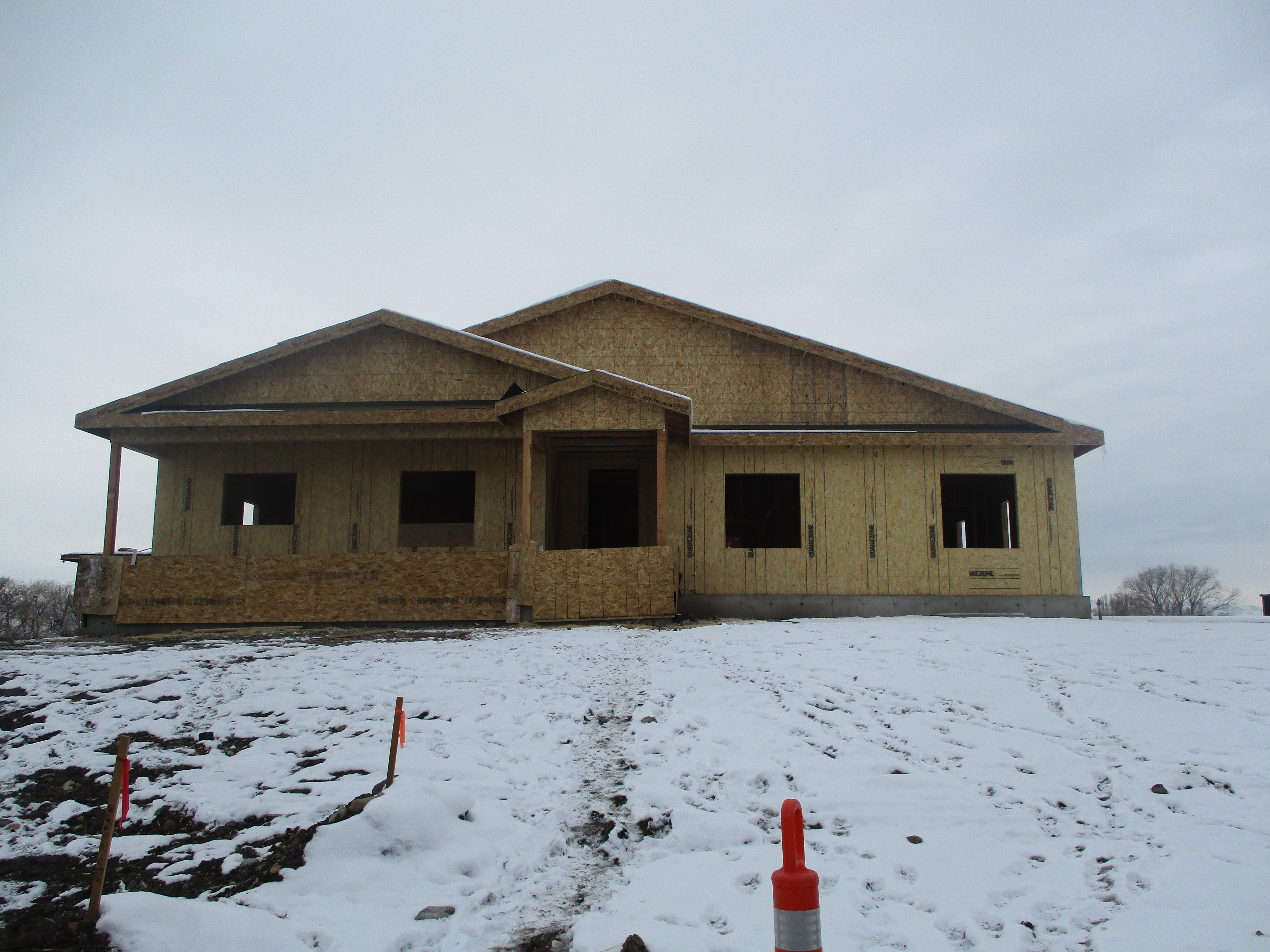
 Total Photos: 2
|
| |
|
|
| Property Address: 596 S STORRS AVE - AMERICAN FORK |
|
| Mailing Address: 598 STORRS AVE AMERICAN FORK, UT 84003 |
|
| Acreage: 8.474378 |
|
| Last Document:
77864-2018
|
|
| Subdivision Map Filing |
|
| Taxing Description:
LOT 2, PLAT A, WILLIAMSON RANCH SUB AREA 8.474 AC.
*Taxing description NOT FOR LEGAL DOCUMENTS
|
|
- Owner Names
- Value History
- Tax History
- Location
- Photos
- Documents
- Aerial Image
| |
----- Real Estate Values ----- |
---Improvements--- |
---Greenbelt--- |
Total |
| Year |
Com |
Res |
Agr |
Tot |
Com |
Res |
Agr |
Tot |
Land |
Homesite |
Tot |
Market Value |
| 2020 |
$0 |
$0 |
$1,694,900 |
$1,694,900 |
$0 |
$0 |
$123,600 |
$123,600 |
$2,880 |
$0 |
$2,880 |
$1,818,500 |
| 2019 |
$0 |
$0 |
$932,200 |
$932,200 |
$0 |
$0 |
$1,000 |
$1,000 |
$0 |
$0 |
$0 |
$933,200 |
| Year |
General Taxes |
Adjustments |
Net Taxes |
Fees |
Payments |
Tax Balance* |
Balance Due |
Tax Area |
| 2020 |
$1,305.78 |
$0.00 |
$1,305.78 |
$0.00 |
|
$0.00
|
$0.00 |
060 - AMERICAN FORK CITY |
| 2019 |
$9,315.20 |
$0.00 |
$9,315.20 |
$0.00 |
|
$0.00
|
$0.00 |
060 - AMERICAN FORK CITY |
* Note: Original tax amount (Does not include applicable interest and/or fees).
| Entry # |
Date |
Recorded |
Type |
Party1 (Grantor) |
Party2 (Grantee) |
| 115306-2020 |
06/23/2020 |
08/06/2020 |
WD |
BAR 6 LAND LLC |
AMERICAN FORK CITY |
| 115305-2020 |
06/18/2020 |
08/06/2020 |
EAS |
BAR 6 LAND LLC |
AMERICAN FORK CITY |
| 119926-2019 |
11/13/2019 |
11/15/2019 |
FARM |
BAR 6 LAND LLC |
WHOM OF INTEREST |
| 69760-2019 |
07/26/2019 |
07/26/2019 |
R FARM |
UTAH COUNTY TREASURER |
BAR 6 LAND (ET AL) |
| 16582-2019 |
02/28/2019 |
02/28/2019 |
W FARM |
UTAH COUNTY ASSESSOR |
WHOM OF INTEREST |
| 77864-2018 |
05/22/2018 |
08/16/2018 |
S PLAT |
BAR 6 LAND LLC |
WILLIAMSON RANCH PLAT A |
Main Menu Comments or Concerns on Value/Appraisal - Assessor's Office
Documents/Owner/Parcel information - Recorder's Office
Address Change for Tax Notice
This page was created on 7/20/2025 6:40:14 AM |