Property Information
mobile view
| Serial Number: 56:044:0002 |
Serial Life: 2022... |
|
|
 Total Photos: 3
|
| |
|
|
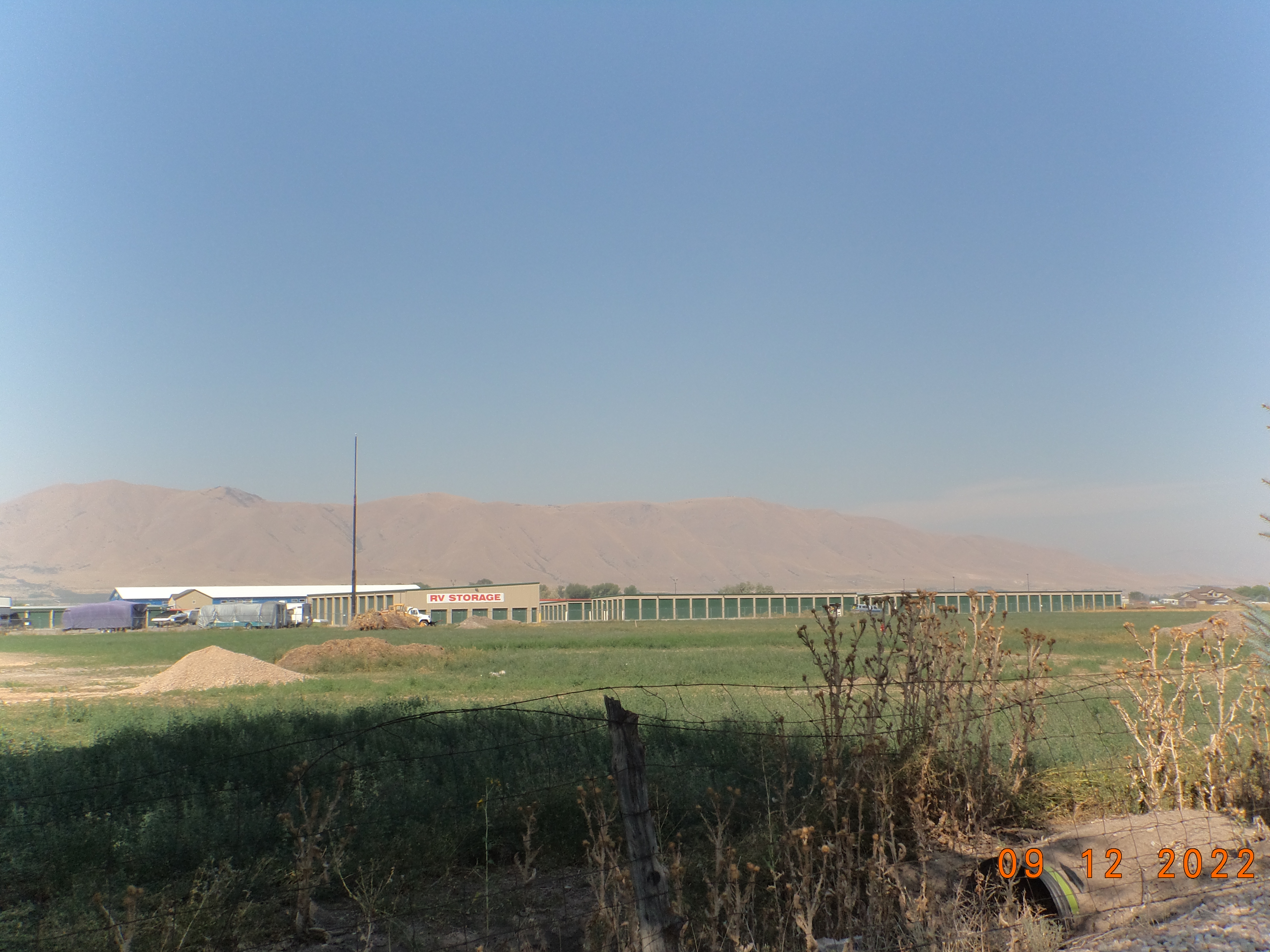
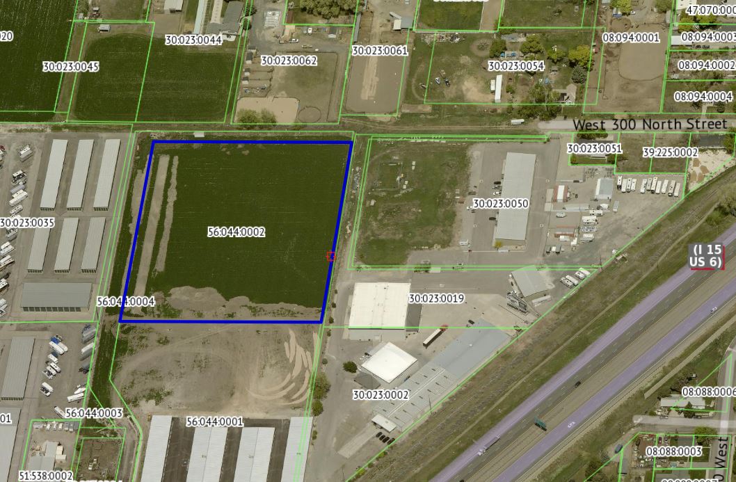
| Property Address: 879 W 300 NORTH - PAYSON |
|
| Mailing Address: 820 W UTAH AVE PAYSON, UT 84651 |
|
| Acreage: 4.959432 |
|
| Last Document:
194454-2021
|
|
| Subdivision Map Filing |
|
| Taxing Description:
PART LOT 2, ZELMA STORAGE SUB DESCRIBED AS FOLLOWS; COM S 646.32 FT & E 622.13 FT FR W 1/4 COR. SEC. 8, T9S, R2E, SLB&M.; S 89 DEG 36' 0" E 416.59 FT; S 0 DEG 50' 0" W 519.55 FT; W 413.28 FT; N 0 DEG 28' 0" E 522.43 FT TO BEG. AREA 4.959 AC.
*Taxing description NOT FOR LEGAL DOCUMENTS
|
|
- Owner Names
- Value History
- Tax History
- Location
- Photos
- Documents
- Aerial Image
| |
----- Real Estate Values ----- |
---Improvements--- |
---Greenbelt--- |
Total |
| Year |
Com |
Res |
Agr |
Tot |
Com |
Res |
Agr |
Tot |
Land |
Homesite |
Tot |
Market Value |
| 2024 |
$1,130,200 |
$0 |
$0 |
$1,130,200 |
$0 |
$0 |
$0 |
$0 |
$0 |
$0 |
$0 |
$1,130,200 |
| 2023 |
$1,101,000 |
$0 |
$0 |
$1,101,000 |
$0 |
$0 |
$0 |
$0 |
$0 |
$0 |
$0 |
$1,101,000 |
| 2022 |
$819,200 |
$0 |
$0 |
$819,200 |
$0 |
$0 |
$0 |
$0 |
$0 |
$0 |
$0 |
$819,200 |
| Year |
General Taxes |
Adjustments |
Net Taxes |
Fees |
Payments |
Tax Balance* |
Balance Due |
Tax District |
| 2025 |
$0.00 |
$0.00 |
$0.00 |
$0.00 |
|
$0.00
|
$0.00 |
170 - PAYSON CITY |
| 2024 |
$11,105.35 |
$0.00 |
$11,105.35 |
$0.00 |
|
$0.00
|
$0.00 |
170 - PAYSON CITY |
| 2023 |
$10,788.70 |
$0.00 |
$10,788.70 |
$0.00 |
|
$0.00
|
$0.00 |
170 - PAYSON CITY |
| 2022 |
$8,161.69 |
$0.00 |
$8,161.69 |
$0.00 |
|
$0.00
|
$0.00 |
170 - PAYSON CITY |
* Note: Original tax amount (Does not include applicable interest and/or fees).
| Entry # |
Date |
Recorded |
Type |
Party1 (Grantor) |
Party2 (Grantee) |
| 49142-2022 |
04/20/2022 |
04/20/2022 |
MOD AGR |
SCHMIDT, CAMERON TEE (ET AL) |
CENTRAL BANK |
| 194454-2021 |
10/07/2021 |
11/18/2021 |
S PLAT |
SCHMIDT, CAMERON TEE (ET AL) |
ZELMA STORAGE |
Main Menu Comments or Concerns on Value/Appraisal - Assessor's Office
Documents/Owner/Parcel information - Recorder's Office
Address Change for Tax Notice
This page was created on 2/1/2025 1:29:03 PM |