Property Information
mobile view
| Serial Number: 59:037:0085 |
Serial Life: 1997... |
|
|
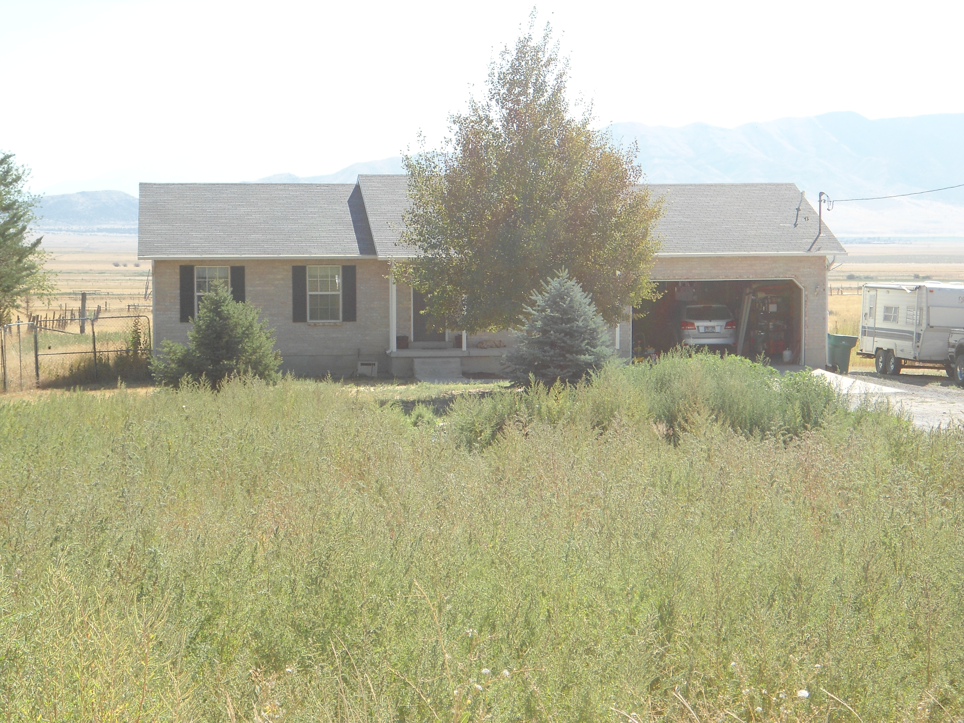 Total Photos: 3
|
| |
|
|
| Property Address: 65 S 200 EAST - CEDAR FORT |
|
| Mailing Address: 2104 WEEPING CHERRY LN EAGLE MOUNTAIN, UT 84005 |
|
| Acreage: 0.650205 |
|
| Last Document:
160124-2021
|
|
| Subdivision Map Filing |
|
| Taxing Description:
COM S 215.91 FT & E .72 FT FR W1/4 COR. SEC. 5, T6S, R2W, SLB&M.; N 88 DEG 30' 16" W 283.41 FT; S 0 DEG 57' 52" W 100 FT; S 88 DEG 30' 16" E 283.073 FT; N 1 DEG 9' 27" E 99.997 FT TO BEG. AREA 0.650 AC.
*Taxing description NOT FOR LEGAL DOCUMENTS
|
|
- Owner Names
- Value History
- Tax History
- Location
- Photos
- Documents
- Aerial Image
| |
----- Real Estate Values ----- |
---Improvements--- |
---Greenbelt--- |
Total |
| Year |
Com |
Res |
Agr |
Tot |
Com |
Res |
Agr |
Tot |
Land |
Homesite |
Tot |
Market Value |
| 2024 |
$0 |
$146,300 |
$0 |
$146,300 |
$0 |
$222,800 |
$0 |
$222,800 |
$0 |
$0 |
$0 |
$369,100 |
| 2023 |
$0 |
$146,300 |
$0 |
$146,300 |
$0 |
$252,500 |
$0 |
$252,500 |
$0 |
$0 |
$0 |
$398,800 |
| 2022 |
$0 |
$151,300 |
$0 |
$151,300 |
$0 |
$237,800 |
$0 |
$237,800 |
$0 |
$0 |
$0 |
$389,100 |
| 2021 |
$0 |
$108,100 |
$0 |
$108,100 |
$0 |
$206,400 |
$0 |
$206,400 |
$0 |
$0 |
$0 |
$314,500 |
| 2020 |
$0 |
$100,100 |
$0 |
$100,100 |
$0 |
$189,400 |
$0 |
$189,400 |
$0 |
$0 |
$0 |
$289,500 |
| 2019 |
$0 |
$100,100 |
$0 |
$100,100 |
$0 |
$164,700 |
$0 |
$164,700 |
$0 |
$0 |
$0 |
$264,800 |
| 2018 |
$0 |
$63,700 |
$0 |
$63,700 |
$0 |
$143,200 |
$0 |
$143,200 |
$0 |
$0 |
$0 |
$206,900 |
| 2017 |
$0 |
$54,600 |
$0 |
$54,600 |
$0 |
$124,500 |
$0 |
$124,500 |
$0 |
$0 |
$0 |
$179,100 |
| 2016 |
$0 |
$43,700 |
$0 |
$43,700 |
$0 |
$108,300 |
$0 |
$108,300 |
$0 |
$0 |
$0 |
$152,000 |
| 2015 |
$0 |
$38,200 |
$0 |
$38,200 |
$0 |
$108,300 |
$0 |
$108,300 |
$0 |
$0 |
$0 |
$146,500 |
| 2014 |
$0 |
$32,100 |
$0 |
$32,100 |
$0 |
$108,300 |
$0 |
$108,300 |
$0 |
$0 |
$0 |
$140,400 |
| 2013 |
$0 |
$31,700 |
$0 |
$31,700 |
$0 |
$108,300 |
$0 |
$108,300 |
$0 |
$0 |
$0 |
$140,000 |
| 2012 |
$0 |
$27,100 |
$0 |
$27,100 |
$0 |
$140,900 |
$0 |
$140,900 |
$0 |
$0 |
$0 |
$168,000 |
| 2011 |
$0 |
$27,100 |
$0 |
$27,100 |
$0 |
$140,900 |
$0 |
$140,900 |
$0 |
$0 |
$0 |
$168,000 |
| 2010 |
$0 |
$27,100 |
$0 |
$27,100 |
$0 |
$140,940 |
$0 |
$140,940 |
$0 |
$0 |
$0 |
$168,040 |
| 2009 |
$0 |
$27,100 |
$0 |
$27,100 |
$0 |
$146,600 |
$0 |
$146,600 |
$0 |
$0 |
$0 |
$173,700 |
| 2008 |
$0 |
$27,100 |
$0 |
$27,100 |
$0 |
$146,600 |
$0 |
$146,600 |
$0 |
$0 |
$0 |
$173,700 |
| 2007 |
$0 |
$27,100 |
$0 |
$27,100 |
$0 |
$146,600 |
$0 |
$146,600 |
$0 |
$0 |
$0 |
$173,700 |
| 2006 |
$0 |
$23,540 |
$0 |
$23,540 |
$0 |
$133,267 |
$0 |
$133,267 |
$0 |
$0 |
$0 |
$156,807 |
| 2005 |
$0 |
$23,540 |
$0 |
$23,540 |
$0 |
$133,267 |
$0 |
$133,267 |
$0 |
$0 |
$0 |
$156,807 |
| 2004 |
$0 |
$23,540 |
$0 |
$23,540 |
$0 |
$133,267 |
$0 |
$133,267 |
$0 |
$0 |
$0 |
$156,807 |
| 2003 |
$0 |
$23,540 |
$0 |
$23,540 |
$0 |
$132,464 |
$0 |
$132,464 |
$0 |
$0 |
$0 |
$156,004 |
| 2002 |
$0 |
$23,540 |
$0 |
$23,540 |
$0 |
$132,464 |
$0 |
$132,464 |
$0 |
$0 |
$0 |
$156,004 |
| 2001 |
$0 |
$23,540 |
$0 |
$23,540 |
$0 |
$132,464 |
$0 |
$132,464 |
$0 |
$0 |
$0 |
$156,004 |
| 2000 |
$0 |
$0 |
$5,096 |
$5,096 |
$0 |
$0 |
$0 |
$0 |
$0 |
$0 |
$0 |
$5,096 |
| 1999 |
$0 |
$0 |
$5,096 |
$5,096 |
$0 |
$0 |
$0 |
$0 |
$0 |
$0 |
$0 |
$5,096 |
| 1998 |
$0 |
$0 |
$5,096 |
$5,096 |
$0 |
$0 |
$0 |
$0 |
$0 |
$0 |
$0 |
$5,096 |
| 1997 |
$0 |
$0 |
$5,096 |
$5,096 |
$0 |
$0 |
$0 |
$0 |
$0 |
$0 |
$0 |
$5,096 |
| Year |
General Taxes |
Adjustments |
Net Taxes |
Fees |
Payments |
Tax Balance* |
Balance Due |
Tax District |
| 2025 |
$0.00 |
$0.00 |
$0.00 |
$0.00 |
|
$0.00
|
$0.00 |
050 - CEDAR FORT CITY |
| 2024 |
$1,585.47 |
$0.00 |
$1,585.47 |
$0.00 |
|
$0.00
|
$0.00 |
050 - CEDAR FORT CITY |
| 2023 |
$1,578.15 |
$0.00 |
$1,578.15 |
$0.00 |
|
$0.00
|
$0.00 |
050 - CEDAR FORT CITY |
| 2022 |
$1,582.14 |
$0.00 |
$1,582.14 |
$0.00 |
|
$0.00
|
$0.00 |
050 - CEDAR FORT CITY |
| 2021 |
$1,543.46 |
$0.00 |
$1,543.46 |
$0.00 |
|
$0.00
|
$0.00 |
050 - CEDAR FORT CITY |
| 2020 |
$1,444.65 |
$0.00 |
$1,444.65 |
$0.00 |
|
$0.00
|
$0.00 |
050 - CEDAR FORT CITY |
| 2019 |
$1,258.18 |
$0.00 |
$1,258.18 |
$0.00 |
|
$0.00
|
$0.00 |
050 - CEDAR FORT CITY |
| 2018 |
$1,042.48 |
$0.00 |
$1,042.48 |
$0.00 |
|
$0.00
|
$0.00 |
050 - CEDAR FORT CITY |
| 2017 |
$931.86 |
$0.00 |
$931.86 |
$0.00 |
|
$0.00
|
$0.00 |
050 - CEDAR FORT CITY |
| 2016 |
$853.05 |
$0.00 |
$853.05 |
$0.00 |
|
$0.00
|
$0.00 |
050 - CEDAR FORT CITY |
| 2015 |
$868.52 |
$0.00 |
$868.52 |
$0.00 |
|
$0.00
|
$0.00 |
050 - CEDAR FORT CITY |
| 2014 |
$836.29 |
$0.00 |
$836.29 |
$0.00 |
|
$0.00
|
$0.00 |
050 - CEDAR FORT CITY |
| 2013 |
$1,018.47 |
($118.88) |
$899.59 |
$0.00 |
|
$0.00
|
$0.00 |
050 - CEDAR FORT CITY |
| 2012 |
$1,097.25 |
$0.00 |
$1,097.25 |
$0.00 |
|
$0.00
|
$0.00 |
050 - CEDAR FORT CITY |
| 2011 |
$1,093.46 |
$0.00 |
$1,093.46 |
$0.00 |
|
$0.00
|
$0.00 |
050 - CEDAR FORT CITY |
| 2010 |
$1,039.38 |
$0.00 |
$1,039.38 |
$0.00 |
|
$0.00
|
$0.00 |
050 - CEDAR FORT CITY |
| 2009 |
$995.86 |
$0.00 |
$995.86 |
$0.00 |
|
$0.00
|
$0.00 |
050 - CEDAR FORT CITY |
| 2008 |
$933.19 |
$0.00 |
$933.19 |
$0.00 |
|
$0.00
|
$0.00 |
050 - CEDAR FORT CITY |
| 2007 |
$878.25 |
$0.00 |
$878.25 |
$0.00 |
|
$0.00
|
$0.00 |
050 - CEDAR FORT CITY |
| 2006 |
$780.94 |
$0.00 |
$780.94 |
$0.00 |
|
$0.00
|
$0.00 |
050 - CEDAR FORT CITY |
| 2005 |
$899.70 |
$0.00 |
$899.70 |
$0.00 |
|
$0.00
|
$0.00 |
050 - CEDAR FORT CITY |
| 2004 |
$927.73 |
$0.00 |
$927.73 |
$0.00 |
|
$0.00
|
$0.00 |
050 - CEDAR FORT CITY |
| 2003 |
$903.41 |
$0.00 |
$903.41 |
$0.00 |
|
$0.00
|
$0.00 |
050 - CEDAR FORT CITY |
| 2002 |
$822.67 |
$0.00 |
$822.67 |
$0.00 |
|
$0.00
|
$0.00 |
050 - CEDAR FORT CITY |
| 2001 |
$807.91 |
$0.00 |
$807.91 |
$0.00 |
|
$0.00
|
$0.00 |
050 - CEDAR FORT CITY |
| 2000 |
$49.46 |
$0.00 |
$49.46 |
$0.00 |
|
$0.00
|
$0.00 |
050 - CEDAR FORT CITY |
| 1999 |
$50.79 |
$0.00 |
$50.79 |
$0.00 |
|
$0.00
|
$0.00 |
050 - CEDAR FORT CITY |
| 1998 |
$48.40 |
$0.00 |
$48.40 |
$0.00 |
|
$0.00
|
$0.00 |
050 - CEDAR FORT CITY |
| 1997 |
$48.11 |
$0.00 |
$48.11 |
$0.00 |
|
$0.00
|
$0.00 |
050 - CEDAR FORT CITY |
* Note: Original tax amount (Does not include applicable interest and/or fees).
| Entry # |
Date |
Recorded |
Type |
Party1 (Grantor) |
Party2 (Grantee) |
| 59912-2024 |
09/03/2024 |
09/03/2024 |
CAN ND |
SCALLEY READING BATES HANSEN & RASMUSSEN PC SUCTEE |
ELTON, WILLIAM JED |
| 27760-2024 |
04/30/2024 |
04/30/2024 |
ND |
SCALLEY READING BATES HANSEN & RASMUSSEN PC SUCTEE |
ELTON, WILLIAM JED |
| 27759-2024 |
04/25/2024 |
04/30/2024 |
SUB TEE |
MOUNTAIN AMERICA FEDERAL CREDIT UNION |
SCALLEY READING BATES HANSEN & RASMUSSEN PC SUCTEE |
| 27758-2024 |
04/25/2024 |
04/30/2024 |
AS |
MORTGAGE ELECTRONIC REGISTRATION SYSTEMS INC |
MOUNTAIN AMERICA FEDERAL CREDIT UNION |
| 173640-2021 |
09/29/2021 |
10/11/2021 |
RSUBTEE |
MORTGAGE ELECTRONIC REGISTRATION SYSTEMS INC (ET AL) |
COOK, NELS |
| 160147-2021 |
09/15/2021 |
09/15/2021 |
D TR |
ELTON, WILLIAM JED BY ATY |
MOUNTAIN AMERICA FEDERAL CREDIT UNION |
| 160146-2021 |
09/09/2021 |
09/15/2021 |
SP PA |
ELTON, WILLIAM JED |
ELTON, CANDICE |
| 160125-2021 |
09/03/2021 |
09/15/2021 |
W DEED |
COOK, NELS WYATT & ASHLEY |
ELTON, WILLIAM JED |
| 160124-2021 |
09/03/2021 |
09/15/2021 |
WD |
COOK, NELS |
ELTON, WILLIAM JED |
| 67942-2020 |
05/19/2020 |
05/19/2020 |
REC |
MOUNTAIN AMERICA FEDERAL CREDIT UNION TEE |
COOK, NELS WYATT & ASHLEY |
| 66361-2020 |
05/15/2020 |
05/18/2020 |
RSUBTEE |
MORTGAGE ELECTRONIC REGISTRATION SYSTEMS INC (ET AL) |
COOK, NELS WYATT & ASHLEY |
| 51109-2020 |
04/15/2020 |
04/20/2020 |
D TR |
COOK, NELS |
FIRST HOME BANK |
| 51108-2020 |
04/15/2020 |
04/20/2020 |
WD |
COOK, NELS WYATT & ASHLEY |
COOK, NELS |
| 109667-2017 |
10/27/2017 |
11/03/2017 |
D TR |
COOK, NELS WYATT & ASHLEY |
MOUNTAIN AMERICA FEDERAL CREDIT UNION |
| 3384-2014 |
11/18/2013 |
01/16/2014 |
REC |
RICHER, ARNOLD TEE |
YATES, DEAN S & LORI |
| 3383-2014 |
10/14/2013 |
01/16/2014 |
SUB TEE |
HOUSEHOLD FINANCE CORPORATION III |
RICHER, ARNOLD SUCTEE |
| 91901-2013 |
09/25/2013 |
09/26/2013 |
D TR |
COOK, NELS WYATT & ASHLEY |
UTAH COMMUNITY FEDERAL CREDIT UNION |
| 91899-2013 |
09/25/2013 |
09/26/2013 |
WD |
YATES, DEAN S & LORI |
COOK, NELS WYATT & ASHLEY |
| 91898-2013 |
09/25/2013 |
09/26/2013 |
EAS AGR |
SMITH, DEAN B & NANCY R TEE (ET AL) |
YATES, DEAN S & LORI |
| 81348-2012 |
08/07/2012 |
09/24/2012 |
REC |
RICHER, ARNOLD SUBTEE |
YATES, DEAN S & LORI |
| 81347-2012 |
07/10/2012 |
09/24/2012 |
SUB TEE |
HOUSEHOLD FINANCE CORPORATION III |
RICHER, ARNOLD SUCTEE |
| 114949-2008 |
10/20/2008 |
10/22/2008 |
CT |
STATE OF UTAH |
WHOM OF INTEREST |
| 107508-2008 |
09/30/2008 |
09/30/2008 |
RESOL |
BOARD OF COUNTY COMMISSIONERS UTAH COUNTY |
WHOM OF INTEREST |
| 131854-2002 |
10/23/2002 |
11/05/2002 |
REC |
FIDELITY NATIONAL TITLE INSURANCE COMPANY SUBTEE |
YATES, DEAN S & LORI |
| 131853-2002 |
10/18/2002 |
11/05/2002 |
SUB TEE |
HOUSEHOLD FINANCE CORPORATION |
FIDELITY NATIONAL TITLE INSURANCE COMPANY SUBTEE |
| 129003-2002 |
08/06/2002 |
10/31/2002 |
SUB AGR |
HARDY, T V PRES |
HOUSEHOLD FINANCE CORPORATION III |
| 101360-2002 |
08/23/2002 |
08/30/2002 |
D TR |
YATES, DEAN S & LORI |
HOUSEHOLD FINANCE CORPORATION III |
| 84523-2001 |
08/21/2001 |
08/23/2001 |
REC |
ASSOCIATED TITLE COMPANY TEE |
YATES, DEAN S & LORI |
| 84522-2001 |
08/10/2001 |
08/23/2001 |
SUB TEE |
HOUSEHOLD FINANCE CORPORATION |
ASSOCIATED TITLE COMPANY SUBTEE |
| 29335-2001 |
03/28/2001 |
03/30/2001 |
REC |
TIMP TITLE INSURANCE AGENCY INC TEE |
YATES, DEAN S & LORI |
| 28079-2001 |
03/14/2001 |
03/28/2001 |
REC |
RIVERS, ROD TEE |
YATES, DEAN S & LORI |
| 28078-2001 |
02/28/2001 |
03/28/2001 |
SUB TEE |
CHASE MORTGAGE COMPANY WEST FKA (ET AL) |
RIVERS, ROD SUBTEE |
| 12639-2001 |
02/12/2001 |
02/14/2001 |
REC |
ASSOCIATED TITLE COMPANY TEE |
YATES, DEAN S & LORI |
| 12638-2001 |
09/18/2000 |
02/14/2001 |
SUB TEE |
HOUSEHOLD FINANCE CORPORATION III |
ASSOCIATED TITLE COMPANY SUBTEE |
| 8550-2001 |
01/20/2001 |
02/01/2001 |
D TR |
YATES, DEAN S & LORI |
HOUSEHOLD FINANCE CORPORATION III |
| 6399-2001 |
01/20/2001 |
01/25/2001 |
D TR |
YATES, DEAN S & LORI |
HOUSEHOLD FINANCE CORPORATION III |
| 3790-2001 |
01/13/2001 |
01/16/2001 |
D TR |
YATES, DEAN S & LORI |
HOUSEHOLD FINANCE CORPORATION III |
| 103645-2000 |
12/27/2000 |
12/29/2000 |
D TR |
YATES, DEAN S & LORI |
HOUSEHOLD FINANCE CORPORATION III |
| 87628-1998 |
06/16/1998 |
08/31/1998 |
AS |
ACCUBANC MORTGAGE CORPORATION |
MELLON MORTGAGE COMPANY |
| 53078-1997 |
07/08/1997 |
07/14/1997 |
RC |
RESIDENTIAL MONEY CENTERS INC |
WHOM OF INTEREST |
| 53077-1997 |
07/08/1997 |
07/14/1997 |
D TR |
YATES, DEAN S & LORI |
RESIDENTIAL MONEY CENTERS INC |
| 92141-1996 |
11/12/1996 |
11/13/1996 |
REC |
BANK OF AMERICAN FORK TEE |
YATES, DEAN S & LORI |
| 89740-1996 |
11/01/1996 |
11/01/1996 |
PW FARM |
UTAH COUNTY ASSESSOR |
WHOM OF INTEREST |
| 88674-1996 |
10/29/1996 |
10/30/1996 |
D TR |
YATES, DEAN S & LORI |
ACCUBANC MORTGAGE CORPORATION DBA (ET AL) |
| 57364-1996 |
07/11/1996 |
07/12/1996 |
D TR |
YATES, DEAN S & LORI |
BANK OF AMERICAN FORK |
| 50955-1996 |
06/18/1996 |
06/19/1996 |
C WD |
SMITH, DEAN B & NANCY R TEE (ET AL) |
YATES, DEAN S & LORI |
Main Menu Comments or Concerns on Value/Appraisal - Assessor's Office
Documents/Owner/Parcel information - Recorder's Office
Address Change for Tax Notice
This page was created on 4/23/2025 7:19:29 AM |

