Property Information
mobile view
| Serial Number: 65:143:0002 |
Serial Life: 2006... |
|
|
 Total Photos: 9
|
| |
|
|
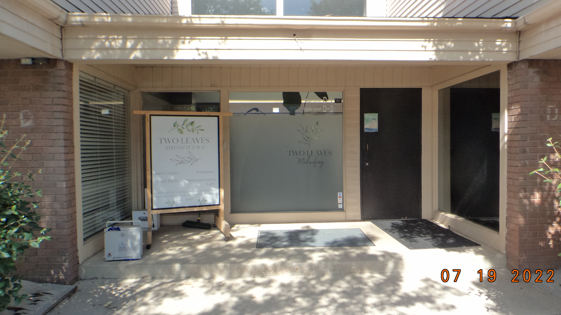
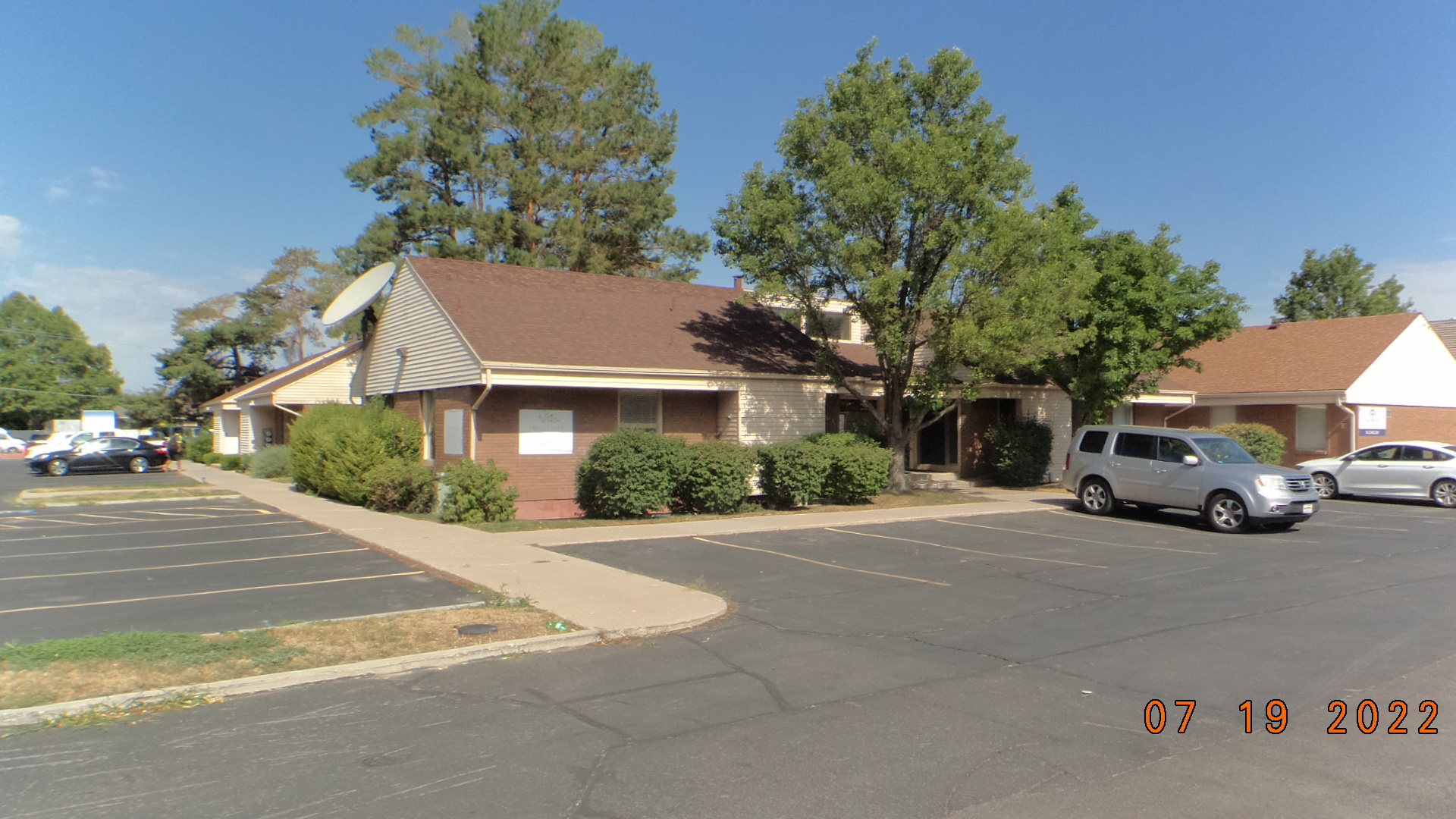
| Property Address: 560 S STATE D1 D2 ST Unit# C1-C2-D1-D2 - OREM |
|
| Mailing Address: 4639 W ATWATER LN SOUTH JORDAN, UT 84009 |
|
| Acreage: 0.056 |
|
| Last Document:
136133-2005
|
|
| Subdivision Map Filing |
|
| Taxing Description:
UNIT 2, CASCADE PROFESSIONAL & COMMERICAL CENTER CONDO. AREA 0.056 AC.
*Taxing description NOT FOR LEGAL DOCUMENTS
|
|
- Owner Names
- Value History
- Tax History
- Location
- Photos
- Documents
- Aerial Image
| |
----- Real Estate Values ----- |
---Improvements--- |
---Greenbelt--- |
Total |
| Year |
Com |
Res |
Agr |
Tot |
Com |
Res |
Agr |
Tot |
Land |
Homesite |
Tot |
Market Value |
| 2024 |
$107,900 |
$0 |
$0 |
$107,900 |
$399,900 |
$0 |
$0 |
$399,900 |
$0 |
$0 |
$0 |
$507,800 |
| 2023 |
$105,800 |
$0 |
$0 |
$105,800 |
$392,000 |
$0 |
$0 |
$392,000 |
$0 |
$0 |
$0 |
$497,800 |
| 2022 |
$105,800 |
$0 |
$0 |
$105,800 |
$278,800 |
$0 |
$0 |
$278,800 |
$0 |
$0 |
$0 |
$384,600 |
| 2021 |
$105,800 |
$0 |
$0 |
$105,800 |
$278,800 |
$0 |
$0 |
$278,800 |
$0 |
$0 |
$0 |
$384,600 |
| 2020 |
$105,800 |
$0 |
$0 |
$105,800 |
$278,800 |
$0 |
$0 |
$278,800 |
$0 |
$0 |
$0 |
$384,600 |
| 2019 |
$105,800 |
$0 |
$0 |
$105,800 |
$278,800 |
$0 |
$0 |
$278,800 |
$0 |
$0 |
$0 |
$384,600 |
| 2018 |
$99,900 |
$0 |
$0 |
$99,900 |
$261,000 |
$0 |
$0 |
$261,000 |
$0 |
$0 |
$0 |
$360,900 |
| 2017 |
$99,900 |
$0 |
$0 |
$99,900 |
$261,000 |
$0 |
$0 |
$261,000 |
$0 |
$0 |
$0 |
$360,900 |
| 2016 |
$96,100 |
$0 |
$0 |
$96,100 |
$242,200 |
$0 |
$0 |
$242,200 |
$0 |
$0 |
$0 |
$338,300 |
| 2015 |
$96,100 |
$0 |
$0 |
$96,100 |
$242,200 |
$0 |
$0 |
$242,200 |
$0 |
$0 |
$0 |
$338,300 |
| 2014 |
$96,100 |
$0 |
$0 |
$96,100 |
$242,200 |
$0 |
$0 |
$242,200 |
$0 |
$0 |
$0 |
$338,300 |
| 2013 |
$96,100 |
$0 |
$0 |
$96,100 |
$219,600 |
$0 |
$0 |
$219,600 |
$0 |
$0 |
$0 |
$315,700 |
| 2012 |
$96,100 |
$0 |
$0 |
$96,100 |
$219,600 |
$0 |
$0 |
$219,600 |
$0 |
$0 |
$0 |
$315,700 |
| 2011 |
$121,400 |
$0 |
$0 |
$121,400 |
$239,480 |
$0 |
$0 |
$239,480 |
$0 |
$0 |
$0 |
$360,880 |
| 2010 |
$131,908 |
$0 |
$0 |
$131,908 |
$282,069 |
$0 |
$0 |
$282,069 |
$0 |
$0 |
$0 |
$413,977 |
| 2009 |
$134,600 |
$0 |
$0 |
$134,600 |
$303,300 |
$0 |
$0 |
$303,300 |
$0 |
$0 |
$0 |
$437,900 |
| 2008 |
$134,600 |
$0 |
$0 |
$134,600 |
$303,300 |
$0 |
$0 |
$303,300 |
$0 |
$0 |
$0 |
$437,900 |
| 2007 |
$134,600 |
$0 |
$0 |
$134,600 |
$181,600 |
$0 |
$0 |
$181,600 |
$0 |
$0 |
$0 |
$316,200 |
| 2006 |
$56,730 |
$0 |
$0 |
$56,730 |
$179,058 |
$0 |
$0 |
$179,058 |
$0 |
$0 |
$0 |
$235,788 |
| Year |
General Taxes |
Adjustments |
Net Taxes |
Fees |
Payments |
Tax Balance* |
Balance Due |
Tax District |
| 2025 |
$0.00 |
$0.00 |
$0.00 |
$0.00 |
|
$0.00
|
$0.00 |
090 - OREM CITY |
| 2024 |
$0.00 |
$0.00 |
$0.00 |
$0.00 |
|
$0.00
|
$0.00 |
090 - OREM CITY |
| 2023 |
$3,787.76 |
$0.00 |
$3,787.76 |
$0.00 |
|
$0.00
|
$0.00 |
090 - OREM CITY |
| 2022 |
$3,020.65 |
$0.00 |
$3,020.65 |
$0.00 |
|
$0.00
|
$0.00 |
090 - OREM CITY |
| 2021 |
$3,626.01 |
$0.00 |
$3,626.01 |
$0.00 |
|
$0.00
|
$0.00 |
090 - OREM CITY |
| 2020 |
$3,689.47 |
$0.00 |
$3,689.47 |
$0.00 |
|
$0.00
|
$0.00 |
090 - OREM CITY |
| 2019 |
$3,547.94 |
$0.00 |
$3,547.94 |
$0.00 |
|
$0.00
|
$0.00 |
090 - OREM CITY |
| 2018 |
$3,484.49 |
$0.00 |
$3,484.49 |
$0.00 |
|
$0.00
|
$0.00 |
090 - OREM CITY |
| 2017 |
$3,577.60 |
$0.00 |
$3,577.60 |
$0.00 |
|
$0.00
|
$0.00 |
090 - OREM CITY |
| 2016 |
$3,636.73 |
$0.00 |
$3,636.73 |
$0.00 |
|
$0.00
|
$0.00 |
090 - OREM CITY |
| 2015 |
$3,845.46 |
$0.00 |
$3,845.46 |
$0.00 |
|
$0.00
|
$0.00 |
090 - OREM CITY |
| 2014 |
$3,863.05 |
$0.00 |
$3,863.05 |
$0.00 |
|
$0.00
|
$0.00 |
090 - OREM CITY |
| 2013 |
$3,887.53 |
$0.00 |
$3,887.53 |
$0.00 |
|
$0.00
|
$0.00 |
090 - OREM CITY |
| 2012 |
$3,967.72 |
$0.00 |
$3,967.72 |
$0.00 |
|
$0.00
|
$0.00 |
090 - OREM CITY |
| 2011 |
$4,870.62 |
($356.73) |
$4,513.89 |
$0.00 |
|
$0.00
|
$0.00 |
090 - OREM CITY |
| 2010 |
$4,847.67 |
$0.00 |
$4,847.67 |
$0.00 |
|
$0.00
|
$0.00 |
090 - OREM CITY |
| 2009 |
$4,753.40 |
$0.00 |
$4,753.40 |
$0.00 |
|
$0.00
|
$0.00 |
090 - OREM CITY |
| 2008 |
$4,404.84 |
$0.00 |
$4,404.84 |
$0.00 |
|
$0.00
|
$0.00 |
090 - OREM CITY |
| 2007 |
$3,144.29 |
$0.00 |
$3,144.29 |
$0.00 |
|
$0.00
|
$0.00 |
090 - OREM CITY |
| 2006 |
$2,496.76 |
$0.00 |
$2,496.76 |
$0.00 |
|
$0.00
|
$0.00 |
090 - OREM CITY |
* Note: Original tax amount (Does not include applicable interest and/or fees).
| Entry # |
Date |
Recorded |
Type |
Party1 (Grantor) |
Party2 (Grantee) |
| 124066-2019 |
11/25/2019 |
11/25/2019 |
REC |
ZIONS BANCORPORATION TEE |
LOSEE INVESTMENTS LLC |
| 76444-2015 |
08/20/2015 |
08/21/2015 |
ADECCON |
DAY, MICHAEL (ET AL) |
WHOM OF INTEREST (ET AL) |
| 112180-2012 |
12/05/2012 |
12/20/2012 |
REC |
BANK OF AMERICAN FORK TEE |
LOSEE INVESTMENTS LLC |
| 109488-2012 |
11/13/2012 |
12/12/2012 |
D TR |
LOSEE INVESTMENTS LLC |
ZIONS FIRST NATIONAL BANK |
| 61317-2009 |
05/28/2009 |
06/03/2009 |
REC |
BANK OF AMERICAN FORK TEE |
LOSEE INVESTMENTS LLC |
| 56304-2009 |
05/20/2009 |
05/21/2009 |
D TR |
LOSEE INVESTMENTS LLC |
BANK OF AMERICAN FORK |
| 25761-2007 |
02/15/2007 |
02/21/2007 |
REC |
BANK OF AMERICAN FORK TEE |
ARGONAUT INVESTMENT COMPANY |
| 20061-2007 |
02/07/2007 |
02/07/2007 |
D TR |
LOSEE INVESTMENTS LLC |
BANK OF AMERICAN FORK |
| 20060-2007 |
02/01/2007 |
02/07/2007 |
WD |
VINTAGE ASSET COMPANY LLC (ET AL) |
LOSEE INVESTMENTS LLC |
| 18899-2006 |
02/15/2006 |
02/15/2006 |
WD |
SPARTAN PROPERTIES LLC |
VINTAGE ASSET COMPANY LLC AN INT (ET AL) |
| 136133-2005 |
11/23/2005 |
11/25/2005 |
QCD |
BLUMENFELD, MAX S |
SPARTAN PROPERTIES LLC |
| 92116-2005 |
08/19/2005 |
08/22/2005 |
R J LN |
ARGONAUT INVESTMENT COMPANY (ET AL) |
CORINTHIAN COLLEGES INC |
| 81670-2005 |
07/26/2005 |
07/28/2005 |
QCD |
SPARTAN PROPERTIES LLC |
BLUMENFELD, MAX S |
| 61432-2005 |
06/02/2005 |
06/08/2005 |
DECLCON |
SPARTAN PROPERTIES LLC (ET AL) |
WHOM OF INTEREST |
| 61431-2005 |
04/06/2005 |
06/08/2005 |
C PLAT |
SPARTAN PROPERTIES LLC |
CASCADE PROFESSIONAL & COMMERCIAL CENTER CONDOMINIUMS |
Main Menu Comments or Concerns on Value/Appraisal - Assessor's Office
Documents/Owner/Parcel information - Recorder's Office
Address Change for Tax Notice
This page was created on 8/16/2024 9:13:24 PM |