Property Information
mobile view
| Serial Number: 65:736:0001 |
Serial Life: 2025... |
|
|
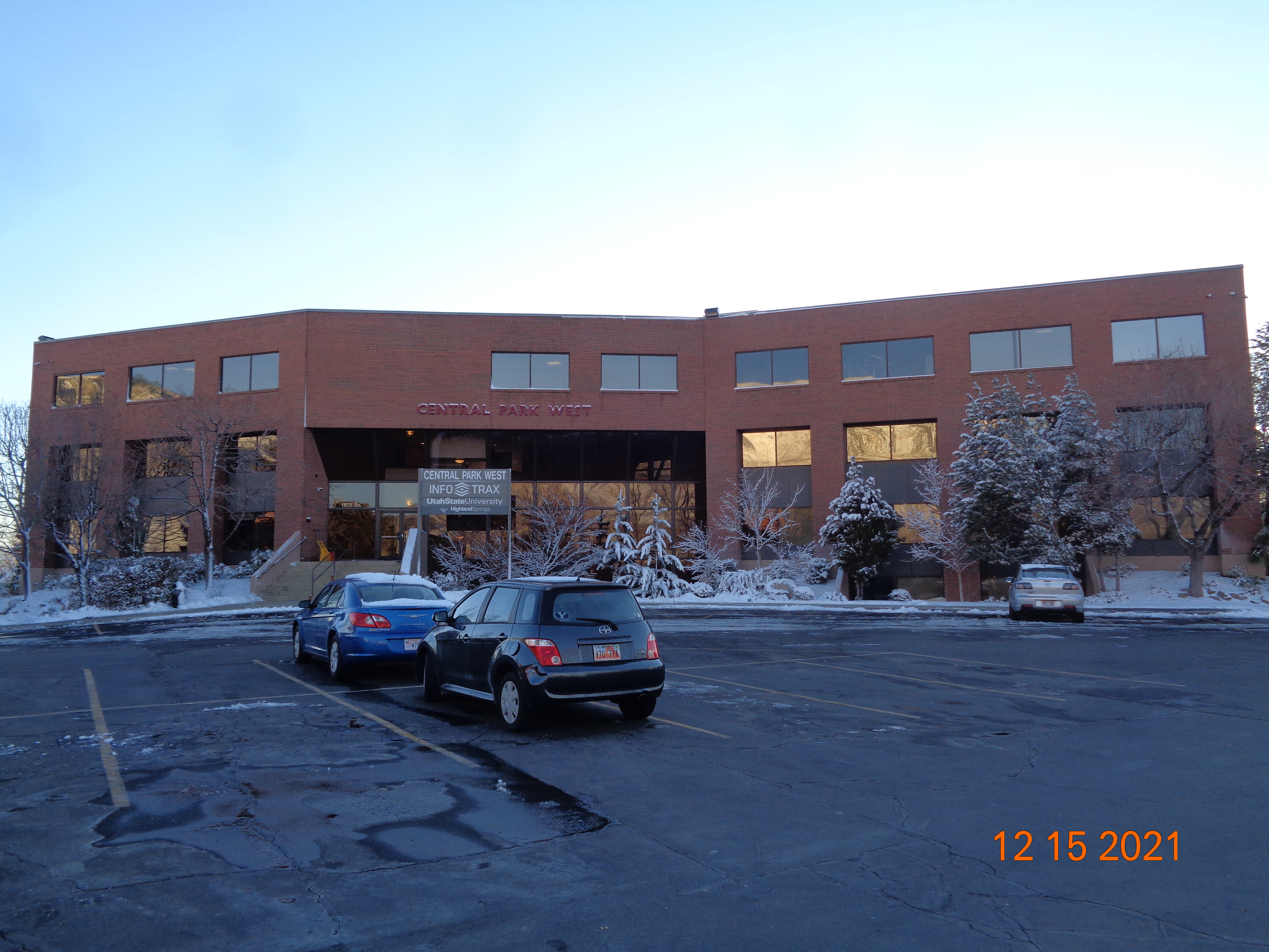 Total Photos: 1
|
| |
|
|
| Property Address: 1875 S STATE ST - OREM |
|
| Mailing Address: 2015 W GROVE PKWY STE J PLEASANT GROVE, UT 84062 |
|
| Acreage: 1.699328 |
|
| Last Document:
16324-2024
|
|
| Subdivision Map Filing |
|
| Taxing Description:
LOT 1, PLAT A, CENTRAL PARK WEST SUB AREA 1.699 AC.
*Taxing description NOT FOR LEGAL DOCUMENTS
|
|
- Owner Names
- Value History
- Tax History
- Location
- Photos
- Documents
- Aerial Image
| |
----- Real Estate Values ----- |
---Improvements--- |
---Greenbelt--- |
Total |
| Year |
Com |
Res |
Agr |
Tot |
Com |
Res |
Agr |
Tot |
Land |
Homesite |
Tot |
Market Value |
| 2025 |
$1,603,200 |
$0 |
$0 |
$1,603,200 |
$5,672,800 |
$0 |
$0 |
$5,672,800 |
$0 |
$0 |
$0 |
$7,276,000 |
| Year |
General Taxes |
Adjustments |
Net Taxes |
Fees |
Payments |
Tax Balance* |
Balance Due |
Tax Area |
| 2026 |
$0.00 |
$0.00 |
$0.00 |
$0.00 |
|
$0.00
|
$0.00 |
090 - OREM CITY |
| 2025 |
$0.00 |
$0.00 |
$0.00 |
$0.00 |
|
$0.00
|
$0.00 |
090 - OREM CITY |
* Note: Original tax amount (Does not include applicable interest and/or fees).
| Entry # |
Date |
Recorded |
Type |
Party1 (Grantor) |
Party2 (Grantee) |
| 61662-2024 |
09/06/2024 |
09/10/2024 |
SUB TEE |
UTAH COMMUNITY FEDERAL CREDIT UNION |
OLD REPUBLIC NATIONAL TITLE INSURANCE COMPANY SUCTEE |
| 37391-2024 |
06/05/2024 |
06/05/2024 |
D TR |
LIFE GIVING RESOURCES INC (ET AL) |
UTAH COMMUNITY FEDERAL CREDIT UNION |
| 16324-2024 |
03/11/2024 |
03/14/2024 |
S PLAT |
MOUNT AIREY FUNDING LLC (ET AL) |
CENTRAL PARK WEST PLAT A |
Main Menu Comments or Concerns on Value/Appraisal - Assessor's Office
Documents/Owner/Parcel information - Recorder's Office
Address Change for Tax Notice
This page was created on 7/26/2025 6:50:36 PM |