Property Information
mobile view
| Serial Number: 66:199:0060 |
Serial Life: 2008... |
|
|
 Total Photos: 2
|
| |
|
|
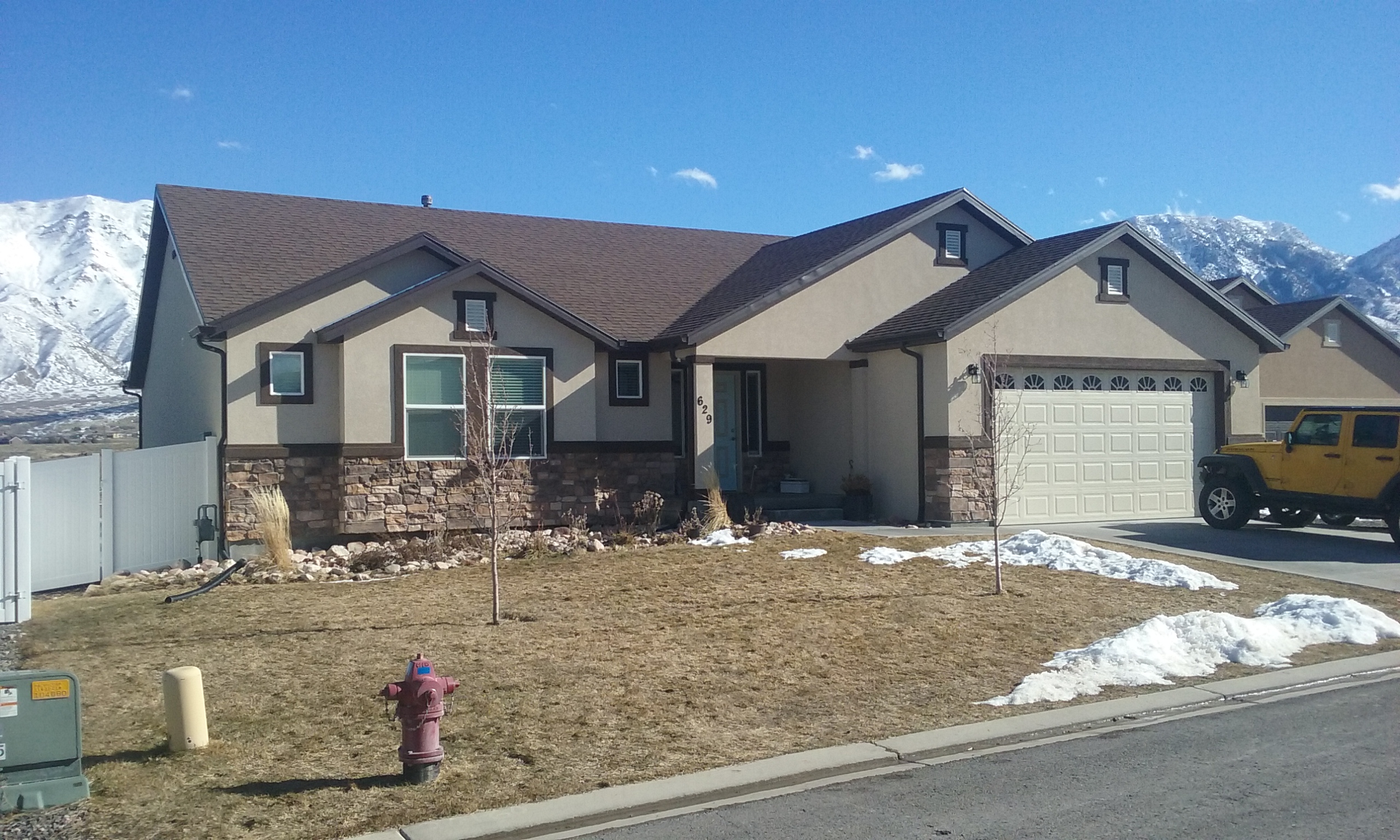
| Property Address: 629 LITTLE ROCK DR - SANTAQUIN |
|
| Mailing Address: 629 LITTLE ROCK DR SANTAQUIN, UT 84655-5597 |
|
| Acreage: 0.198 |
|
| Last Document:
41180-2016
|
|
| Subdivision Map Filing |
|
| Taxing Description:
LOT 60, PLAT B, STONE HOLLOW AT SUMMIT RIDGE SUBDV. AREA 0.198 AC.
*Taxing description NOT FOR LEGAL DOCUMENTS
|
|
- Owner Names
- Value History
- Tax History
- Location
- Photos
- Documents
- Aerial Image
| |
----- Real Estate Values ----- |
---Improvements--- |
---Greenbelt--- |
Total |
| Year |
Com |
Res |
Agr |
Tot |
Com |
Res |
Agr |
Tot |
Land |
Homesite |
Tot |
Market Value |
| 2024 |
$0 |
$134,800 |
$0 |
$134,800 |
$0 |
$308,500 |
$0 |
$308,500 |
$0 |
$0 |
$0 |
$443,300 |
| 2023 |
$0 |
$134,700 |
$0 |
$134,700 |
$0 |
$327,600 |
$0 |
$327,600 |
$0 |
$0 |
$0 |
$462,300 |
| 2022 |
$0 |
$143,600 |
$0 |
$143,600 |
$0 |
$342,600 |
$0 |
$342,600 |
$0 |
$0 |
$0 |
$486,200 |
| 2021 |
$0 |
$79,800 |
$0 |
$79,800 |
$0 |
$280,600 |
$0 |
$280,600 |
$0 |
$0 |
$0 |
$360,400 |
| 2020 |
$0 |
$66,500 |
$0 |
$66,500 |
$0 |
$269,800 |
$0 |
$269,800 |
$0 |
$0 |
$0 |
$336,300 |
| 2019 |
$0 |
$63,000 |
$0 |
$63,000 |
$0 |
$234,600 |
$0 |
$234,600 |
$0 |
$0 |
$0 |
$297,600 |
| 2018 |
$0 |
$56,000 |
$0 |
$56,000 |
$0 |
$204,000 |
$0 |
$204,000 |
$0 |
$0 |
$0 |
$260,000 |
| 2017 |
$0 |
$56,000 |
$0 |
$56,000 |
$0 |
$189,300 |
$0 |
$189,300 |
$0 |
$0 |
$0 |
$245,300 |
| 2016 |
$0 |
$39,900 |
$0 |
$39,900 |
$0 |
$0 |
$0 |
$0 |
$0 |
$0 |
$0 |
$39,900 |
| 2015 |
$0 |
$36,400 |
$0 |
$36,400 |
$0 |
$0 |
$0 |
$0 |
$0 |
$0 |
$0 |
$36,400 |
| 2014 |
$0 |
$36,400 |
$0 |
$36,400 |
$0 |
$0 |
$0 |
$0 |
$0 |
$0 |
$0 |
$36,400 |
| 2013 |
$0 |
$31,800 |
$0 |
$31,800 |
$0 |
$0 |
$0 |
$0 |
$0 |
$0 |
$0 |
$31,800 |
| 2012 |
$0 |
$35,400 |
$0 |
$35,400 |
$0 |
$0 |
$0 |
$0 |
$0 |
$0 |
$0 |
$35,400 |
| 2011 |
$0 |
$32,600 |
$0 |
$32,600 |
$0 |
$0 |
$0 |
$0 |
$0 |
$0 |
$0 |
$32,600 |
| 2010 |
$0 |
$36,000 |
$0 |
$36,000 |
$0 |
$0 |
$0 |
$0 |
$0 |
$0 |
$0 |
$36,000 |
| 2009 |
$0 |
$42,000 |
$0 |
$42,000 |
$0 |
$0 |
$0 |
$0 |
$0 |
$0 |
$0 |
$42,000 |
| 2008 |
$0 |
$60,000 |
$0 |
$60,000 |
$0 |
$0 |
$0 |
$0 |
$0 |
$0 |
$0 |
$60,000 |
| Year |
General Taxes |
Adjustments |
Net Taxes |
Fees |
Payments |
Tax Balance* |
Balance Due |
Tax District |
| 2025 |
$0.00 |
$0.00 |
$0.00 |
$0.00 |
|
$0.00
|
$0.00 |
190 - SANTAQUIN CITY |
| 2024 |
$2,448.39 |
$0.00 |
$2,448.39 |
$0.00 |
|
$0.00
|
$0.00 |
190 - SANTAQUIN CITY |
| 2023 |
$2,545.19 |
$0.00 |
$2,545.19 |
$0.00 |
|
$0.00
|
$0.00 |
190 - SANTAQUIN CITY |
| 2022 |
$2,595.21 |
$0.00 |
$2,595.21 |
$0.00 |
|
$0.00
|
$0.00 |
190 - SANTAQUIN CITY |
| 2021 |
$2,256.34 |
$0.00 |
$2,256.34 |
$0.00 |
|
$0.00
|
$0.00 |
190 - SANTAQUIN CITY |
| 2020 |
$2,172.78 |
$0.00 |
$2,172.78 |
$0.00 |
|
$0.00
|
$0.00 |
190 - SANTAQUIN CITY |
| 2019 |
$1,880.19 |
$0.00 |
$1,880.19 |
$0.00 |
|
$0.00
|
$0.00 |
190 - SANTAQUIN CITY |
| 2018 |
$1,722.72 |
$0.00 |
$1,722.72 |
$0.00 |
|
$0.00
|
$0.00 |
190 - SANTAQUIN CITY |
| 2017 |
$1,673.08 |
$0.00 |
$1,673.08 |
$0.00 |
|
$0.00
|
$0.00 |
190 - SANTAQUIN CITY |
| 2016 |
$504.97 |
$0.00 |
$504.97 |
$0.00 |
|
$0.00
|
$0.00 |
190 - SANTAQUIN CITY |
| 2015 |
$469.71 |
$0.00 |
$469.71 |
$0.00 |
|
$0.00
|
$0.00 |
190 - SANTAQUIN CITY |
| 2014 |
$470.65 |
$0.00 |
$470.65 |
$0.00 |
|
$0.00
|
$0.00 |
190 - SANTAQUIN CITY |
| 2013 |
$433.72 |
$0.00 |
$433.72 |
$0.00 |
|
$0.00
|
$0.00 |
190 - SANTAQUIN CITY |
| 2012 |
$467.67 |
$0.00 |
$467.67 |
$0.00 |
|
$0.00
|
$0.00 |
190 - SANTAQUIN CITY |
| 2011 |
$423.08 |
$0.00 |
$423.08 |
$0.00 |
|
$0.00
|
$0.00 |
190 - SANTAQUIN CITY |
| 2010 |
$527.73 |
($75.39) |
$452.34 |
$0.00 |
|
$0.00
|
$0.00 |
190 - SANTAQUIN CITY |
| 2009 |
$498.75 |
$0.00 |
$498.75 |
$0.00 |
|
$0.00
|
$0.00 |
190 - SANTAQUIN CITY |
| 2008 |
$658.50 |
($109.75) |
$548.75 |
$0.00 |
|
$0.00
|
$0.00 |
190 - SANTAQUIN CITY |
* Note: Original tax amount (Does not include applicable interest and/or fees).
| Entry # |
Date |
Recorded |
Type |
Party1 (Grantor) |
Party2 (Grantee) |
| 161723-2021 |
08/27/2021 |
09/17/2021 |
DECLCOV |
HG 1 UTAH LLC (ET AL) |
WHOM OF INTEREST |
| 23190-2021 |
02/05/2021 |
02/08/2021 |
R DECL |
HG 1 UTAH LLC (ET AL) |
WHOM OF INTEREST |
| 202292-2020 |
12/03/2002 |
12/18/2020 |
AGR |
HG UTAH 1 LLC (ET AL) |
SANTAQUIN CITY CORPORATION |
| 45258-2020 |
04/03/2020 |
04/08/2020 |
REC |
FIRST AMERICAN TITLE INSURANCE COMPANY TEE |
WEIGHT, LYNN E & CAROL J |
| 45257-2020 |
04/03/2020 |
04/08/2020 |
SUB TEE |
MORTGAGE ELECTRONIC REGISTRATION SYSTEMS INC |
FIRST AMERICAN TITLE INSURANCE COMPANY SUBTEE |
| 139651-2019 |
12/31/2019 |
12/31/2019 |
QCD |
WEIGHT, LYNN E & CAROL J |
WEIGHT, LYNN E & CAROL J TEE (ET AL) |
| 77782-2019 |
08/14/2019 |
08/14/2019 |
ADECCOV |
HG UTAH 1 LLC |
WHOM OF INTEREST |
| 26935-2018 |
03/22/2018 |
03/22/2018 |
COVLAND |
SRC MASTER ASSOCIATION |
WHOM OF INTEREST |
| 38517-2017 |
04/07/2017 |
04/21/2017 |
REC |
CENTRAL BANK TEE |
SALISBURY LAND LLC |
| 128960-2016 |
06/16/2016 |
12/22/2016 |
REC |
GT TITLE SERVICES INC TEE |
SALISBURY DEVELOPERS INC |
| 41181-2016 |
05/20/2016 |
05/10/2016 |
D TR |
WEIGHT, LYNN E & CAROL J |
ACADEMY MORTGAGE CORPORATION |
| 41180-2016 |
05/02/2016 |
05/10/2016 |
WD |
SALISBURY DEVELOPERS INC |
WEIGHT, LYNN E & CAROL J |
| 93413-2015 |
10/08/2015 |
10/13/2015 |
D TR |
SALISBURY DEVELOPERS INC |
M & T BANK |
| 93412-2015 |
10/13/2015 |
10/13/2015 |
WD |
SALISBURY LAND |
SALISBURY DEVELOPERS INC |
| 14942-2015 |
02/25/2015 |
02/26/2015 |
REC |
CENTRAL BANK TEE |
SUMMIT RIDGE COMMUNITIES LLC |
| 14939-2015 |
02/24/2015 |
02/26/2015 |
D TR |
SALISBURY LAND L L C |
CENTRAL BANK |
| 14938-2015 |
02/25/2015 |
02/26/2015 |
WD |
CENTRAL BANK |
SALISBURY LAND L L C |
| 104015-2013 |
11/07/2013 |
11/07/2013 |
DECLCOV |
SRC MASTER ASSOCIATION |
WHOM OF INTEREST |
| 69198-2011 |
09/29/2011 |
09/30/2011 |
WD |
SUMMIT RIDGE COMMUNITIES LLC |
CENTRAL BANK |
| 69196-2011 |
09/29/2011 |
09/30/2011 |
AGR |
CENTRAL BANK |
SUMMIT RIDGE COMMUNITIES LLC (ET AL) |
| 91257-2010 |
10/22/2010 |
10/22/2010 |
REC |
PRO-TITLE AND ESCROW INC TEE |
KBS FARM HOLDINGS LLC |
| 91256-2010 |
10/22/2010 |
10/22/2010 |
REC |
PRO-TITLE AND ESCROW INC TEE |
KBS FARM HOLDINGS LLC |
| 40954-2009 |
04/15/2009 |
04/16/2009 |
SCRIVAF |
PRO-TITLE AND ESCROW INC |
WHOM OF INTEREST |
| 40953-2009 |
04/15/2009 |
04/16/2009 |
CORR AF |
PRO-TITLE AND ESCROW INC |
WHOM OF INTEREST |
| 114949-2008 |
10/20/2008 |
10/22/2008 |
CT |
STATE OF UTAH |
WHOM OF INTEREST |
| 107508-2008 |
09/30/2008 |
09/30/2008 |
RESOL |
BOARD OF COUNTY COMMISSIONERS UTAH COUNTY |
WHOM OF INTEREST |
| 71350-2007 |
02/07/2007 |
05/15/2007 |
S PLAT |
SUMMIT RIDGE COMMUNITIES LLC |
STONE HOLLOW AT SUMMIT RIDGE PLAT B |
Main Menu Comments or Concerns on Value/Appraisal - Assessor's Office
Documents/Owner/Parcel information - Recorder's Office
Address Change for Tax Notice
This page was created on 4/6/2025 7:35:34 PM |
