Property Information
mobile view
| Serial Number: 66:570:0327 |
Serial Life: 2018... |
|
|
 Total Photos: 2
|
| |
|
|
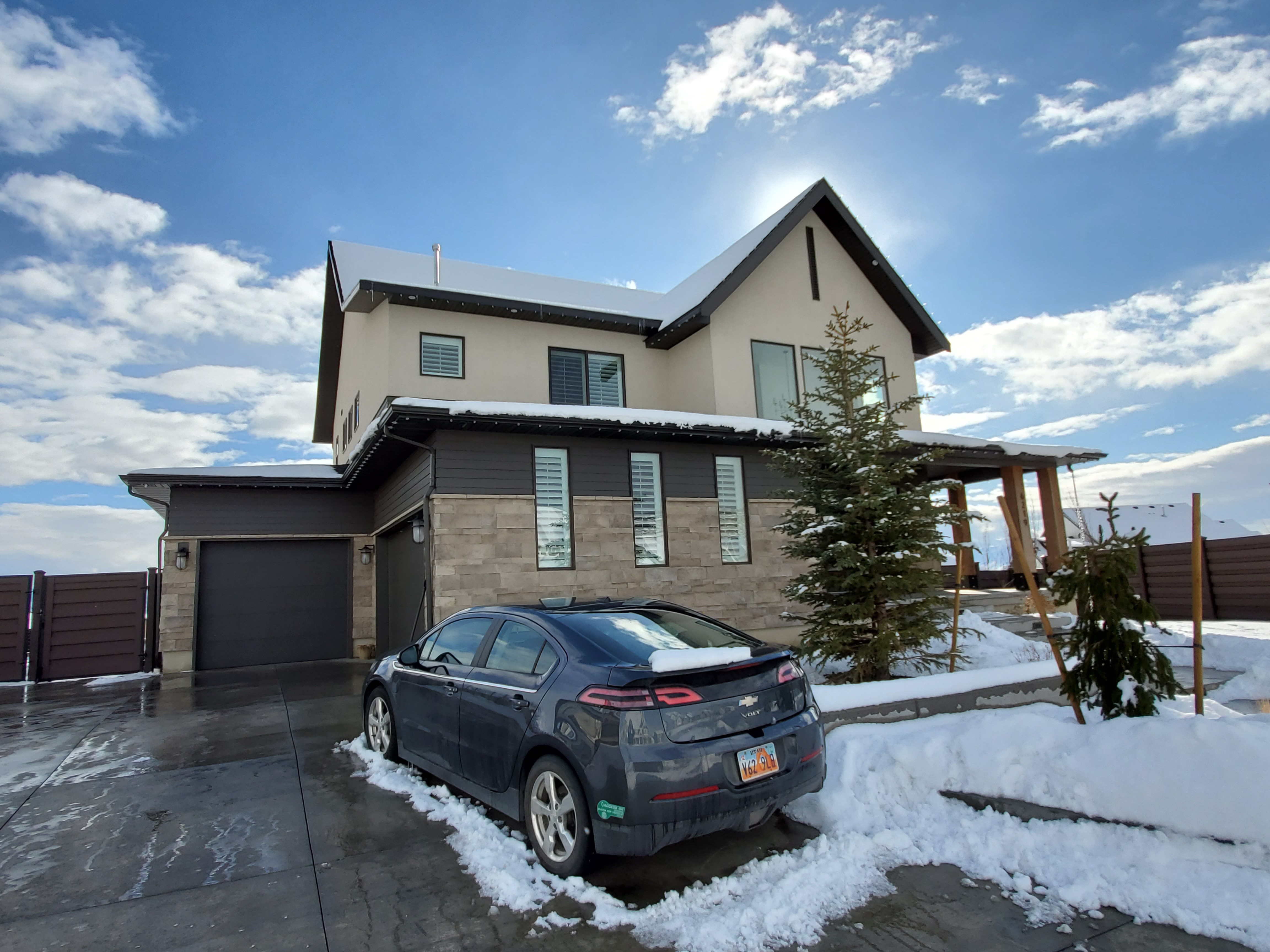
| Property Address: 6219 W GRANT CIR - HIGHLAND |
|
| Mailing Address: 6219 W GRANT CIR HIGHLAND, UT 84003 |
|
| Acreage: 0.346385 |
|
| Last Document:
60418-2018
|
|
| Subdivision Map Filing |
|
| Taxing Description:
LOT 327, SKYE ESTATES, FINAL PLAT, PHASE 3 SUB AREA 0.346 AC.
*Taxing description NOT FOR LEGAL DOCUMENTS
|
|
- Owner Names
- Value History
- Tax History
- Location
- Photos
- Documents
- Aerial Image
| |
----- Real Estate Values ----- |
---Improvements--- |
---Greenbelt--- |
Total |
| Year |
Com |
Res |
Agr |
Tot |
Com |
Res |
Agr |
Tot |
Land |
Homesite |
Tot |
Market Value |
| 2024 |
$0 |
$485,300 |
$0 |
$485,300 |
$0 |
$716,900 |
$0 |
$716,900 |
$0 |
$0 |
$0 |
$1,202,200 |
| 2023 |
$0 |
$441,200 |
$0 |
$441,200 |
$0 |
$781,500 |
$0 |
$781,500 |
$0 |
$0 |
$0 |
$1,222,700 |
| 2022 |
$0 |
$462,400 |
$0 |
$462,400 |
$0 |
$635,200 |
$0 |
$635,200 |
$0 |
$0 |
$0 |
$1,097,600 |
| 2021 |
$0 |
$272,000 |
$0 |
$272,000 |
$0 |
$492,400 |
$0 |
$492,400 |
$0 |
$0 |
$0 |
$764,400 |
| 2020 |
$0 |
$236,500 |
$0 |
$236,500 |
$0 |
$478,100 |
$0 |
$478,100 |
$0 |
$0 |
$0 |
$714,600 |
| 2019 |
$0 |
$236,500 |
$0 |
$236,500 |
$0 |
$413,700 |
$0 |
$413,700 |
$0 |
$0 |
$0 |
$650,200 |
| 2018 |
$0 |
$229,200 |
$0 |
$229,200 |
$0 |
$194,100 |
$0 |
$194,100 |
$0 |
$0 |
$0 |
$423,300 |
| Year |
General Taxes |
Adjustments |
Net Taxes |
Fees |
Payments |
Tax Balance* |
Balance Due |
Tax District |
| 2025 |
$0.00 |
$0.00 |
$0.00 |
$0.00 |
|
$0.00
|
$0.00 |
045 - HIGHLAND CITY |
| 2024 |
$5,353.16 |
$0.00 |
$5,353.16 |
$0.00 |
|
$0.00
|
$0.00 |
045 - HIGHLAND CITY |
| 2023 |
$5,047.00 |
$0.00 |
$5,047.00 |
$0.00 |
|
$0.00
|
$0.00 |
045 - HIGHLAND CITY |
| 2022 |
$4,672.48 |
$0.00 |
$4,672.48 |
$0.00 |
|
$0.00
|
$0.00 |
045 - HIGHLAND CITY |
| 2021 |
$3,972.13 |
$0.00 |
$3,972.13 |
$0.00 |
|
$0.00
|
$0.00 |
045 - HIGHLAND CITY |
| 2020 |
$3,786.45 |
$0.00 |
$3,786.45 |
$0.00 |
|
$0.00
|
$0.00 |
045 - HIGHLAND CITY |
| 2019 |
$3,293.23 |
$0.00 |
$3,293.23 |
$0.00 |
|
$0.00
|
$0.00 |
045 - HIGHLAND CITY |
| 2018 |
$2,255.98 |
$0.00 |
$2,255.98 |
$0.00 |
|
$0.00
|
$0.00 |
045 - HIGHLAND CITY |
* Note: Original tax amount (Does not include applicable interest and/or fees).
| Entry # |
Date |
Recorded |
Type |
Party1 (Grantor) |
Party2 (Grantee) |
| 107557-2020 |
07/16/2020 |
07/27/2020 |
WD |
SCHILLING, SCOTT & CHRISTINA |
SCHILLING, SCOTT F & CHRISTINA C TEE (ET AL) |
| 83760-2020 |
|
06/17/2020 |
FN ST |
SCHILLING, SCOTT |
LOANPAL LLC |
| 60418-2018 |
06/04/2018 |
06/27/2018 |
SP WD |
D R HORTON INC |
SCHILLING, SCOTT & CHRISTINA |
| 48957-2018 |
05/16/2018 |
05/25/2018 |
N |
D R HORTON INC |
WHOM OF INTEREST |
| 53284-2017 |
05/26/2017 |
06/02/2017 |
AFF SUR |
DERBY, SCOTT W |
WHOM OF INTEREST |
| 48409-2017 |
05/18/2017 |
05/19/2017 |
SP WD |
D R HORTON INC |
DRH ENERGY INC |
| 42027-2017 |
04/24/2017 |
05/02/2017 |
DECLCOV |
D R HORTON INC |
WHOM OF INTEREST |
| 42026-2017 |
04/25/2017 |
05/02/2017 |
S PLAT |
D R HORTON INC |
SKYE ESTATES PHASE 3 FINAL PLAT |
Main Menu Comments or Concerns on Value/Appraisal - Assessor's Office
Documents/Owner/Parcel information - Recorder's Office
Address Change for Tax Notice
This page was created on 12/27/2024 7:52:14 AM |
