Property Information
mobile view
| Serial Number: 66:611:0406 |
Serial Life: 2019... |
|
|
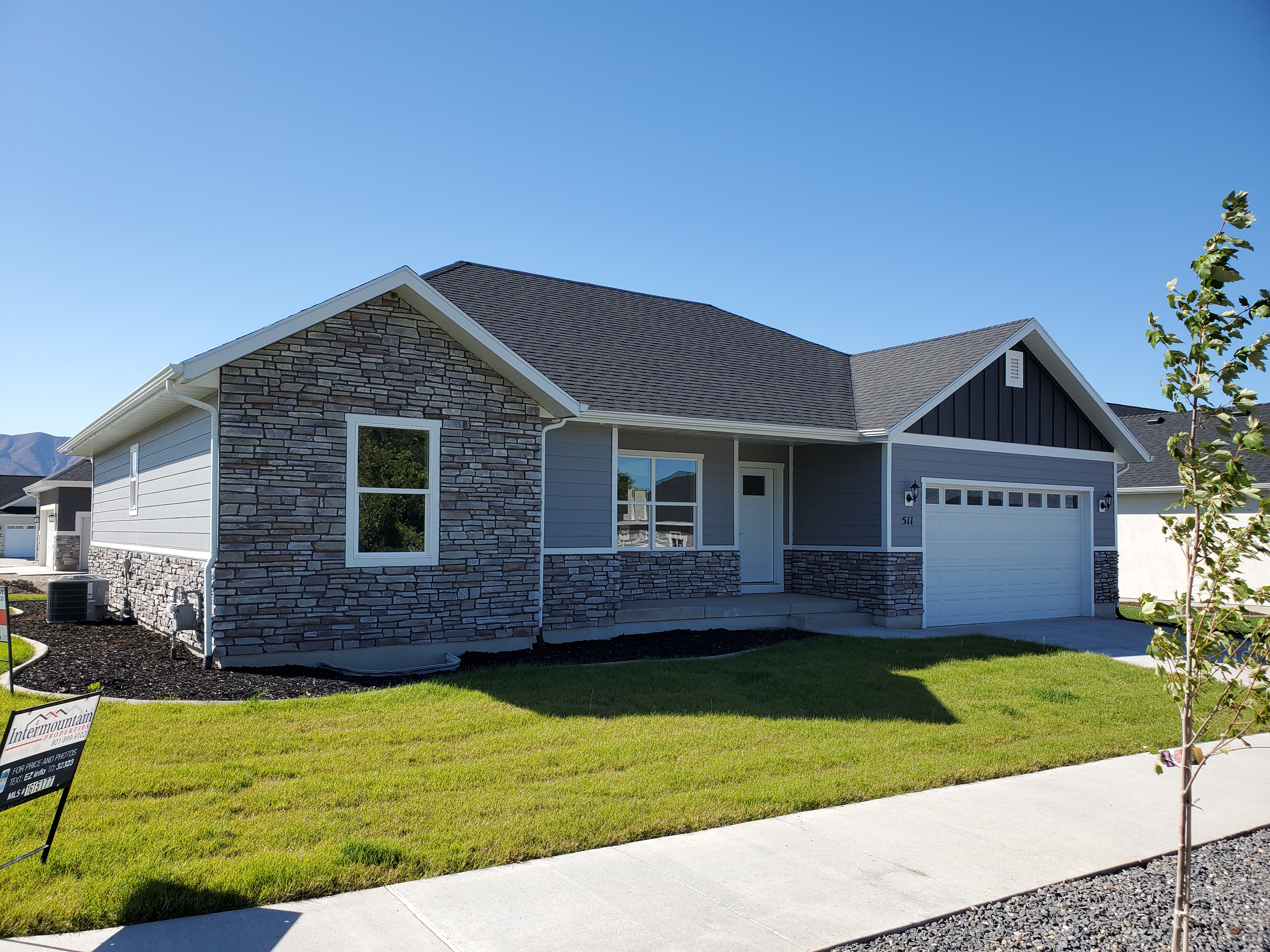
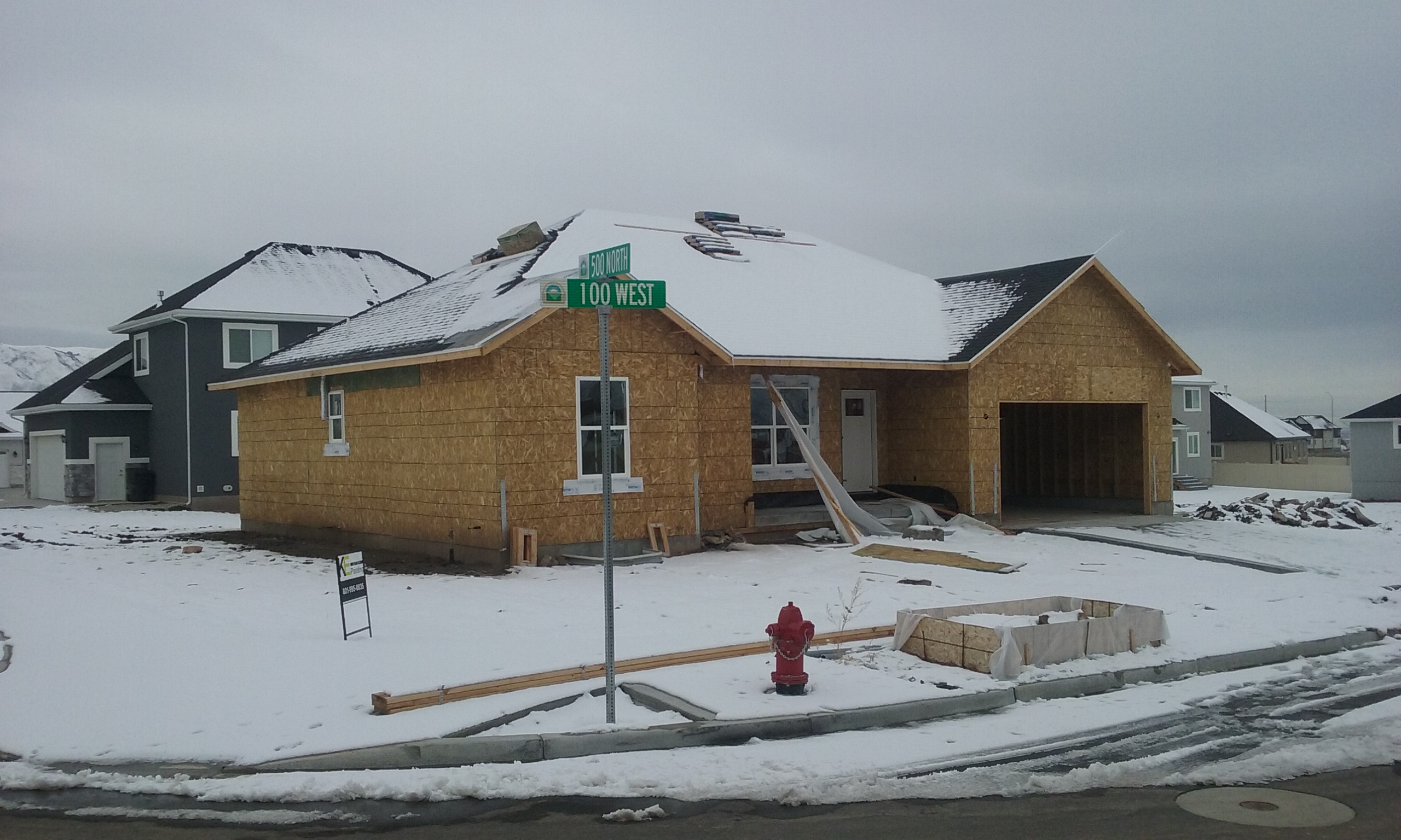
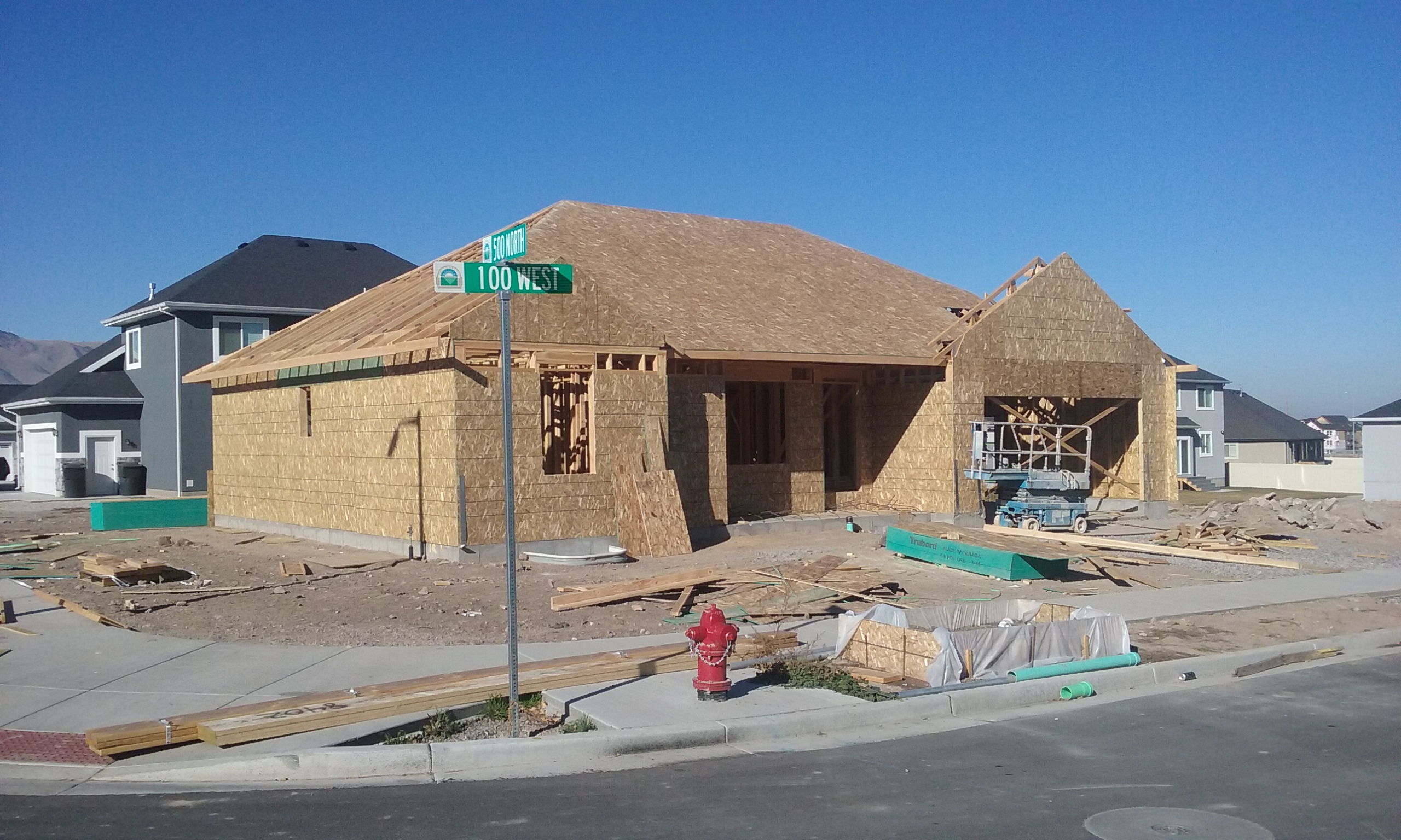
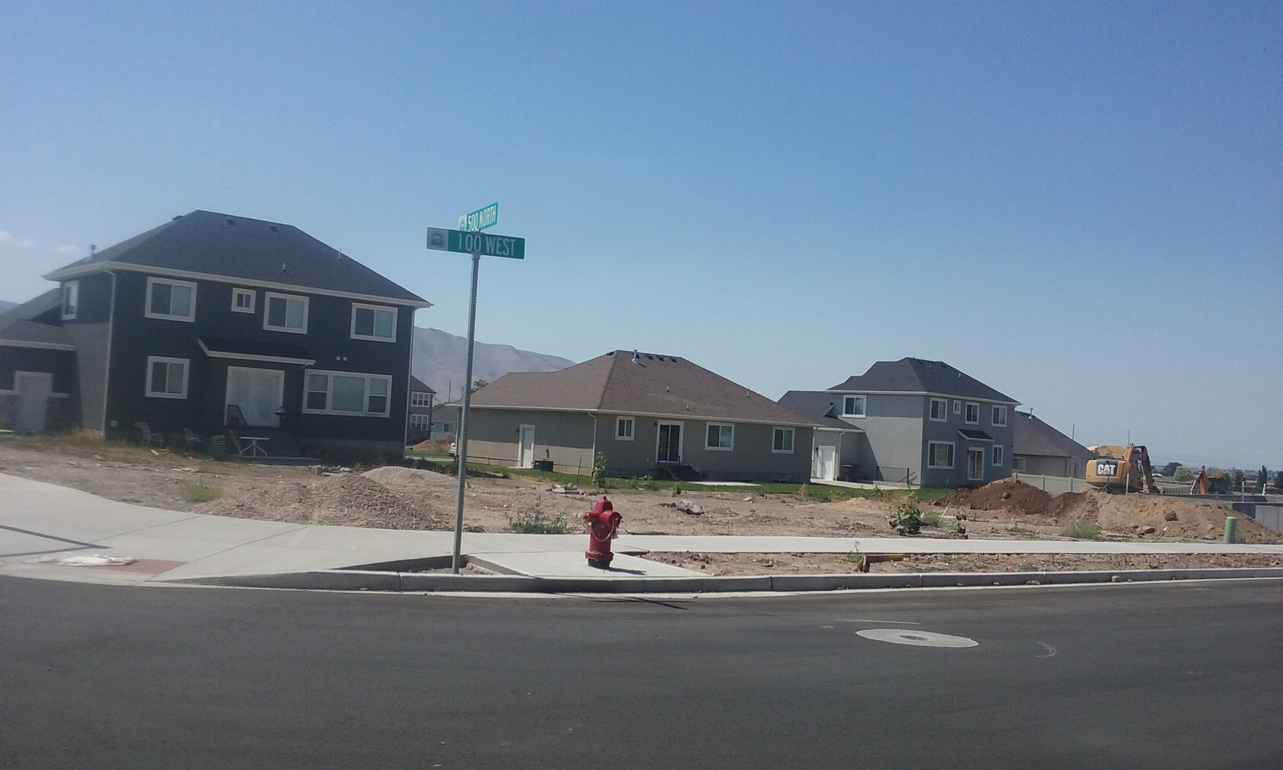
Total Photos: 4
|
| |
|
|
| Property Address: 511 N 100 WEST - PAYSON
more see "Addrs" tab below..
|
|
| Mailing Address: 511 N 100 W PAYSON, UT 84651 |
|
| Acreage: 0.178351 |
|
| Last Document:
44614-2018
|
|
| Subdivision Map Filing |
|
| Taxing Description:
LOT 406, PLAT D, STERLING GROVE SUB AREA 0.178 AC.
*Taxing description NOT FOR LEGAL DOCUMENTS
|
|
- Owner Names
- Value History
- Tax History
- Location
- Photos
- Documents
- Aerial Image
- Addrs
| |
----- Real Estate Values ----- |
---Improvements--- |
---Greenbelt--- |
Total |
| Year |
Com |
Res |
Agr |
Tot |
Com |
Res |
Agr |
Tot |
Land |
Homesite |
Tot |
Market Value |
| 2024 |
$0 |
$146,200 |
$0 |
$146,200 |
$0 |
$328,900 |
$0 |
$328,900 |
$0 |
$0 |
$0 |
$475,100 |
| 2023 |
$0 |
$146,000 |
$0 |
$146,000 |
$0 |
$339,100 |
$0 |
$339,100 |
$0 |
$0 |
$0 |
$485,100 |
| 2022 |
$0 |
$155,700 |
$0 |
$155,700 |
$0 |
$328,500 |
$0 |
$328,500 |
$0 |
$0 |
$0 |
$484,200 |
| 2021 |
$0 |
$103,800 |
$0 |
$103,800 |
$0 |
$220,600 |
$0 |
$220,600 |
$0 |
$0 |
$0 |
$324,400 |
| 2020 |
$0 |
$90,300 |
$0 |
$90,300 |
$0 |
$206,600 |
$0 |
$206,600 |
$0 |
$0 |
$0 |
$296,900 |
| 2019 |
$0 |
$85,500 |
$0 |
$85,500 |
$0 |
$95,200 |
$0 |
$95,200 |
$0 |
$0 |
$0 |
$180,700 |
| Year |
General Taxes |
Adjustments |
Net Taxes |
Fees |
Payments |
Tax Balance* |
Balance Due |
Tax District |
| 2025 |
$0.00 |
$0.00 |
$0.00 |
$0.00 |
|
$0.00
|
$0.00 |
170 - PAYSON CITY |
| 2024 |
$0.00 |
$0.00 |
$0.00 |
$0.00 |
|
$0.00
|
$0.00 |
170 - PAYSON CITY |
| 2023 |
$2,614.42 |
$0.00 |
$2,614.42 |
$0.00 |
|
$0.00
|
$0.00 |
170 - PAYSON CITY |
| 2022 |
$2,653.25 |
$0.00 |
$2,653.25 |
$0.00 |
|
$0.00
|
$0.00 |
170 - PAYSON CITY |
| 2021 |
$2,015.08 |
$0.00 |
$2,015.08 |
$0.00 |
|
$0.00
|
$0.00 |
170 - PAYSON CITY |
| 2020 |
$1,885.08 |
$0.00 |
$1,885.08 |
$0.00 |
|
$0.00
|
$0.00 |
170 - PAYSON CITY |
| 2019 |
$1,119.08 |
$0.00 |
$1,119.08 |
$0.00 |
|
$0.00
|
$0.00 |
170 - PAYSON CITY |
* Note: Original tax amount (Does not include applicable interest and/or fees).
| Entry # |
Date |
Recorded |
Type |
Party1 (Grantor) |
Party2 (Grantee) |
| 129307-2020 |
08/27/2020 |
08/27/2020 |
CORR AF |
STRAWBERRY WATER USER'S ASSOCIATION |
WHOM OF INTEREST |
| 126214-2020 |
04/22/2020 |
08/24/2020 |
WATER D |
SHEPHERD, SHAUN L & CELESTE K |
R & C LLC |
| 74241-2020 |
05/27/2020 |
06/01/2020 |
WD |
BROWN, JAMES W & DIANA J |
BROWN, JAMES WARREN & DIANA JEAN TEE (ET AL) |
| 33424-2020 |
03/16/2020 |
03/16/2020 |
WD |
JOHNSON, KEVIN V |
BROWN, JAMES W & DIANA J |
| 21741-2020 |
02/18/2020 |
02/21/2020 |
REC |
CENTRAL BANK TEE |
R & C LLC |
| 53128-2018 |
05/25/2018 |
06/07/2018 |
P REC |
CENTRAL BANK TEE |
R & C LLC |
| 53127-2018 |
05/25/2018 |
06/07/2018 |
P REC |
CENTRAL BANK TEE |
R & C LLC |
| 44614-2018 |
05/10/2018 |
05/14/2018 |
WD |
R&C LLC |
JOHNSON, KEVIN V |
| 11106-2018 |
01/16/2018 |
02/05/2018 |
S PLAT |
R&C LLC |
STERLING GROVE PLAT D |
114 W 500 NORTH - PAYSON
511 N 100 WEST - PAYSON
Main Menu Comments or Concerns on Value/Appraisal - Assessor's Office
Documents/Owner/Parcel information - Recorder's Office
Address Change for Tax Notice
This page was created on 7/24/2024 4:01:48 AM |