Property Information
mobile view
| Serial Number: 67:025:0220 |
Serial Life: 2019... |
|
|
 Total Photos: 2
|
| |
|
|
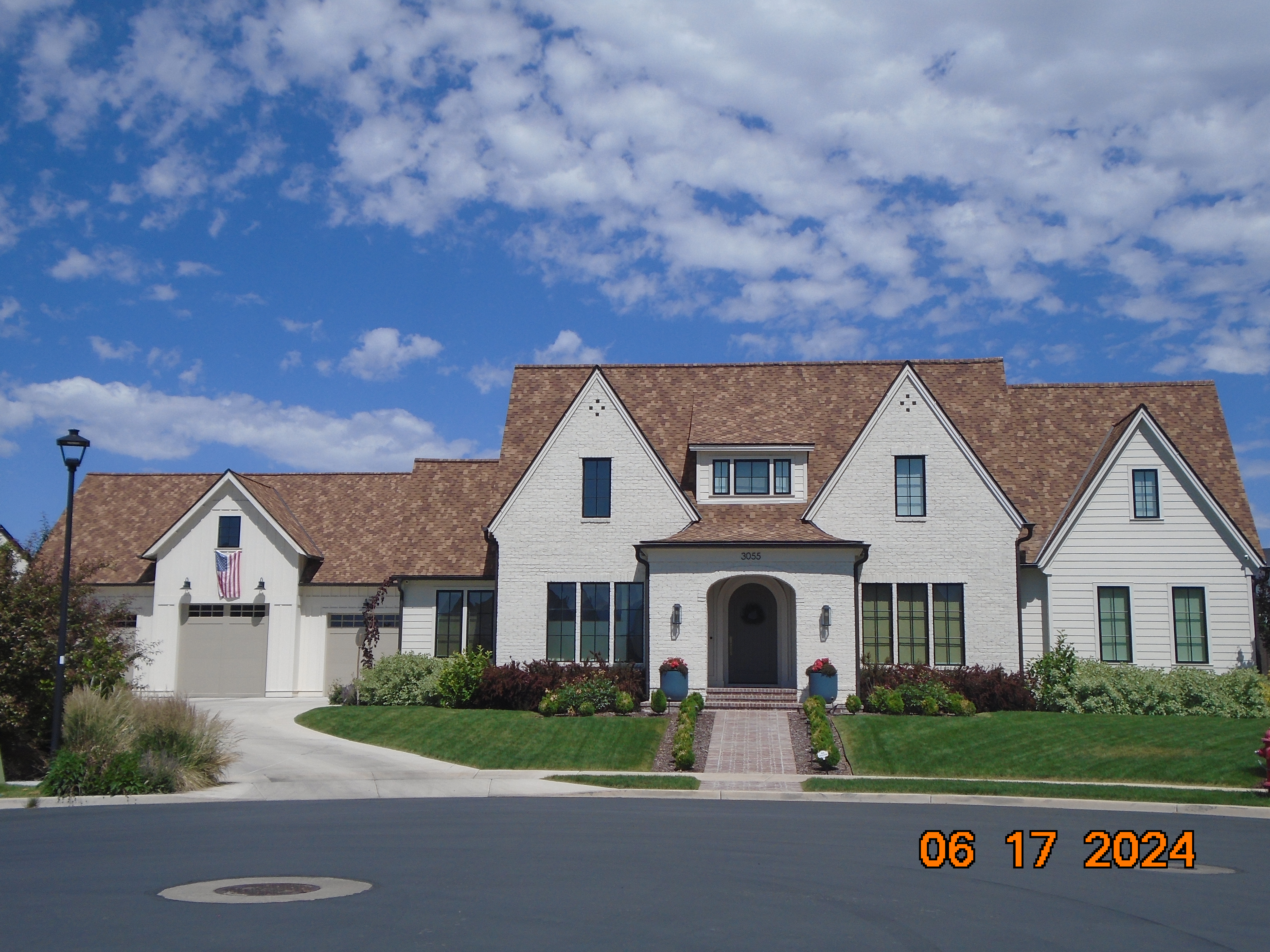
| Property Address: 3055 N 650 WEST - PLEASANT GROVE |
|
| Mailing Address: 3055 N 650 W PLEASANT GROVE, UT 84062 |
|
| Acreage: 0.562797 |
|
| Last Document:
97306-2019
|
|
| Subdivision Map Filing |
|
| Taxing Description:
LOT 220, PLAT B, MANILA PARK ESTATES SUB AREA 0.563 AC.
*Taxing description NOT FOR LEGAL DOCUMENTS
|
|
- Owner Names
- Value History
- Tax History
- Location
- Photos
- Documents
- Aerial Image
| |
----- Real Estate Values ----- |
---Improvements--- |
---Greenbelt--- |
Total |
| Year |
Com |
Res |
Agr |
Tot |
Com |
Res |
Agr |
Tot |
Land |
Homesite |
Tot |
Market Value |
| 2024 |
$0 |
$445,800 |
$0 |
$445,800 |
$0 |
$1,502,300 |
$0 |
$1,502,300 |
$0 |
$0 |
$0 |
$1,948,100 |
| 2023 |
$0 |
$405,300 |
$0 |
$405,300 |
$0 |
$1,465,600 |
$0 |
$1,465,600 |
$0 |
$0 |
$0 |
$1,870,900 |
| 2022 |
$0 |
$426,200 |
$0 |
$426,200 |
$0 |
$1,267,400 |
$0 |
$1,267,400 |
$0 |
$0 |
$0 |
$1,693,600 |
| 2021 |
$0 |
$266,400 |
$0 |
$266,400 |
$0 |
$953,600 |
$0 |
$953,600 |
$0 |
$0 |
$0 |
$1,220,000 |
| 2020 |
$0 |
$246,700 |
$0 |
$246,700 |
$0 |
$0 |
$0 |
$0 |
$0 |
$0 |
$0 |
$246,700 |
| 2019 |
$0 |
$229,100 |
$0 |
$229,100 |
$0 |
$0 |
$0 |
$0 |
$0 |
$0 |
$0 |
$229,100 |
| Year |
General Taxes |
Adjustments |
Net Taxes |
Fees |
Payments |
Tax Balance* |
Balance Due |
Tax District |
| 2025 |
$0.00 |
$0.00 |
$0.00 |
$0.00 |
|
$0.00
|
$0.00 |
070 - PLEASANT GROVE CITY |
| 2024 |
$9,181.30 |
$0.00 |
$9,181.30 |
$0.00 |
|
$0.00
|
$0.00 |
070 - PLEASANT GROVE CITY |
| 2023 |
$8,422.32 |
($195.50) |
$8,226.82 |
$0.00 |
|
$0.00
|
$0.00 |
070 - PLEASANT GROVE CITY |
| 2022 |
$7,662.35 |
$0.00 |
$7,662.35 |
$0.00 |
|
$0.00
|
$0.00 |
070 - PLEASANT GROVE CITY |
| 2021 |
$7,492.94 |
($901.71) |
$6,591.23 |
$0.00 |
|
$0.00
|
$0.00 |
070 - PLEASANT GROVE CITY |
| 2020 |
$2,471.93 |
$0.00 |
$2,471.93 |
$0.00 |
|
$0.00
|
$0.00 |
070 - PLEASANT GROVE CITY |
| 2019 |
$2,219.75 |
$0.00 |
$2,219.75 |
$0.00 |
|
$0.00
|
$0.00 |
070 - PLEASANT GROVE CITY |
* Note: Original tax amount (Does not include applicable interest and/or fees).
| Entry # |
Date |
Recorded |
Type |
Party1 (Grantor) |
Party2 (Grantee) |
| 72263-2023 |
11/02/2023 |
11/02/2023 |
WD |
JENKINS, MORGAN D & LESLIE |
JENKINS, MORGAN & LESLIE TEE (ET AL) |
| 159698-2021 |
08/25/2021 |
09/15/2021 |
D TR |
JENKINS, MORGAN D & LESLIE |
ALLY BANK |
| 151830-2021 |
08/31/2021 |
08/31/2021 |
REC |
FORTIS PRIVATE BANK TEE |
JENKINS, MORGAN D & LESLIE |
| 165245-2020 |
10/19/2020 |
10/22/2020 |
MOD AGR |
JENKINS, MORGAN D & LESLIE |
FORTIS PRIVATE BANK |
| 97307-2019 |
09/27/2019 |
09/27/2019 |
D TR |
JENKINS, MORGAN D & LESLIE |
FORTIS PRIVATE BANK |
| 97306-2019 |
09/27/2019 |
09/27/2019 |
WD |
JENKINS, LESLIE |
JENKINS, MORGAN D & LESLIE |
| 82301-2018 |
08/29/2018 |
08/29/2018 |
WD |
POC DEVELOPMENT LLC BY (ET AL) |
JENKINS, LESLIE |
| 71686-2018 |
07/24/2018 |
07/31/2018 |
DECLCOV |
POC DEVELOPMENT LLC |
WHOM OF INTEREST |
| 65362-2018 |
12/05/2017 |
07/12/2018 |
S PLAT |
POC DEVELOPMENT LLC |
MANILA PARK ESTATES PLAT B |
Main Menu Comments or Concerns on Value/Appraisal - Assessor's Office
Documents/Owner/Parcel information - Recorder's Office
Address Change for Tax Notice
This page was created on 1/26/2025 2:06:33 PM |
