Property Information
mobile view
| Serial Number: 67:073:0528 |
Serial Life: 2021... |
|
|
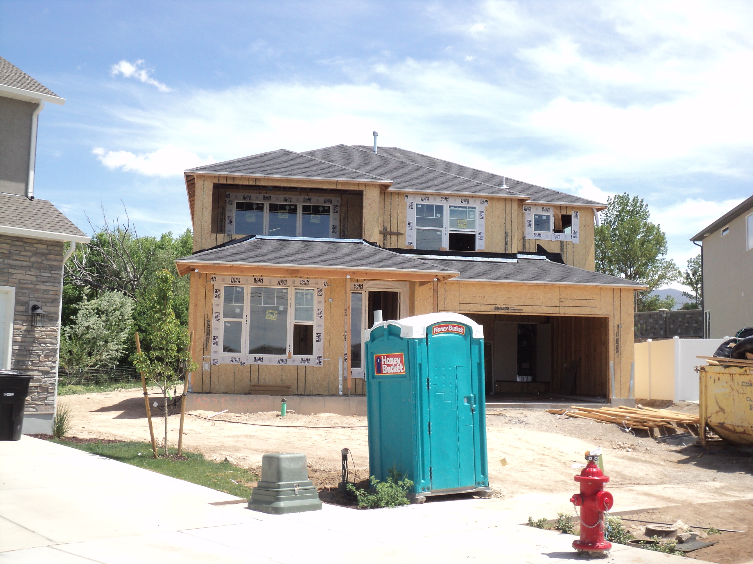 Total Photos: 1
|
| |
|
|
| Property Address: 1823 E 1600 NORTH - SPANISH FORK |
|
| Mailing Address: 1823 E 1600 N SPANISH FORK, UT 84660 |
|
| Acreage: 0.433033 |
|
| Last Document:
165266-2021
|
|
| Subdivision Map Filing |
|
| Taxing Description:
PART LOT 503, MEADOW CREEK RIDGE PHASE 5 SUB DESCRIBED AS FOLLOWS; COM N 269.85 FT & E 3502.77 FT FR SW COR. SEC. 8, T8S, R3E, SLB&M.; N 89 DEG 32' 44" E 60.94 FT; S 88 DEG 54' 24" E 105.3 FT; S 85 DEG 55' 57" E 22.83 FT; S 34 DEG 24' 11" W 110.37 FT; N 72 DEG 22' 28" W 56.02 FT; S 66 DEG 41' 50" W 131.34 FT; ALONG A CURVE TO L (CHORD BEARS: N 39 DEG 44' 20" W 33.95 FT, RADIUS = 60 FT); N 33 DEG 49' 48" E 124.11 FT TO BEG. AREA 0.433 AC.
*Taxing description NOT FOR LEGAL DOCUMENTS
|
|
- Owner Names
- Value History
- Tax History
- Location
- Photos
- Documents
- Aerial Image
| |
----- Real Estate Values ----- |
---Improvements--- |
---Greenbelt--- |
Total |
| Year |
Com |
Res |
Agr |
Tot |
Com |
Res |
Agr |
Tot |
Land |
Homesite |
Tot |
Market Value |
| 2024 |
$0 |
$210,400 |
$0 |
$210,400 |
$0 |
$294,900 |
$0 |
$294,900 |
$0 |
$0 |
$0 |
$505,300 |
| 2023 |
$0 |
$210,400 |
$0 |
$210,400 |
$0 |
$321,700 |
$0 |
$321,700 |
$0 |
$0 |
$0 |
$532,100 |
| 2022 |
$0 |
$224,300 |
$0 |
$224,300 |
$0 |
$297,700 |
$0 |
$297,700 |
$0 |
$0 |
$0 |
$522,000 |
| 2021 |
$0 |
$160,200 |
$0 |
$160,200 |
$0 |
$0 |
$0 |
$0 |
$0 |
$0 |
$0 |
$160,200 |
| Year |
General Taxes |
Adjustments |
Net Taxes |
Fees |
Payments |
Tax Balance* |
Balance Due |
Tax District |
| 2025 |
$0.00 |
$0.00 |
$0.00 |
$0.00 |
|
$0.00
|
$0.00 |
150 - SPANISH FORK CITY |
| 2024 |
$0.00 |
$0.00 |
$0.00 |
$0.00 |
|
$0.00
|
$0.00 |
150 - SPANISH FORK CITY |
| 2023 |
$2,836.12 |
$0.00 |
$2,836.12 |
$0.00 |
|
$0.00
|
$0.00 |
150 - SPANISH FORK CITY |
| 2022 |
$2,836.84 |
$0.00 |
$2,836.84 |
$0.00 |
|
$0.00
|
$0.00 |
150 - SPANISH FORK CITY |
| 2021 |
$1,799.05 |
$0.00 |
$1,799.05 |
$0.00 |
|
$0.00
|
$0.00 |
150 - SPANISH FORK CITY |
* Note: Original tax amount (Does not include applicable interest and/or fees).
| Entry # |
Date |
Recorded |
Type |
Party1 (Grantor) |
Party2 (Grantee) |
| 52965-2024 |
08/07/2024 |
08/07/2024 |
SUB TEE |
INTERCAP LENDING INC |
MERIDIAN TITLE COMPANY SUBTEE |
| 51536-2024 |
07/30/2024 |
08/01/2024 |
D TR |
COX, RILEY & TESSEA |
RESICENTRAL LLC |
| 51535-2024 |
07/31/2024 |
08/01/2024 |
WD |
PRATT, JAMES & MAKENNA |
COX, RILEY & TESSEA |
| 170650-2021 |
10/04/2021 |
10/04/2021 |
PRSUBTE |
MDF ESTATE PLANNING SERVICES INC TEE (ET AL) |
MEADOW CREEK SUBDIVISION LLC |
| 165267-2021 |
09/22/2021 |
09/24/2021 |
D TR |
PRATT, JAMES & MAKENNA |
INTERCAP LENDING INC |
| 165266-2021 |
09/21/2021 |
09/24/2021 |
WD |
BACH HOMES LLC |
PRATT, JAMES & MAKENNA |
| 165265-2021 |
09/21/2021 |
09/24/2021 |
WD |
MEADOW CREEK SUBDIVISION LLC |
BACH HOMES LLC |
| 136900-2020 |
09/03/2020 |
09/09/2020 |
EAS |
MEADOW CREEK SUBDIVISION LLC |
MEADOW CREEK SUBDIVISION LLC |
| 136898-2020 |
09/04/2020 |
09/09/2020 |
BLA |
MEADOW CREEK SUBDIVISION LLC |
BRADSHAW, BRUCE K & HEIDI |
Main Menu Comments or Concerns on Value/Appraisal - Assessor's Office
Documents/Owner/Parcel information - Recorder's Office
Address Change for Tax Notice
This page was created on 8/25/2024 9:10:38 PM |