Property Information
mobile view
| Serial Number: 09:101:0014 |
Serial Life: 1983-2002 |
|
|
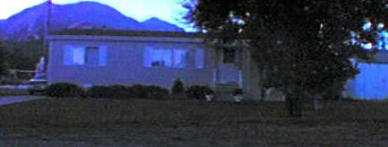
Total Photos: 1
|
| |
|
|
| Property Address: |
|
| Mailing Address: 89 W 300 N SANTAQUIN, UT 84655-7037 |
|
| Acreage: 0.22 |
|
| Last Document:
92264-1998
|
|
| Subdivision Map Filing |
|
| Taxing Description:
COM NE COR LOT 4, BLK 40, PLAT B, SANTAQUIN; S 120 FT; W 80 FT; N 120 FT; E 80 FT TO BEG. AREA .22 ACRE.
*Taxing description NOT FOR LEGAL DOCUMENTS
|
|
- Owner Names
- Value History
- Tax History
- Location
- Photos
- Documents
- Aerial Image
| |
----- Real Estate Values ----- |
---Improvements--- |
---Greenbelt--- |
Total |
| Year |
Com |
Res |
Agr |
Tot |
Com |
Res |
Agr |
Tot |
Land |
Homesite |
Tot |
Market Value |
| 2002 |
$0 |
$0 |
$26,259 |
$26,259 |
$0 |
$0 |
$0 |
$0 |
$0 |
$0 |
$0 |
$26,259 |
| 2001 |
$0 |
$0 |
$26,259 |
$26,259 |
$0 |
$0 |
$0 |
$0 |
$0 |
$0 |
$0 |
$26,259 |
| 2000 |
$0 |
$0 |
$24,541 |
$24,541 |
$0 |
$0 |
$0 |
$0 |
$0 |
$0 |
$0 |
$24,541 |
| 1999 |
$0 |
$0 |
$24,541 |
$24,541 |
$0 |
$0 |
$0 |
$0 |
$0 |
$0 |
$0 |
$24,541 |
| 1998 |
$0 |
$0 |
$24,541 |
$24,541 |
$0 |
$0 |
$0 |
$0 |
$0 |
$0 |
$0 |
$24,541 |
| 1997 |
$0 |
$0 |
$24,541 |
$24,541 |
$0 |
$0 |
$0 |
$0 |
$0 |
$0 |
$0 |
$24,541 |
| 1996 |
$0 |
$0 |
$24,541 |
$24,541 |
$0 |
$0 |
$0 |
$0 |
$0 |
$0 |
$0 |
$24,541 |
| 1995 |
$0 |
$0 |
$22,310 |
$22,310 |
$0 |
$0 |
$0 |
$0 |
$0 |
$0 |
$0 |
$22,310 |
| 1994 |
$0 |
$0 |
$13,047 |
$13,047 |
$0 |
$0 |
$0 |
$0 |
$0 |
$0 |
$0 |
$13,047 |
| 1993 |
$0 |
$0 |
$13,047 |
$13,047 |
$0 |
$0 |
$0 |
$0 |
$0 |
$0 |
$0 |
$13,047 |
| 1992 |
$0 |
$0 |
$11,970 |
$11,970 |
$0 |
$0 |
$0 |
$0 |
$0 |
$0 |
$0 |
$11,970 |
| 1991 |
$0 |
$0 |
$10,500 |
$10,500 |
$0 |
$0 |
$0 |
$0 |
$0 |
$0 |
$0 |
$10,500 |
| 1990 |
$0 |
$0 |
$10,500 |
$10,500 |
$0 |
$0 |
$0 |
$0 |
$0 |
$0 |
$0 |
$10,500 |
| 1989 |
$0 |
$0 |
$10,500 |
$10,500 |
$0 |
$0 |
$0 |
$0 |
$0 |
$0 |
$0 |
$10,500 |
| 1988 |
$0 |
$0 |
$10,500 |
$10,500 |
$0 |
$0 |
$0 |
$0 |
$0 |
$0 |
$0 |
$10,500 |
| 1987 |
$0 |
$0 |
$10,825 |
$10,825 |
$0 |
$0 |
$0 |
$0 |
$0 |
$0 |
$0 |
$10,825 |
| 1986 |
$0 |
$0 |
$10,825 |
$10,825 |
$0 |
$0 |
$0 |
$0 |
$0 |
$0 |
$0 |
$10,825 |
| 1985 |
$0 |
$0 |
$10,825 |
$10,825 |
$0 |
$0 |
$0 |
$0 |
$0 |
$0 |
$0 |
$10,825 |
| 1984 |
$0 |
$0 |
$10,931 |
$10,931 |
$0 |
$0 |
$0 |
$0 |
$0 |
$0 |
$0 |
$10,931 |
| Year |
General Taxes |
Adjustments |
Net Taxes |
Fees |
Payments |
Tax Balance* |
Balance Due |
Tax District |
| 2002 |
$303.19 |
$0.00 |
$303.19 |
$0.00 |
|
$0.00
|
$0.00 |
190 - SANTAQUIN CITY |
| 2001 |
$305.10 |
$0.00 |
$305.10 |
$0.00 |
|
$0.00
|
$0.00 |
190 - SANTAQUIN CITY |
| 2000 |
$283.20 |
$0.00 |
$283.20 |
$0.00 |
|
$0.00
|
$0.00 |
190 - SANTAQUIN CITY |
| 1999 |
$268.55 |
$0.00 |
$268.55 |
$0.00 |
|
$0.00
|
$0.00 |
190 - SANTAQUIN CITY |
| 1998 |
$261.90 |
$0.00 |
$261.90 |
$0.00 |
|
$0.00
|
$0.00 |
190 - SANTAQUIN CITY |
| 1997 |
$284.45 |
$0.00 |
$284.45 |
$0.00 |
|
$0.00
|
$0.00 |
190 - SANTAQUIN CITY |
| 1996 |
$280.23 |
$0.00 |
$280.23 |
$0.00 |
|
$0.00
|
$0.00 |
190 - SANTAQUIN CITY |
| 1995 |
$255.63 |
$0.00 |
$255.63 |
$0.00 |
|
$0.00
|
$0.00 |
190 - SANTAQUIN CITY |
| 1994 |
$186.70 |
$0.00 |
$186.70 |
$0.00 |
|
$0.00
|
$0.00 |
190 - SANTAQUIN CITY |
| 1993 |
$164.53 |
$0.00 |
$164.53 |
$0.00 |
|
$0.00
|
$0.00 |
190 - SANTAQUIN CITY |
| 1992 |
$147.94 |
$0.00 |
$147.94 |
$0.00 |
|
$0.00
|
$0.00 |
190 - SANTAQUIN CITY |
| 1991 |
$138.67 |
$0.00 |
$138.67 |
$0.00 |
|
$0.00
|
$0.00 |
190 - SANTAQUIN CITY |
| 1990 |
$127.77 |
$0.00 |
$127.77 |
$0.00 |
|
$0.00
|
$0.00 |
190 - SANTAQUIN CITY |
| 1989 |
$131.82 |
$0.00 |
$131.82 |
$0.00 |
|
$0.00
|
$0.00 |
190 - SANTAQUIN CITY |
| 1988 |
$131.78 |
$0.00 |
$131.78 |
$0.00 |
|
$0.00
|
$0.00 |
190 - SANTAQUIN CITY |
| 1987 |
$134.48 |
$0.00 |
$134.48 |
$0.00 |
|
$0.00
|
$0.00 |
190 - SANTAQUIN CITY |
| 1986 |
$129.54 |
$0.00 |
$129.54 |
$0.00 |
|
$0.00
|
$0.00 |
190 - SANTAQUIN CITY |
| 1985 |
$128.34 |
$0.00 |
$128.34 |
$0.00 |
|
$0.00
|
$0.00 |
190 - SANTAQUIN CITY |
| 1984 |
$123.46 |
$0.00 |
$123.46 |
$0.00 |
|
$0.00
|
$0.00 |
190 - SANTAQUIN CITY |
* Note: Original tax amount (Does not include applicable interest and/or fees).
| Entry # |
Date |
Recorded |
Type |
Party1 (Grantor) |
Party2 (Grantee) |
| 39622-2002 |
04/09/2002 |
04/09/2002 |
QCD |
WILLIAMS, KATHLEEN M |
WILLIAMS, KATHLEEN M |
| 92264-1998 |
05/22/1997 |
09/11/1998 |
WD |
HORE, FRED & FRED W AKA |
WILLIAMS, KATHLEEN M |
| 39390-1997 |
05/22/1997 |
05/22/1997 |
WD |
WILLIAMS, KATHLEEN M |
HORE, FRED & FRED W AKA |
| 54055-1993 |
08/10/1993 |
08/10/1993 |
WD |
HORE, FRED |
WILLIAMS, KATHLEEN M |
| 54054-1993 |
07/30/1993 |
08/10/1993 |
AF DC |
HORE, LUCILLE ANNA PETERSON & LUCILLE AKA |
WHOM OF INTEREST |
| 11192-1982 |
05/05/1982 |
05/05/1982 |
WD |
HORE, FRED & LUCILLE |
HORE, FRED & LUCILLE |
Main Menu Comments or Concerns on Value/Appraisal - Assessor's Office
Documents/Owner/Parcel information - Recorder's Office
Address Change for Tax Notice
This page was created on 7/24/2024 12:19:18 AM |