Property Information
mobile view
| Serial Number: 25:013:0036 |
Serial Life: 2010... |
|
|
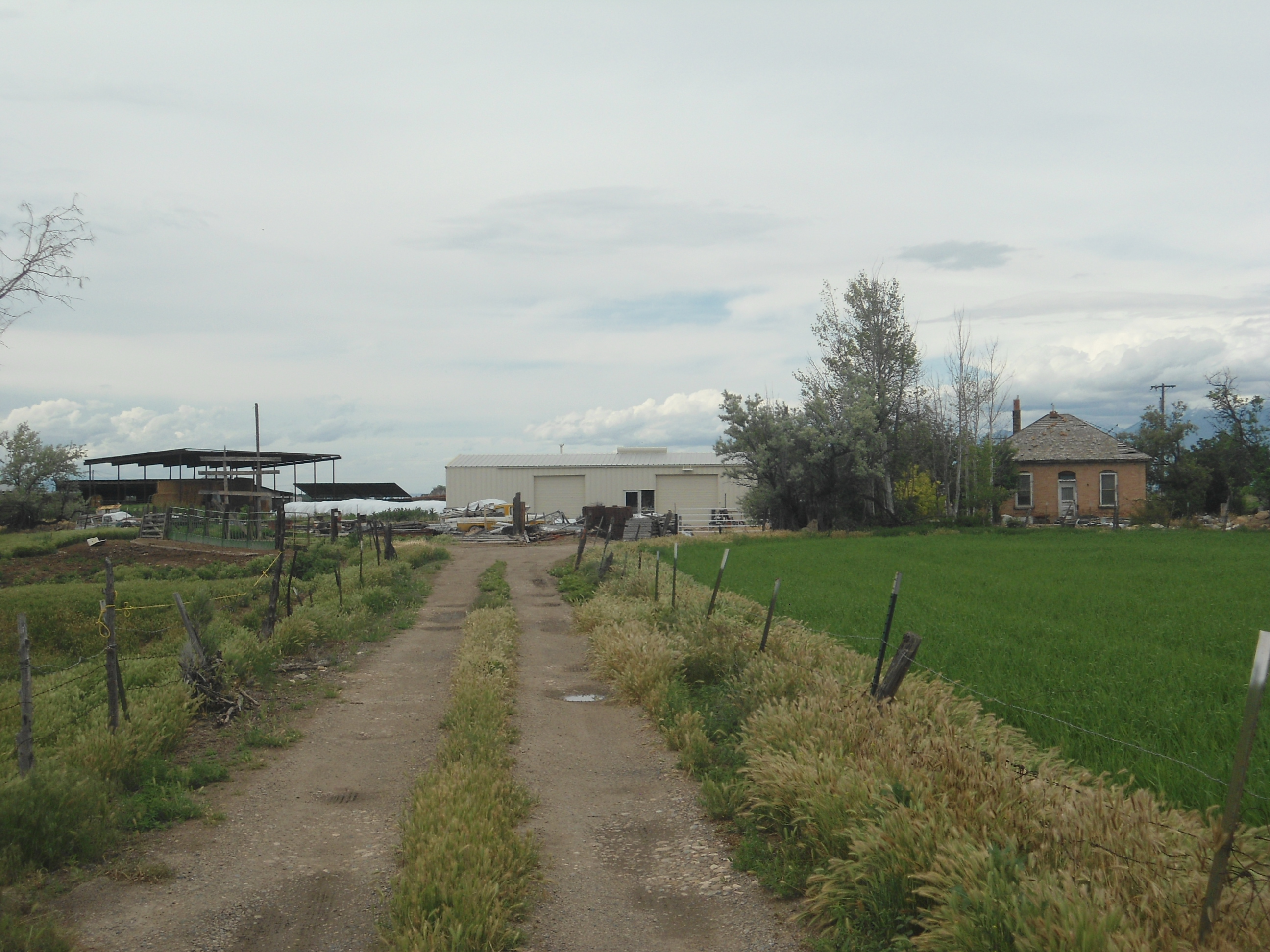 Total Photos: 1
|
| |
|
|
| Property Address: |
|
| Mailing Address: 3283 W 7300 S SPANISH FORK, UT 84660-4045 |
|
| Acreage: 1.384573 |
|
| Last Document:
124731-2009
|
|
| Subdivision Map Filing |
|
| Taxing Description:
COM S 377.36 FT & E 1721.31 FT FR W 1/4 COR. SEC. 23, T8S, R2E, SLB&M.; N 56 DEG 15' 0" W 258.05 FT; W 137.83 FT; N 13 DEG 8' 10" W 79.82 FT; S 75 DEG 20' 0" E 352.67 FT; N 75 DEG 5' 0" E 210.99 FT; S 11 DEG 45' 0" E 206.98 FT; W 99.04 FT; N 81 DEG 59' 59" W 118.8 FT TO BEG. AREA 1.385 AC.
*Taxing description NOT FOR LEGAL DOCUMENTS
|
|
- Owner Names
- Value History
- Tax History
- Location
- Photos
- Documents
- Aerial Image
| |
----- Real Estate Values ----- |
---Improvements--- |
---Greenbelt--- |
Total |
| Year |
Com |
Res |
Agr |
Tot |
Com |
Res |
Agr |
Tot |
Land |
Homesite |
Tot |
Market Value |
| 2024 |
$0 |
$79,700 |
$8,600 |
$88,300 |
$0 |
$13,100 |
$0 |
$13,100 |
$0 |
$0 |
$0 |
$101,400 |
| 2023 |
$0 |
$79,700 |
$8,600 |
$88,300 |
$0 |
$13,100 |
$0 |
$13,100 |
$0 |
$0 |
$0 |
$101,400 |
| 2022 |
$0 |
$133,000 |
$9,200 |
$142,200 |
$0 |
$13,100 |
$0 |
$13,100 |
$0 |
$0 |
$0 |
$155,300 |
| 2021 |
$0 |
$68,300 |
$5,400 |
$73,700 |
$0 |
$11,900 |
$0 |
$11,900 |
$0 |
$0 |
$0 |
$85,600 |
| 2020 |
$0 |
$88,700 |
$4,800 |
$93,500 |
$0 |
$11,900 |
$0 |
$11,900 |
$0 |
$0 |
$0 |
$105,400 |
| 2019 |
$0 |
$99,000 |
$6,500 |
$105,500 |
$0 |
$11,900 |
$0 |
$11,900 |
$0 |
$0 |
$0 |
$117,400 |
| 2018 |
$0 |
$81,000 |
$6,500 |
$87,500 |
$0 |
$11,200 |
$0 |
$11,200 |
$0 |
$0 |
$0 |
$98,700 |
| 2017 |
$0 |
$67,500 |
$6,500 |
$74,000 |
$0 |
$10,100 |
$0 |
$10,100 |
$0 |
$0 |
$0 |
$84,100 |
| 2016 |
$0 |
$49,500 |
$6,500 |
$56,000 |
$0 |
$10,100 |
$0 |
$10,100 |
$0 |
$0 |
$0 |
$66,100 |
| 2015 |
$0 |
$0 |
$23,500 |
$23,500 |
$0 |
$0 |
$10,100 |
$10,100 |
$0 |
$0 |
$0 |
$33,600 |
| 2014 |
$0 |
$0 |
$23,500 |
$23,500 |
$0 |
$0 |
$10,100 |
$10,100 |
$0 |
$0 |
$0 |
$33,600 |
| 2013 |
$0 |
$27,700 |
$0 |
$27,700 |
$0 |
$13,000 |
$0 |
$13,000 |
$0 |
$0 |
$0 |
$40,700 |
| 2012 |
$0 |
$29,400 |
$2,500 |
$31,900 |
$0 |
$40,100 |
$16,800 |
$56,900 |
$0 |
$0 |
$0 |
$88,800 |
| 2011 |
$0 |
$29,400 |
$2,500 |
$31,900 |
$0 |
$40,100 |
$16,800 |
$56,900 |
$0 |
$0 |
$0 |
$88,800 |
| 2010 |
$0 |
$29,400 |
$2,500 |
$31,900 |
$0 |
$40,100 |
$16,800 |
$56,900 |
$0 |
$0 |
$0 |
$88,800 |
| Year |
General Taxes |
Adjustments |
Net Taxes |
Fees |
Payments |
Tax Balance* |
Balance Due |
Tax District |
| 2025 |
$0.00 |
$0.00 |
$0.00 |
$0.00 |
|
$0.00
|
$0.00 |
120 - NEBO SCHOOL DIST S/A 6-7-8 |
| 2024 |
$1,014.41 |
$0.00 |
$1,014.41 |
$0.00 |
|
$0.00
|
$0.00 |
120 - NEBO SCHOOL DIST S/A 6-7-8 |
| 2023 |
$1,013.59 |
$0.00 |
$1,013.59 |
$0.00 |
|
$0.00
|
$0.00 |
120 - NEBO SCHOOL DIST S/A 6-7-8 |
| 2022 |
$1,580.80 |
$0.00 |
$1,580.80 |
$0.00 |
|
$0.00
|
$0.00 |
120 - NEBO SCHOOL DIST S/A 6-7-8 |
| 2021 |
$1,466.09 |
($451.56) |
$1,014.53 |
$0.00 |
|
$0.00
|
$0.00 |
120 - NEBO SCHOOL DIST S/A 6-7-8 |
| 2020 |
$1,635.74 |
($349.12) |
$1,286.62 |
$0.00 |
|
$0.00
|
$0.00 |
120 - NEBO SCHOOL DIST S/A 6-7-8 |
| 2019 |
$1,404.46 |
$0.00 |
$1,404.46 |
$0.00 |
|
$0.00
|
$0.00 |
120 - NEBO SCHOOL DIST S/A 6-7-8 |
| 2018 |
$1,234.14 |
$0.00 |
$1,234.14 |
$0.00 |
|
$0.00
|
$0.00 |
120 - NEBO SCHOOL DIST S/A 6-7-8 |
| 2017 |
$1,081.69 |
$0.00 |
$1,081.69 |
$0.00 |
|
$0.00
|
$0.00 |
120 - NEBO SCHOOL DIST S/A 6-7-8 |
| 2016 |
$876.88 |
$0.00 |
$876.88 |
$0.00 |
|
$0.00
|
$0.00 |
120 - NEBO SCHOOL DIST S/A 6-7-8 |
| 2015 |
$449.50 |
$0.00 |
$449.50 |
$0.00 |
|
$0.00
|
$0.00 |
120 - NEBO SCHOOL DIST S/A 6-7-8 |
| 2014 |
$449.27 |
$0.00 |
$449.27 |
$0.00 |
|
$0.00
|
$0.00 |
120 - NEBO SCHOOL DIST S/A 6-7-8 |
| 2013 |
$566.10 |
$0.00 |
$566.10 |
$0.00 |
|
$0.00
|
$0.00 |
120 - NEBO SCHOOL DIST S/A 6-7-8 |
| 2012 |
$810.24 |
$0.00 |
$810.24 |
$0.00 |
|
$0.00
|
$0.00 |
120 - NEBO SCHOOL DIST S/A 6-7-8 |
| 2011 |
$795.51 |
$0.00 |
$795.51 |
$0.00 |
|
$0.00
|
$0.00 |
120 - NEBO SCHOOL DIST S/A 6-7-8 |
| 2010 |
$777.11 |
$0.00 |
$777.11 |
$0.00 |
|
$0.00
|
$0.00 |
120 - NEBO SCHOOL DIST S/A 6-7-8 |
* Note: Original tax amount (Does not include applicable interest and/or fees).
| Entry # |
Date |
Recorded |
Type |
Party1 (Grantor) |
Party2 (Grantee) |
| 5544-2023 |
01/30/2023 |
01/30/2023 |
QCD |
PULLMAN, CHARLES DEE |
PULLMAN, CRAIG ALAN & CHRISTINE |
| 109012-2021 |
03/12/2021 |
06/15/2021 |
N |
LARSEN FAMILY FARMS LLC |
WHOM OF INTEREST |
| 3187-2015 |
12/04/2014 |
01/14/2015 |
QCD |
UNITED STATES OF AMERICA |
SOUTH UTAH VALLEY ELECTRIC SERVICE DISTRICT |
| 124731-2009 |
12/03/2009 |
12/03/2009 |
N SPREC |
UTAH COUNTY RECORDER |
WHOM OF INTEREST |
Main Menu Comments or Concerns on Value/Appraisal - Assessor's Office
Documents/Owner/Parcel information - Recorder's Office
Address Change for Tax Notice
This page was created on 3/12/2025 11:38:35 AM |