Property Information
mobile view
| Serial Number: 35:047:0018 |
Serial Life: 1979... |
|
|
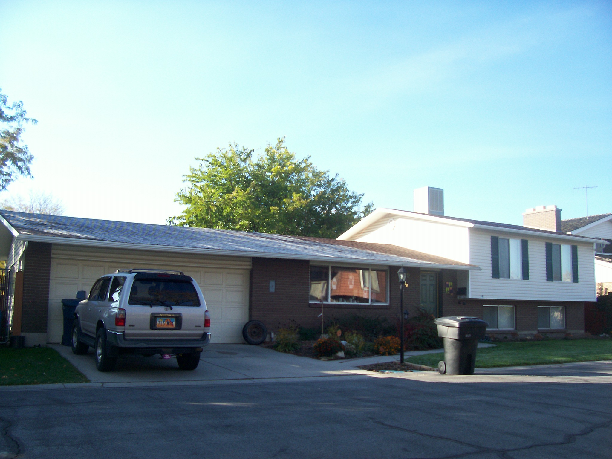 Total Photos: 2
|
| |
|
|
| Property Address: 330 E 1730 SOUTH - OREM |
|
| Mailing Address: 330 E 1730 S OREM, UT 84058-7913 |
|
| Acreage: 0.137743 |
|
| Last Document:
36070-1993
|
|
| Subdivision Map Filing |
|
| Taxing Description:
LOT 36, SEC B, BURNING TREE ACRES PLANNED DWELLING GROUP SUB AREA 0.138 AC.
*Taxing description NOT FOR LEGAL DOCUMENTS
|
|
- Owner Names
- Value History
- Tax History
- Location
- Photos
- Documents
- Aerial Image
| 2012... |
|
BAIR, DUANE T |
|
| 2012... |
|
BAIR, KRISTIN N |
|
| 1994-2011 |
|
BAIR, DUANE T |
|
| 1994-2011 |
|
BAIR, KRISTIN N |
|
| 1990-1993 |
|
SIMMONS, DANIEL L |
|
| 1990-1993 |
|
SIMMONS, TRUDY W |
|
| 1989 |
|
GIBBY, PAMELA F |
|
| 1989NV |
|
GIBBY, PAMELA F |
|
| 1989NV |
|
GIBBY, RICHARD D |
|
| 1987-1988 |
|
GIBBONS, JAMES D |
|
| 1985-1986 |
|
THATCHER, LINDA R |
|
| 1985-1986 |
|
THATCHER, TERRY D |
|
| 1984 |
|
WATSON, DWAYNE C |
|
| 1984 |
|
WATSON, TEDDIE G |
|
| 1979-1983 |
|
WATSON, DWAYNE C |
|
| 1979-1983 |
|
WATSON, TEDDIE G |
|
| |
----- Real Estate Values ----- |
---Improvements--- |
---Greenbelt--- |
Total |
| Year |
Com |
Res |
Agr |
Tot |
Com |
Res |
Agr |
Tot |
Land |
Homesite |
Tot |
Market Value |
| 2024 |
$0 |
$193,400 |
$0 |
$193,400 |
$0 |
$243,100 |
$0 |
$243,100 |
$0 |
$0 |
$0 |
$436,500 |
| 2023 |
$0 |
$193,400 |
$0 |
$193,400 |
$0 |
$244,700 |
$0 |
$244,700 |
$0 |
$0 |
$0 |
$438,100 |
| 2022 |
$0 |
$206,200 |
$0 |
$206,200 |
$0 |
$219,200 |
$0 |
$219,200 |
$0 |
$0 |
$0 |
$425,400 |
| 2021 |
$0 |
$121,300 |
$0 |
$121,300 |
$0 |
$203,000 |
$0 |
$203,000 |
$0 |
$0 |
$0 |
$324,300 |
| 2020 |
$0 |
$97,000 |
$0 |
$97,000 |
$0 |
$197,100 |
$0 |
$197,100 |
$0 |
$0 |
$0 |
$294,100 |
| 2019 |
$0 |
$84,100 |
$0 |
$84,100 |
$0 |
$197,100 |
$0 |
$197,100 |
$0 |
$0 |
$0 |
$281,200 |
| 2018 |
$0 |
$80,800 |
$0 |
$80,800 |
$0 |
$171,400 |
$0 |
$171,400 |
$0 |
$0 |
$0 |
$252,200 |
| 2017 |
$0 |
$74,400 |
$0 |
$74,400 |
$0 |
$149,000 |
$0 |
$149,000 |
$0 |
$0 |
$0 |
$223,400 |
| 2016 |
$0 |
$64,700 |
$0 |
$64,700 |
$0 |
$142,900 |
$0 |
$142,900 |
$0 |
$0 |
$0 |
$207,600 |
| 2015 |
$0 |
$64,700 |
$0 |
$64,700 |
$0 |
$124,300 |
$0 |
$124,300 |
$0 |
$0 |
$0 |
$189,000 |
| 2014 |
$0 |
$66,600 |
$0 |
$66,600 |
$0 |
$114,100 |
$0 |
$114,100 |
$0 |
$0 |
$0 |
$180,700 |
| 2013 |
$0 |
$64,600 |
$0 |
$64,600 |
$0 |
$99,200 |
$0 |
$99,200 |
$0 |
$0 |
$0 |
$163,800 |
| 2012 |
$0 |
$52,400 |
$0 |
$52,400 |
$0 |
$94,400 |
$0 |
$94,400 |
$0 |
$0 |
$0 |
$146,800 |
| 2011 |
$0 |
$57,500 |
$0 |
$57,500 |
$0 |
$90,200 |
$0 |
$90,200 |
$0 |
$0 |
$0 |
$147,700 |
| 2010 |
$0 |
$61,754 |
$0 |
$61,754 |
$0 |
$95,244 |
$0 |
$95,244 |
$0 |
$0 |
$0 |
$156,998 |
| 2009 |
$0 |
$96,000 |
$0 |
$96,000 |
$0 |
$71,900 |
$0 |
$71,900 |
$0 |
$0 |
$0 |
$167,900 |
| 2008 |
$0 |
$96,000 |
$0 |
$96,000 |
$0 |
$99,200 |
$0 |
$99,200 |
$0 |
$0 |
$0 |
$195,200 |
| 2007 |
$0 |
$100,000 |
$0 |
$100,000 |
$0 |
$103,300 |
$0 |
$103,300 |
$0 |
$0 |
$0 |
$203,300 |
| 2006 |
$0 |
$68,200 |
$0 |
$68,200 |
$0 |
$95,800 |
$0 |
$95,800 |
$0 |
$0 |
$0 |
$164,000 |
| 2005 |
$0 |
$64,988 |
$0 |
$64,988 |
$0 |
$91,271 |
$0 |
$91,271 |
$0 |
$0 |
$0 |
$156,259 |
| 2004 |
$0 |
$64,988 |
$0 |
$64,988 |
$0 |
$91,271 |
$0 |
$91,271 |
$0 |
$0 |
$0 |
$156,259 |
| 2003 |
$0 |
$64,988 |
$0 |
$64,988 |
$0 |
$91,271 |
$0 |
$91,271 |
$0 |
$0 |
$0 |
$156,259 |
| 2002 |
$0 |
$64,988 |
$0 |
$64,988 |
$0 |
$91,271 |
$0 |
$91,271 |
$0 |
$0 |
$0 |
$156,259 |
| 2001 |
$0 |
$64,988 |
$0 |
$64,988 |
$0 |
$91,271 |
$0 |
$91,271 |
$0 |
$0 |
$0 |
$156,259 |
| 2000 |
$0 |
$60,736 |
$0 |
$60,736 |
$0 |
$85,340 |
$0 |
$85,340 |
$0 |
$0 |
$0 |
$146,076 |
| 1999 |
$0 |
$56,763 |
$0 |
$56,763 |
$0 |
$79,757 |
$0 |
$79,757 |
$0 |
$0 |
$0 |
$136,520 |
| 1998 |
$0 |
$56,763 |
$0 |
$56,763 |
$0 |
$79,757 |
$0 |
$79,757 |
$0 |
$0 |
$0 |
$136,520 |
| 1997 |
$0 |
$56,763 |
$0 |
$56,763 |
$0 |
$79,757 |
$0 |
$79,757 |
$0 |
$0 |
$0 |
$136,520 |
| 1996 |
$0 |
$50,817 |
$0 |
$50,817 |
$0 |
$71,403 |
$0 |
$71,403 |
$0 |
$0 |
$0 |
$122,220 |
| 1995 |
$0 |
$46,197 |
$0 |
$46,197 |
$0 |
$71,403 |
$0 |
$71,403 |
$0 |
$0 |
$0 |
$117,600 |
| 1994 |
$0 |
$27,016 |
$0 |
$27,016 |
$0 |
$57,583 |
$0 |
$57,583 |
$0 |
$0 |
$0 |
$84,599 |
| 1993 |
$0 |
$27,016 |
$0 |
$27,016 |
$0 |
$57,583 |
$0 |
$57,583 |
$0 |
$0 |
$0 |
$84,599 |
| 1992 |
$0 |
$24,785 |
$0 |
$24,785 |
$0 |
$52,828 |
$0 |
$52,828 |
$0 |
$0 |
$0 |
$77,613 |
| 1991 |
$0 |
$21,741 |
$0 |
$21,741 |
$0 |
$43,614 |
$0 |
$43,614 |
$0 |
$0 |
$0 |
$65,355 |
| 1990 |
$0 |
$21,741 |
$0 |
$21,741 |
$0 |
$43,614 |
$0 |
$43,614 |
$0 |
$0 |
$0 |
$65,355 |
| 1989 |
$0 |
$21,741 |
$0 |
$21,741 |
$0 |
$43,614 |
$0 |
$43,614 |
$0 |
$0 |
$0 |
$65,355 |
| 1988 |
$0 |
$21,742 |
$0 |
$21,742 |
$0 |
$43,175 |
$0 |
$43,175 |
$0 |
$0 |
$0 |
$64,917 |
| 1987 |
$0 |
$21,742 |
$0 |
$21,742 |
$0 |
$55,908 |
$0 |
$55,908 |
$0 |
$0 |
$0 |
$77,650 |
| 1986 |
$0 |
$21,742 |
$0 |
$21,742 |
$0 |
$55,909 |
$0 |
$55,909 |
$0 |
$0 |
$0 |
$77,651 |
| 1985 |
$0 |
$21,742 |
$0 |
$21,742 |
$0 |
$55,908 |
$0 |
$55,908 |
$0 |
$0 |
$0 |
$77,650 |
| 1984 |
$0 |
$21,958 |
$0 |
$21,958 |
$0 |
$56,475 |
$0 |
$56,475 |
$0 |
$0 |
$0 |
$78,433 |
| Year |
General Taxes |
Adjustments |
Net Taxes |
Fees |
Payments |
Tax Balance* |
Balance Due |
Tax District |
| 2025 |
$0.00 |
$0.00 |
$0.00 |
$0.00 |
|
$0.00
|
$0.00 |
090 - OREM CITY |
| 2024 |
$1,963.33 |
$0.00 |
$1,963.33 |
$0.00 |
|
$0.00
|
$0.00 |
090 - OREM CITY |
| 2023 |
$1,833.43 |
$0.00 |
$1,833.43 |
$0.00 |
|
$0.00
|
$0.00 |
090 - OREM CITY |
| 2022 |
$1,837.60 |
$0.00 |
$1,837.60 |
$0.00 |
|
$0.00
|
$0.00 |
090 - OREM CITY |
| 2021 |
$1,681.63 |
$0.00 |
$1,681.63 |
$0.00 |
|
$0.00
|
$0.00 |
090 - OREM CITY |
| 2020 |
$1,551.72 |
$0.00 |
$1,551.72 |
$0.00 |
|
$0.00
|
$0.00 |
090 - OREM CITY |
| 2019 |
$1,426.74 |
$0.00 |
$1,426.74 |
$0.00 |
|
$0.00
|
$0.00 |
090 - OREM CITY |
| 2018 |
$1,339.25 |
$0.00 |
$1,339.25 |
$0.00 |
|
$0.00
|
$0.00 |
090 - OREM CITY |
| 2017 |
$1,218.01 |
$0.00 |
$1,218.01 |
$0.00 |
|
$0.00
|
$0.00 |
090 - OREM CITY |
| 2016 |
$1,227.44 |
$0.00 |
$1,227.44 |
$0.00 |
|
$0.00
|
$0.00 |
090 - OREM CITY |
| 2015 |
$1,181.60 |
$0.00 |
$1,181.60 |
$0.00 |
|
$0.00
|
$0.00 |
090 - OREM CITY |
| 2014 |
$1,134.88 |
$0.00 |
$1,134.88 |
$0.00 |
|
$0.00
|
$0.00 |
090 - OREM CITY |
| 2013 |
$1,109.37 |
$0.00 |
$1,109.37 |
$0.00 |
|
$0.00
|
$0.00 |
090 - OREM CITY |
| 2012 |
$1,014.74 |
$0.00 |
$1,014.74 |
$0.00 |
|
$0.00
|
$0.00 |
090 - OREM CITY |
| 2011 |
$1,016.09 |
$0.00 |
$1,016.09 |
$0.00 |
|
$0.00
|
$0.00 |
090 - OREM CITY |
| 2010 |
$1,011.15 |
$0.00 |
$1,011.15 |
$0.00 |
|
$0.00
|
$0.00 |
090 - OREM CITY |
| 2009 |
$1,002.40 |
$0.00 |
$1,002.40 |
$0.00 |
|
$0.00
|
$0.00 |
090 - OREM CITY |
| 2008 |
$1,079.93 |
$0.00 |
$1,079.93 |
$0.00 |
|
$0.00
|
$0.00 |
090 - OREM CITY |
| 2007 |
$1,111.89 |
$0.00 |
$1,111.89 |
$0.00 |
|
$0.00
|
$0.00 |
090 - OREM CITY |
| 2006 |
$955.13 |
$0.00 |
$955.13 |
$0.00 |
|
$0.00
|
$0.00 |
090 - OREM CITY |
| 2005 |
$1,027.18 |
$0.00 |
$1,027.18 |
$0.00 |
|
$0.00
|
$0.00 |
090 - OREM CITY |
| 2004 |
$1,008.96 |
$0.00 |
$1,008.96 |
$0.00 |
|
$0.00
|
$0.00 |
090 - OREM CITY |
| 2003 |
$979.05 |
$0.00 |
$979.05 |
$0.00 |
|
$0.00
|
$0.00 |
090 - OREM CITY |
| 2002 |
$894.74 |
$0.00 |
$894.74 |
$0.00 |
|
$0.00
|
$0.00 |
090 - OREM CITY |
| 2001 |
$886.15 |
$0.00 |
$886.15 |
$0.00 |
|
$0.00
|
$0.00 |
090 - OREM CITY |
| 2000 |
$856.53 |
$0.00 |
$856.53 |
$0.00 |
|
$0.00
|
$0.00 |
090 - OREM CITY |
| 1999 |
$824.14 |
$0.00 |
$824.14 |
$0.00 |
|
$0.00
|
$0.00 |
090 - OREM CITY |
| 1998 |
$778.19 |
$0.00 |
$778.19 |
$0.00 |
|
$0.00
|
$0.00 |
090 - OREM CITY |
| 1997 |
$774.96 |
$0.00 |
$774.96 |
$0.00 |
|
$0.00
|
$0.00 |
090 - OREM CITY |
| 1996 |
$633.83 |
$0.00 |
$633.83 |
$0.00 |
|
$0.00
|
$0.00 |
090 - OREM CITY |
| 1995 |
$690.14 |
$0.00 |
$690.14 |
$0.00 |
|
$0.00
|
$0.00 |
090 - OREM CITY |
| 1994 |
$791.00 |
$0.00 |
$791.00 |
$0.00 |
|
$0.00
|
$0.00 |
090 - OREM CITY |
| 1993 |
$700.03 |
$0.00 |
$700.03 |
$0.00 |
|
$0.00
|
$0.00 |
090 - OREM CITY |
| 1992 |
$647.51 |
$0.00 |
$647.51 |
$0.00 |
|
$0.00
|
$0.00 |
090 - OREM CITY |
| 1991 |
$570.06 |
$0.00 |
$570.06 |
$0.00 |
|
$0.00
|
$0.00 |
090 - OREM CITY |
| 1990 |
$548.00 |
$0.00 |
$548.00 |
$0.00 |
|
$0.00
|
$0.00 |
090 - OREM CITY |
| 1989 |
$558.51 |
$0.00 |
$558.51 |
$0.00 |
|
$0.00
|
$0.00 |
090 - OREM CITY |
| 1988 |
$553.44 |
$0.00 |
$553.44 |
$0.00 |
|
$0.00
|
$0.00 |
090 - OREM CITY |
| 1987 |
$651.05 |
$0.00 |
$651.05 |
$0.00 |
|
$0.00
|
$0.00 |
090 - OREM CITY |
| 1986 |
$642.29 |
$0.00 |
$642.29 |
$0.00 |
|
$0.00
|
$0.00 |
090 - OREM CITY |
| 1985 |
$646.11 |
$0.00 |
$646.11 |
$0.00 |
|
$0.00
|
$0.00 |
090 - OREM CITY |
| 1984 |
$640.11 |
$0.00 |
$640.11 |
$0.00 |
|
$0.00
|
$0.00 |
090 - OREM CITY |
* Note: Original tax amount (Does not include applicable interest and/or fees).
| Entry # |
Date |
Recorded |
Type |
Party1 (Grantor) |
Party2 (Grantee) |
| 98499-2022 |
|
09/08/2022 |
FN ST |
BAIR, DUANE |
ENERBANKUSA |
| 59586-2022 |
05/11/2022 |
05/16/2022 |
D TR |
BAIR, DUANE T & KRISTIN N |
UTAH COMMUNITY FEDERAL CREDIT UNION |
| 8279-2016 |
02/01/2016 |
02/01/2016 |
REC |
FIRST AMERICAN TITLE INSURANCE COMPANY TEE |
BAIR, DUANE T & KRISTIN N |
| 24905-2012 |
03/05/2012 |
03/28/2012 |
REC |
CAPITAL COMMUNITY BANK TEE |
BAIR, DUANE T & KRISTIN N |
| 133735-2009 |
12/17/2009 |
12/31/2009 |
REC |
FIRST AMERICAN TITLE COMPANY TEE |
BAIR, DUANE T & KRISTIN N |
| 133734-2009 |
12/17/2009 |
12/31/2009 |
SUB TEE |
GMAC MORTGAGE LLC |
FIRST AMERICAN TITLE COMPANY SUCTEE |
| 129698-2009 |
12/17/2009 |
12/18/2009 |
RC |
CAPITAL COMMUNITY BANK |
WHOM OF INTEREST |
| 129697-2009 |
12/16/2009 |
12/18/2009 |
D TR |
BAIR, DUANE T & KRISTIN N |
CAPITAL COMMUNITY BANK |
| 125218-2009 |
11/30/2009 |
12/04/2009 |
D TR |
BAIR, DUANE T & KRISTIN N |
PROVIDENT FUNDING ASSOCIATES LP |
| 116912-2006 |
09/06/2006 |
09/06/2006 |
ART INC |
BURNING TREE ACRES PLANNED DWELLING GROUP NON-PROFIT CORPORATION |
WHOM OF INTEREST |
| 50079-2006 |
04/17/2006 |
04/25/2006 |
REC |
CAPITAL COMMUNITY BANK TEE |
BAIR, DUANE T & KRISTIN N (ET AL) |
| 79795-2001 |
03/29/2001 |
08/10/2001 |
RC |
CAPITAL COMMUNITY BANK |
WHOM OF INTEREST |
| 79794-2001 |
03/29/2001 |
08/10/2001 |
RC |
CAPITAL COMMUNITY BANK |
WHOM OF INTEREST |
| 79793-2001 |
03/29/2001 |
08/10/2001 |
RC |
CAPITAL COMMUNITY BANK |
WHOM OF INTEREST |
| 38767-2001 |
03/29/2001 |
04/24/2001 |
D TR |
BAIR, DUANE T & KRISTIN N (ET AL) |
CAPITAL COMMUNITY BANK |
| 33887-2001 |
04/06/2001 |
04/11/2001 |
AS |
AMERICAN LENDING NETWORK INC |
GMAC MORTGAGE CORPORATION |
| 33807-2001 |
04/06/2001 |
04/11/2001 |
D TR |
BAIR, DUANE T & KRISTIN N |
AMERICAN LENDING NETWORK INC |
| 33806-2001 |
04/10/2001 |
04/11/2001 |
REC |
CAPITAL COMMUNITY BANK TEE |
BAIR, DUANE T & KRISTIN N (ET AL) |
| 30752-2001 |
04/02/2001 |
04/03/2001 |
D TR |
BAIR, DUANE T & KRISTIN N (ET AL) |
CAPITAL COMMUNITY BANK |
| 61947-2000 |
05/19/1999 |
08/08/2000 |
ADECCOV |
BURNING TREE ACRES HOME OWNERS ASSOCIATION |
WHOM OF INTEREST |
| 4354-1996 |
01/17/1996 |
01/18/1996 |
REC |
RELIANCE ABSTRACT COMPANY SUCTEE |
BAIR, DUANE T & KRISTIN N |
| 4353-1996 |
01/13/1996 |
01/18/1996 |
SUB TEE |
CACHE MORTGAGE CORPORATION |
RELIANCE TITLE ABSTRACT COMPANY SUCTEE |
| 83702-1995 |
10/24/1995 |
12/04/1995 |
AS |
ACCESS MORTGAGE CORPORATION |
FIRST NATIONWIDE MORTGAGE CORPORATION |
| 73970-1995 |
10/24/1995 |
10/30/1995 |
AS |
ACCESS MORTGAGE CORPORATION |
FIRST NATIONWIDE MORTGAGE CORPORATION |
| 73969-1995 |
10/24/1995 |
10/30/1995 |
D TR |
BAIR, DUANE T & KRISTIN N |
ACCESS MORTGAGE CORPORATION |
| 90645-1993 |
12/09/1993 |
12/10/1993 |
REC |
OLD REPUBLIC TITLE OF UTAH TEE |
GIBBONS, JAMES D |
| 90644-1993 |
09/23/1993 |
12/10/1993 |
SUB TEE |
FLEET MORTGAGE CORP FKA (ET AL) |
OLD REPUBLIC TITLE OF UTAH SUCTEE |
| 54887-1993 |
07/07/1993 |
08/13/1993 |
REC |
ZIONS FIRST NATIONAL BANK TEE |
SIMMONS, DANIEL L & TRUDY W |
| 36071-1993 |
06/03/1993 |
06/04/1993 |
D TR |
BAIR, DUANE T & KRISTIN M |
CACHE MORTGAGE CORPORATION |
| 36070-1993 |
06/03/1993 |
06/04/1993 |
WD |
SIMMONS, DANIEL L & TRUDY W |
BAIR, DUANE T & KRISTIN N |
| 67554-1992 |
12/08/1992 |
12/09/1992 |
RC |
ZIONS BANK |
WHOM OF INTEREST |
| 67553-1992 |
12/08/1992 |
12/09/1992 |
D TR |
SIMMONS, DANIEL L & TRUDY W |
ZIONS FIRST NATIONAL BANK |
| 13297-1989 |
03/31/1989 |
05/12/1989 |
WD |
GIBBY, PAMELA F |
SIMMONS, DANIEL L & TRUDY W |
| 8132-1989 |
03/31/1989 |
03/31/1989 |
WD |
GIBBY, PAMELA F |
SIMMONS, DANIEL L & TRUDY W |
| 854-1988 |
01/06/1988 |
01/12/1988 |
QCD |
GIBBY, RICHARD D |
GIBBY, PAMELA F |
| 853-1988 |
01/06/1988 |
01/12/1988 |
WD |
GIBBONS, JAMES D |
GIBBY, PAMELA F & RICHARD D |
| 34932-1986 |
09/30/1986 |
10/14/1986 |
REC |
ZIONS FIRST NATIONAL BANK TEE |
WATSON, DWAYNE C & TEDDIE G |
| 32091-1986 |
09/12/1986 |
09/24/1986 |
AS |
FIRST SECURITY BANK OF UTAH |
FLEET MORTGAGE CORP |
| 30739-1986 |
09/05/1986 |
09/15/1986 |
REC |
ZIONS FIRST NATIONAL BANK TEE |
THATCHER, TERRY D & LINDA R |
| 30738-1986 |
09/05/1986 |
09/15/1986 |
REC |
ZIONS FIRST NATIONAL BANK TEE |
THATCHER, TERRY D & LINDA R |
| 26339-1986 |
07/29/1986 |
08/14/1986 |
REC |
ZIONS FIRST NATIONAL BANK TEE |
THATCHER, TERRY D & LINDA R |
| 24828-1986 |
07/31/1986 |
08/01/1986 |
TR D |
GIBBONS, JAMES D |
FIRST SECURITY BANK OF UTAH |
| 24827-1986 |
08/01/1986 |
08/01/1986 |
WD |
THATCHER, TERRY D & LINDA R |
GIBBONS, JAMES D |
| 20733-1986 |
06/30/1986 |
07/01/1986 |
N LN |
THATCHER, TERRY & LINDA |
BURNING TREE ACRES ASSOC |
| 9042-1986 |
01/03/1986 |
03/28/1986 |
TR D |
THATCHER, TERRY & LINDA M |
ZIONS FIRST NATIONAL BANK |
| 2608-1984 |
01/24/1984 |
01/26/1984 |
REC |
ZIONS FIRST NATIONAL BANK TEE |
WATSON, DWAYNE C & TEDDIE G |
| 175-1984 |
12/29/1983 |
01/04/1984 |
REC |
ZIONS FIRST NATIONAL BANK TEE |
WATSON, DWAYNE C & TEDDIE G |
| 173-1984 |
12/29/1983 |
01/04/1984 |
REC |
GROW, ROBERT J TEE |
WATSON, DWAYNE C & TEDDIE G |
| 172-1984 |
01/04/1984 |
01/04/1984 |
TR D |
THATCHER, TERRY D & LINDA R |
ZIONS FIRST NATIONAL BANK |
| 171-1984 |
01/03/1984 |
01/04/1984 |
WD |
WATSON, DWAYNE C & TEDDY G |
THATCHER, TERRY D & LINDA R |
| 22269-1981 |
07/22/1981 |
08/03/1981 |
ND |
GROW, ROBERT J TEE |
WATSON, DWAYNE C & TEDDIE G |
| 22268-1981 |
06/02/1981 |
08/03/1981 |
SUB TEE |
ELLIS, STEPHEN B & HAZEL T (ET AL) |
GROW, ROBERT J SUCTEE |
| 23839-1980 |
07/15/1980 |
07/16/1980 |
RC |
GROW, ROBERT J |
WHOM OF INTEREST |
| 23837-1980 |
07/15/1980 |
07/16/1980 |
RC |
GROW, ROBERT J |
WHOM OF INTEREST |
| 23836-1980 |
07/15/1980 |
07/16/1980 |
RC |
GROW, ROBERT J |
WHOM OF INTEREST |
| 23835-1980 |
07/02/1980 |
07/16/1980 |
TR D |
WATSON, DWAYNE C & TEDDIE G |
ELLIS, STEPHEN T & KATHLEEN G (ET AL) |
| 24215-1975 |
11/25/1975 |
11/28/1975 |
CAN ND |
ZIONS FIRST NATIONAL BANK |
WATSON, DWAYNE C & TEDDIE G |
| 16216-1975 |
08/15/1975 |
08/20/1975 |
ND |
ZIONS FIRST NATIONAL BANK |
WATSON, DWAYNE C & TEDDIE G |
| 1807-1975 |
01/29/1975 |
02/04/1975 |
TR D |
WATSON, DWAYNE C & TEDDIE G |
ZIONS FIRST NATIONAL BANK |
| 21273-1974 |
11/27/1974 |
11/27/1974 |
WD |
MARRIOTT, DOUGLAS G & GEORGINA D |
BURNING TREE ACRES HOME OWNERS ASSN |
| 2127-1973 |
01/30/1973 |
02/08/1973 |
TR D |
WATSON, DWAYNE C & TEDDIE G |
ZIONS FIRST NATIONAL BANK |
| 17692-1972 |
11/02/1972 |
11/09/1972 |
REL |
PRUDENTIAL FEDERAL SAVINGS & LOAN ASSOCIATION |
ALAND, JAMES A & MARIAN |
| 16146-1972 |
10/13/1922 |
10/16/1972 |
TR D |
WATSON, DWAYNE C & TEDDIE G |
ZIONS FIRST NATIONAL BANK |
| 16145-1972 |
10/13/1972 |
10/16/1972 |
WD |
ALAND, JAMES A & MARIAN |
WATSON, DWAYNE C & TEDDIE G |
| 11628-1971 |
08/30/1971 |
09/03/1971 |
NA AGR |
ALAND, JAMES A & MARIAN |
PRUDENTIAL FEDERAL SAVINGS & LOAN ASSOCIATION |
| 11627-1971 |
08/30/1971 |
09/03/1971 |
D TR |
ALAND, JAMES A & MARIAN |
PRUDENTIAL FEDERAL SAVINGS & LOAN ASSOCIATION |
| 11626-1971 |
08/30/1971 |
09/03/1971 |
WD |
MARRIOTT, DOUGLAS G & GEORGINA D |
ALAND, JAMES A & MARIAN |
| 3213-1971 |
03/08/1971 |
03/12/1971 |
WD |
KARTCHNER, JAMES A & LOIS M |
MARRIOTT, DOUGLAS G & GEORGINIA D |
| 3212-1971 |
03/08/1971 |
03/12/1971 |
QCD |
KARTCHNER, JAMES A & LOIS M |
MARRIOTT, DOUGLAS G & GEORGINA D |
| 3296-1970 |
11/05/1969 |
04/07/1970 |
P PLAT |
KARTCHNER, JAMES A |
BURNING TREE ACRES SEC B |
| 7729-1935 |
04/25/1934 |
08/23/1935 |
WD |
KARTCHNER, M E JR |
KARTCHNER, JAMES A |
Main Menu Comments or Concerns on Value/Appraisal - Assessor's Office
Documents/Owner/Parcel information - Recorder's Office
Address Change for Tax Notice
This page was created on 3/1/2025 1:21:21 PM |
