Property Information
mobile view
| Serial Number: 40:009:0004 |
Serial Life: 1962... |
|
|
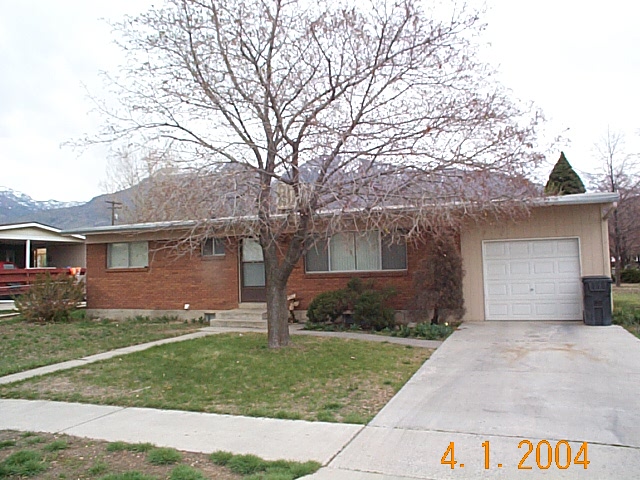 Total Photos: 1
|
| |
|
|
| Property Address: 676 N 600 EAST - AMERICAN FORK |
|
| Mailing Address: 670 E 650 N AMERICAN FORK, UT 84003-1947 |
|
| Acreage: 0.28 |
|
| Last Document:
186842-2020
|
|
| Subdivision Map Filing |
|
| Taxing Description:
COM E 137.37 FT & S 35.71 FT & S 43'W 203.5 FT FR N1/4 COR OF SEC 13, T5S, R1E, SLB&M; THENCE N 89 DEG 45'E 123 FT; S 43'W 82 FT; S 89 DEG 45"W 123 FT; N 43'E 82 FT TO BEG. AREA .28 ACRES.
*Taxing description NOT FOR LEGAL DOCUMENTS
|
|
- Owner Names
- Value History
- Tax History
- Location
- Photos
- Documents
- Aerial Image
| |
----- Real Estate Values ----- |
---Improvements--- |
---Greenbelt--- |
Total |
| Year |
Com |
Res |
Agr |
Tot |
Com |
Res |
Agr |
Tot |
Land |
Homesite |
Tot |
Market Value |
| 2024 |
$0 |
$196,700 |
$0 |
$196,700 |
$0 |
$194,400 |
$0 |
$194,400 |
$0 |
$0 |
$0 |
$391,100 |
| 2023 |
$0 |
$196,700 |
$0 |
$196,700 |
$0 |
$183,900 |
$0 |
$183,900 |
$0 |
$0 |
$0 |
$380,600 |
| 2022 |
$0 |
$207,500 |
$0 |
$207,500 |
$0 |
$201,200 |
$0 |
$201,200 |
$0 |
$0 |
$0 |
$408,700 |
| 2021 |
$0 |
$148,200 |
$0 |
$148,200 |
$0 |
$151,300 |
$0 |
$151,300 |
$0 |
$0 |
$0 |
$299,500 |
| 2019 |
$0 |
$113,400 |
$0 |
$113,400 |
$0 |
$129,400 |
$0 |
$129,400 |
$0 |
$0 |
$0 |
$242,800 |
| 2018 |
$0 |
$113,400 |
$0 |
$113,400 |
$0 |
$129,400 |
$0 |
$129,400 |
$0 |
$0 |
$0 |
$242,800 |
| 2017 |
$0 |
$109,600 |
$0 |
$109,600 |
$0 |
$127,000 |
$0 |
$127,000 |
$0 |
$0 |
$0 |
$236,600 |
| 2016 |
$0 |
$80,900 |
$0 |
$80,900 |
$0 |
$129,100 |
$0 |
$129,100 |
$0 |
$0 |
$0 |
$210,000 |
| 2015 |
$0 |
$80,900 |
$0 |
$80,900 |
$0 |
$129,100 |
$0 |
$129,100 |
$0 |
$0 |
$0 |
$210,000 |
| 2014 |
$0 |
$75,600 |
$0 |
$75,600 |
$0 |
$121,600 |
$0 |
$121,600 |
$0 |
$0 |
$0 |
$197,200 |
| 2013 |
$0 |
$61,400 |
$0 |
$61,400 |
$0 |
$105,700 |
$0 |
$105,700 |
$0 |
$0 |
$0 |
$167,100 |
| 2012 |
$0 |
$52,600 |
$0 |
$52,600 |
$0 |
$110,900 |
$0 |
$110,900 |
$0 |
$0 |
$0 |
$163,500 |
| 2011 |
$0 |
$52,600 |
$0 |
$52,600 |
$0 |
$112,500 |
$0 |
$112,500 |
$0 |
$0 |
$0 |
$165,100 |
| 2010 |
$0 |
$68,154 |
$0 |
$68,154 |
$0 |
$100,245 |
$0 |
$100,245 |
$0 |
$0 |
$0 |
$168,399 |
| 2009 |
$0 |
$103,800 |
$0 |
$103,800 |
$0 |
$66,300 |
$0 |
$66,300 |
$0 |
$0 |
$0 |
$170,100 |
| 2008 |
$0 |
$103,800 |
$0 |
$103,800 |
$0 |
$76,500 |
$0 |
$76,500 |
$0 |
$0 |
$0 |
$180,300 |
| 2007 |
$0 |
$109,300 |
$0 |
$109,300 |
$0 |
$80,500 |
$0 |
$80,500 |
$0 |
$0 |
$0 |
$189,800 |
| 2006 |
$0 |
$49,700 |
$0 |
$49,700 |
$0 |
$112,700 |
$0 |
$112,700 |
$0 |
$0 |
$0 |
$162,400 |
| 2005 |
$0 |
$49,687 |
$0 |
$49,687 |
$0 |
$68,121 |
$0 |
$68,121 |
$0 |
$0 |
$0 |
$117,808 |
| 2004 |
$0 |
$49,687 |
$0 |
$49,687 |
$0 |
$68,121 |
$0 |
$68,121 |
$0 |
$0 |
$0 |
$117,808 |
| Year |
General Taxes |
Adjustments |
Net Taxes |
Fees |
Payments |
Tax Balance* |
Balance Due |
Tax District |
| 2025 |
$0.00 |
$0.00 |
$0.00 |
$0.00 |
|
$0.00
|
$0.00 |
060 - AMERICAN FORK CITY |
| 2024 |
$1,935.95 |
$0.00 |
$1,935.95 |
$0.00 |
|
$0.00
|
$0.00 |
060 - AMERICAN FORK CITY |
| 2023 |
$1,777.00 |
$0.00 |
$1,777.00 |
$0.00 |
|
$0.00
|
$0.00 |
060 - AMERICAN FORK CITY |
| 2022 |
$1,933.60 |
$0.00 |
$1,933.60 |
$0.00 |
|
$0.00
|
$0.00 |
060 - AMERICAN FORK CITY |
| 2021 |
$1,649.39 |
$167.44 |
$1,816.83 |
$0.00 |
|
$0.00
|
$0.00 |
060 - AMERICAN FORK CITY |
| 2018 |
$1,394.16 |
$0.00 |
$1,394.16 |
$0.00 |
|
$0.00
|
$0.00 |
060 - AMERICAN FORK CITY |
| 2017 |
$1,384.45 |
$0.00 |
$1,384.45 |
$0.00 |
|
$0.00
|
$0.00 |
060 - AMERICAN FORK CITY |
| 2016 |
$1,322.59 |
$0.00 |
$1,322.59 |
$0.00 |
|
$0.00
|
$0.00 |
060 - AMERICAN FORK CITY |
| 2015 |
$1,393.62 |
$0.00 |
$1,393.62 |
$0.00 |
|
$0.00
|
$0.00 |
060 - AMERICAN FORK CITY |
| 2014 |
$1,326.68 |
$0.00 |
$1,326.68 |
$0.00 |
|
$0.00
|
$0.00 |
060 - AMERICAN FORK CITY |
| 2013 |
$1,211.49 |
$0.00 |
$1,211.49 |
$0.00 |
|
$0.00
|
$0.00 |
060 - AMERICAN FORK CITY |
| 2012 |
$1,209.31 |
$0.00 |
$1,209.31 |
$0.00 |
|
$0.00
|
$0.00 |
060 - AMERICAN FORK CITY |
| 2011 |
$1,217.88 |
$0.00 |
$1,217.88 |
$0.00 |
|
$0.00
|
$0.00 |
060 - AMERICAN FORK CITY |
| 2010 |
$1,166.18 |
$0.00 |
$1,166.18 |
$0.00 |
|
$0.00
|
$0.00 |
060 - AMERICAN FORK CITY |
| 2009 |
$1,084.40 |
$0.00 |
$1,084.40 |
$0.00 |
|
$0.00
|
$0.00 |
060 - AMERICAN FORK CITY |
| 2008 |
$1,080.50 |
$0.00 |
$1,080.50 |
$0.00 |
|
$0.00
|
$0.00 |
060 - AMERICAN FORK CITY |
| 2007 |
$1,093.38 |
$0.00 |
$1,093.38 |
$0.00 |
|
$0.00
|
$0.00 |
060 - AMERICAN FORK CITY |
| 2006 |
$1,005.83 |
$0.00 |
$1,005.83 |
$0.00 |
|
$0.00
|
$0.00 |
060 - AMERICAN FORK CITY |
| 2005 |
$789.33 |
$0.00 |
$789.33 |
$0.00 |
|
$0.00
|
$0.00 |
060 - AMERICAN FORK CITY |
| 2004 |
$792.44 |
$0.00 |
$792.44 |
$0.00 |
|
$0.00
|
$0.00 |
060 - AMERICAN FORK CITY |
* Note: Original tax amount (Does not include applicable interest and/or fees).
| Entry # |
Date |
Recorded |
Type |
Party1 (Grantor) |
Party2 (Grantee) |
| 115339-2021 |
06/22/2021 |
06/28/2021 |
SP WD |
GARRETT, LARRY |
L&D GARRETT UTAH LLC |
| 186909-2020 |
11/23/2020 |
11/24/2020 |
D TR |
GARRETT, LARRY |
UNITED WHOLESALE MORTGAGE LLC |
| 186842-2020 |
11/23/2020 |
11/24/2020 |
WD |
COMMUNITY PRESBYTERIAN CHURCH OF AMERICAN FORK |
GARRETT, LARRY |
| 14-2016 |
12/22/2015 |
01/04/2016 |
REC |
BANK OF AMERICAN FORK TEE |
COMMUNITY PRESBYTERIAN CHURCH OF AMERICAN FORK |
| 76301-2010 |
09/01/2010 |
09/09/2010 |
D TR |
COMMUNITY PRESBYTERIAN CHURCH OF AMERICAN FORK BY (ET AL) |
BANK OF AMERICAN FORK |
| 114949-2008 |
10/20/2008 |
10/22/2008 |
CT |
STATE OF UTAH |
WHOM OF INTEREST |
| 107508-2008 |
09/30/2008 |
09/30/2008 |
RESOL |
BOARD OF COUNTY COMMISSIONERS UTAH COUNTY |
WHOM OF INTEREST |
| 76846-1995 |
11/06/1995 |
11/08/1995 |
RESOL |
UTAH COUNTY COMMISSIONERS |
WHOM OF INTEREST |
| 3677-1961 |
02/28/1961 |
03/21/1961 |
WD |
HANSEN, MERRILL B & MARILYN M |
COMMUNITY PRESBYTERIAN CHURCH OF AMERICAN FORK |
Main Menu Comments or Concerns on Value/Appraisal - Assessor's Office
Documents/Owner/Parcel information - Recorder's Office
Address Change for Tax Notice
This page was created on 2/23/2025 10:15:25 AM |