Property Information
mobile view
| Serial Number: 52:049:0030 |
Serial Life: 1990-2012 |
|
|
 Total Photos: 3
|
| |
|
|
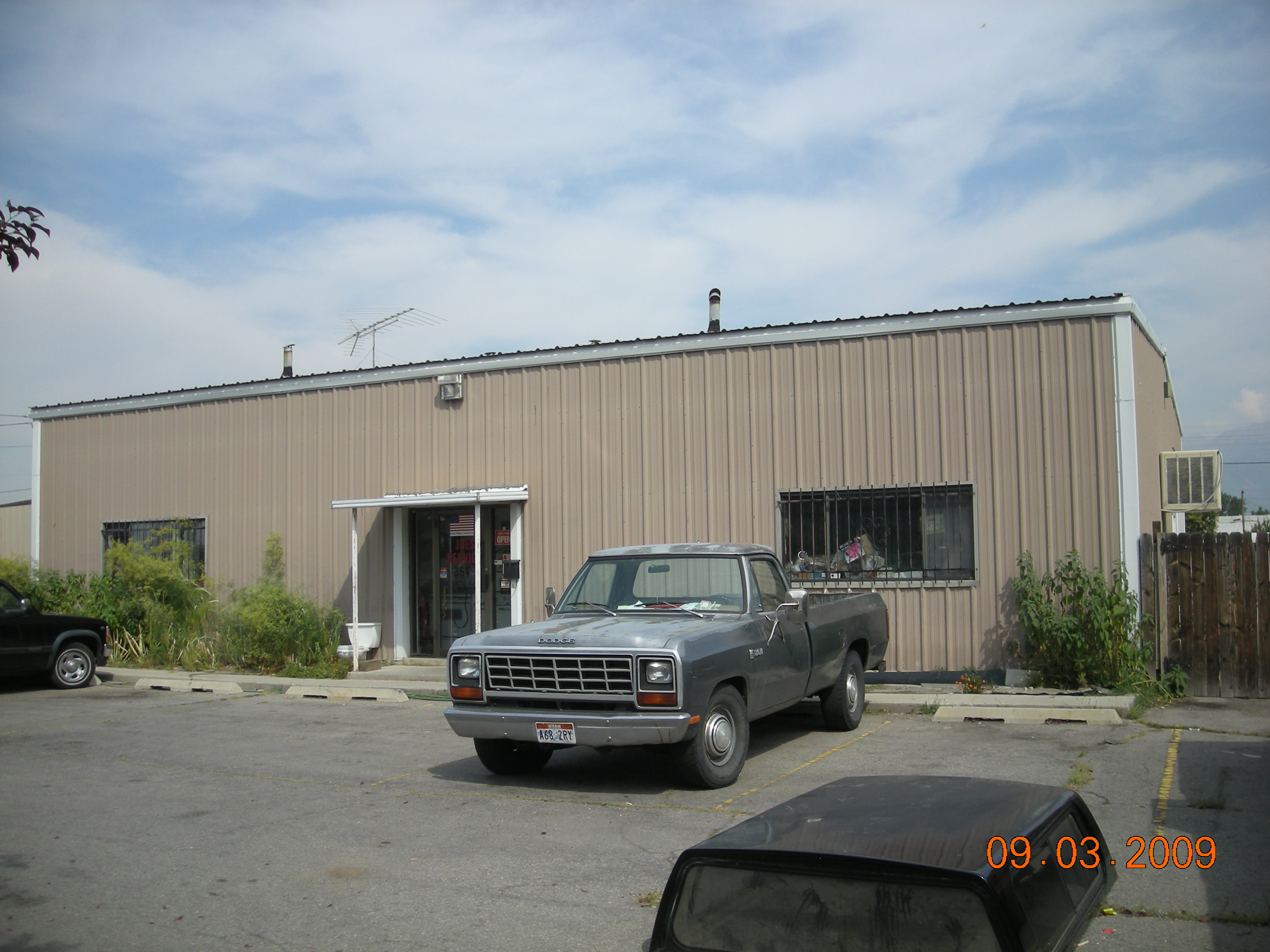
| Property Address: 340 W 700 SOUTH - PROVO |
|
| Mailing Address: 1997 W 6000 S ROY, UT 84067-1423 |
|
| Acreage: 0.29 |
|
| Last Document:
52005-2010
|
|
| Subdivision Map Filing |
|
| Taxing Description:
COM N 8 FT FR SE COR LOT 1, BLK 5, SOUTH SIDE ADDITION; W 112.70 FT; N 59'48"W 114.53 FT; N 89 DEG 44'17"E 113.23 FT; S 43'38"E 115.04 FT TO BEG. AREA .29 ACRE.
*Taxing description NOT FOR LEGAL DOCUMENTS
|
|
- Owner Names
- Value History
- Tax History
- Location
- Photos
- Documents
- Aerial Image
| 2011-2012 |
|
PJ'S PROPERTY MANAGEMENT LC |
|
| 2001-2010 |
|
LEBARON, JOSEPH N |
|
| 1999-2000 |
|
MORTENSEN, JERRY D |
|
| 1999-2000 |
|
MORTENSEN, PHYLLIS H |
|
| 1999NV |
|
BLAKELY, DAVID JAMES |
|
| 1999NV |
|
BLAKELY, DAVID JAMES |
|
| 1999NV |
|
FITE, LOIS J |
|
| 1998 |
|
HETZEL, ANNE J |
|
| 1998 |
|
HETZEL, J DAVID |
|
| 1990-1997 |
|
FISHER, RONNY G |
|
| 1990-1997 |
|
HETZEL, ANNE J |
|
| 1990-1997 |
|
HETZEL, J DAVID |
|
| |
----- Real Estate Values ----- |
---Improvements--- |
---Greenbelt--- |
Total |
| Year |
Com |
Res |
Agr |
Tot |
Com |
Res |
Agr |
Tot |
Land |
Homesite |
Tot |
Market Value |
| 2012 |
$57,400 |
$0 |
$0 |
$57,400 |
$81,000 |
$0 |
$0 |
$81,000 |
$0 |
$0 |
$0 |
$138,400 |
| 2011 |
$57,400 |
$0 |
$0 |
$57,400 |
$81,000 |
$0 |
$0 |
$81,000 |
$0 |
$0 |
$0 |
$138,400 |
| 2010 |
$62,353 |
$0 |
$0 |
$62,353 |
$85,304 |
$0 |
$0 |
$85,304 |
$0 |
$0 |
$0 |
$147,657 |
| 2009 |
$64,700 |
$0 |
$0 |
$64,700 |
$116,200 |
$0 |
$0 |
$116,200 |
$0 |
$0 |
$0 |
$180,900 |
| 2008 |
$64,700 |
$0 |
$0 |
$64,700 |
$116,200 |
$0 |
$0 |
$116,200 |
$0 |
$0 |
$0 |
$180,900 |
| 2007 |
$55,100 |
$0 |
$0 |
$55,100 |
$118,900 |
$0 |
$0 |
$118,900 |
$0 |
$0 |
$0 |
$174,000 |
| 2006 |
$45,905 |
$0 |
$0 |
$45,905 |
$108,109 |
$0 |
$0 |
$108,109 |
$0 |
$0 |
$0 |
$154,014 |
| 2005 |
$45,905 |
$0 |
$0 |
$45,905 |
$108,109 |
$0 |
$0 |
$108,109 |
$0 |
$0 |
$0 |
$154,014 |
| 2004 |
$45,905 |
$0 |
$0 |
$45,905 |
$79,329 |
$0 |
$0 |
$79,329 |
$0 |
$0 |
$0 |
$125,234 |
| 2003 |
$45,905 |
$0 |
$0 |
$45,905 |
$79,329 |
$0 |
$0 |
$79,329 |
$0 |
$0 |
$0 |
$125,234 |
| 2002 |
$45,905 |
$0 |
$0 |
$45,905 |
$79,329 |
$0 |
$0 |
$79,329 |
$0 |
$0 |
$0 |
$125,234 |
| 2001 |
$39,370 |
$0 |
$0 |
$39,370 |
$68,035 |
$0 |
$0 |
$68,035 |
$0 |
$0 |
$0 |
$107,405 |
| 2000 |
$36,794 |
$0 |
$0 |
$36,794 |
$68,035 |
$0 |
$0 |
$68,035 |
$0 |
$0 |
$0 |
$104,829 |
| 1999 |
$33,148 |
$0 |
$0 |
$33,148 |
$61,293 |
$0 |
$0 |
$61,293 |
$0 |
$0 |
$0 |
$94,441 |
| 1998 |
$31,873 |
$0 |
$0 |
$31,873 |
$58,936 |
$0 |
$0 |
$58,936 |
$0 |
$0 |
$0 |
$90,809 |
| 1997 |
$31,873 |
$0 |
$0 |
$31,873 |
$58,936 |
$0 |
$0 |
$58,936 |
$0 |
$0 |
$0 |
$90,809 |
| 1996 |
$31,873 |
$0 |
$0 |
$31,873 |
$58,936 |
$0 |
$0 |
$58,936 |
$0 |
$0 |
$0 |
$90,809 |
| 1995 |
$31,873 |
$0 |
$0 |
$31,873 |
$58,936 |
$0 |
$0 |
$58,936 |
$0 |
$0 |
$0 |
$90,809 |
| 1994 |
$18,639 |
$0 |
$0 |
$18,639 |
$58,936 |
$0 |
$0 |
$58,936 |
$0 |
$0 |
$0 |
$77,575 |
| 1993 |
$18,639 |
$0 |
$0 |
$18,639 |
$58,936 |
$0 |
$0 |
$58,936 |
$0 |
$0 |
$0 |
$77,575 |
| 1992 |
$17,100 |
$0 |
$0 |
$17,100 |
$54,070 |
$0 |
$0 |
$54,070 |
$0 |
$0 |
$0 |
$71,170 |
| 1991 |
$15,000 |
$0 |
$0 |
$15,000 |
$54,070 |
$0 |
$0 |
$54,070 |
$0 |
$0 |
$0 |
$69,070 |
| 1990 |
$15,000 |
$0 |
$0 |
$15,000 |
$54,070 |
$0 |
$0 |
$54,070 |
$0 |
$0 |
$0 |
$69,070 |
| Year |
General Taxes |
Adjustments |
Net Taxes |
Fees |
Payments |
Tax Balance* |
Balance Due |
Tax District |
| 2012 |
$1,678.79 |
$0.00 |
$1,678.79 |
$0.00 |
|
$0.00
|
$0.00 |
110 - PROVO CITY |
| 2011 |
$1,629.52 |
$0.00 |
$1,629.52 |
$0.00 |
|
$0.00
|
$0.00 |
110 - PROVO CITY |
| 2010 |
$1,596.91 |
$0.00 |
$1,596.91 |
$0.00 |
|
$0.00
|
$0.00 |
110 - PROVO CITY |
| 2009 |
$1,908.31 |
$0.00 |
$1,908.31 |
$0.00 |
|
$0.00
|
$0.00 |
110 - PROVO CITY |
| 2008 |
$1,759.61 |
$0.00 |
$1,759.61 |
$0.00 |
|
$0.00
|
$0.00 |
110 - PROVO CITY |
| 2007 |
$1,527.20 |
$0.00 |
$1,527.20 |
$0.00 |
|
$0.00
|
$0.00 |
110 - PROVO CITY |
| 2006 |
$1,615.30 |
$0.00 |
$1,615.30 |
$0.00 |
|
$0.00
|
$0.00 |
110 - PROVO CITY |
| 2005 |
$1,664.28 |
$0.00 |
$1,664.28 |
$0.00 |
|
$0.00
|
$0.00 |
110 - PROVO CITY |
| 2004 |
$1,363.17 |
$0.00 |
$1,363.17 |
$0.00 |
|
$0.00
|
$0.00 |
110 - PROVO CITY |
| 2003 |
$1,329.48 |
$0.00 |
$1,329.48 |
$0.00 |
|
$0.00
|
$0.00 |
110 - PROVO CITY |
| 2002 |
$1,322.97 |
$0.00 |
$1,322.97 |
$0.00 |
|
$0.00
|
$0.00 |
110 - PROVO CITY |
| 2001 |
$1,120.02 |
$0.00 |
$1,120.02 |
$0.00 |
|
$0.00
|
$0.00 |
110 - PROVO CITY |
| 2000 |
$1,104.69 |
$0.00 |
$1,104.69 |
$0.00 |
|
$0.00
|
$0.00 |
110 - PROVO CITY |
| 1999 |
$1,060.67 |
$0.00 |
$1,060.67 |
$0.00 |
|
$0.00
|
$0.00 |
110 - PROVO CITY |
| 1998 |
$979.38 |
$0.00 |
$979.38 |
$0.00 |
|
$0.00
|
$0.00 |
110 - PROVO CITY |
| 1997 |
$1,046.76 |
$0.00 |
$1,046.76 |
$0.00 |
|
$0.00
|
$0.00 |
110 - PROVO CITY |
| 1996 |
$1,025.42 |
$0.00 |
$1,025.42 |
$0.00 |
|
$0.00
|
$0.00 |
110 - PROVO CITY |
| 1995 |
$1,105.69 |
$0.00 |
$1,105.69 |
$0.00 |
|
$0.00
|
$0.00 |
110 - PROVO CITY |
| 1994 |
$1,108.62 |
$0.00 |
$1,108.62 |
$0.00 |
|
$0.00
|
$0.00 |
110 - PROVO CITY |
| 1993 |
$1,058.50 |
$0.00 |
$1,058.50 |
$0.00 |
|
$0.00
|
$0.00 |
110 - PROVO CITY |
| 1992 |
$955.43 |
$0.00 |
$955.43 |
$0.00 |
|
$0.00
|
$0.00 |
110 - PROVO CITY |
| 1991 |
$947.77 |
$0.00 |
$947.77 |
$0.00 |
|
$0.00
|
$0.00 |
110 - PROVO CITY |
| 1990 |
$851.33 |
$0.00 |
$851.33 |
$0.00 |
|
$0.00
|
$0.00 |
110 - PROVO CITY |
* Note: Original tax amount (Does not include applicable interest and/or fees).
| Entry # |
Date |
Recorded |
Type |
Party1 (Grantor) |
Party2 (Grantee) |
| 84190-2012 |
09/28/2012 |
09/28/2012 |
N SPREC |
UTAH COUNTY RECORDER |
WHOM OF INTEREST |
| 64010-2010 |
08/02/2010 |
08/02/2010 |
R NOT |
PROVO CITY CORPORATION |
LE BARON, JOSEPH N |
| 52007-2010 |
06/23/2010 |
06/23/2010 |
REC |
BROWN, J SCOTT SUCTEE |
LEBARON, JOSEPH N |
| 52006-2010 |
06/22/2010 |
06/23/2010 |
D TR |
PJ'S PROPERTY MANAGEMENT LC |
CENTRAL BANK |
| 52005-2010 |
06/22/2010 |
06/23/2010 |
WD |
LEBARON, JOSEPH N |
PJ'S PROPERTY MANAGEMENT LC |
| 40561-2010 |
05/17/2010 |
05/18/2010 |
N TEE S |
BROWN, J SCOTT SUCTEE |
WHOM OF INTEREST |
| 8897-2010 |
|
02/01/2010 |
ND |
WHOM OF INTEREST |
LEBARON, JOSEPH N |
| 8896-2010 |
01/26/2010 |
02/01/2010 |
SUB TEE |
CENTRAL BANK |
BROWN, J SCOTT SUCTEE |
| 107064-2005 |
09/22/2005 |
09/22/2005 |
REC |
PRO-TITLE AND ESCROW INC TEE |
HETZEL, J DAVID & ANNE (ET AL) |
| 107063-2005 |
09/18/2005 |
09/22/2005 |
SUB TEE |
WILLDEN, BONNIE |
PRO-TITLE AND ESCROW INC SUCTEE |
| 52959-2005 |
05/13/2005 |
05/17/2005 |
REC |
CENTRAL BANK TEE |
LEBARON, JOSEPH N |
| 51727-2005 |
05/10/2005 |
05/13/2005 |
D TR |
LEBARON, JOSEPH N |
CENTRAL BANK SPANISH FORK |
| 51565-2005 |
05/10/2005 |
05/13/2005 |
D TR |
LEBARON, JOSEPH N |
CENTRAL BANK SPAISH FORK |
| 99173-2002 |
08/23/2002 |
08/28/2002 |
REC |
CAPITAL COMMUNITY BANK TEE |
JACOBSON, CARL A & JENNY C |
| 34765-2002 |
03/27/2002 |
03/28/2002 |
N |
LEBARON, JOE N |
PROVO CITY |
| 47085-2000 |
06/15/2000 |
06/15/2000 |
CORR AF |
FIRST AMERICAN TITLE CO (ET AL) |
WHOM OF INTEREST |
| 8604-2000 |
02/01/2000 |
02/01/2000 |
SCRIVAF |
FIRST AMERICAN TITLE CO (ET AL) |
WHOM OF INTEREST |
| 121679-1999 |
|
11/18/1999 |
FN ST |
LE BARON, JOSEPH N |
WASHINGTON MUTUAL BANK DBA (ET AL) |
| 121677-1999 |
11/17/1999 |
11/18/1999 |
WD |
MORTENSEN, JERRY D & PHYLLIS H TEE (ET AL) |
LEBARON, JOSEPH N |
| 117878-1998 |
11/12/1998 |
11/16/1998 |
R LN |
MORTENSEN, JERRY |
BLAKELY, DAVID JAMES (ET AL) |
| 117877-1998 |
10/22/1998 |
11/16/1998 |
WD |
BLAKELY, DAVID JAMES |
MORTENSEN, JERRY D & PHYLLIS H TEE |
| 117876-1998 |
09/24/1998 |
11/16/1998 |
QCD |
FITE, LOIS J AKA (ET AL) |
BLAKELY, DAVID JAMES |
| 117875-1998 |
06/10/1998 |
11/16/1998 |
WD |
HETZEL, J DAVID & ANNE J |
BLAKELY, DAVID JAMES (ET AL) |
| 101-1998 |
01/02/1998 |
01/02/1998 |
N LN |
BLAKELY, DAVID JAMES (ET AL) |
MORTENSEN, JERRY |
| 57284-1997 |
07/23/1997 |
07/29/1997 |
P REC |
OREM COMMUNITY BANK TEE |
JACOBSON, CARL A & JENNY C |
| 55566-1997 |
07/10/1997 |
07/22/1997 |
P REC |
OREM COMMUNITY BANK TEE |
JACOBSON, CARL & JENNY C |
| 33914-1997 |
04/29/1997 |
05/02/1997 |
QCD |
FISHER, RONEY G |
HETZEL, J DAVID & ANNE J |
| 28949-1995 |
05/05/1995 |
05/09/1995 |
TR D |
JACOBSON, CARL A & JENNY |
UNIVERSAL CAMPUS FEDERAL CREDIT UNION |
| 59573-1994 |
07/22/1994 |
07/22/1994 |
D TR |
JACOBSON, CARL A & JENNY C |
OREM COMMUNITY BANK |
| 28728-1992 |
06/10/1992 |
06/11/1992 |
NI |
BLAKELY, DAVID JAMES (ET AL) |
WHOM OF INTEREST |
| 28003-1992 |
06/08/1992 |
06/08/1992 |
R LN |
FORD CONSTRUCTION COMPANY INC |
WHOM OF INTEREST |
| 12719-1992 |
12/31/1991 |
03/19/1992 |
NI |
HETZEL, J DAVID |
WHOM OF INTEREST |
| 929-1991 |
01/10/1991 |
01/10/1991 |
N LN |
UNIVERSITY OF UTAH (ET AL) |
FORD CONSTRUCTION COMPANY INC |
| 30544-1989 |
10/10/1989 |
10/10/1989 |
AS |
WILLDEN, R DUANE |
WILLDEN, DARRELL R |
| 30543-1989 |
10/03/1989 |
10/10/1989 |
TR D |
HETZEL, J DAVID & ANNE J (ET AL) |
WILLDEN, R DUANE & DARRELL R |
| 30542-1989 |
10/03/1989 |
10/10/1989 |
WD |
WILLDEN, R DUANE & DARRELL R |
HETZEL, J DAVID & ANNE J 50%INT (ET AL) |
Main Menu Comments or Concerns on Value/Appraisal - Assessor's Office
Documents/Owner/Parcel information - Recorder's Office
Address Change for Tax Notice
This page was created on 3/18/2025 1:39:16 PM |

