Property Information
mobile view
| Serial Number: 54:170:0015 |
Serial Life: 2003... |
|
|
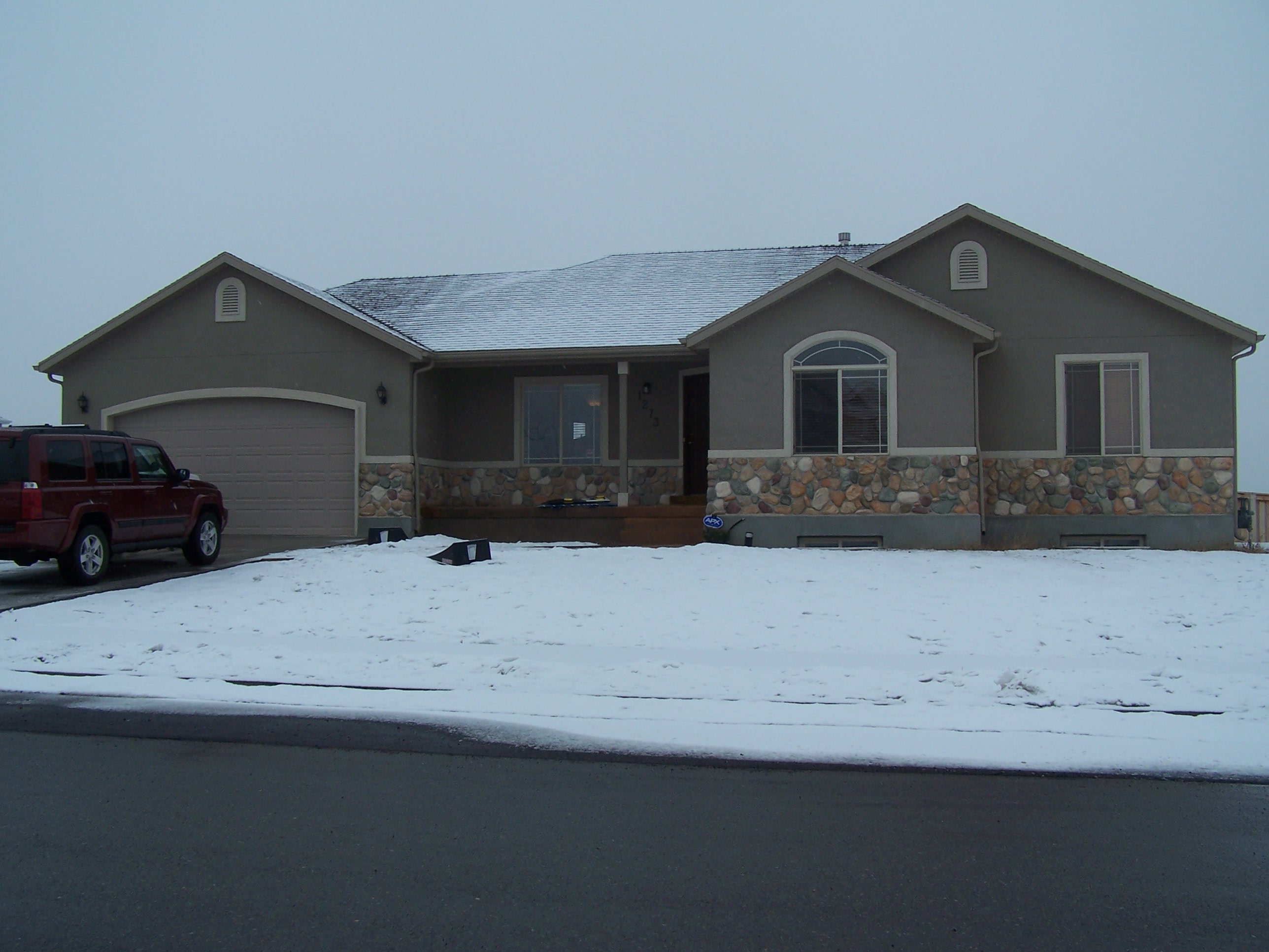
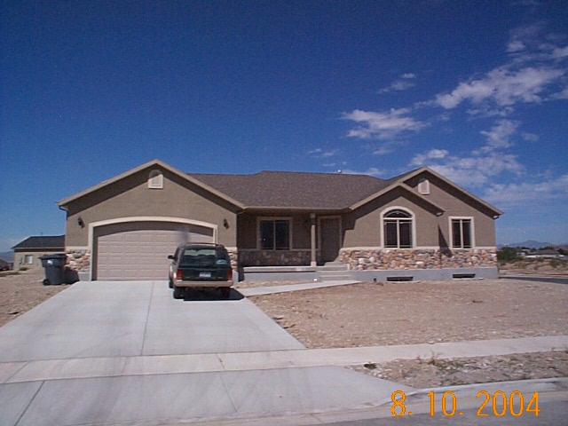
Total Photos: 2
|
| |
|
|
| Property Address: 1273 N 500 WEST - AMERICAN FORK |
|
| Mailing Address: 2296 N 180 W PLEASANT GROVE, UT 84062-9091 |
|
| Acreage: 0.253 |
|
| Last Document:
66291-2004
|
|
| Subdivision Map Filing |
|
| Taxing Description:
LOT 15, PLAT E, VIRGINIA RIDGE SUBDV. AREA 0.253 AC.
*Taxing description NOT FOR LEGAL DOCUMENTS
|
|
- Owner Names
- Value History
- Tax History
- Location
- Photos
- Documents
- Aerial Image
| |
----- Real Estate Values ----- |
---Improvements--- |
---Greenbelt--- |
Total |
| Year |
Com |
Res |
Agr |
Tot |
Com |
Res |
Agr |
Tot |
Land |
Homesite |
Tot |
Market Value |
| 2024 |
$0 |
$227,000 |
$0 |
$227,000 |
$0 |
$330,000 |
$0 |
$330,000 |
$0 |
$0 |
$0 |
$557,000 |
| 2023 |
$0 |
$206,400 |
$0 |
$206,400 |
$0 |
$347,600 |
$0 |
$347,600 |
$0 |
$0 |
$0 |
$554,000 |
| 2022 |
$0 |
$217,000 |
$0 |
$217,000 |
$0 |
$417,500 |
$0 |
$417,500 |
$0 |
$0 |
$0 |
$634,500 |
| 2021 |
$0 |
$135,600 |
$0 |
$135,600 |
$0 |
$302,500 |
$0 |
$302,500 |
$0 |
$0 |
$0 |
$438,100 |
| 2020 |
$0 |
$125,600 |
$0 |
$125,600 |
$0 |
$282,700 |
$0 |
$282,700 |
$0 |
$0 |
$0 |
$408,300 |
| 2019 |
$0 |
$125,600 |
$0 |
$125,600 |
$0 |
$265,000 |
$0 |
$265,000 |
$0 |
$0 |
$0 |
$390,600 |
| 2018 |
$0 |
$121,900 |
$0 |
$121,900 |
$0 |
$235,100 |
$0 |
$235,100 |
$0 |
$0 |
$0 |
$357,000 |
| 2017 |
$0 |
$92,400 |
$0 |
$92,400 |
$0 |
$204,400 |
$0 |
$204,400 |
$0 |
$0 |
$0 |
$296,800 |
| 2016 |
$0 |
$79,800 |
$0 |
$79,800 |
$0 |
$207,800 |
$0 |
$207,800 |
$0 |
$0 |
$0 |
$287,600 |
| 2015 |
$0 |
$79,800 |
$0 |
$79,800 |
$0 |
$207,800 |
$0 |
$207,800 |
$0 |
$0 |
$0 |
$287,600 |
| 2014 |
$0 |
$79,800 |
$0 |
$79,800 |
$0 |
$207,800 |
$0 |
$207,800 |
$0 |
$0 |
$0 |
$287,600 |
| 2013 |
$0 |
$53,000 |
$0 |
$53,000 |
$0 |
$180,700 |
$0 |
$180,700 |
$0 |
$0 |
$0 |
$233,700 |
| 2012 |
$0 |
$50,800 |
$0 |
$50,800 |
$0 |
$173,900 |
$0 |
$173,900 |
$0 |
$0 |
$0 |
$224,700 |
| 2011 |
$0 |
$50,800 |
$0 |
$50,800 |
$0 |
$160,000 |
$0 |
$160,000 |
$0 |
$0 |
$0 |
$210,800 |
| 2010 |
$0 |
$52,200 |
$0 |
$52,200 |
$0 |
$162,889 |
$0 |
$162,889 |
$0 |
$0 |
$0 |
$215,089 |
| 2009 |
$0 |
$99,400 |
$0 |
$99,400 |
$0 |
$126,100 |
$0 |
$126,100 |
$0 |
$0 |
$0 |
$225,500 |
| 2008 |
$0 |
$106,900 |
$0 |
$106,900 |
$0 |
$152,400 |
$0 |
$152,400 |
$0 |
$0 |
$0 |
$259,300 |
| 2007 |
$0 |
$112,500 |
$0 |
$112,500 |
$0 |
$160,400 |
$0 |
$160,400 |
$0 |
$0 |
$0 |
$272,900 |
| 2006 |
$0 |
$51,300 |
$0 |
$51,300 |
$0 |
$174,400 |
$0 |
$174,400 |
$0 |
$0 |
$0 |
$225,700 |
| 2005 |
$0 |
$51,250 |
$0 |
$51,250 |
$0 |
$116,602 |
$0 |
$116,602 |
$0 |
$0 |
$0 |
$167,852 |
| 2004 |
$0 |
$51,250 |
$0 |
$51,250 |
$0 |
$0 |
$0 |
$0 |
$0 |
$0 |
$0 |
$51,250 |
| 2003 |
$0 |
$51,250 |
$0 |
$51,250 |
$0 |
$0 |
$0 |
$0 |
$0 |
$0 |
$0 |
$51,250 |
| Year |
General Taxes |
Adjustments |
Net Taxes |
Fees |
Payments |
Tax Balance* |
Balance Due |
Tax District |
| 2025 |
$0.00 |
$0.00 |
$0.00 |
$0.00 |
|
$0.00
|
$0.00 |
060 - AMERICAN FORK CITY |
| 2024 |
$0.00 |
$0.00 |
$0.00 |
$0.00 |
|
$0.00
|
$0.00 |
060 - AMERICAN FORK CITY |
| 2023 |
$2,586.60 |
$0.00 |
$2,586.60 |
$0.00 |
|
$0.00
|
$0.00 |
060 - AMERICAN FORK CITY |
| 2022 |
$3,001.88 |
$0.00 |
$3,001.88 |
$0.00 |
|
$0.00
|
$0.00 |
060 - AMERICAN FORK CITY |
| 2021 |
$2,412.68 |
$0.00 |
$2,412.68 |
$0.00 |
|
$0.00
|
$0.00 |
060 - AMERICAN FORK CITY |
| 2020 |
$2,318.41 |
$0.00 |
$2,318.41 |
$0.00 |
|
$0.00
|
$0.00 |
060 - AMERICAN FORK CITY |
| 2019 |
$2,144.43 |
$0.00 |
$2,144.43 |
$0.00 |
|
$0.00
|
$0.00 |
060 - AMERICAN FORK CITY |
| 2018 |
$2,049.89 |
$0.00 |
$2,049.89 |
$0.00 |
|
$0.00
|
$0.00 |
060 - AMERICAN FORK CITY |
| 2017 |
$1,736.71 |
$0.00 |
$1,736.71 |
$0.00 |
|
$0.00
|
$0.00 |
060 - AMERICAN FORK CITY |
| 2016 |
$1,811.32 |
$0.00 |
$1,811.32 |
$0.00 |
|
$0.00
|
$0.00 |
060 - AMERICAN FORK CITY |
| 2015 |
$1,908.60 |
$0.00 |
$1,908.60 |
$0.00 |
|
$0.00
|
$0.00 |
060 - AMERICAN FORK CITY |
| 2014 |
$1,934.86 |
$0.00 |
$1,934.86 |
$0.00 |
|
$0.00
|
$0.00 |
060 - AMERICAN FORK CITY |
| 2013 |
$1,694.35 |
$0.00 |
$1,694.35 |
$0.00 |
|
$0.00
|
$0.00 |
060 - AMERICAN FORK CITY |
| 2012 |
$1,661.97 |
$0.00 |
$1,661.97 |
$0.00 |
|
$0.00
|
$0.00 |
060 - AMERICAN FORK CITY |
| 2011 |
$1,554.99 |
$0.00 |
$1,554.99 |
$0.00 |
|
$0.00
|
$0.00 |
060 - AMERICAN FORK CITY |
| 2010 |
$1,489.50 |
$0.00 |
$1,489.50 |
$0.00 |
|
$0.00
|
$0.00 |
060 - AMERICAN FORK CITY |
| 2009 |
$1,437.57 |
$0.00 |
$1,437.57 |
$0.00 |
|
$0.00
|
$0.00 |
060 - AMERICAN FORK CITY |
| 2008 |
$1,553.93 |
$0.00 |
$1,553.93 |
$0.00 |
|
$0.00
|
$0.00 |
060 - AMERICAN FORK CITY |
| 2007 |
$1,572.10 |
$0.00 |
$1,572.10 |
$0.00 |
|
$0.00
|
$0.00 |
060 - AMERICAN FORK CITY |
| 2006 |
$1,397.88 |
$0.00 |
$1,397.88 |
$0.00 |
|
$0.00
|
$0.00 |
060 - AMERICAN FORK CITY |
| 2005 |
$1,124.63 |
$0.00 |
$1,124.63 |
$0.00 |
|
$0.00
|
$0.00 |
060 - AMERICAN FORK CITY |
| 2004 |
$626.79 |
$0.00 |
$626.79 |
$0.00 |
|
$0.00
|
$0.00 |
060 - AMERICAN FORK CITY |
| 2003 |
$616.74 |
$0.00 |
$616.74 |
$0.00 |
|
$0.00
|
$0.00 |
060 - AMERICAN FORK CITY |
* Note: Original tax amount (Does not include applicable interest and/or fees).
| Entry # |
Date |
Recorded |
Type |
Party1 (Grantor) |
Party2 (Grantee) |
| 78463-2010 |
09/15/2010 |
09/16/2010 |
WD |
DAVIS, JIM |
DAVIS, WALLACE JAMES TEE |
| 114949-2008 |
10/20/2008 |
10/22/2008 |
CT |
STATE OF UTAH |
WHOM OF INTEREST |
| 107508-2008 |
09/30/2008 |
09/30/2008 |
RESOL |
BOARD OF COUNTY COMMISSIONERS UTAH COUNTY |
WHOM OF INTEREST |
| 66291-2004 |
06/09/2004 |
06/09/2004 |
WD |
CARSON DAVIS INVESTMENTS LC |
DAVIS, JIM |
| 51658-2004 |
04/20/2004 |
05/05/2004 |
P REC |
PROVO LAND TITLE COMPANY TEE |
SALISBURY DEVELOPMENT LC |
| 66577-2002 |
|
06/12/2002 |
QCD |
SALISBURY DEVELOPMENT LC |
CARSON DAVIS INVESTMENTS LC |
| 66574-2002 |
05/28/2002 |
06/12/2002 |
S PLAT |
SALISBURY DEVELOPMENT LC (ET AL) |
VIRGINIA RIDGE PLAT E |
Main Menu Comments or Concerns on Value/Appraisal - Assessor's Office
Documents/Owner/Parcel information - Recorder's Office
Address Change for Tax Notice
This page was created on 7/14/2024 8:09:13 AM |