Property Information
mobile view
| Serial Number: 13:044:0179 |
Serial Life: 2021... |
|
|
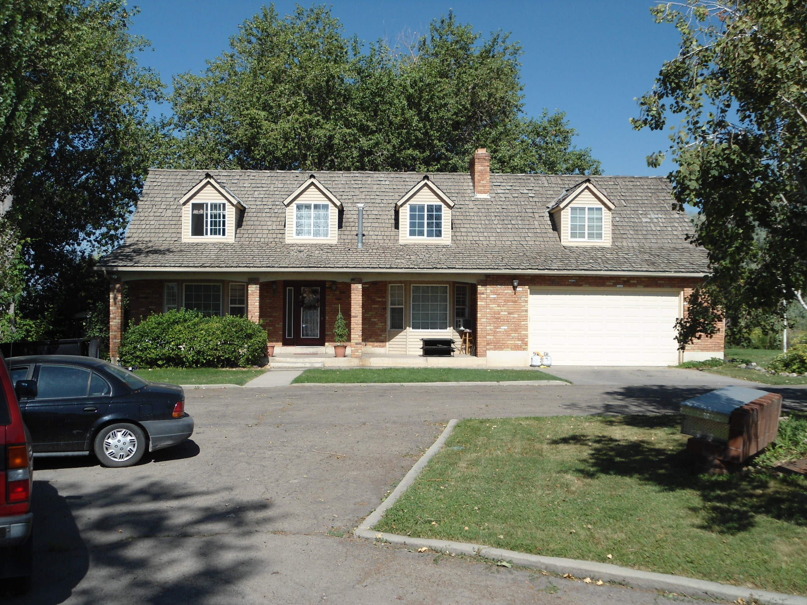 Total Photos: 1
|
| |
|
|
| Property Address: 508 S STORRS AVE - AMERICAN FORK |
|
| Mailing Address: 508 S STORRS AVE AMERICAN FORK, UT 84003 |
|
| Acreage: 0.705891 |
|
| Last Document:
136545-2020
|
|
| Subdivision Map Filing |
|
| Taxing Description:
COM E 1193.24 FT & N 223.64 FT & N 0 DEG 24' 0" E 972.03 FT & E 139.03 FT FR SW COR. SEC. 23, T5S, R1E, SLB&M.; N 9 DEG 49' 13" E 101.6 FT; N 10 DEG 56' 35" E 35.78 FT; N 31 DEG 44' 36" E 86.94 FT; S 86 DEG 2' 17" E 36.16 FT; S 50 DEG 42' 28" E 138.69 FT; S 17 DEG 59' 49" W 5.92 FT; E 8.71 FT; S 50 DEG 42' 24" E 6.65 FT; S 42 DEG 39' 33" W 160.94 FT; N 82 DEG 41' 0" W 73.44 FT; W 43.4 FT TO BEG. AREA 0.706 AC.
*Taxing description NOT FOR LEGAL DOCUMENTS
|
|
- Owner Names
- Value History
- Tax History
- Location
- Photos
- Documents
- Aerial Image
| |
----- Real Estate Values ----- |
---Improvements--- |
---Greenbelt--- |
Total |
| Year |
Com |
Res |
Agr |
Tot |
Com |
Res |
Agr |
Tot |
Land |
Homesite |
Tot |
Market Value |
| 2024 |
$0 |
$251,800 |
$0 |
$251,800 |
$0 |
$317,800 |
$0 |
$317,800 |
$0 |
$0 |
$0 |
$569,600 |
| 2023 |
$0 |
$251,800 |
$0 |
$251,800 |
$0 |
$305,300 |
$0 |
$305,300 |
$0 |
$0 |
$0 |
$557,100 |
| 2022 |
$0 |
$265,600 |
$0 |
$265,600 |
$0 |
$352,400 |
$0 |
$352,400 |
$0 |
$0 |
$0 |
$618,000 |
| 2021 |
$0 |
$166,000 |
$0 |
$166,000 |
$0 |
$279,700 |
$0 |
$279,700 |
$0 |
$0 |
$0 |
$445,700 |
| Year |
General Taxes |
Adjustments |
Net Taxes |
Fees |
Payments |
Tax Balance* |
Balance Due |
Tax District |
| 2025 |
$0.00 |
$0.00 |
$0.00 |
$0.00 |
|
$0.00
|
$0.00 |
060 - AMERICAN FORK CITY |
| 2024 |
$2,819.52 |
$0.00 |
$2,819.52 |
$0.00 |
|
$0.00
|
$0.00 |
060 - AMERICAN FORK CITY |
| 2023 |
$2,601.07 |
$0.00 |
$2,601.07 |
$0.00 |
|
$0.00
|
$0.00 |
060 - AMERICAN FORK CITY |
| 2022 |
$2,923.82 |
$0.00 |
$2,923.82 |
$0.00 |
|
$0.00
|
$0.00 |
060 - AMERICAN FORK CITY |
| 2021 |
$2,454.54 |
$0.00 |
$2,454.54 |
$0.00 |
|
$0.00
|
$0.00 |
060 - AMERICAN FORK CITY |
* Note: Original tax amount (Does not include applicable interest and/or fees).
| Entry # |
Date |
Recorded |
Type |
Party1 (Grantor) |
Party2 (Grantee) |
| 136730-2020 |
09/03/2020 |
09/09/2020 |
D TR |
BURR, ANDREW L (ET AL) |
GUILD MORTGAGE COMPANY |
| 136545-2020 |
09/04/2020 |
09/09/2020 |
WD |
LOVERIDGE, MICHAEL S & LINDA |
BURR, ANDREW L (ET AL) |
| 135445-2020 |
09/04/2020 |
09/04/2020 |
REC |
ALTABANK TEE |
LOVERIDGE, MICHAEL S & LINDA |
| 120614-2020 |
08/14/2020 |
08/14/2020 |
N SPREC |
UTAH COUNTY RECORDER |
WHOM OF INTEREST |
Main Menu Comments or Concerns on Value/Appraisal - Assessor's Office
Documents/Owner/Parcel information - Recorder's Office
Address Change for Tax Notice
This page was created on 2/18/2025 6:09:23 PM |