Property Information
mobile view
| Serial Number: 14:024:0139 |
Serial Life: 2005-2015 |
|
|
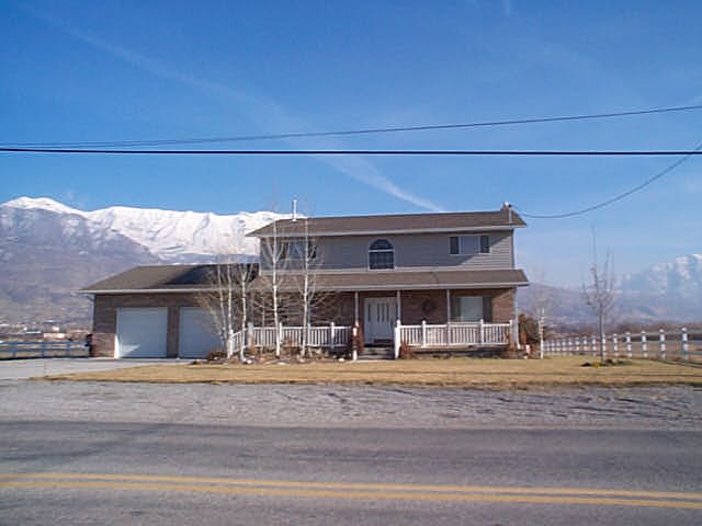
Total Photos: 1
|
| |
|
|
| Property Address: 15 S 1300 WEST - PLEASANT GROVE |
|
| Mailing Address: 578 S STATE ST OREM, UT 84058-6369 |
|
| Acreage: 0.5 |
|
| Last Document:
69083-2015
|
|
| Subdivision Map Filing |
|
| Taxing Description:
COM N 307.88 FT & W 1479.67 FT FR SE COR. SEC. 19, T5S, R2E, SLB&M.; S 89 DEG 18' 38" W 197.83 FT; N 0 DEG 51' 6" E 109.93 FT; N 89 DEG 7' 4" E 197.4 FT; S 0 DEG 36' 55" W 110.58 FT TO BEG. AREA 0.500 AC.
*Taxing description NOT FOR LEGAL DOCUMENTS
|
|
- Owner Names
- Value History
- Tax History
- Location
- Photos
- Documents
- Aerial Image
| |
----- Real Estate Values ----- |
---Improvements--- |
---Greenbelt--- |
Total |
| Year |
Com |
Res |
Agr |
Tot |
Com |
Res |
Agr |
Tot |
Land |
Homesite |
Tot |
Market Value |
| 2015 |
$0 |
$77,300 |
$0 |
$77,300 |
$0 |
$180,100 |
$0 |
$180,100 |
$0 |
$0 |
$0 |
$257,400 |
| 2014 |
$0 |
$77,300 |
$0 |
$77,300 |
$0 |
$180,100 |
$0 |
$180,100 |
$0 |
$0 |
$0 |
$257,400 |
| 2013 |
$0 |
$73,100 |
$0 |
$73,100 |
$0 |
$156,600 |
$0 |
$156,600 |
$0 |
$0 |
$0 |
$229,700 |
| 2012 |
$0 |
$69,500 |
$0 |
$69,500 |
$0 |
$142,400 |
$0 |
$142,400 |
$0 |
$0 |
$0 |
$211,900 |
| 2011 |
$0 |
$62,200 |
$0 |
$62,200 |
$0 |
$158,600 |
$0 |
$158,600 |
$0 |
$0 |
$0 |
$220,800 |
| 2010 |
$0 |
$57,900 |
$0 |
$57,900 |
$0 |
$181,556 |
$0 |
$181,556 |
$0 |
$0 |
$0 |
$239,456 |
| 2009 |
$0 |
$57,900 |
$0 |
$57,900 |
$0 |
$186,300 |
$0 |
$186,300 |
$0 |
$0 |
$0 |
$244,200 |
| 2008 |
$0 |
$65,000 |
$0 |
$65,000 |
$0 |
$216,700 |
$0 |
$216,700 |
$0 |
$0 |
$0 |
$281,700 |
| 2007 |
$0 |
$65,000 |
$0 |
$65,000 |
$0 |
$216,700 |
$0 |
$216,700 |
$0 |
$0 |
$0 |
$281,700 |
| 2006 |
$0 |
$65,000 |
$0 |
$65,000 |
$0 |
$225,909 |
$0 |
$225,909 |
$0 |
$0 |
$0 |
$290,909 |
| 2005 |
$0 |
$65,000 |
$0 |
$65,000 |
$0 |
$225,909 |
$0 |
$225,909 |
$0 |
$0 |
$0 |
$290,909 |
| Year |
General Taxes |
Adjustments |
Net Taxes |
Fees |
Payments |
Tax Balance* |
Balance Due |
Tax District |
| 2015 |
$1,639.24 |
$0.00 |
$1,639.24 |
$0.00 |
|
$0.00
|
$0.00 |
070 - PLEASANT GROVE CITY |
| 2014 |
$1,654.81 |
$0.00 |
$1,654.81 |
$0.00 |
|
$0.00
|
$0.00 |
070 - PLEASANT GROVE CITY |
| 2013 |
$1,600.54 |
$0.00 |
$1,600.54 |
$0.00 |
|
$0.00
|
$0.00 |
070 - PLEASANT GROVE CITY |
| 2012 |
$1,509.37 |
$0.00 |
$1,509.37 |
$0.00 |
|
$0.00
|
$0.00 |
070 - PLEASANT GROVE CITY |
| 2011 |
$1,563.42 |
$0.00 |
$1,563.42 |
$0.00 |
|
$0.00
|
$0.00 |
070 - PLEASANT GROVE CITY |
| 2010 |
$1,586.47 |
$0.00 |
$1,586.47 |
$0.00 |
|
$0.00
|
$0.00 |
070 - PLEASANT GROVE CITY |
| 2009 |
$1,492.32 |
$0.00 |
$1,492.32 |
$0.00 |
|
$0.00
|
$0.00 |
070 - PLEASANT GROVE CITY |
| 2008 |
$1,592.11 |
$0.00 |
$1,592.11 |
$0.00 |
|
$0.00
|
$0.00 |
070 - PLEASANT GROVE CITY |
| 2007 |
$1,529.05 |
$0.00 |
$1,529.05 |
$0.00 |
|
$0.00
|
$0.00 |
070 - PLEASANT GROVE CITY |
| 2006 |
$1,690.08 |
$0.00 |
$1,690.08 |
$0.00 |
|
$0.00
|
$0.00 |
070 - PLEASANT GROVE CITY |
| 2005 |
$1,960.80 |
$0.00 |
$1,960.80 |
$0.00 |
|
$0.00
|
$0.00 |
070 - PLEASANT GROVE CITY |
* Note: Original tax amount (Does not include applicable interest and/or fees).
| Entry # |
Date |
Recorded |
Type |
Party1 (Grantor) |
Party2 (Grantee) |
| 98193-2015 |
05/19/2015 |
10/29/2015 |
S PLAT |
GEORGETOWN DEVELOPMENT INC |
GARDEN GROVE PUD PLAT A |
| 69332-2015 |
07/30/2015 |
07/31/2015 |
S TR D |
GEORGETOWN DEVELOPMENT INC |
WATKINS, DAN |
| 69331-2015 |
07/27/2015 |
07/31/2015 |
D TR |
GEORGETOWN DEVELOPMENT INC |
CENTRAL BANK |
| 69083-2015 |
07/27/2015 |
07/31/2015 |
WD |
BEAN, CINDY R |
GEORGETOWN DEVELOPMENT INC |
| 101705-2008 |
08/28/2008 |
09/15/2008 |
WATERCT |
STATE OF UTAH |
ROBINSON, JERRY & MARIE C |
| 121152-2004 |
10/19/2004 |
10/26/2004 |
QCD |
ROBINSON, JERRY & MARIE C |
BEAN, CINDY TEE |
| 65466-2004 |
06/05/2004 |
06/08/2004 |
WD |
ROBINSON, JERRY & MARIE |
BEAN, CINDY R |
Main Menu Comments or Concerns on Value/Appraisal - Assessor's Office
Documents/Owner/Parcel information - Recorder's Office
Address Change for Tax Notice
This page was created on 8/9/2024 6:55:52 AM |