Property Information
mobile view
| Serial Number: 14:036:0014 |
Serial Life: 1980... |
|
|
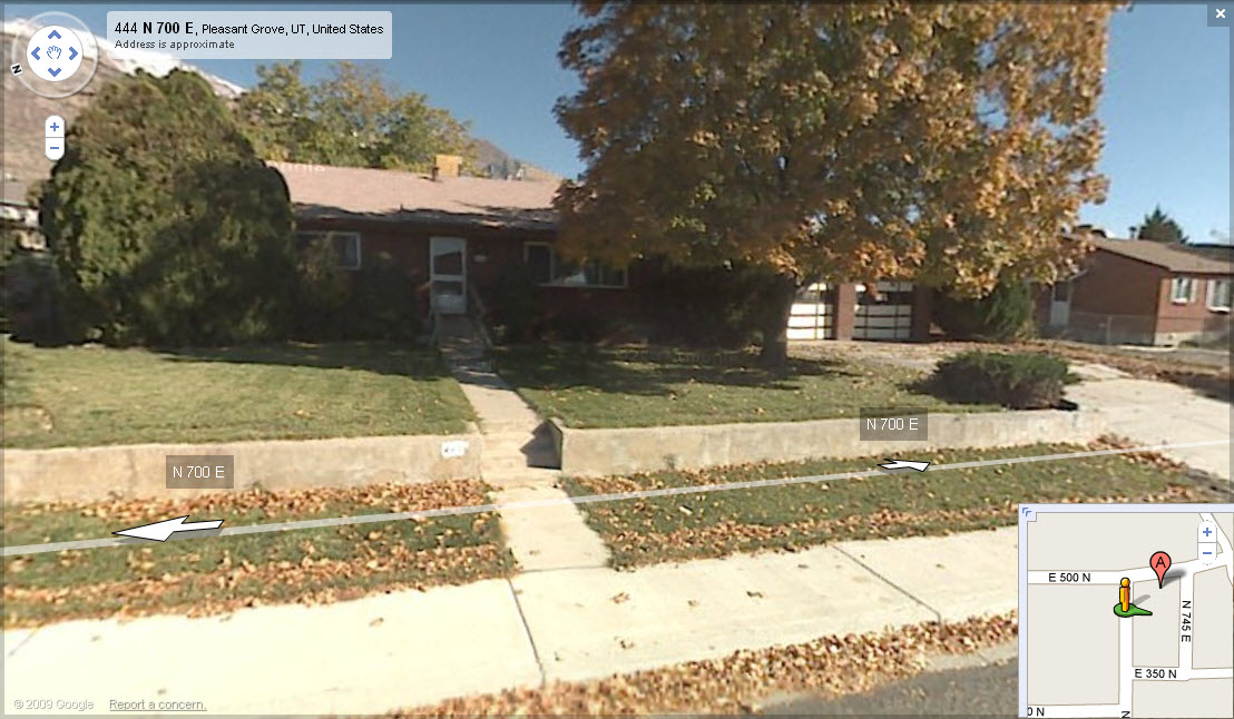 Total Photos: 1
|
| |
|
|
| Property Address: 440 N 700 EAST - PLEASANT GROVE |
|
| Mailing Address: 440 N 700 E PLEASANT GROVE, UT 84062-2450 |
|
| Acreage: 0.28 |
|
| Last Document:
59187-1999
|
|
| Subdivision Map Filing |
|
| Taxing Description:
COM N 478.58 FT & E 38.99 FT FR INTERSECTION MONUMENT AT 3RD N AND 7TH E ST PLEASANT GROVE CITY SURVEY; E 126.5 FT; N 119.49 FT; W 26.17 FT; S 0 DEG 29' 2" W 30.49 FT; W 100.43 FT; S 89 FT TO BEG. AREA 0.258 AC.
*Taxing description NOT FOR LEGAL DOCUMENTS
|
|
- Owner Names
- Value History
- Tax History
- Location
- Photos
- Documents
- Aerial Image
| 2012... |
|
HEBBERT, PAUL |
|
| 2012... |
|
HEBBERT, SHARLENE |
|
| 2010-2011 |
|
SMITH, MARK ALLRED |
|
| 2009 |
|
SMITH, MARK ALLRED |
|
| 2000-2008 |
|
SMITH, CLARA A |
|
| 2000-2008 |
|
SMITH, THALES S |
|
| 2000NV |
|
SMITH, CLARA S |
|
| 2000NV |
|
SMITH, THALES S |
|
| 1983-1999 |
|
SMITH, CLARA A |
|
| 1983-1999 |
|
SMITH, THALES S |
|
| 1982 |
|
SMITH, CLARA A |
|
| 1982 |
|
SMITH, THALES S |
|
| 1980-1981 |
|
NIELSEN, BLAINE A |
|
| 1980-1981 |
|
NIELSEN, MARY R |
|
| |
----- Real Estate Values ----- |
---Improvements--- |
---Greenbelt--- |
Total |
| Year |
Com |
Res |
Agr |
Tot |
Com |
Res |
Agr |
Tot |
Land |
Homesite |
Tot |
Market Value |
| 2024 |
$0 |
$204,300 |
$0 |
$204,300 |
$0 |
$257,700 |
$0 |
$257,700 |
$0 |
$0 |
$0 |
$462,000 |
| 2023 |
$0 |
$204,300 |
$0 |
$204,300 |
$0 |
$255,000 |
$0 |
$255,000 |
$0 |
$0 |
$0 |
$459,300 |
| 2022 |
$0 |
$215,500 |
$0 |
$215,500 |
$0 |
$249,600 |
$0 |
$249,600 |
$0 |
$0 |
$0 |
$465,100 |
| 2021 |
$0 |
$153,900 |
$0 |
$153,900 |
$0 |
$182,200 |
$0 |
$182,200 |
$0 |
$0 |
$0 |
$336,100 |
| 2020 |
$0 |
$137,400 |
$0 |
$137,400 |
$0 |
$165,600 |
$0 |
$165,600 |
$0 |
$0 |
$0 |
$303,000 |
| 2019 |
$0 |
$126,200 |
$0 |
$126,200 |
$0 |
$154,400 |
$0 |
$154,400 |
$0 |
$0 |
$0 |
$280,600 |
| 2018 |
$0 |
$115,100 |
$0 |
$115,100 |
$0 |
$140,700 |
$0 |
$140,700 |
$0 |
$0 |
$0 |
$255,800 |
| 2017 |
$0 |
$96,500 |
$0 |
$96,500 |
$0 |
$140,700 |
$0 |
$140,700 |
$0 |
$0 |
$0 |
$237,200 |
| 2016 |
$0 |
$81,700 |
$0 |
$81,700 |
$0 |
$136,800 |
$0 |
$136,800 |
$0 |
$0 |
$0 |
$218,500 |
| 2015 |
$0 |
$81,700 |
$0 |
$81,700 |
$0 |
$121,800 |
$0 |
$121,800 |
$0 |
$0 |
$0 |
$203,500 |
| 2014 |
$0 |
$79,500 |
$0 |
$79,500 |
$0 |
$109,900 |
$0 |
$109,900 |
$0 |
$0 |
$0 |
$189,400 |
| 2013 |
$0 |
$53,300 |
$0 |
$53,300 |
$0 |
$107,400 |
$0 |
$107,400 |
$0 |
$0 |
$0 |
$160,700 |
| 2012 |
$0 |
$51,700 |
$0 |
$51,700 |
$0 |
$119,500 |
$0 |
$119,500 |
$0 |
$0 |
$0 |
$171,200 |
| 2011 |
$0 |
$46,200 |
$0 |
$46,200 |
$0 |
$115,800 |
$0 |
$115,800 |
$0 |
$0 |
$0 |
$162,000 |
| 2010 |
$0 |
$55,947 |
$0 |
$55,947 |
$0 |
$119,757 |
$0 |
$119,757 |
$0 |
$0 |
$0 |
$175,704 |
| 2009 |
$0 |
$114,200 |
$0 |
$114,200 |
$0 |
$65,600 |
$0 |
$65,600 |
$0 |
$0 |
$0 |
$179,800 |
| 2008 |
$0 |
$128,300 |
$0 |
$128,300 |
$0 |
$52,400 |
$0 |
$52,400 |
$0 |
$0 |
$0 |
$180,700 |
| 2007 |
$0 |
$128,300 |
$0 |
$128,300 |
$0 |
$52,400 |
$0 |
$52,400 |
$0 |
$0 |
$0 |
$180,700 |
| 2006 |
$0 |
$61,900 |
$0 |
$61,900 |
$0 |
$97,300 |
$0 |
$97,300 |
$0 |
$0 |
$0 |
$159,200 |
| 2005 |
$0 |
$61,914 |
$0 |
$61,914 |
$0 |
$89,022 |
$0 |
$89,022 |
$0 |
$0 |
$0 |
$150,936 |
| 2004 |
$0 |
$61,914 |
$0 |
$61,914 |
$0 |
$89,022 |
$0 |
$89,022 |
$0 |
$0 |
$0 |
$150,936 |
| 2003 |
$0 |
$61,914 |
$0 |
$61,914 |
$0 |
$89,022 |
$0 |
$89,022 |
$0 |
$0 |
$0 |
$150,936 |
| 2002 |
$0 |
$61,914 |
$0 |
$61,914 |
$0 |
$89,022 |
$0 |
$89,022 |
$0 |
$0 |
$0 |
$150,936 |
| 2001 |
$0 |
$61,914 |
$0 |
$61,914 |
$0 |
$89,022 |
$0 |
$89,022 |
$0 |
$0 |
$0 |
$150,936 |
| 2000 |
$0 |
$57,864 |
$0 |
$57,864 |
$0 |
$83,237 |
$0 |
$83,237 |
$0 |
$0 |
$0 |
$141,101 |
| 1999 |
$0 |
$57,864 |
$0 |
$57,864 |
$0 |
$83,237 |
$0 |
$83,237 |
$0 |
$0 |
$0 |
$141,101 |
| 1998 |
$0 |
$51,207 |
$0 |
$51,207 |
$0 |
$73,661 |
$0 |
$73,661 |
$0 |
$0 |
$0 |
$124,868 |
| 1997 |
$0 |
$51,207 |
$0 |
$51,207 |
$0 |
$73,661 |
$0 |
$73,661 |
$0 |
$0 |
$0 |
$124,868 |
| 1996 |
$0 |
$44,447 |
$0 |
$44,447 |
$0 |
$63,936 |
$0 |
$63,936 |
$0 |
$0 |
$0 |
$108,383 |
| 1995 |
$0 |
$40,406 |
$0 |
$40,406 |
$0 |
$63,936 |
$0 |
$63,936 |
$0 |
$0 |
$0 |
$104,342 |
| 1994 |
$0 |
$23,629 |
$0 |
$23,629 |
$0 |
$51,561 |
$0 |
$51,561 |
$0 |
$0 |
$0 |
$75,190 |
| 1993 |
$0 |
$23,629 |
$0 |
$23,629 |
$0 |
$51,561 |
$0 |
$51,561 |
$0 |
$0 |
$0 |
$75,190 |
| 1992 |
$0 |
$21,678 |
$0 |
$21,678 |
$0 |
$47,304 |
$0 |
$47,304 |
$0 |
$0 |
$0 |
$68,982 |
| 1991 |
$0 |
$19,016 |
$0 |
$19,016 |
$0 |
$40,437 |
$0 |
$40,437 |
$0 |
$0 |
$0 |
$59,453 |
| 1990 |
$0 |
$19,016 |
$0 |
$19,016 |
$0 |
$40,437 |
$0 |
$40,437 |
$0 |
$0 |
$0 |
$59,453 |
| 1989 |
$0 |
$19,016 |
$0 |
$19,016 |
$0 |
$40,437 |
$0 |
$40,437 |
$0 |
$0 |
$0 |
$59,453 |
| 1988 |
$0 |
$19,017 |
$0 |
$19,017 |
$0 |
$41,348 |
$0 |
$41,348 |
$0 |
$0 |
$0 |
$60,365 |
| 1987 |
$0 |
$19,017 |
$0 |
$19,017 |
$0 |
$52,442 |
$0 |
$52,442 |
$0 |
$0 |
$0 |
$71,459 |
| 1986 |
$0 |
$19,017 |
$0 |
$19,017 |
$0 |
$52,443 |
$0 |
$52,443 |
$0 |
$0 |
$0 |
$71,460 |
| 1985 |
$0 |
$19,017 |
$0 |
$19,017 |
$0 |
$52,441 |
$0 |
$52,441 |
$0 |
$0 |
$0 |
$71,458 |
| 1984 |
$0 |
$19,208 |
$0 |
$19,208 |
$0 |
$52,975 |
$0 |
$52,975 |
$0 |
$0 |
$0 |
$72,183 |
| Year |
General Taxes |
Adjustments |
Net Taxes |
Fees |
Payments |
Tax Balance* |
Balance Due |
Tax District |
| 2025 |
$0.00 |
$0.00 |
$0.00 |
$0.00 |
|
$0.00
|
$0.00 |
070 - PLEASANT GROVE CITY |
| 2024 |
$2,177.38 |
$0.00 |
$2,177.38 |
$0.00 |
|
$0.00
|
$0.00 |
070 - PLEASANT GROVE CITY |
| 2023 |
$2,067.65 |
($47.99) |
$2,019.66 |
$0.00 |
|
$0.00
|
$0.00 |
070 - PLEASANT GROVE CITY |
| 2022 |
$2,104.25 |
$0.00 |
$2,104.25 |
$0.00 |
|
$0.00
|
$0.00 |
070 - PLEASANT GROVE CITY |
| 2021 |
$1,815.83 |
$0.00 |
$1,815.83 |
$0.00 |
|
$0.00
|
$0.00 |
070 - PLEASANT GROVE CITY |
| 2020 |
$1,669.83 |
$0.00 |
$1,669.83 |
$0.00 |
|
$0.00
|
$0.00 |
070 - PLEASANT GROVE CITY |
| 2019 |
$1,495.30 |
$0.00 |
$1,495.30 |
$0.00 |
|
$0.00
|
$0.00 |
070 - PLEASANT GROVE CITY |
| 2018 |
$1,441.65 |
$0.00 |
$1,441.65 |
$0.00 |
|
$0.00
|
$0.00 |
070 - PLEASANT GROVE CITY |
| 2017 |
$1,381.05 |
$0.00 |
$1,381.05 |
$0.00 |
|
$0.00
|
$0.00 |
070 - PLEASANT GROVE CITY |
| 2016 |
$1,317.72 |
$0.00 |
$1,317.72 |
$0.00 |
|
$0.00
|
$0.00 |
070 - PLEASANT GROVE CITY |
| 2015 |
$1,295.98 |
$0.00 |
$1,295.98 |
$0.00 |
|
$0.00
|
$0.00 |
070 - PLEASANT GROVE CITY |
| 2014 |
$1,217.64 |
$0.00 |
$1,217.64 |
$0.00 |
|
$0.00
|
$0.00 |
070 - PLEASANT GROVE CITY |
| 2013 |
$1,119.75 |
$0.00 |
$1,119.75 |
$0.00 |
|
$0.00
|
$0.00 |
070 - PLEASANT GROVE CITY |
| 2012 |
$1,219.47 |
$0.00 |
$1,219.47 |
$0.00 |
|
$0.00
|
$0.00 |
070 - PLEASANT GROVE CITY |
| 2011 |
$1,147.07 |
$0.00 |
$1,147.07 |
$0.00 |
|
$0.00
|
$0.00 |
070 - PLEASANT GROVE CITY |
| 2010 |
$1,164.09 |
$0.00 |
$1,164.09 |
$0.00 |
|
$0.00
|
$0.00 |
070 - PLEASANT GROVE CITY |
| 2009 |
$1,098.77 |
$0.00 |
$1,098.77 |
$0.00 |
|
$0.00
|
$0.00 |
070 - PLEASANT GROVE CITY |
| 2008 |
$1,021.28 |
$0.00 |
$1,021.28 |
$0.00 |
|
$0.00
|
$0.00 |
070 - PLEASANT GROVE CITY |
| 2007 |
$980.83 |
$0.00 |
$980.83 |
$0.00 |
|
$0.00
|
$0.00 |
070 - PLEASANT GROVE CITY |
| 2006 |
$924.90 |
$0.00 |
$924.90 |
$0.00 |
|
$0.00
|
$0.00 |
070 - PLEASANT GROVE CITY |
| 2005 |
$1,017.35 |
$0.00 |
$1,017.35 |
$0.00 |
|
$0.00
|
$0.00 |
070 - PLEASANT GROVE CITY |
| 2004 |
$1,030.13 |
$0.00 |
$1,030.13 |
$0.00 |
|
$0.00
|
$0.00 |
070 - PLEASANT GROVE CITY |
| 2003 |
$1,021.58 |
$0.00 |
$1,021.58 |
$0.00 |
|
$0.00
|
$0.00 |
070 - PLEASANT GROVE CITY |
| 2002 |
$943.63 |
$0.00 |
$943.63 |
$0.00 |
|
$0.00
|
$0.00 |
070 - PLEASANT GROVE CITY |
| 2001 |
$931.35 |
$0.00 |
$931.35 |
$0.00 |
|
$0.00
|
$0.00 |
070 - PLEASANT GROVE CITY |
| 2000 |
$904.41 |
$0.00 |
$904.41 |
$0.00 |
|
$0.00
|
$0.00 |
070 - PLEASANT GROVE CITY |
| 1999 |
$914.34 |
$0.00 |
$914.34 |
$0.00 |
|
$0.00
|
$0.00 |
070 - PLEASANT GROVE CITY |
| 1998 |
$793.37 |
$0.00 |
$793.37 |
$0.00 |
|
$0.00
|
$0.00 |
070 - PLEASANT GROVE CITY |
| 1997 |
$764.73 |
$0.00 |
$764.73 |
$0.00 |
|
$0.00
|
$0.00 |
070 - PLEASANT GROVE CITY |
| 1996 |
$655.84 |
$0.00 |
$655.84 |
$0.00 |
|
$0.00
|
$0.00 |
070 - PLEASANT GROVE CITY |
| 1995 |
$710.29 |
$0.00 |
$710.29 |
$0.00 |
|
$0.00
|
$0.00 |
070 - PLEASANT GROVE CITY |
| 1994 |
$775.32 |
$0.00 |
$775.32 |
$0.00 |
|
$0.00
|
$0.00 |
070 - PLEASANT GROVE CITY |
| 1993 |
$662.12 |
$0.00 |
$662.12 |
$0.00 |
|
$0.00
|
$0.00 |
070 - PLEASANT GROVE CITY |
| 1992 |
$608.10 |
$0.00 |
$608.10 |
$0.00 |
|
$0.00
|
$0.00 |
070 - PLEASANT GROVE CITY |
| 1991 |
$554.42 |
$0.00 |
$554.42 |
$0.00 |
|
$0.00
|
$0.00 |
070 - PLEASANT GROVE CITY |
| 1990 |
$534.19 |
$0.00 |
$534.19 |
$0.00 |
|
$0.00
|
$0.00 |
070 - PLEASANT GROVE CITY |
| 1989 |
$542.32 |
$0.00 |
$542.32 |
$0.00 |
|
$0.00
|
$0.00 |
070 - PLEASANT GROVE CITY |
| 1988 |
$559.04 |
$0.00 |
$559.04 |
$0.00 |
|
$0.00
|
$0.00 |
070 - PLEASANT GROVE CITY |
| 1987 |
$652.64 |
$0.00 |
$652.64 |
$0.00 |
|
$0.00
|
$0.00 |
070 - PLEASANT GROVE CITY |
| 1986 |
$639.44 |
$0.00 |
$639.44 |
$0.00 |
|
$0.00
|
$0.00 |
070 - PLEASANT GROVE CITY |
| 1985 |
$645.01 |
$0.00 |
$645.01 |
$0.00 |
|
$0.00
|
$0.00 |
070 - PLEASANT GROVE CITY |
| 1984 |
$640.04 |
$0.00 |
$640.04 |
$0.00 |
|
$0.00
|
$0.00 |
070 - PLEASANT GROVE CITY |
* Note: Original tax amount (Does not include applicable interest and/or fees).
| Entry # |
Date |
Recorded |
Type |
Party1 (Grantor) |
Party2 (Grantee) |
| 16759-2017 |
02/08/2017 |
02/17/2017 |
REC |
RIVERS, ROD TEE |
HEBBERT, PAUL |
| 16758-2017 |
01/25/2017 |
02/17/2017 |
SUB TEE |
MORTGAGE ELECTRONIC REGISTRATION SYSTEMS INC |
RIVERS, ROD SUCTEE |
| 44823-2016 |
05/13/2016 |
05/20/2016 |
D TR |
HEBBERT, PAUL & SHARLENE |
MOUNTAIN AMERICA FEDERAL CREDIT UNION |
| 89488-2011 |
12/15/2011 |
12/14/2011 |
CORR AF |
AFFILIATED FIRST TITLE INSURANCE AGENCY INC (ET AL) |
WHOM OF INTEREST |
| 76098-2011 |
10/14/2011 |
10/25/2011 |
WD |
HEBBERT, PAUL |
HEBBERT, PAUL & SHARLENE |
| 74304-2011 |
10/14/2011 |
10/18/2011 |
D TR |
HEBBERT, PAUL |
SUN VALLEY MORTGAGE SERVICES LLC |
| 74303-2011 |
10/14/2011 |
10/18/2011 |
WD |
SMITH, MARK ALLRED TEE (ET AL) |
HEBBERT, PAUL |
| 128776-2008 |
11/25/2008 |
12/09/2008 |
CTINCUM |
SMITH, MARK ALLRED |
SMITH, MARK ALLRED TEE |
| 67298-2004 |
05/25/2004 |
06/14/2004 |
REC |
RICHARDS, BRUCE L TEE |
SMITH, THALES S & CLARA A |
| 67297-2004 |
03/05/2004 |
06/14/2004 |
SUB TEE |
FAMILY FIRST FEDERAL CREDIT UNION |
RICHARDS, BRUCE L SUCTEE |
| 59189-1999 |
05/17/1999 |
05/21/1999 |
WD |
SMITH, THALES S & CLARA A |
SMITH, THALES S & CLARA A TEE |
| 59188-1999 |
05/17/1999 |
05/21/1999 |
D TR |
SMITH, THALES S & CLARA A |
FAMILY FIRST FEDERAL CREDIT UNION |
| 59187-1999 |
05/17/1999 |
05/21/1999 |
WD |
SMITH, THALES S & CLARA A (ET AL) |
SMITH, THALES S & CLARA S |
| 76846-1995 |
11/06/1995 |
11/08/1995 |
RESOL |
UTAH COUNTY COMMISSIONERS |
WHOM OF INTEREST |
| 3137-1982 |
12/18/1981 |
02/08/1982 |
QCD |
SMITH, THALES S & CLARA A |
SMITH, THALES S & CLARA A TEE |
| 3136-1982 |
12/17/1981 |
02/08/1982 |
WD |
SMITH, THALES S & CLARA A |
SMITH, THALES S & CLARA A |
| 30448-1981 |
05/25/1978 |
10/21/1981 |
WD |
NIELSEN, BLAINE A & MARY R |
SMITH, THALES S & CLARA A |
| 10694-1981 |
03/26/1981 |
04/14/1981 |
REL |
OCCIDENTAL LIFE INSURANCE COMPANY OF CALIFORNIA |
NIELSEN, BLAINE A & MARY R |
Main Menu Comments or Concerns on Value/Appraisal - Assessor's Office
Documents/Owner/Parcel information - Recorder's Office
Address Change for Tax Notice
This page was created on 2/25/2025 3:59:47 AM |