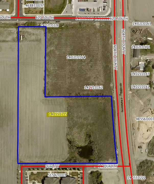
Property Information
mobile view
| Serial Number: 14:055:0215 |
Serial Life: 2021... |
|
|
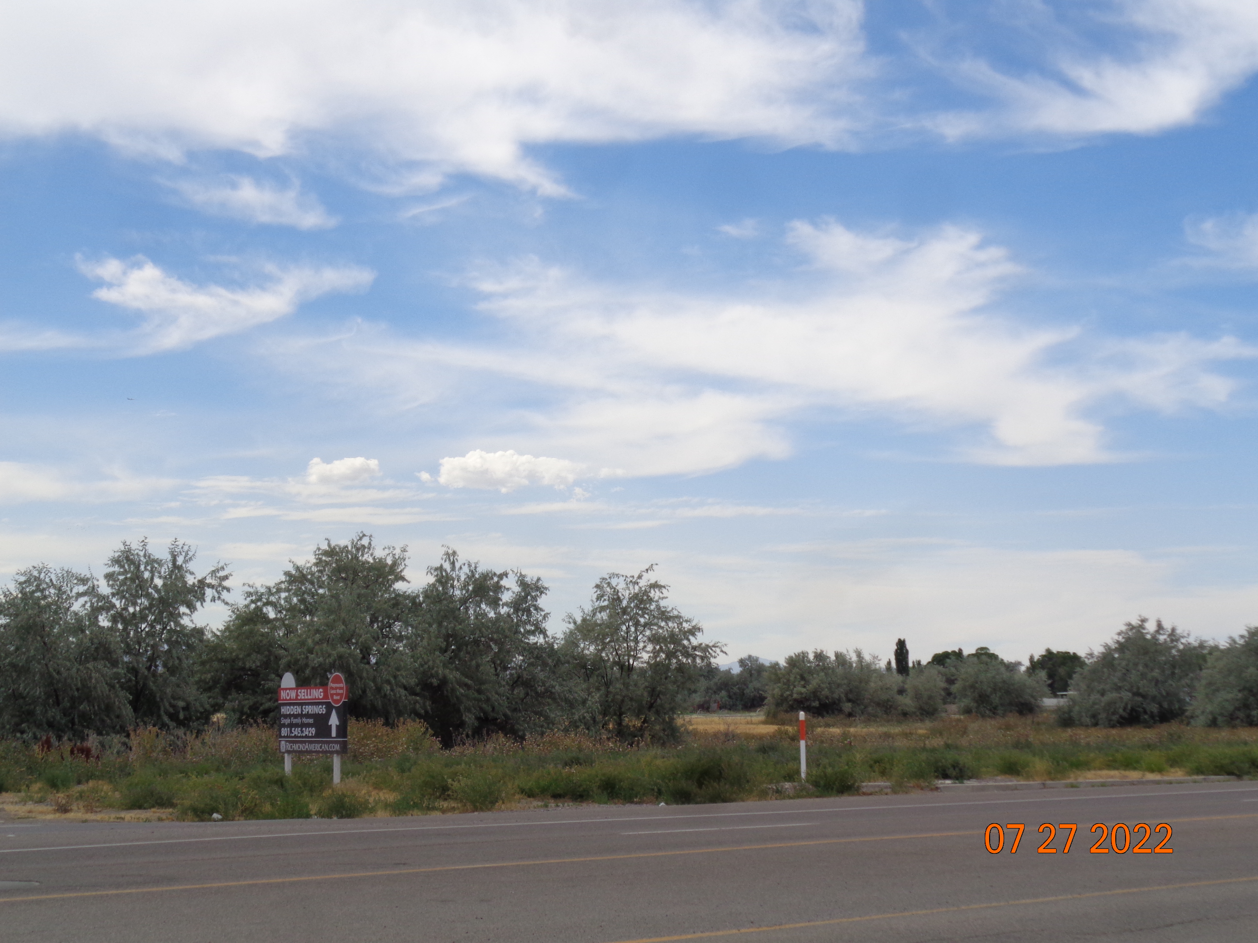 Total Photos: 3
|
| |
|
|
| Property Address: PLEASANT GROVE |
|
| Mailing Address: 1278 N 350 W AMERICAN FORK, UT 84003-5187 |
|
| Acreage: 6.494662 |
|
| Last Document:
101973-2020
|
|
| Subdivision Map Filing |
|
| Taxing Description:
COM N 51.18 FT & W 2027.97 FT FR S 1/4 COR. SEC. 19, T5S, R2E, SLB&M.; N 89 DEG 28' 41" E 388.42 FT; ALONG A CURVE TO L (CHORD BEARS: S 4 DEG 44' 35" E 391.26 FT, RADIUS = 6056 FT); W 580.51 FT; N 0 DEG 59' 26" W 76.05 FT; N 1 DEG 3' 54" E 51.31 FT; N 0 DEG 25' 38" E 668.39 FT; S 89 DEG 24' 26" E 161.74 FT; S 0 DEG 47' 33" W 13.71 FT; S 89 DEG 28' 30" W .98 FT; S 0 DEG 47' 28" W 393.98 FT TO BEG. AREA 6.495 AC.
*Taxing description NOT FOR LEGAL DOCUMENTS
|
|
- Owner Names
- Value History
- Tax History
- Location
- Photos
- Documents
- Aerial Image
| |
----- Real Estate Values ----- |
---Improvements--- |
---Greenbelt--- |
Total |
| Year |
Com |
Res |
Agr |
Tot |
Com |
Res |
Agr |
Tot |
Land |
Homesite |
Tot |
Market Value |
| 2024 |
$2,908,700 |
$0 |
$0 |
$2,908,700 |
$0 |
$0 |
$0 |
$0 |
$2,017 |
$0 |
$2,017 |
$2,908,700 |
| 2023 |
$2,873,800 |
$0 |
$0 |
$2,873,800 |
$0 |
$0 |
$0 |
$0 |
$1,852 |
$0 |
$1,852 |
$2,873,800 |
| 2022 |
$2,926,100 |
$0 |
$0 |
$2,926,100 |
$0 |
$0 |
$0 |
$0 |
$1,872 |
$0 |
$1,872 |
$2,926,100 |
| 2021 |
$2,811,600 |
$0 |
$0 |
$2,811,600 |
$0 |
$0 |
$0 |
$0 |
$1,836 |
$0 |
$1,836 |
$2,811,600 |
| Year |
General Taxes |
Adjustments |
Net Taxes |
Fees |
Payments |
Tax Balance* |
Balance Due |
Tax District |
| 2025 |
$0.00 |
$0.00 |
$0.00 |
$0.00 |
|
$0.00
|
$0.00 |
070 - PLEASANT GROVE CITY |
| 2024 |
$0.00 |
$0.00 |
$0.00 |
$0.00 |
|
($0.35)
|
($0.35) |
070 - PLEASANT GROVE CITY |
| 2023 |
$15.16 |
($0.35) |
$14.81 |
$0.00 |
|
$0.00
|
$0.00 |
070 - PLEASANT GROVE CITY |
| 2022 |
$15.40 |
$0.00 |
$15.40 |
$0.00 |
|
$0.00
|
$0.00 |
070 - PLEASANT GROVE CITY |
| 2021 |
$18.04 |
$0.00 |
$18.04 |
$0.00 |
|
$0.00
|
$0.00 |
070 - PLEASANT GROVE CITY |
* Note: Original tax amount (Does not include applicable interest and/or fees).
| Entry # |
Date |
Recorded |
Type |
Party1 (Grantor) |
Party2 (Grantee) |
| 137520-2021 |
08/05/2021 |
08/06/2021 |
N |
PLEASANT GROVE CITY |
WHOM OF INTEREST |
| 137504-2021 |
08/05/2021 |
08/06/2021 |
N |
PLEASANT GROVE CITY |
WHOM OF INTEREST |
| 74164-2021 |
04/05/2021 |
04/20/2021 |
FARM |
VEST, KURT V & LARRY E TEE (ET AL) |
WHOM OF INTEREST |
| 101974-2020 |
07/15/2020 |
07/17/2020 |
WATER D |
SMART TOWN LLC |
VEST, KURT V & LARRY E TEE (ET AL) |
| 101973-2020 |
07/15/2020 |
07/17/2020 |
SP WD |
SMART TOWN LLC |
VEST, KURT V & LARRY E TEE (ET AL) |
Main Menu Comments or Concerns on Value/Appraisal - Assessor's Office
Documents/Owner/Parcel information - Recorder's Office
Address Change for Tax Notice
This page was created on 9/15/2024 3:26:53 PM |