Property Information
mobile view
| Serial Number: 17:040:0011 |
Serial Life: 1980-2015 |
|
|
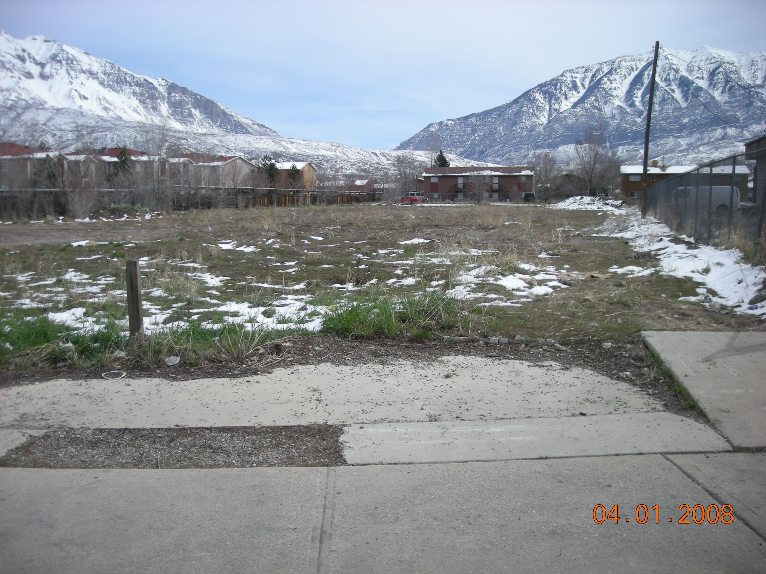 Total Photos: 3
|
| |
|
|
| Property Address: 1024 N STATE - OREM |
|
| Mailing Address: 1010 N STATE ST OREM, UT 84057-3153 |
|
| Acreage: 0.17 |
|
| Last Document:
144695-2007
|
|
| Subdivision Map Filing |
|
| Taxing Description:
BEG. 330 FT E FROM NW COR OF NE1/4 OF SEC 10, T 6 S, R2 E, SLBM; WHERE E LINE OF U.S. HIGHWAY # 91 INTERSECTS N LINE OF SD SEC 10 & S 17 45' E 1296.8 FT FROM SD INTERSECTION; N 17 45' W 60 FT; E 140 FT; S 57.1 FT; W 121.7 FT TO BEG. AREA .17 OF AN ACRE M OR L.
*Taxing description NOT FOR LEGAL DOCUMENTS
|
|
- Owner Names
- Value History
- Tax History
- Location
- Photos
- Documents
- Aerial Image
| 2008-2015 |
|
HARDLE, STEVEN KENNETH |
|
| 2008-2015 |
|
STEVEN KENNETH HARDLE REVOCABLE TRUST DEC 8 2005 THE |
|
| 2008NV |
|
HARDLE, STEVE |
|
| 2004-2007 |
|
KEB ENTERPRISES LP |
|
| 2003 |
|
MEHLHOFF BUSINESS PARK L C |
|
| 2003 |
|
PARAMORE, NORMA P |
|
| 2003NV |
|
MEHLHOFF PROPERTIES-OREM LC |
|
| 2003NV |
|
PARAMORE, NORMA |
|
| 1998-2002 |
|
MEHLHOFF PROPERTIES-OREM LC |
|
| 1998-2002 |
|
PARAMORE, NORMA |
|
| 1994-1997 |
|
MEHLHOFF, JEANICE O |
|
| 1994-1997 |
|
PARAMORE, NORMA |
|
| 1992-1993 |
|
MEHLHOFF, DONALD F ETUX |
|
| 1992-1993 |
|
PARAMORE, NORMA |
|
| 1983-1991 |
|
MEHLHOFF, DONALD F ETUX |
|
| 1983-1991 |
|
PARAMORE, KEITH L |
|
| 1980-1982 |
|
MEHLEOFF, DONALD F ETUX |
|
| 1980-1982 |
|
PARAMORE, KEITH L |
|
| |
----- Real Estate Values ----- |
---Improvements--- |
---Greenbelt--- |
Total |
| Year |
Com |
Res |
Agr |
Tot |
Com |
Res |
Agr |
Tot |
Land |
Homesite |
Tot |
Market Value |
| 2015 |
$58,300 |
$0 |
$0 |
$58,300 |
$0 |
$0 |
$0 |
$0 |
$0 |
$0 |
$0 |
$58,300 |
| 2014 |
$55,500 |
$0 |
$0 |
$55,500 |
$0 |
$0 |
$0 |
$0 |
$0 |
$0 |
$0 |
$55,500 |
| 2013 |
$58,800 |
$0 |
$0 |
$58,800 |
$0 |
$0 |
$0 |
$0 |
$0 |
$0 |
$0 |
$58,800 |
| 2012 |
$58,800 |
$0 |
$0 |
$58,800 |
$0 |
$0 |
$0 |
$0 |
$0 |
$0 |
$0 |
$58,800 |
| 2011 |
$58,800 |
$0 |
$0 |
$58,800 |
$0 |
$0 |
$0 |
$0 |
$0 |
$0 |
$0 |
$58,800 |
| 2010 |
$58,800 |
$0 |
$0 |
$58,800 |
$0 |
$0 |
$0 |
$0 |
$0 |
$0 |
$0 |
$58,800 |
| 2009 |
$60,000 |
$0 |
$0 |
$60,000 |
$0 |
$0 |
$0 |
$0 |
$0 |
$0 |
$0 |
$60,000 |
| 2008 |
$63,300 |
$0 |
$0 |
$63,300 |
$30,300 |
$0 |
$0 |
$30,300 |
$0 |
$0 |
$0 |
$93,600 |
| 2007 |
$60,300 |
$0 |
$0 |
$60,300 |
$28,900 |
$0 |
$0 |
$28,900 |
$0 |
$0 |
$0 |
$89,200 |
| 2006 |
$50,242 |
$0 |
$0 |
$50,242 |
$26,312 |
$0 |
$0 |
$26,312 |
$0 |
$0 |
$0 |
$76,554 |
| 2005 |
$50,242 |
$0 |
$0 |
$50,242 |
$26,312 |
$0 |
$0 |
$26,312 |
$0 |
$0 |
$0 |
$76,554 |
| 2004 |
$50,242 |
$0 |
$0 |
$50,242 |
$26,312 |
$0 |
$0 |
$26,312 |
$0 |
$0 |
$0 |
$76,554 |
| 2003 |
$50,242 |
$0 |
$0 |
$50,242 |
$26,312 |
$0 |
$0 |
$26,312 |
$0 |
$0 |
$0 |
$76,554 |
| 2002 |
$50,242 |
$0 |
$0 |
$50,242 |
$26,312 |
$0 |
$0 |
$26,312 |
$0 |
$0 |
$0 |
$76,554 |
| 2001 |
$43,089 |
$0 |
$0 |
$43,089 |
$22,566 |
$0 |
$0 |
$22,566 |
$0 |
$0 |
$0 |
$65,655 |
| 2000 |
$40,270 |
$0 |
$0 |
$40,270 |
$22,566 |
$0 |
$0 |
$22,566 |
$0 |
$0 |
$0 |
$62,836 |
| 1999 |
$40,270 |
$0 |
$0 |
$40,270 |
$22,566 |
$0 |
$0 |
$22,566 |
$0 |
$0 |
$0 |
$62,836 |
| 1998 |
$38,721 |
$0 |
$0 |
$38,721 |
$21,698 |
$0 |
$0 |
$21,698 |
$0 |
$0 |
$0 |
$60,419 |
| 1997 |
$38,721 |
$0 |
$0 |
$38,721 |
$21,698 |
$0 |
$0 |
$21,698 |
$0 |
$0 |
$0 |
$60,419 |
| 1996 |
$38,721 |
$0 |
$0 |
$38,721 |
$21,698 |
$0 |
$0 |
$21,698 |
$0 |
$0 |
$0 |
$60,419 |
| 1995 |
$38,721 |
$0 |
$0 |
$38,721 |
$21,698 |
$0 |
$0 |
$21,698 |
$0 |
$0 |
$0 |
$60,419 |
| 1994 |
$22,644 |
$0 |
$0 |
$22,644 |
$21,698 |
$0 |
$0 |
$21,698 |
$0 |
$0 |
$0 |
$44,342 |
| 1993 |
$22,644 |
$0 |
$0 |
$22,644 |
$21,698 |
$0 |
$0 |
$21,698 |
$0 |
$0 |
$0 |
$44,342 |
| 1992 |
$20,774 |
$0 |
$0 |
$20,774 |
$19,906 |
$0 |
$0 |
$19,906 |
$0 |
$0 |
$0 |
$40,680 |
| 1991 |
$18,223 |
$0 |
$0 |
$18,223 |
$19,906 |
$0 |
$0 |
$19,906 |
$0 |
$0 |
$0 |
$38,129 |
| 1990 |
$18,223 |
$0 |
$0 |
$18,223 |
$19,906 |
$0 |
$0 |
$19,906 |
$0 |
$0 |
$0 |
$38,129 |
| 1989 |
$18,223 |
$0 |
$0 |
$18,223 |
$19,906 |
$0 |
$0 |
$19,906 |
$0 |
$0 |
$0 |
$38,129 |
| 1988 |
$18,224 |
$0 |
$0 |
$18,224 |
$19,906 |
$0 |
$0 |
$19,906 |
$0 |
$0 |
$0 |
$38,130 |
| 1987 |
$18,788 |
$0 |
$0 |
$18,788 |
$19,906 |
$0 |
$0 |
$19,906 |
$0 |
$0 |
$0 |
$38,694 |
| 1986 |
$18,788 |
$0 |
$0 |
$18,788 |
$19,906 |
$0 |
$0 |
$19,906 |
$0 |
$0 |
$0 |
$38,694 |
| 1985 |
$18,788 |
$0 |
$0 |
$18,788 |
$19,906 |
$0 |
$0 |
$19,906 |
$0 |
$0 |
$0 |
$38,694 |
| 1984 |
$18,975 |
$0 |
$0 |
$18,975 |
$19,906 |
$0 |
$0 |
$19,906 |
$0 |
$0 |
$0 |
$38,881 |
| Year |
General Taxes |
Adjustments |
Net Taxes |
Fees |
Payments |
Tax Balance* |
Balance Due |
Tax District |
| 2015 |
$662.70 |
$0.00 |
$662.70 |
$0.00 |
|
$0.00
|
$0.00 |
090 - OREM CITY |
| 2014 |
$633.75 |
$0.00 |
$633.75 |
$0.00 |
|
$0.00
|
$0.00 |
090 - OREM CITY |
| 2013 |
$724.06 |
$0.00 |
$724.06 |
$0.00 |
|
$0.00
|
$0.00 |
090 - OREM CITY |
| 2012 |
$739.00 |
$0.00 |
$739.00 |
$0.00 |
|
$0.00
|
$0.00 |
090 - OREM CITY |
| 2011 |
$735.47 |
$0.00 |
$735.47 |
$0.00 |
|
$0.00
|
$0.00 |
090 - OREM CITY |
| 2010 |
$688.55 |
$0.00 |
$688.55 |
$0.00 |
|
$0.00
|
$0.00 |
090 - OREM CITY |
| 2009 |
$651.30 |
$0.00 |
$651.30 |
$0.00 |
|
$0.00
|
$0.00 |
090 - OREM CITY |
| 2008 |
$941.52 |
$0.00 |
$941.52 |
$0.00 |
|
$0.00
|
$0.00 |
090 - OREM CITY |
| 2007 |
$887.00 |
$0.00 |
$887.00 |
$0.00 |
|
$0.00
|
$0.00 |
090 - OREM CITY |
| 2006 |
$810.63 |
$0.00 |
$810.63 |
$0.00 |
|
$0.00
|
$0.00 |
090 - OREM CITY |
| 2005 |
$914.97 |
$0.00 |
$914.97 |
$0.00 |
|
$0.00
|
$0.00 |
090 - OREM CITY |
| 2004 |
$898.74 |
$0.00 |
$898.74 |
$0.00 |
|
$0.00
|
$0.00 |
090 - OREM CITY |
| 2003 |
$872.10 |
$0.00 |
$872.10 |
$0.00 |
|
$0.00
|
$0.00 |
090 - OREM CITY |
| 2002 |
$797.00 |
$0.00 |
$797.00 |
$0.00 |
|
$0.00
|
$0.00 |
090 - OREM CITY |
| 2001 |
$676.97 |
$0.00 |
$676.97 |
$0.00 |
|
$0.00
|
$0.00 |
090 - OREM CITY |
| 2000 |
$669.89 |
$0.00 |
$669.89 |
$0.00 |
|
$0.00
|
$0.00 |
090 - OREM CITY |
| 1999 |
$689.69 |
$0.00 |
$689.69 |
$0.00 |
|
$0.00
|
$0.00 |
090 - OREM CITY |
| 1998 |
$626.18 |
$0.00 |
$626.18 |
$0.00 |
|
$0.00
|
$0.00 |
090 - OREM CITY |
| 1997 |
$623.58 |
$0.00 |
$623.58 |
$0.00 |
|
$0.00
|
$0.00 |
090 - OREM CITY |
| 1996 |
$569.69 |
$0.00 |
$569.69 |
$0.00 |
|
$0.00
|
$0.00 |
090 - OREM CITY |
| 1995 |
$644.67 |
$0.00 |
$644.67 |
$0.00 |
|
$0.00
|
$0.00 |
090 - OREM CITY |
| 1994 |
$609.70 |
$0.00 |
$609.70 |
$0.00 |
|
$0.00
|
$0.00 |
090 - OREM CITY |
| 1993 |
$520.45 |
$0.00 |
$520.45 |
$0.00 |
|
$0.00
|
$0.00 |
090 - OREM CITY |
| 1992 |
$483.11 |
$0.00 |
$483.11 |
$0.00 |
|
$0.00
|
$0.00 |
090 - OREM CITY |
| 1991 |
$473.43 |
$0.00 |
$473.43 |
$0.00 |
|
$0.00
|
$0.00 |
090 - OREM CITY |
| 1990 |
$426.28 |
$0.00 |
$426.28 |
$0.00 |
|
$0.00
|
$0.00 |
090 - OREM CITY |
| 1989 |
$434.45 |
$0.00 |
$434.45 |
$0.00 |
|
$0.00
|
$0.00 |
090 - OREM CITY |
| 1988 |
$433.43 |
$0.00 |
$433.43 |
$0.00 |
|
$0.00
|
$0.00 |
090 - OREM CITY |
| 1987 |
$432.57 |
$0.00 |
$432.57 |
$0.00 |
|
$0.00
|
$0.00 |
090 - OREM CITY |
| 1986 |
$426.75 |
$0.00 |
$426.75 |
$0.00 |
|
$0.00
|
$0.00 |
090 - OREM CITY |
| 1985 |
$429.28 |
$0.00 |
$429.28 |
$0.00 |
|
$0.00
|
$0.00 |
090 - OREM CITY |
| 1984 |
$423.09 |
$0.00 |
$423.09 |
$0.00 |
|
$0.00
|
$0.00 |
090 - OREM CITY |
* Note: Original tax amount (Does not include applicable interest and/or fees).
| Entry # |
Date |
Recorded |
Type |
Party1 (Grantor) |
Party2 (Grantee) |
| 31806-2015 |
04/16/2015 |
04/16/2015 |
WD |
HARDLE, STEVEN KENNETH TEE (ET AL) |
SBS STORAGE-OREM LLC |
| 28084-2013 |
03/21/2013 |
03/25/2013 |
CAN ND |
DESERET FIRST FEDERAL CREDIT UNION TEE |
WHOM OF INTEREST |
| 65629-2011 |
09/15/2011 |
09/16/2011 |
ND |
DESERET FIRST FEDERAL CREDIT UNION TEE |
HARDLE, STEVE |
| 144695-2007 |
10/05/2007 |
10/05/2007 |
QCD |
HARDLE, STEVE |
HARDLE, STEVEN KENNETH TEE (ET AL) |
| 119134-2007 |
08/15/2007 |
08/15/2007 |
REC |
TITLE WEST TITLE COMPANY TEE |
HARDLE, STEVE |
| 59247-2007 |
04/19/2007 |
04/23/2007 |
TR D |
HARDLE, STEVE |
KEB ENTERPRISES |
| 59246-2007 |
04/19/2007 |
04/23/2007 |
TR D |
HARDLE, STEVEN K |
DESERET FIRST FEDERAL CREDIT UNION |
| 59198-2007 |
04/19/2007 |
04/23/2007 |
WD |
KEB ENTERPRISES LP |
HARDLE, STEVE |
| 154318-2003 |
09/19/2003 |
09/22/2003 |
WD |
MEHLHOFF, DONALD F TEE (ET AL) |
KEB ENTERPRISES LP |
| 145956-2002 |
11/12/2002 |
12/02/2002 |
WD |
MEHLHOFF PROPERTIES OREM LC |
MEHLHOFF BUSINESS PARK LC |
| 113225-2002 |
09/24/2002 |
09/26/2002 |
QCD |
PARAMORE, NORMA P |
PARAMORE, NORMA P TEE |
| 37685-1997 |
03/13/1997 |
05/16/1997 |
C WD |
MEHLHOFF, JEANICE O & JEANICE O TEE |
MEHLHOFF PROPERTIES-OREM LC |
| 31241-1997 |
03/25/1997 |
04/25/1997 |
WD |
MEHLHOFF, JEANICE O TEE |
MEHLHOFF PROPERTIES - OREM LC |
| 96404-1993 |
04/19/1993 |
12/30/1993 |
QCD |
MEHLHOFF, DONALD F & JEANICE O |
MEHLHOFF, DONALD F & JEANICE O TEE |
| 2774-1992 |
01/22/1992 |
01/22/1992 |
AF DC |
PARAMORE, KEITH L DEC |
PARAMORE, NORMA P |
| 14692-1990 |
05/08/1990 |
05/10/1990 |
ORDINRP |
OREM CITY REDEVELOPMENT PLAT #90-08 |
WHOM OF INTEREST |
| 29426-1981 |
08/28/1981 |
10/08/1981 |
REC |
WALKER BANK & TRUST COMPANY TEE |
PARAMORE, KEITH L & NORMA (ET AL) |
| 41567-1980 |
05/29/1980 |
12/02/1980 |
REC |
WALKER BANK & TRUST COMPANY TEE |
PARAMORE, KEITH L & NORMA P (ET AL) |
Main Menu Comments or Concerns on Value/Appraisal - Assessor's Office
Documents/Owner/Parcel information - Recorder's Office
Address Change for Tax Notice
This page was created on 4/1/2025 2:25:39 PM |

