Property Information
mobile view
| Serial Number: 02:032:0066 |
Serial Life: 2022 |
|
|
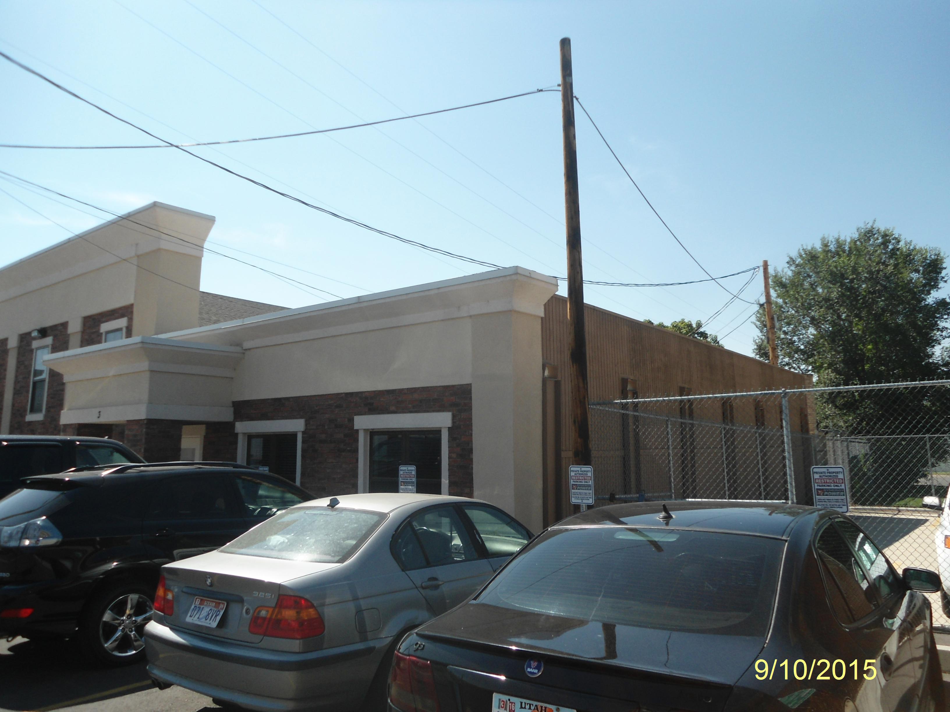 Total Photos: 1
|
| |
|
|
| Property Address: 76 W MAIN - AMERICAN FORK |
|
| Mailing Address: 76 W MAIN ST AMERICAN FORK, UT 84003 |
|
| Acreage: 0.314987 |
|
| Last Document:
180226-2021
|
|
| Subdivision Map Filing |
|
| Taxing Description:
COM S 89 DEG 18' 6" E 74.81 FT FR SW COR. BLK. 19, PLAT A, AMERICAN FORK CITY SURVEY; N 0 DEG 41' 54" E 130.02 FT; S 89 DEG 18' 31" E 68.21 FT; N 0 DEG 41' 15" E 6.53 FT; E 27.94 FT; S 41.24 FT; E 43.12 FT; S 0 DEG 42' 33" W 17.45 FT; N 89 DEG 18' 37" W 40.05 FT; S 0 DEG 41' 23" W 78.75 FT; N 89 DEG 18' 6" W 99.79 FT TO BEG. AREA 0.315 AC.
*Taxing description NOT FOR LEGAL DOCUMENTS
|
|
- Owner Names
- Value History
- Tax History
- Location
- Photos
- Documents
- Aerial Image
| |
----- Real Estate Values ----- |
---Improvements--- |
---Greenbelt--- |
Total |
| Year |
Com |
Res |
Agr |
Tot |
Com |
Res |
Agr |
Tot |
Land |
Homesite |
Tot |
Market Value |
| 2022 |
$297,300 |
$0 |
$0 |
$297,300 |
$633,700 |
$0 |
$0 |
$633,700 |
$0 |
$0 |
$0 |
$931,000 |
| Year |
General Taxes |
Adjustments |
Net Taxes |
Fees |
Payments |
Tax Balance* |
Balance Due |
Tax District |
| 2022 |
$8,008.46 |
$0.00 |
$8,008.46 |
$0.00 |
|
$0.00
|
$0.00 |
060 - AMERICAN FORK CITY |
* Note: Original tax amount (Does not include applicable interest and/or fees).
| Entry # |
Date |
Recorded |
Type |
Party1 (Grantor) |
Party2 (Grantee) |
| 3021-2022 |
01/07/2022 |
01/07/2022 |
CORR AF |
GREENBRIER TITLE INSURANCE AGENCY INC (ET AL) |
WHOM OF INTEREST |
| 180229-2021 |
10/20/2021 |
10/22/2021 |
EAS |
JACOB, WILLIAM T & JANEANE W (ET AL) |
JACOB, WILLIAM T & JANEANE W (ET AL) |
| 180226-2021 |
10/20/2021 |
10/22/2021 |
WD |
JACOB, WILLIAM T & JANEANE W |
JACOB, WILLIAM T & JANEANE W |
Main Menu Comments or Concerns on Value/Appraisal - Assessor's Office
Documents/Owner/Parcel information - Recorder's Office
Address Change for Tax Notice
This page was created on 9/16/2024 11:32:50 PM |