Property Information
mobile view
| Serial Number: 25:013:0044 |
Serial Life: 2022-2023 |
|
|
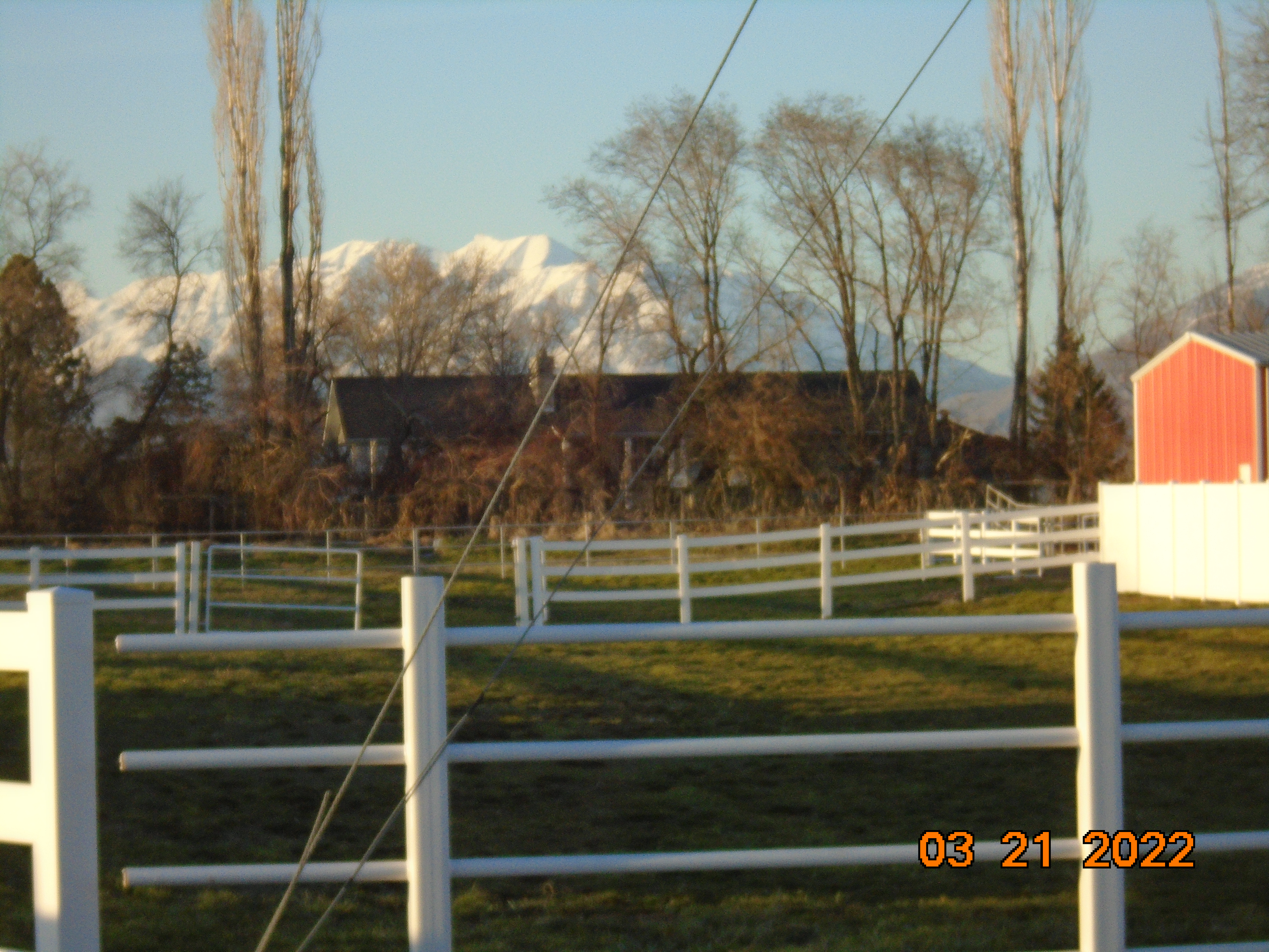 Total Photos: 1
|
| |
|
|
| Property Address: 1802 W 900 SOUTH - SPANISH FORK |
|
| Mailing Address: 742 W TRIPLE CROWN MAPLETON, UT 84664 |
|
| Acreage: 11.155757 |
|
| Last Document:
88717-2021
|
|
| Subdivision Map Filing |
|
| Taxing Description:
COM S 156.32 FT & W 504.53 FT FR N 1/4 COR. SEC. 26, T8S, R2E, SLB&M.; N 5 DEG 44' 54" W 328.17 FT; N 18 DEG 46' 0" W 372.51 FT; N 44 DEG 33' 5" E 121.09 FT; S 72 DEG 19' 1" E 544.8 FT; S 57 DEG 27' 42" E 115.11 FT; S 15 DEG 4' 28" E 281.34 FT; S 52 DEG 56' 12" E 88.15 FT; S 1 DEG 21' 12" E 247.79 FT; S 27.05 FT; W 143.66 FT; S 3.39 FT; W 7.62 FT; N 87 DEG 50' 42" W 82.37 FT; N 84 DEG 57' 39" W 27.54 FT; S 41 DEG 15' 27" W 7.07 FT; W 4.56 FT; N 80 DEG 23' 0" W 134.64 FT; N 80 DEG 1' 0" W 95.7 FT; S 23.13 FT; N 83 DEG 44' 9" W 9.85 FT; N 81 DEG 15' 0" W 24.49 FT; N 79 DEG 1' 11" W 61.04 FT; N 77 DEG 40' 21" W 89.4 FT; S 0 DEG 58' 32" W 46.99 FT; W 19.31 FT; N 0 DEG 52' 4" E 60.35 FT TO BEG. AREA 11.156 AC.
*Taxing description NOT FOR LEGAL DOCUMENTS
|
|
- Owner Names
- Value History
- Tax History
- Location
- Photos
- Documents
- Aerial Image
| |
----- Real Estate Values ----- |
---Improvements--- |
---Greenbelt--- |
Total |
| Year |
Com |
Res |
Agr |
Tot |
Com |
Res |
Agr |
Tot |
Land |
Homesite |
Tot |
Market Value |
| 2023 |
$0 |
$219,300 |
$655,600 |
$874,900 |
$0 |
$289,400 |
$0 |
$289,400 |
$218 |
$153,000 |
$153,218 |
$1,164,300 |
| 2022 |
$0 |
$233,800 |
$699,000 |
$932,800 |
$0 |
$266,600 |
$0 |
$266,600 |
$218 |
$153,000 |
$153,218 |
$1,199,400 |
| Year |
General Taxes |
Adjustments |
Net Taxes |
Fees |
Payments |
Tax Balance* |
Balance Due |
Tax District |
| 2023 |
$2,360.13 |
$0.00 |
$2,360.13 |
$0.00 |
|
$0.00
|
$0.00 |
150 - SPANISH FORK CITY |
| 2022 |
$2,282.49 |
$0.00 |
$2,282.49 |
$0.00 |
|
$0.00
|
$0.00 |
150 - SPANISH FORK CITY |
* Note: Original tax amount (Does not include applicable interest and/or fees).
| Entry # |
Date |
Recorded |
Type |
Party1 (Grantor) |
Party2 (Grantee) |
| 18096-2023 |
03/22/2023 |
03/23/2023 |
QCD |
MINER, GARY |
EVANS MEADOWS LLC |
| 127065-2022 |
12/23/2022 |
12/27/2022 |
C WD |
FAUSETT, WADE G & MINDIE L TEE (ET AL) |
EVANS MEADOWS LLC |
| 93617-2021 |
05/17/2021 |
05/18/2021 |
D TR |
STEPHENS, JULIE D & ANTHONY WADE |
MY MOVE MORTGAGE LLC DBA (ET AL) |
| 88718-2021 |
05/07/2021 |
05/11/2021 |
QCD |
FAUSETT, WADE G & MINDIE L TEE (ET AL) |
MINER, GARY |
| 88717-2021 |
05/28/2021 |
05/11/2021 |
QCD |
MINER, GARY |
FAUSETT, WADE G & MINDIE L TEE (ET AL) |
Main Menu Comments or Concerns on Value/Appraisal - Assessor's Office
Documents/Owner/Parcel information - Recorder's Office
Address Change for Tax Notice
This page was created on 9/16/2024 8:04:45 PM |