Property Information
mobile view
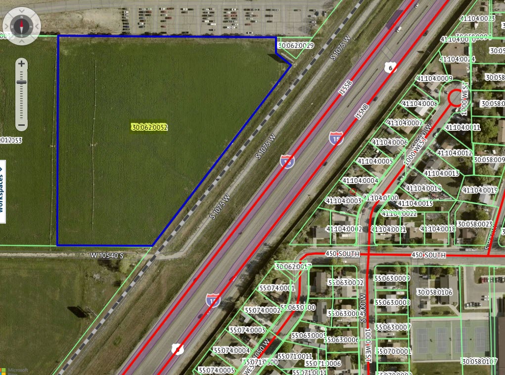
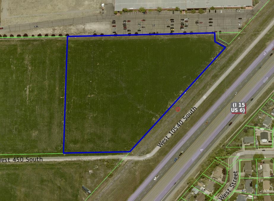
| Serial Number: 30:062:0052 |
Serial Life: 2021... |
|
|
 Total Photos: 4
|
| |
|
|
| Property Address: |
|
| Mailing Address: 11251 N SUNSET DR HIGHLAND, UT 84003 |
|
| Acreage: 7.894081 |
|
| Last Document:
89542-2020
|
|
| Subdivision Map Filing |
|
| Taxing Description:
COM W 330.1 FT & S 783.88 FT FR NE 1/4 COR. SEC. 18, T9S, R2E, SLB&M.; S 37 DEG 47' 32" W 705.71 FT; N 89 DEG 39' 13" W 293.22 FT; N 0 DEG 24' 2" E 648.86 FT; S 89 DEG 26' 46" E 666.99 FT; S 89 DEG 27' 13" E 6.58 FT; S 49.24 FT; S 52 DEG 0' 0" E 60.39 FT TO BEG. AREA 7.894 AC.
*Taxing description NOT FOR LEGAL DOCUMENTS
|
|
- Owner Names
- Value History
- Tax History
- Location
- Photos
- Documents
- Aerial Image
| |
----- Real Estate Values ----- |
---Improvements--- |
---Greenbelt--- |
Total |
| Year |
Com |
Res |
Agr |
Tot |
Com |
Res |
Agr |
Tot |
Land |
Homesite |
Tot |
Market Value |
| 2024 |
$1,525,100 |
$0 |
$0 |
$1,525,100 |
$0 |
$0 |
$0 |
$0 |
$3,708 |
$0 |
$3,708 |
$1,525,100 |
| 2023 |
$1,485,600 |
$0 |
$0 |
$1,485,600 |
$0 |
$0 |
$0 |
$0 |
$3,401 |
$0 |
$3,401 |
$1,485,600 |
| 2022 |
$1,168,800 |
$0 |
$0 |
$1,168,800 |
$0 |
$0 |
$0 |
$0 |
$3,440 |
$0 |
$3,440 |
$1,168,800 |
| 2021 |
$1,080,000 |
$0 |
$0 |
$1,080,000 |
$0 |
$0 |
$0 |
$0 |
$3,369 |
$0 |
$3,369 |
$1,080,000 |
| Year |
General Taxes |
Adjustments |
Net Taxes |
Fees |
Payments |
Tax Balance* |
Balance Due |
Tax District |
| 2025 |
$0.00 |
$0.00 |
$0.00 |
$0.00 |
|
$0.00
|
$0.00 |
170 - PAYSON CITY |
| 2024 |
$36.43 |
$0.00 |
$36.43 |
$0.00 |
|
$0.00
|
$0.00 |
170 - PAYSON CITY |
| 2023 |
$33.33 |
$0.00 |
$33.33 |
$0.00 |
|
$0.00
|
$0.00 |
170 - PAYSON CITY |
| 2022 |
$34.27 |
$0.00 |
$34.27 |
$0.00 |
|
$0.00
|
$0.00 |
170 - PAYSON CITY |
| 2021 |
$38.05 |
$0.00 |
$38.05 |
$0.00 |
|
$0.00
|
$0.00 |
170 - PAYSON CITY |
* Note: Original tax amount (Does not include applicable interest and/or fees).
| Entry # |
Date |
Recorded |
Type |
Party1 (Grantor) |
Party2 (Grantee) |
| 72366-2023 |
07/08/2023 |
11/03/2023 |
EAS |
RICH, STEPHEN R C G PTNR (ET AL) |
PARKER, WAYNE J & GLADYS JEANETTE Y TEE (ET AL) |
| 189013-2021 |
11/05/2021 |
11/08/2021 |
SP WD |
PENROD, ROSANNA & ROSANNA SUE AKA (ET AL) |
RSVP PROPERTIES LLC |
| 74163-2021 |
04/06/2021 |
04/20/2021 |
FARM |
PENROD, ROSANNA |
WHOM OF INTEREST |
| 102021-2020 |
07/07/2020 |
07/17/2020 |
REC |
CENTRAL BANK TEE |
MARY KAYE'S FAMILY LIMITED PARTNERSHIP |
| 89542-2020 |
06/25/2020 |
06/26/2020 |
QCD |
MARY KAYE'S FAMILY LIMITED PARTNERSHIP BY (ET AL) |
PENROD, ROSANNA |
| 89541-2020 |
06/25/2020 |
06/26/2020 |
WD W |
MARY KAYE'S FAMILY LIMITED PARTNERSHIP BY (ET AL) |
PENROD, ROSANNA |
| 88681-2020 |
06/25/2020 |
06/25/2020 |
N SPREC |
UTAH COUNTY RECORDER |
WHOM OF INTEREST |
Main Menu Comments or Concerns on Value/Appraisal - Assessor's Office
Documents/Owner/Parcel information - Recorder's Office
Address Change for Tax Notice
This page was created on 2/20/2025 3:28:39 PM |