Property Information
mobile view
| Serial Number: 35:109:0004 |
Serial Life: 2013... |
|
|
 Total Photos: 5
|
| |
|
|
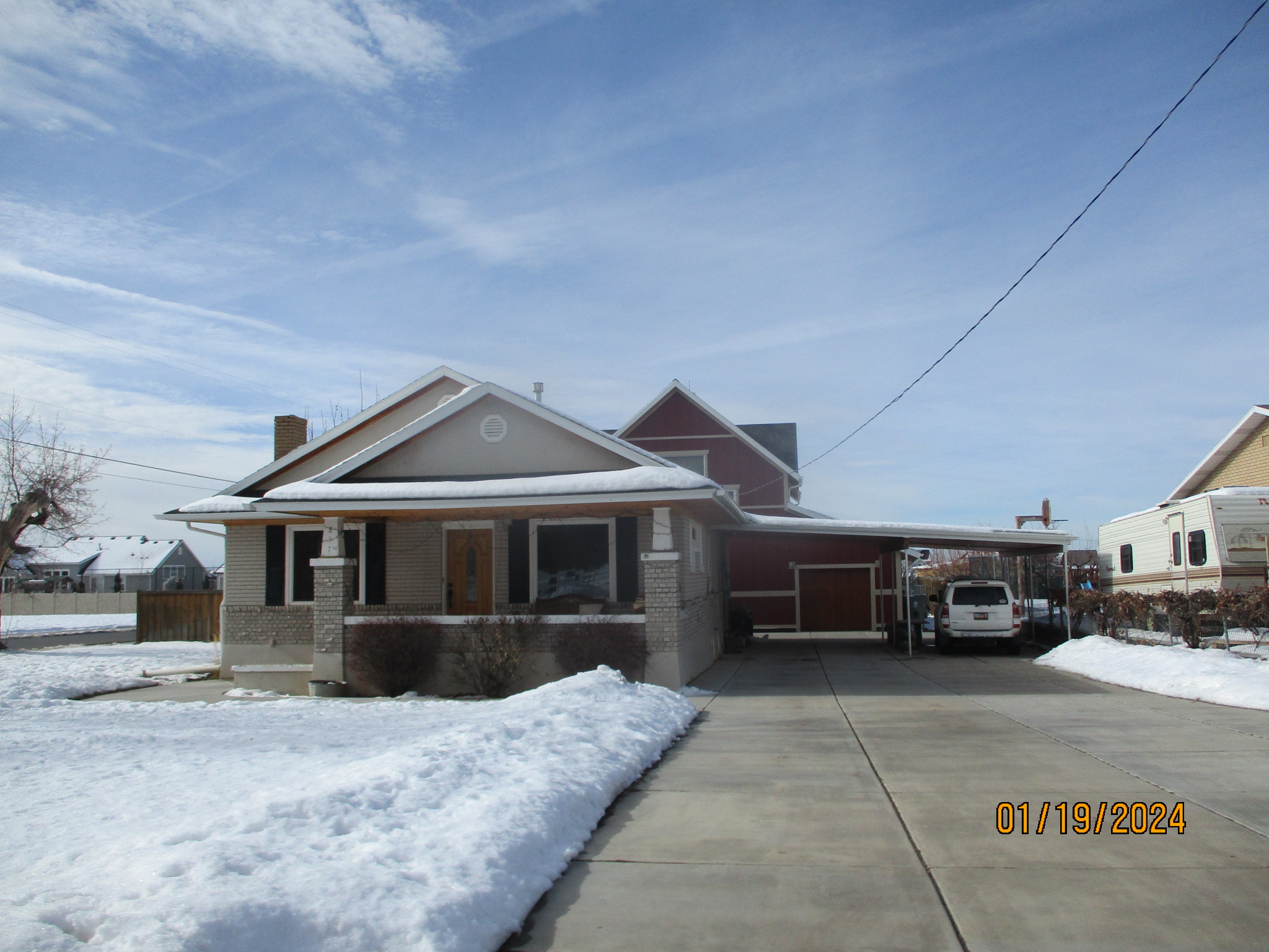
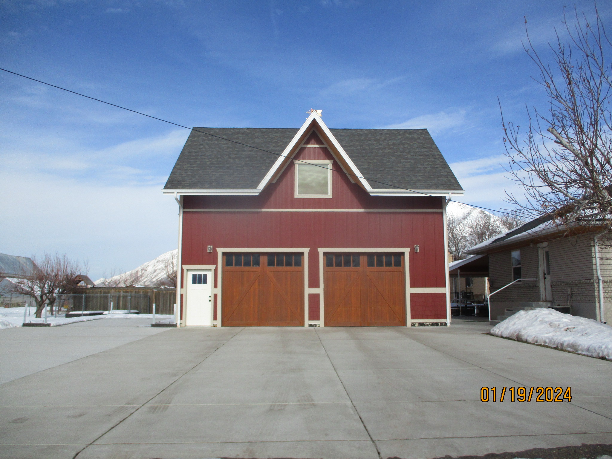
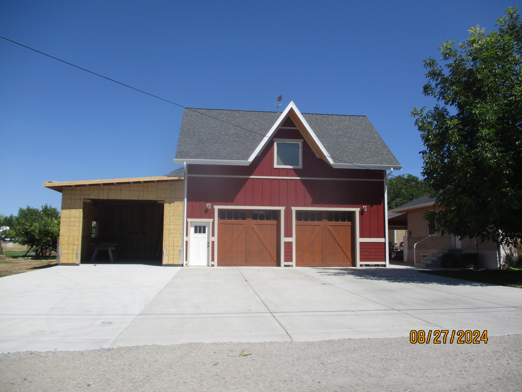
| Property Address: 817 N 300 WEST - MAPLETON |
|
| Mailing Address: 817 N 300 W MAPLETON, UT 84664-3414 |
|
| Acreage: 0.532743 |
|
| Last Document:
14142-2012
|
|
| Subdivision Map Filing |
|
| Taxing Description:
LOT 3, BANKS SUB AREA 0.388 AC. ALSO COM FR A PT N 89 DEG 40' E 25.25 CH & N 21' E 2.89 CH FR CTR SEC. 10, T8S, R3E, SLB&M.; N 107.45 FT; N 89 DEG 37' 5" W 7.59 FT; S 0 DEG 23' 11" W 81.32 FT; N 89 DEG 35' 33" W 203.06 FT; S 27.63 FT; E 12.8 RD TO BEG. AREA 0.145 AC. TOTAL AREA .533 AC.
*Taxing description NOT FOR LEGAL DOCUMENTS
|
|
- Owner Names
- Value History
- Tax History
- Location
- Photos
- Documents
- Aerial Image
| |
----- Real Estate Values ----- |
---Improvements--- |
---Greenbelt--- |
Total |
| Year |
Com |
Res |
Agr |
Tot |
Com |
Res |
Agr |
Tot |
Land |
Homesite |
Tot |
Market Value |
| 2024 |
$0 |
$278,000 |
$0 |
$278,000 |
$0 |
$115,400 |
$0 |
$115,400 |
$0 |
$0 |
$0 |
$393,400 |
| 2023 |
$0 |
$277,900 |
$0 |
$277,900 |
$0 |
$114,800 |
$0 |
$114,800 |
$0 |
$0 |
$0 |
$392,700 |
| 2022 |
$0 |
$296,300 |
$0 |
$296,300 |
$0 |
$101,700 |
$0 |
$101,700 |
$0 |
$0 |
$0 |
$398,000 |
| 2021 |
$0 |
$185,200 |
$0 |
$185,200 |
$0 |
$78,200 |
$0 |
$78,200 |
$0 |
$0 |
$0 |
$263,400 |
| 2020 |
$0 |
$163,900 |
$0 |
$163,900 |
$0 |
$78,200 |
$0 |
$78,200 |
$0 |
$0 |
$0 |
$242,100 |
| 2019 |
$0 |
$157,300 |
$0 |
$157,300 |
$0 |
$68,000 |
$0 |
$68,000 |
$0 |
$0 |
$0 |
$225,300 |
| 2018 |
$0 |
$132,500 |
$0 |
$132,500 |
$0 |
$56,700 |
$0 |
$56,700 |
$0 |
$0 |
$0 |
$189,200 |
| 2017 |
$0 |
$124,200 |
$0 |
$124,200 |
$0 |
$49,300 |
$0 |
$49,300 |
$0 |
$0 |
$0 |
$173,500 |
| 2016 |
$0 |
$115,900 |
$0 |
$115,900 |
$0 |
$42,900 |
$0 |
$42,900 |
$0 |
$0 |
$0 |
$158,800 |
| 2015 |
$0 |
$103,500 |
$0 |
$103,500 |
$0 |
$42,900 |
$0 |
$42,900 |
$0 |
$0 |
$0 |
$146,400 |
| 2014 |
$0 |
$99,300 |
$0 |
$99,300 |
$0 |
$42,900 |
$0 |
$42,900 |
$0 |
$0 |
$0 |
$142,200 |
| 2013 |
$0 |
$83,100 |
$0 |
$83,100 |
$0 |
$42,900 |
$0 |
$42,900 |
$0 |
$0 |
$0 |
$126,000 |
| Year |
General Taxes |
Adjustments |
Net Taxes |
Fees |
Payments |
Tax Balance* |
Balance Due |
Tax District |
| 2025 |
$0.00 |
$0.00 |
$0.00 |
$0.00 |
|
$0.00
|
$0.00 |
140 - MAPLETON CITY |
| 2024 |
$2,208.70 |
$0.00 |
$2,208.70 |
$0.00 |
|
|
Click for Payoff
|
140 - MAPLETON CITY |
| 2023 |
$2,190.95 |
$0.00 |
$2,190.95 |
$0.00 |
|
$0.00
|
$0.00 |
140 - MAPLETON CITY |
| 2022 |
$2,245.70 |
$0.00 |
$2,245.70 |
$0.00 |
|
$0.00
|
$0.00 |
140 - MAPLETON CITY |
| 2021 |
$1,760.03 |
$0.00 |
$1,760.03 |
$0.00 |
|
$0.00
|
$0.00 |
140 - MAPLETON CITY |
| 2020 |
$1,672.43 |
$0.00 |
$1,672.43 |
$0.00 |
|
$0.00
|
$0.00 |
140 - MAPLETON CITY |
| 2019 |
$1,524.77 |
$0.00 |
$1,524.77 |
$0.00 |
|
$0.00
|
$0.00 |
140 - MAPLETON CITY |
| 2018 |
$1,345.08 |
$0.00 |
$1,345.08 |
$0.00 |
|
$0.00
|
$0.00 |
140 - MAPLETON CITY |
| 2017 |
$1,278.31 |
$0.00 |
$1,278.31 |
$0.00 |
|
$0.00
|
$0.00 |
140 - MAPLETON CITY |
| 2016 |
$1,176.99 |
$0.00 |
$1,176.99 |
$0.00 |
|
$0.00
|
$0.00 |
140 - MAPLETON CITY |
| 2015 |
$1,091.69 |
$0.00 |
$1,091.69 |
$0.00 |
|
$0.00
|
$0.00 |
140 - MAPLETON CITY |
| 2014 |
$1,079.77 |
$0.00 |
$1,079.77 |
$0.00 |
|
$0.00
|
$0.00 |
140 - MAPLETON CITY |
| 2013 |
$1,018.50 |
$0.00 |
$1,018.50 |
$0.00 |
|
$0.00
|
$0.00 |
140 - MAPLETON CITY |
* Note: Original tax amount (Does not include applicable interest and/or fees).
| Entry # |
Date |
Recorded |
Type |
Party1 (Grantor) |
Party2 (Grantee) |
| 41585-2023 |
06/28/2023 |
06/28/2023 |
WD |
GREEN, DENVER W |
GREEN, DENVER WAYNE TEE (ET AL) |
| 36971-2017 |
02/09/2017 |
04/18/2017 |
REC |
HALLIDAY, PAUL M JR SUCTEE |
GREEN, DENVER W |
| 36970-2017 |
01/11/2017 |
04/18/2017 |
SUB TEE |
HOME FRONT MORTGAGE INC |
HALLIDAY, PAUL M JR SUBTEE |
| 61257-2015 |
05/20/2015 |
07/09/2015 |
REC |
ZIONS FIRST NATIONAL BANK TEE |
GREEN, DENVER W |
| 54579-2015 |
04/28/2015 |
06/22/2015 |
D TR |
GREEN, DENVER W |
ZIONS FIRST NATIONAL BANK |
| 40652-2014 |
05/19/2014 |
06/16/2014 |
D TR |
GREEN, DENVER W |
ZIONS FIRST NATIONAL BANK |
| 39929-2012 |
05/03/2012 |
05/14/2012 |
REC |
CITIBANK TEE |
GREEN, DENVER & SHARON |
| 39928-2012 |
05/03/2012 |
05/14/2012 |
SUB TEE |
CITIMORTGAGE INC (ET AL) |
GREEN, DENIVER & SHARON |
| 16232-2012 |
02/28/2012 |
02/29/2012 |
D TR |
GREEN, DENVER W |
HOME FRONT MORTGAGE INC |
| 14142-2012 |
02/22/2012 |
02/23/2012 |
QCD |
GREEN, DENVER |
GREEN, DENVER W |
Main Menu Comments or Concerns on Value/Appraisal - Assessor's Office
Documents/Owner/Parcel information - Recorder's Office
Address Change for Tax Notice
This page was created on 10/18/2024 2:49:40 AM |