Property Information
mobile view
| Serial Number: 37:139:0018 |
Serial Life: 2000-2022 |
|
|
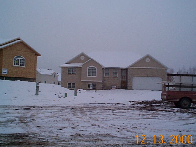 Total Photos: 1
|
| |
|
|
| Property Address: 497 W 1500 SOUTH - PAYSON |
|
| Mailing Address: 497 W 1500 S PAYSON, UT 84651-8651 |
|
| Acreage: 0.454 |
|
| Last Document:
69761-2001
|
|
| Subdivision Map Filing |
|
| Taxing Description:
LOT 18, PLAT B, DRY CREEK PRD. AREA 0.454 AC.
*Taxing description NOT FOR LEGAL DOCUMENTS
|
|
- Owner Names
- Value History
- Tax History
- Location
- Photos
- Documents
- Aerial Image
| |
----- Real Estate Values ----- |
---Improvements--- |
---Greenbelt--- |
Total |
| Year |
Com |
Res |
Agr |
Tot |
Com |
Res |
Agr |
Tot |
Land |
Homesite |
Tot |
Market Value |
| 2022 |
$0 |
$187,700 |
$0 |
$187,700 |
$0 |
$333,700 |
$0 |
$333,700 |
$0 |
$0 |
$0 |
$521,400 |
| 2021 |
$0 |
$134,100 |
$0 |
$134,100 |
$0 |
$254,700 |
$0 |
$254,700 |
$0 |
$0 |
$0 |
$388,800 |
| 2020 |
$0 |
$121,900 |
$0 |
$121,900 |
$0 |
$238,500 |
$0 |
$238,500 |
$0 |
$0 |
$0 |
$360,400 |
| 2019 |
$0 |
$100,900 |
$0 |
$100,900 |
$0 |
$238,300 |
$0 |
$238,300 |
$0 |
$0 |
$0 |
$339,200 |
| 2018 |
$0 |
$88,300 |
$0 |
$88,300 |
$0 |
$207,200 |
$0 |
$207,200 |
$0 |
$0 |
$0 |
$295,500 |
| 2017 |
$0 |
$79,900 |
$0 |
$79,900 |
$0 |
$207,200 |
$0 |
$207,200 |
$0 |
$0 |
$0 |
$287,100 |
| 2016 |
$0 |
$71,400 |
$0 |
$71,400 |
$0 |
$204,500 |
$0 |
$204,500 |
$0 |
$0 |
$0 |
$275,900 |
| 2015 |
$0 |
$63,000 |
$0 |
$63,000 |
$0 |
$178,800 |
$0 |
$178,800 |
$0 |
$0 |
$0 |
$241,800 |
| 2014 |
$0 |
$58,800 |
$0 |
$58,800 |
$0 |
$178,800 |
$0 |
$178,800 |
$0 |
$0 |
$0 |
$237,600 |
| 2013 |
$0 |
$51,500 |
$0 |
$51,500 |
$0 |
$155,500 |
$0 |
$155,500 |
$0 |
$0 |
$0 |
$207,000 |
| 2012 |
$0 |
$55,600 |
$0 |
$55,600 |
$0 |
$143,400 |
$0 |
$143,400 |
$0 |
$0 |
$0 |
$199,000 |
| 2011 |
$0 |
$47,600 |
$0 |
$47,600 |
$0 |
$156,200 |
$0 |
$156,200 |
$0 |
$0 |
$0 |
$203,800 |
| 2010 |
$0 |
$72,667 |
$0 |
$72,667 |
$0 |
$143,914 |
$0 |
$143,914 |
$0 |
$0 |
$0 |
$216,581 |
| 2009 |
$0 |
$73,700 |
$0 |
$73,700 |
$0 |
$148,400 |
$0 |
$148,400 |
$0 |
$0 |
$0 |
$222,100 |
| 2008 |
$0 |
$73,700 |
$0 |
$73,700 |
$0 |
$200,600 |
$0 |
$200,600 |
$0 |
$0 |
$0 |
$274,300 |
| 2007 |
$0 |
$76,000 |
$0 |
$76,000 |
$0 |
$206,800 |
$0 |
$206,800 |
$0 |
$0 |
$0 |
$282,800 |
| 2006 |
$0 |
$52,000 |
$0 |
$52,000 |
$0 |
$153,000 |
$0 |
$153,000 |
$0 |
$0 |
$0 |
$205,000 |
| 2005 |
$0 |
$37,236 |
$0 |
$37,236 |
$0 |
$154,220 |
$0 |
$154,220 |
$0 |
$0 |
$0 |
$191,456 |
| 2004 |
$0 |
$37,236 |
$0 |
$37,236 |
$0 |
$154,220 |
$0 |
$154,220 |
$0 |
$0 |
$0 |
$191,456 |
| 2003 |
$0 |
$37,236 |
$0 |
$37,236 |
$0 |
$154,220 |
$0 |
$154,220 |
$0 |
$0 |
$0 |
$191,456 |
| 2002 |
$0 |
$37,236 |
$0 |
$37,236 |
$0 |
$154,220 |
$0 |
$154,220 |
$0 |
$0 |
$0 |
$191,456 |
| 2001 |
$0 |
$42,800 |
$0 |
$42,800 |
$0 |
$140,200 |
$0 |
$140,200 |
$0 |
$0 |
$0 |
$183,000 |
| 2000 |
$0 |
$40,000 |
$0 |
$40,000 |
$0 |
$0 |
$0 |
$0 |
$0 |
$0 |
$0 |
$40,000 |
| Year |
General Taxes |
Adjustments |
Net Taxes |
Fees |
Payments |
Tax Balance* |
Balance Due |
Tax District |
| 2022 |
$2,857.09 |
$0.00 |
$2,857.09 |
$0.00 |
|
$0.00
|
$0.00 |
170 - PAYSON CITY |
| 2021 |
$2,415.11 |
$0.00 |
$2,415.11 |
$0.00 |
|
$0.00
|
$0.00 |
170 - PAYSON CITY |
| 2020 |
$2,288.25 |
$0.00 |
$2,288.25 |
$0.00 |
|
$0.00
|
$0.00 |
170 - PAYSON CITY |
| 2019 |
$2,100.67 |
$0.00 |
$2,100.67 |
$0.00 |
|
$0.00
|
$0.00 |
170 - PAYSON CITY |
| 2018 |
$1,898.78 |
$0.00 |
$1,898.78 |
$0.00 |
|
$0.00
|
$0.00 |
170 - PAYSON CITY |
| 2017 |
$1,886.49 |
$0.00 |
$1,886.49 |
$0.00 |
|
$0.00
|
$0.00 |
170 - PAYSON CITY |
| 2016 |
$1,824.89 |
$0.00 |
$1,824.89 |
$0.00 |
|
$0.00
|
$0.00 |
170 - PAYSON CITY |
| 2015 |
$1,610.38 |
$0.00 |
$1,610.38 |
$0.00 |
|
$0.00
|
$0.00 |
170 - PAYSON CITY |
| 2014 |
$1,571.03 |
$0.00 |
$1,571.03 |
$0.00 |
|
$0.00
|
$0.00 |
170 - PAYSON CITY |
| 2013 |
$1,432.69 |
$0.00 |
$1,432.69 |
$0.00 |
|
$0.00
|
$0.00 |
170 - PAYSON CITY |
| 2012 |
$1,398.11 |
$0.00 |
$1,398.11 |
$0.00 |
|
$0.00
|
$0.00 |
170 - PAYSON CITY |
| 2011 |
$1,397.87 |
$0.00 |
$1,397.87 |
$0.00 |
|
$0.00
|
$0.00 |
170 - PAYSON CITY |
| 2010 |
$1,448.50 |
$0.00 |
$1,448.50 |
$0.00 |
|
$0.00
|
$0.00 |
170 - PAYSON CITY |
| 2009 |
$1,406.86 |
$0.00 |
$1,406.86 |
$0.00 |
|
$0.00
|
$0.00 |
170 - PAYSON CITY |
| 2008 |
$1,616.22 |
$0.00 |
$1,616.22 |
$0.00 |
|
$0.00
|
$0.00 |
170 - PAYSON CITY |
| 2007 |
$1,652.77 |
$0.00 |
$1,652.77 |
$0.00 |
|
$0.00
|
$0.00 |
170 - PAYSON CITY |
| 2006 |
$1,331.24 |
$0.00 |
$1,331.24 |
$0.00 |
|
$0.00
|
$0.00 |
170 - PAYSON CITY |
| 2005 |
$1,323.53 |
$0.00 |
$1,323.53 |
$0.00 |
|
$0.00
|
$0.00 |
170 - PAYSON CITY |
| 2004 |
$1,327.21 |
$0.00 |
$1,327.21 |
$0.00 |
|
$0.00
|
$0.00 |
170 - PAYSON CITY |
| 2003 |
$1,204.64 |
$0.00 |
$1,204.64 |
$0.00 |
|
$0.00
|
$0.00 |
170 - PAYSON CITY |
| 2002 |
$1,175.79 |
$0.00 |
$1,175.79 |
$0.00 |
|
$0.00
|
$0.00 |
170 - PAYSON CITY |
| 2001 |
$1,144.69 |
$0.00 |
$1,144.69 |
$0.00 |
|
$0.00
|
$0.00 |
170 - PAYSON CITY |
| 2000 |
$450.04 |
$0.00 |
$450.04 |
$0.00 |
|
$0.00
|
$0.00 |
170 - PAYSON CITY |
* Note: Original tax amount (Does not include applicable interest and/or fees).
| Entry # |
Date |
Recorded |
Type |
Party1 (Grantor) |
Party2 (Grantee) |
| 72737-2022 |
06/13/2022 |
06/21/2022 |
QCD |
KENNARD, KIRTIS & KELLY |
BAXTER, RICK & KAREN RENAE |
| 3187-2015 |
12/04/2014 |
01/14/2015 |
QCD |
UNITED STATES OF AMERICA |
SOUTH UTAH VALLEY ELECTRIC SERVICE DISTRICT |
| 47690-2014 |
03/20/2014 |
07/11/2014 |
WATERAG |
KENNARD, KIRTIS & KELLY |
STRAWBERRY WATER USERS ASSOCIATION (ET AL) |
| 69543-2013 |
01/05/2013 |
07/19/2013 |
REC |
FIRST AMERICAN TITLE INSURANCE COMPANY TEE |
CALDWELL, RICHARD M & MARCY |
| 92016-2011 |
12/20/2011 |
12/21/2011 |
ND RES |
WOODALL, JAMES H TEE |
CALDWELL, RICHARD M & MARCY |
| 90105-2011 |
12/12/2011 |
12/15/2011 |
D TR |
KENNARD, KIRTIS & KELLY |
STEARNS LENDING INC |
| 89956-2011 |
12/13/2011 |
12/15/2011 |
WD |
CALDWELL, RICHARD M & MARCY |
KENNARD, KIRTIS & KELLY |
| 28318-2011 |
04/06/2011 |
04/13/2011 |
SUB TEE |
GMAC MORTGAGE LLC |
WOODALL, JAMES H SUCTEE |
| 27905-2011 |
04/11/2011 |
04/11/2011 |
ND |
WOODALL, JAMES H |
CALDWELL, RICHARD M & MARCY |
| 26920-2011 |
03/25/2011 |
04/07/2011 |
AS |
MORTGAGE ELECTRONIC REGISTRATION SYSTEMS INC |
GMAC MORTGAGE LLC |
| 60573-2009 |
05/27/2009 |
06/02/2009 |
REC |
HALLIDAY, PAUL M SUCTEE |
CALDWELL, RICHARD M & MARCY |
| 60572-2009 |
05/07/2009 |
06/02/2009 |
SUB TEE |
MORTGAGE ELECTRONIC REGISTRATION SYSTEMS INC |
HALLIDAY, PAUL M SUCTEE |
| 7869-2009 |
01/22/2009 |
01/27/2009 |
D TR |
CALDWELL, RICHARD M & MARCY |
STEARNS LENDING INC |
| 7739-2009 |
01/26/2009 |
01/27/2009 |
REC |
OLD REPUBLIC TITLE COMPANY OF UTAH TEE |
PAYSON DRY CREEK LLC |
| 114949-2008 |
10/20/2008 |
10/22/2008 |
CT |
STATE OF UTAH |
WHOM OF INTEREST |
| 107508-2008 |
09/30/2008 |
09/30/2008 |
RESOL |
BOARD OF COUNTY COMMISSIONERS UTAH COUNTY |
WHOM OF INTEREST |
| 48157-2007 |
03/23/2007 |
04/03/2007 |
RSUBTEE |
MORTGAGE ELECTRONIC REGISTRATION SYSTEMS INC (ET AL) |
CALDWELL, RICHARD M & MARCY |
| 18397-2007 |
01/24/2007 |
02/06/2007 |
REC |
KEY BANK NATIONAL ASSOCIATION TEE |
CALDWELL, RICHARD M & MARCY |
| 3319-2007 |
01/02/2007 |
01/08/2007 |
D TR |
CALDWELL, RICHARD M & MARCY |
FIRST NLC FINANCIAL SERVICES LLC |
| 5813-2005 |
01/19/2005 |
01/19/2005 |
J LN |
CALDWELL, RICHARD M & MARCH |
STOCK BUILDING SUPPLY WEST |
| 63004-2003 |
04/24/2003 |
04/25/2003 |
REC |
OLD REPUBLIC TITLE OF UTAH TEE |
PAYSON DRY CREEK LLC |
| 40641-2002 |
03/22/2002 |
04/11/2002 |
D TR |
CALDWELL, RICHARD M & MARCY |
KEY BANK NATIONAL ASSOCIATION |
| 106369-2001 |
03/22/2001 |
10/18/2001 |
REC |
OLD REPUBLIC TITLE OF UTAH TEE |
PAYSON DRY CREEK |
| 85896-2001 |
08/24/2001 |
08/27/2001 |
REC |
WESTERN COMMUNITY BANK TEE |
COLLINGS, CHRIS |
| 73715-2001 |
07/11/2001 |
07/26/2001 |
REC |
FIRST AMERICAN TITLE CO TEE |
COLLINGS, CHRIS |
| 69762-2001 |
07/12/2001 |
07/16/2001 |
D TR |
CALDWELL, RICHARD M & MARCY |
SECURITY NATIONAL MORTGAGE COMPANY |
| 69761-2001 |
07/11/2001 |
07/16/2001 |
WD |
COLLINGS, CHRIS |
CALDWELL, RICHARD M & MARCY |
| 26472-2001 |
03/22/2001 |
03/22/2001 |
SCRIVAF |
OLD REPUBLIC TITLE OF UTAH |
WHOM OF INTEREST |
| 96314-2000 |
11/30/2000 |
12/05/2000 |
P AS |
BUEHNER, DONALD J |
FIRST CAPITAL FUNDING LC |
| 81688-2000 |
10/16/2000 |
10/16/2000 |
R LN |
J W DIRT INC |
WHOM OF INTEREST |
| 81687-2000 |
10/16/2000 |
10/16/2000 |
R LN |
STAKER PAVING AND CONSTRUCTION COMPANY INC |
WHOM OF INTEREST |
| 72069-2000 |
08/16/2000 |
09/14/2000 |
SUB TEE |
MONITOR FINANCE |
OLD REPUBLIC TITLE OF UTAH SUBTEE |
| 66554-2000 |
07/31/2000 |
08/24/2000 |
P AS |
FIRST CAPITAL FUNDING LC |
CESCA ALICE BUEHNER TRUST |
| 60185-2000 |
07/28/2000 |
08/02/2000 |
N LN |
PAYSON DRY CREEK LLC |
STAKER PAVING AND CONSTRUCTION COMPANY INC (ET AL) |
| 58851-2000 |
07/27/2000 |
07/28/2000 |
P REC |
BACKMAN-STEWART TITLE SERVICES LTD TEE BY (ET AL) |
PAYSON DRY CREEK LLC |
| 58850-2000 |
07/20/2000 |
07/28/2000 |
SUB TEE |
MONITOR FINANCE LC |
BACKMAN-STEWART TITLE SERVICES LTD SUBTEE |
| 58326-2000 |
07/27/2000 |
07/27/2000 |
N LN |
COOK PROPERTIES LLC (ET AL) |
J W DIRT INC |
| 40665-2000 |
05/15/2000 |
05/23/2000 |
P REC |
OLD REPUBLIC TITLE OF UTAH TEE |
PAYSON DRY CREEK LLC |
| 40664-2000 |
05/15/2000 |
05/23/2000 |
P REC |
OLD REPUBLIC TITLE OF UTAH TEE |
PAYSON DRY CREEK LLC |
| 40663-2000 |
05/15/2000 |
05/23/2000 |
P REC |
OLD REPUBLIC TITLE OF UTAH TEE |
PAYSON DRY CREEK LLC |
| 37977-2000 |
05/10/2000 |
05/12/2000 |
SUB TEE |
MONITOR FINANCE LC |
OLD REPUBLIC TITLE OF UTAH SUCTEE |
| 37821-2000 |
05/12/2000 |
05/12/2000 |
REC |
OLD REPUBLIC TITLE OF UTAH TEE |
COOK, GLENN F |
| 37820-2000 |
05/12/2000 |
05/12/2000 |
REC |
OLD REPUBLIC TITLE OF UTAH TEE |
COOK, GLENN F |
| 36462-2000 |
05/05/2000 |
05/08/2000 |
S D TR |
COLLINGS, CHRIS |
PAYSON DRY CREEK LLC |
| 36461-2000 |
05/05/2000 |
05/08/2000 |
D TR |
COLLINGS, CHRIS |
WESTERN COMMUNITY BANK |
| 36451-2000 |
04/25/2000 |
05/08/2000 |
WD |
PAYSON DRY CREEK LLC |
COLLINGS, CHRIS |
| 119363-1999 |
11/09/1999 |
11/10/1999 |
W FARM |
UTAH COUNTY ASSESSOR |
WHOM OF INTEREST |
| 114677-1999 |
10/27/1999 |
10/27/1999 |
REC |
OLD REPUBLIC TITLE OF UTAH TEE |
COOK, GLEN F |
| 114676-1999 |
08/03/1999 |
10/27/1999 |
SUB TEE |
JONES, BARRY G PTNR (ET AL) |
OLD REPUBLIC TITLE OF UTAH SUBTEE |
| 114675-1999 |
10/27/1999 |
10/27/1999 |
REC |
OLD REPUBLIC TITLE OF UTAH TEE |
COOK, GLEN F |
| 105689-1999 |
09/09/1999 |
09/29/1999 |
AGR |
PAYSON DRY CREEK LC |
PAYSON CITY |
| 105688-1999 |
09/07/1999 |
09/29/1999 |
RES COV |
PAYSON DRY CREEK LC |
WHOM OF INTEREST |
| 105687-1999 |
07/21/1999 |
09/29/1999 |
S PLAT |
PAYSON DRY CREEK LC |
DRY CREEK PRD PLAT B |
Main Menu Comments or Concerns on Value/Appraisal - Assessor's Office
Documents/Owner/Parcel information - Recorder's Office
Address Change for Tax Notice
This page was created on 4/6/2025 6:55:17 PM |