Property Information
mobile view
| Serial Number: 37:271:0001 |
Serial Life: 2009... |
|
|
 Total Photos: 12
|
| |
|
|
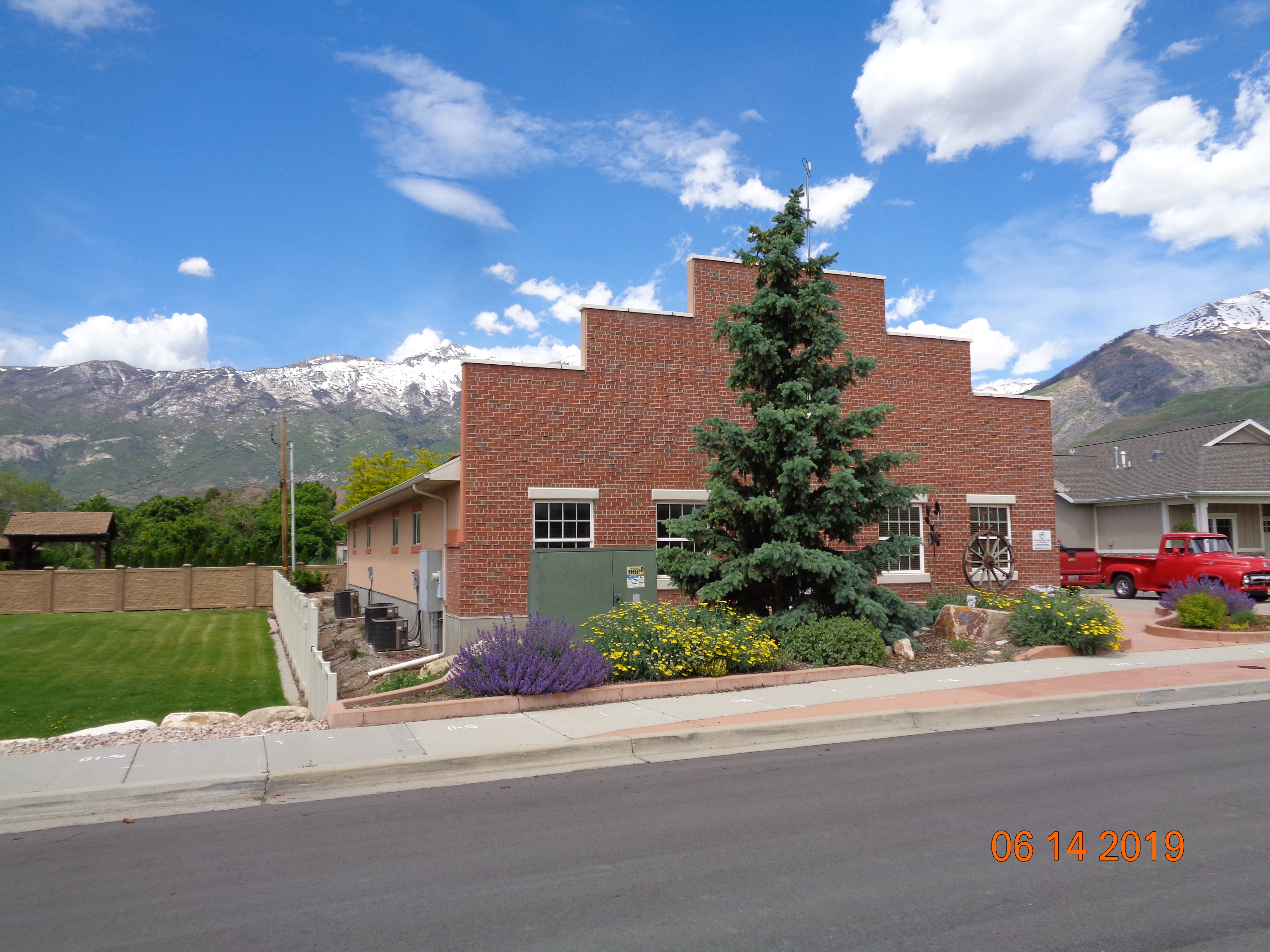
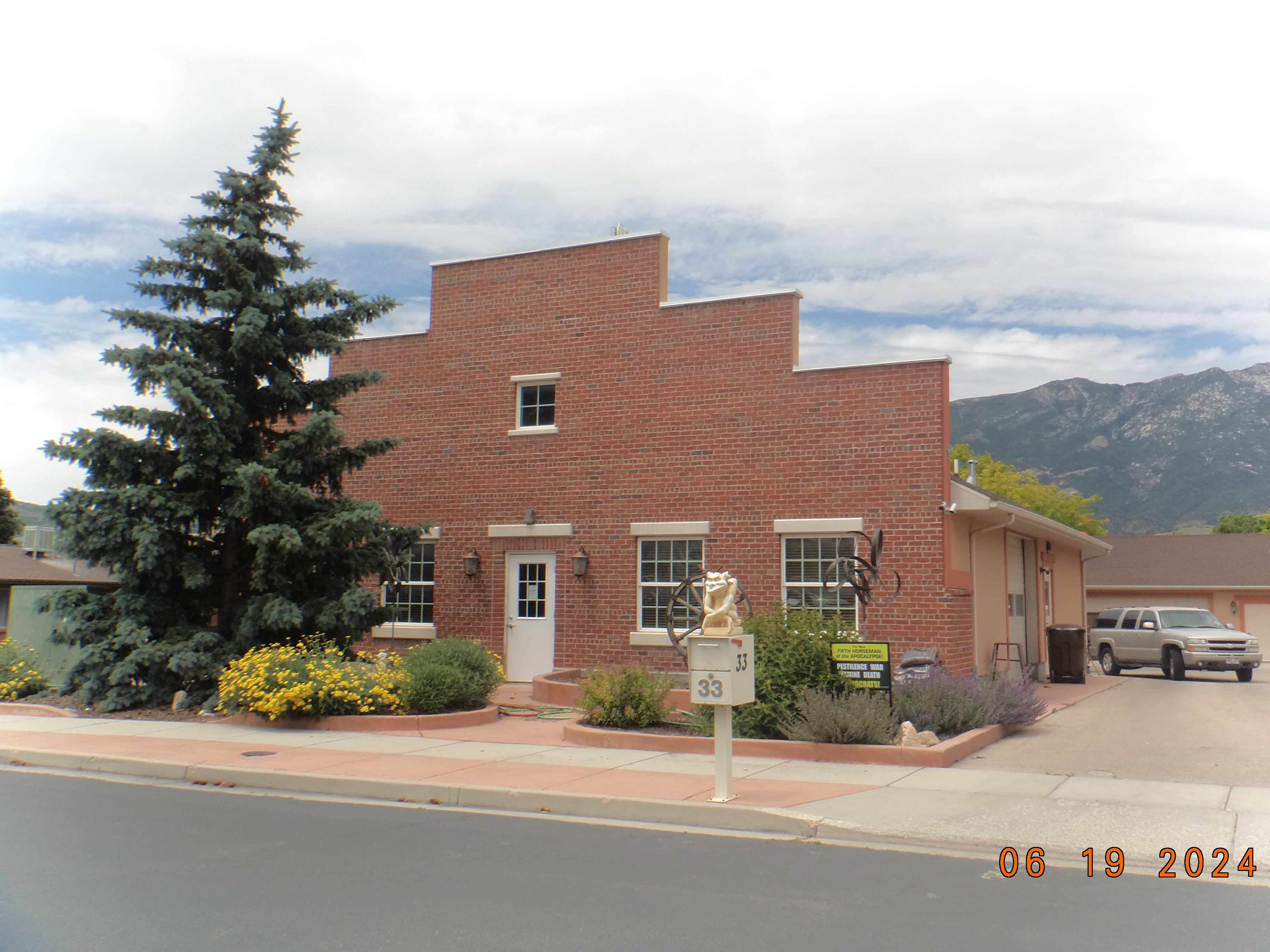
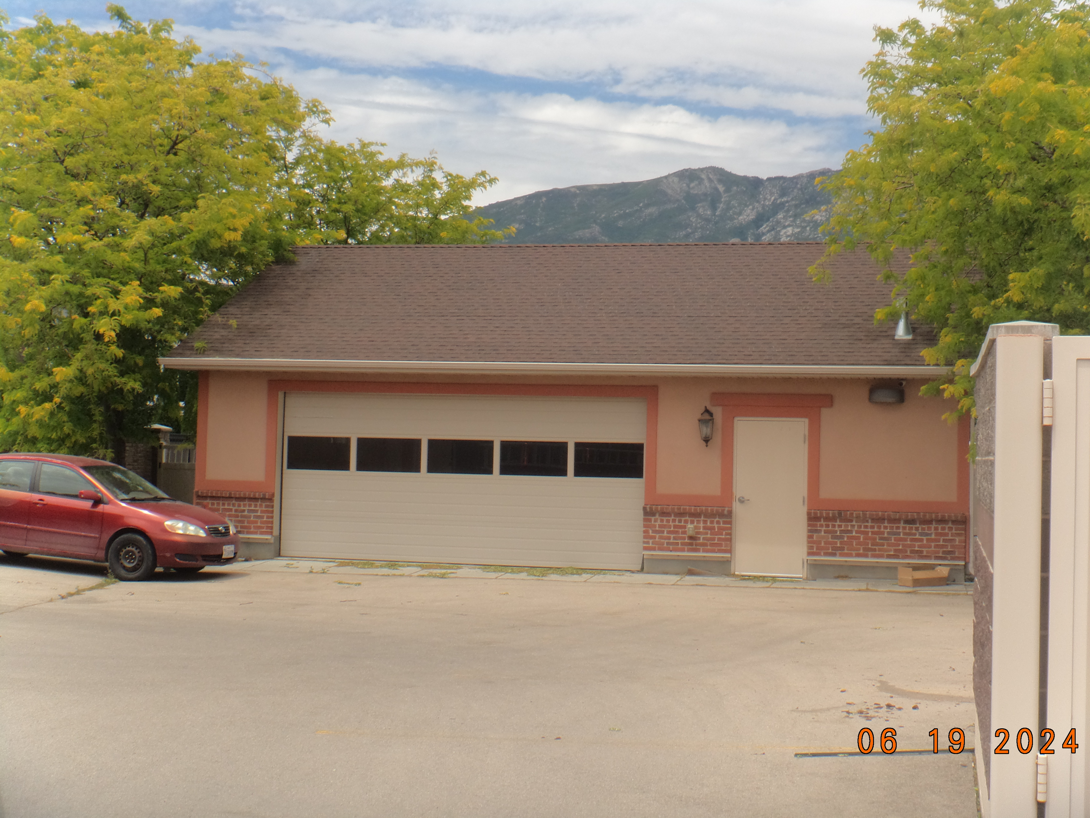
| Property Address: 33 E RED PINE DR - ALPINE |
|
| Mailing Address: 1517 PROSPECT LN ALPINE, UT 84004 |
|
| Acreage: 0.311 |
|
| Last Document:
97838-2022
|
|
| Subdivision Map Filing |
|
| Taxing Description:
LOT 1, PLAT B, DRY CREEK SOUTHEAST SUBDV. AREA 0.311 AC.
*Taxing description NOT FOR LEGAL DOCUMENTS
|
|
- Owner Names
- Value History
- Tax History
- Location
- Photos
- Documents
- Aerial Image
| |
----- Real Estate Values ----- |
---Improvements--- |
---Greenbelt--- |
Total |
| Year |
Com |
Res |
Agr |
Tot |
Com |
Res |
Agr |
Tot |
Land |
Homesite |
Tot |
Market Value |
| 2024 |
$229,000 |
$0 |
$0 |
$229,000 |
$227,000 |
$0 |
$0 |
$227,000 |
$0 |
$0 |
$0 |
$456,000 |
| 2023 |
$227,500 |
$0 |
$0 |
$227,500 |
$218,800 |
$0 |
$0 |
$218,800 |
$0 |
$0 |
$0 |
$446,300 |
| 2022 |
$223,100 |
$0 |
$0 |
$223,100 |
$210,400 |
$0 |
$0 |
$210,400 |
$0 |
$0 |
$0 |
$433,500 |
| 2021 |
$160,700 |
$0 |
$0 |
$160,700 |
$264,700 |
$0 |
$0 |
$264,700 |
$0 |
$0 |
$0 |
$425,400 |
| 2020 |
$160,700 |
$0 |
$0 |
$160,700 |
$277,800 |
$0 |
$0 |
$277,800 |
$0 |
$0 |
$0 |
$438,500 |
| 2019 |
$148,700 |
$0 |
$0 |
$148,700 |
$197,000 |
$0 |
$0 |
$197,000 |
$0 |
$0 |
$0 |
$345,700 |
| 2018 |
$135,300 |
$0 |
$0 |
$135,300 |
$192,200 |
$0 |
$0 |
$192,200 |
$0 |
$0 |
$0 |
$327,500 |
| 2017 |
$129,000 |
$0 |
$0 |
$129,000 |
$222,300 |
$0 |
$0 |
$222,300 |
$0 |
$0 |
$0 |
$351,300 |
| 2016 |
$122,900 |
$0 |
$0 |
$122,900 |
$193,500 |
$0 |
$0 |
$193,500 |
$0 |
$0 |
$0 |
$316,400 |
| 2015 |
$117,000 |
$0 |
$0 |
$117,000 |
$168,300 |
$0 |
$0 |
$168,300 |
$0 |
$0 |
$0 |
$285,300 |
| 2014 |
$111,500 |
$0 |
$0 |
$111,500 |
$168,300 |
$0 |
$0 |
$168,300 |
$0 |
$0 |
$0 |
$279,800 |
| 2013 |
$101,400 |
$0 |
$0 |
$101,400 |
$168,300 |
$0 |
$0 |
$168,300 |
$0 |
$0 |
$0 |
$269,700 |
| 2012 |
$145,100 |
$0 |
$0 |
$145,100 |
$146,900 |
$0 |
$0 |
$146,900 |
$0 |
$0 |
$0 |
$292,000 |
| 2011 |
$145,100 |
$0 |
$0 |
$145,100 |
$146,900 |
$0 |
$0 |
$146,900 |
$0 |
$0 |
$0 |
$292,000 |
| 2010 |
$157,682 |
$0 |
$0 |
$157,682 |
$154,659 |
$0 |
$0 |
$154,659 |
$0 |
$0 |
$0 |
$312,341 |
| 2009 |
$160,900 |
$0 |
$0 |
$160,900 |
$166,300 |
$0 |
$0 |
$166,300 |
$0 |
$0 |
$0 |
$327,200 |
| Year |
General Taxes |
Adjustments |
Net Taxes |
Fees |
Payments |
Tax Balance* |
Balance Due |
Tax District |
| 2025 |
$0.00 |
$0.00 |
$0.00 |
$0.00 |
|
$0.00
|
$0.00 |
040 - ALPINE CITY |
| 2024 |
$3,912.48 |
$0.00 |
$3,912.48 |
$0.00 |
|
$0.00
|
$0.00 |
040 - ALPINE CITY |
| 2023 |
$3,566.83 |
$0.00 |
$3,566.83 |
$0.00 |
|
$0.00
|
$0.00 |
040 - ALPINE CITY |
| 2022 |
$3,567.27 |
$0.00 |
$3,567.27 |
$0.00 |
|
$0.00
|
$0.00 |
040 - ALPINE CITY |
| 2021 |
$4,097.45 |
$0.00 |
$4,097.45 |
$0.00 |
|
$0.00
|
$0.00 |
040 - ALPINE CITY |
| 2020 |
$4,315.72 |
$0.00 |
$4,315.72 |
$0.00 |
|
$0.00
|
$0.00 |
040 - ALPINE CITY |
| 2019 |
$3,259.26 |
$0.00 |
$3,259.26 |
$0.00 |
|
$0.00
|
$0.00 |
040 - ALPINE CITY |
| 2018 |
$3,125.01 |
$0.00 |
$3,125.01 |
$0.00 |
|
$0.00
|
$0.00 |
040 - ALPINE CITY |
| 2017 |
$3,464.52 |
$0.00 |
$3,464.52 |
$0.00 |
|
$0.00
|
$0.00 |
040 - ALPINE CITY |
| 2016 |
$3,346.88 |
$0.00 |
$3,346.88 |
$0.00 |
|
$0.00
|
$0.00 |
040 - ALPINE CITY |
| 2015 |
$3,190.22 |
$0.00 |
$3,190.22 |
$0.00 |
|
$0.00
|
$0.00 |
040 - ALPINE CITY |
| 2014 |
$3,162.58 |
$0.00 |
$3,162.58 |
$0.00 |
|
$0.00
|
$0.00 |
040 - ALPINE CITY |
| 2013 |
$3,291.69 |
$0.00 |
$3,291.69 |
$0.00 |
|
$0.00
|
$0.00 |
040 - ALPINE CITY |
| 2012 |
$3,665.18 |
$0.00 |
$3,665.18 |
$0.00 |
|
$0.00
|
$0.00 |
040 - ALPINE CITY |
| 2011 |
$3,646.50 |
$0.00 |
$3,646.50 |
$0.00 |
|
$0.00
|
$0.00 |
040 - ALPINE CITY |
| 2010 |
$3,494.16 |
$0.00 |
$3,494.16 |
$0.00 |
|
$0.00
|
$0.00 |
040 - ALPINE CITY |
| 2009 |
$3,366.56 |
$0.00 |
$3,366.56 |
$0.00 |
|
$0.00
|
$0.00 |
040 - ALPINE CITY |
* Note: Original tax amount (Does not include applicable interest and/or fees).
| Entry # |
Date |
Recorded |
Type |
Party1 (Grantor) |
Party2 (Grantee) |
| 97838-2022 |
08/26/2022 |
09/06/2022 |
WD |
BURNETT, FORREST H TEE (ET AL) |
BURNETT, FORREST H & MAUREEN TEE (ET AL) |
| 176350-2020 |
11/06/2020 |
11/06/2020 |
CEM D |
EASTLAWN MEMORIAL HILL (ET AL) |
REESE, DONALD D & DORTHY MAE TEE (ET AL) |
| 79077-2008 |
07/02/2008 |
07/11/2008 |
EAS AGR |
QUESTAR GAS COMPANY |
KODIAK BUILDERS INC |
| 18106-2008 |
11/27/2007 |
02/15/2008 |
S PLAT |
BURNETT, FOREST H TEE |
DRY CREEK SOUTHEAST PLAT B |
Main Menu Comments or Concerns on Value/Appraisal - Assessor's Office
Documents/Owner/Parcel information - Recorder's Office
Address Change for Tax Notice
This page was created on 1/29/2025 6:48:29 AM |