UtahCounty.Gov - The Official Website of Utah County Government

Property Information

mobile view

Serial Number: 40:619:0048 Serial Life: 2024...    
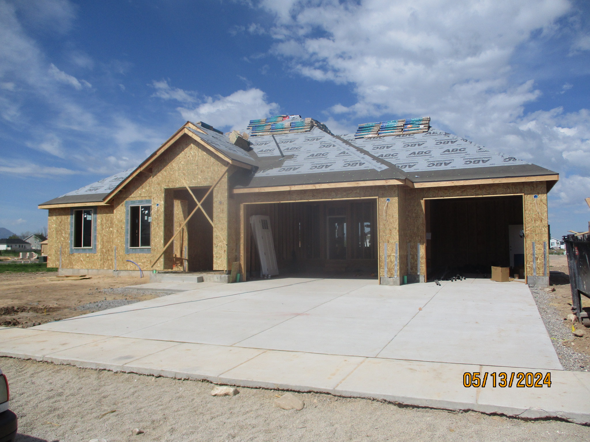
Parcel Photo
Total Photos: 2
     
Property Address:  467 N 1150 WEST - MAPLETON  
Mailing Address: 467 N 1150 W MAPLETON, UT 84664  
Acreage: 0.49973  
Last Document: 82269-2023  
Subdivision Map Filing   
Taxing Description:  LOT 48, PLAT B, GRINDSTONE ESTATES SUB AREA 0.500 AC.

*Taxing description NOT FOR LEGAL DOCUMENTS


  • Owner Names
  • Value History
  • Tax History
  • Location
  • Photos
  • Documents
  • Aerial Image
 
----- Real Estate Values -----
---Improvements---
---Greenbelt---
Total
Year
Com
Res
Agr
Tot
Com
Res
Agr
Tot
Land
Homesite
Tot
    Market Value
2024
$0
$320,200
$0
$320,200
$0
$0
$0
$0
$0
$0
$0
$320,200
Year
General Taxes
Adjustments
Net Taxes
Fees
Payments
Tax Balance*
Balance Due
Tax District
2025
$0.00
$0.00
$0.00
$0.00
$0.00
$0.00     140 - MAPLETON CITY
2024
$3,268.60
$0.00
$3,268.60
$0.00 Click for Payoff     140 - MAPLETON CITY

* Note: Original tax amount (Does not include applicable interest and/or fees).
Parcel Photo
Parcel Photo
Entry # Date Recorded Type Party1 (Grantor) Party2 (Grantee)
70229-2024 10/07/2024 10/10/2024 D TR ANDRUS, SHALAY GUILD MORTGAGE COMPANY LLC
70228-2024 10/07/2024 10/10/2024 WD RIDING SIDING CONSTRUCTION LLC ANDRUS, SHALAY
48481-2024 07/19/2024 07/22/2024 PRSUBTE M&T BANK (ET AL) RIDING SIDING CONSTRUCTION LLC
20680-2024 03/18/2024 04/01/2024 GEO HAZ LEIFSON, MICHAEL WHOM OF INTEREST
14489-2024 03/04/2024 03/06/2024 D TR RIDING SIDING CONSTRUCTION LLC M & T BANK
82269-2023 12/14/2023 12/20/2023 S PLAT RIDING SIDING CONSTRUCTION LLC GRINDSTONE ESTATES PLAT B


Main Menu

Comments or Concerns on Value/Appraisal - Assessor's Office
Documents/Owner/Parcel information - Recorder's Office
Address Change for Tax Notice

This page was created on 10/16/2024 9:14:13 AM

× Large Image