Property Information
mobile view
| Serial Number: 43:109:0010 |
Serial Life: 2002... |
|
|
 Total Photos: 4
|
| |
|
|
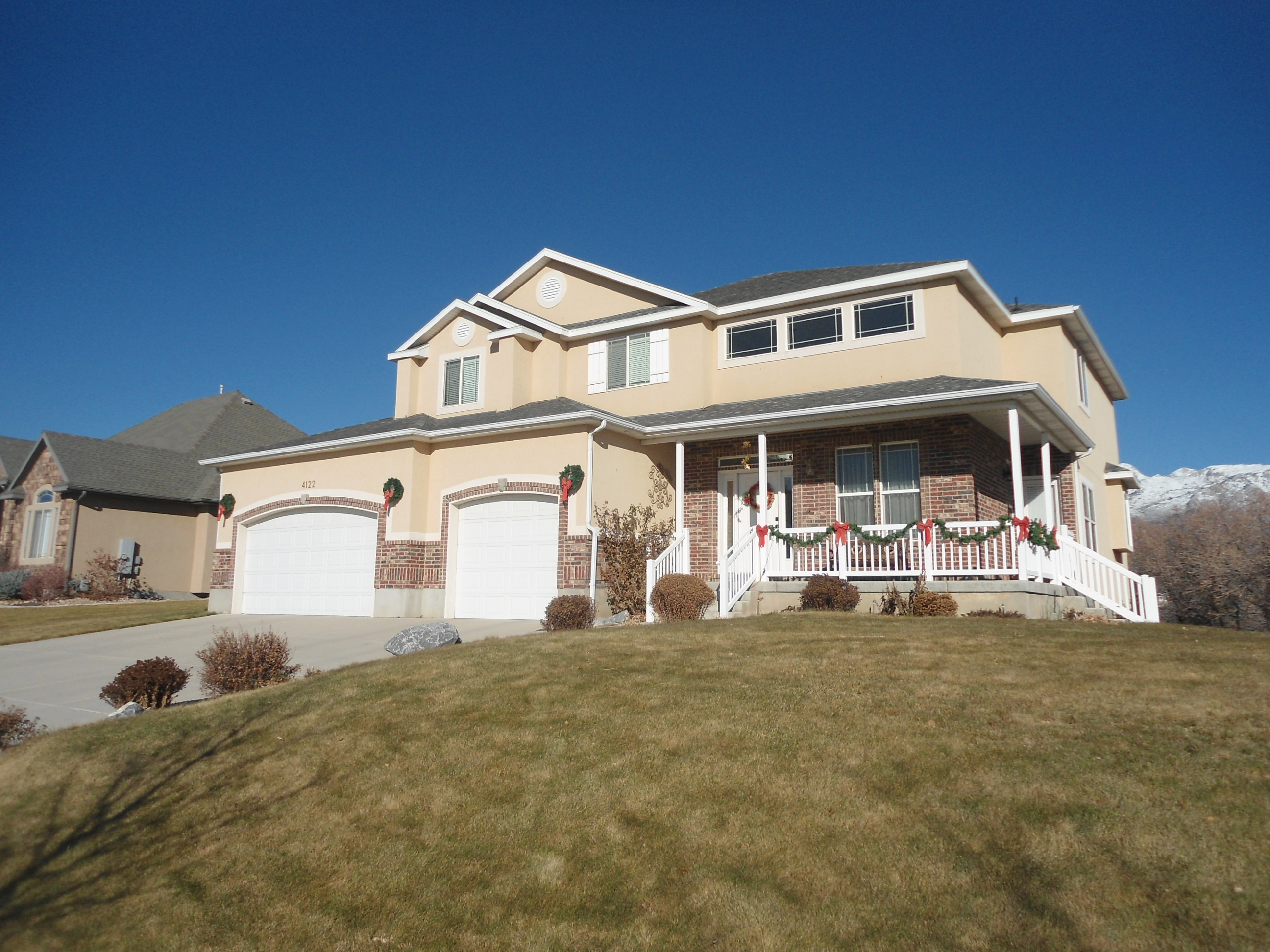
| Property Address: 4122 W SANDALWOOD DR - CEDAR HILLS |
|
| Mailing Address: 4122 W SANDALWOOD DR CEDAR HILLS, UT 84062-8514 |
|
| Acreage: 0.441 |
|
| Last Document:
77697-2002
|
|
| Subdivision Map Filing |
|
| Taxing Description:
LOT 10, PLAT B, JUNIPER HEIGHTS SUBDV. AREA 0.441 AC.
*Taxing description NOT FOR LEGAL DOCUMENTS
|
|
- Owner Names
- Value History
- Tax History
- Location
- Photos
- Documents
- Aerial Image
| |
----- Real Estate Values ----- |
---Improvements--- |
---Greenbelt--- |
Total |
| Year |
Com |
Res |
Agr |
Tot |
Com |
Res |
Agr |
Tot |
Land |
Homesite |
Tot |
Market Value |
| 2024 |
$0 |
$330,200 |
$0 |
$330,200 |
$0 |
$507,300 |
$0 |
$507,300 |
$0 |
$0 |
$0 |
$837,500 |
| 2023 |
$0 |
$300,200 |
$0 |
$300,200 |
$0 |
$528,300 |
$0 |
$528,300 |
$0 |
$0 |
$0 |
$828,500 |
| 2022 |
$0 |
$315,700 |
$0 |
$315,700 |
$0 |
$528,000 |
$0 |
$528,000 |
$0 |
$0 |
$0 |
$843,700 |
| 2021 |
$0 |
$225,500 |
$0 |
$225,500 |
$0 |
$397,000 |
$0 |
$397,000 |
$0 |
$0 |
$0 |
$622,500 |
| 2020 |
$0 |
$208,800 |
$0 |
$208,800 |
$0 |
$354,500 |
$0 |
$354,500 |
$0 |
$0 |
$0 |
$563,300 |
| 2019 |
$0 |
$196,300 |
$0 |
$196,300 |
$0 |
$354,500 |
$0 |
$354,500 |
$0 |
$0 |
$0 |
$550,800 |
| 2018 |
$0 |
$196,300 |
$0 |
$196,300 |
$0 |
$317,200 |
$0 |
$317,200 |
$0 |
$0 |
$0 |
$513,500 |
| 2017 |
$0 |
$175,400 |
$0 |
$175,400 |
$0 |
$300,800 |
$0 |
$300,800 |
$0 |
$0 |
$0 |
$476,200 |
| 2016 |
$0 |
$172,000 |
$0 |
$172,000 |
$0 |
$261,600 |
$0 |
$261,600 |
$0 |
$0 |
$0 |
$433,600 |
| 2015 |
$0 |
$172,000 |
$0 |
$172,000 |
$0 |
$261,600 |
$0 |
$261,600 |
$0 |
$0 |
$0 |
$433,600 |
| 2014 |
$0 |
$142,000 |
$0 |
$142,000 |
$0 |
$227,500 |
$0 |
$227,500 |
$0 |
$0 |
$0 |
$369,500 |
| 2013 |
$0 |
$122,200 |
$0 |
$122,200 |
$0 |
$227,500 |
$0 |
$227,500 |
$0 |
$0 |
$0 |
$349,700 |
| 2012 |
$0 |
$105,300 |
$0 |
$105,300 |
$0 |
$222,200 |
$0 |
$222,200 |
$0 |
$0 |
$0 |
$327,500 |
| 2011 |
$0 |
$86,500 |
$0 |
$86,500 |
$0 |
$260,100 |
$0 |
$260,100 |
$0 |
$0 |
$0 |
$346,600 |
| 2010 |
$0 |
$101,804 |
$0 |
$101,804 |
$0 |
$266,594 |
$0 |
$266,594 |
$0 |
$0 |
$0 |
$368,398 |
| 2009 |
$0 |
$149,700 |
$0 |
$149,700 |
$0 |
$241,000 |
$0 |
$241,000 |
$0 |
$0 |
$0 |
$390,700 |
| 2008 |
$0 |
$187,100 |
$0 |
$187,100 |
$0 |
$327,000 |
$0 |
$327,000 |
$0 |
$0 |
$0 |
$514,100 |
| 2007 |
$0 |
$196,900 |
$0 |
$196,900 |
$0 |
$344,200 |
$0 |
$344,200 |
$0 |
$0 |
$0 |
$541,100 |
| 2006 |
$0 |
$81,000 |
$0 |
$81,000 |
$0 |
$274,700 |
$0 |
$274,700 |
$0 |
$0 |
$0 |
$355,700 |
| 2005 |
$0 |
$81,000 |
$0 |
$81,000 |
$0 |
$246,551 |
$0 |
$246,551 |
$0 |
$0 |
$0 |
$327,551 |
| 2004 |
$0 |
$81,000 |
$0 |
$81,000 |
$0 |
$246,551 |
$0 |
$246,551 |
$0 |
$0 |
$0 |
$327,551 |
| 2003 |
$0 |
$81,000 |
$0 |
$81,000 |
$0 |
$231,865 |
$0 |
$231,865 |
$0 |
$0 |
$0 |
$312,865 |
| 2002 |
$0 |
$71,662 |
$0 |
$71,662 |
$0 |
$0 |
$0 |
$0 |
$0 |
$0 |
$0 |
$71,662 |
| Year |
General Taxes |
Adjustments |
Net Taxes |
Fees |
Payments |
Tax Balance* |
Balance Due |
Tax District |
| 2025 |
$0.00 |
$0.00 |
$0.00 |
$0.00 |
|
($776.00)
|
($776.00) |
021 - CEDAR HILLS CITY |
| 2024 |
$3,889.52 |
$0.00 |
$3,889.52 |
$0.00 |
|
$0.00
|
$0.00 |
021 - CEDAR HILLS CITY |
| 2023 |
$3,581.15 |
$0.00 |
$3,581.15 |
$0.00 |
|
$0.00
|
$0.00 |
021 - CEDAR HILLS CITY |
| 2022 |
$3,733.63 |
$0.00 |
$3,733.63 |
$0.00 |
|
$0.00
|
$0.00 |
021 - CEDAR HILLS CITY |
| 2021 |
$3,362.46 |
$0.00 |
$3,362.46 |
$0.00 |
|
$0.00
|
$0.00 |
021 - CEDAR HILLS CITY |
| 2020 |
$3,117.98 |
$0.00 |
$3,117.98 |
$0.00 |
|
$0.00
|
$0.00 |
021 - CEDAR HILLS CITY |
| 2019 |
$2,936.09 |
$0.00 |
$2,936.09 |
$0.00 |
|
$0.00
|
$0.00 |
021 - CEDAR HILLS CITY |
| 2018 |
$2,905.02 |
$0.00 |
$2,905.02 |
$0.00 |
|
$0.00
|
$0.00 |
021 - CEDAR HILLS CITY |
| 2017 |
$2,771.27 |
$0.00 |
$2,771.27 |
$0.00 |
|
$0.00
|
$0.00 |
021 - CEDAR HILLS CITY |
| 2016 |
$2,712.95 |
$0.00 |
$2,712.95 |
$0.00 |
|
$0.00
|
$0.00 |
021 - CEDAR HILLS CITY |
| 2015 |
$2,866.29 |
$0.00 |
$2,866.29 |
$0.00 |
|
$0.00
|
$0.00 |
021 - CEDAR HILLS CITY |
| 2014 |
$2,459.43 |
$0.00 |
$2,459.43 |
$0.00 |
|
$0.00
|
$0.00 |
021 - CEDAR HILLS CITY |
| 2013 |
$2,559.02 |
$0.00 |
$2,559.02 |
$0.00 |
|
$0.00
|
$0.00 |
021 - CEDAR HILLS CITY |
| 2012 |
$2,489.15 |
$0.00 |
$2,489.15 |
$0.00 |
|
$0.00
|
$0.00 |
021 - CEDAR HILLS CITY |
| 2011 |
$2,625.17 |
$0.00 |
$2,625.17 |
$0.00 |
|
$0.00
|
$0.00 |
021 - CEDAR HILLS CITY |
| 2010 |
$2,624.93 |
$0.00 |
$2,624.93 |
$0.00 |
|
$0.00
|
$0.00 |
021 - CEDAR HILLS CITY |
| 2009 |
$2,564.87 |
$0.00 |
$2,564.87 |
$0.00 |
|
$0.00
|
$0.00 |
021 - CEDAR HILLS CITY |
| 2008 |
$3,128.97 |
$0.00 |
$3,128.97 |
$0.00 |
|
$0.00
|
$0.00 |
021 - CEDAR HILLS CITY |
| 2007 |
$3,237.05 |
$0.00 |
$3,237.05 |
$0.00 |
|
$0.00
|
$0.00 |
021 - CEDAR HILLS CITY |
| 2006 |
$2,227.70 |
$0.00 |
$2,227.70 |
$0.00 |
|
$0.00
|
$0.00 |
021 - CEDAR HILLS CITY |
| 2005 |
$2,089.05 |
$0.00 |
$2,089.05 |
$0.00 |
|
$0.00
|
$0.00 |
021 - CEDAR HILLS CITY |
| 2004 |
$2,095.54 |
$0.00 |
$2,095.54 |
$0.00 |
|
$0.00
|
$0.00 |
021 - CEDAR HILLS CITY |
| 2003 |
$1,993.84 |
$0.00 |
$1,993.84 |
$0.00 |
|
$0.00
|
$0.00 |
021 - CEDAR HILLS CITY |
| 2002 |
$779.04 |
$0.00 |
$779.04 |
$0.00 |
|
$0.00
|
$0.00 |
021 - CEDAR HILLS CITY |
* Note: Original tax amount (Does not include applicable interest and/or fees).
| Entry # |
Date |
Recorded |
Type |
Party1 (Grantor) |
Party2 (Grantee) |
| 54018-2022 |
04/29/2022 |
04/29/2022 |
REC |
BACKMAN TITLE SERVICES LTD BY (ET AL) |
COTTAGE REAL ESTATE & CONSTRUCTION CORP |
| 49395-2022 |
04/18/2022 |
04/21/2022 |
RC |
ROCK CANYON BANK |
WHOM OF INTEREST |
| 49394-2022 |
04/18/2022 |
04/21/2022 |
D TR |
WRIGHT, JACOB EMERY & BRITTANY ANNE |
ROCK CANYON BANK |
| 37194-2022 |
03/21/2022 |
03/25/2022 |
WD |
WRIGHT, JACOB EMERY |
WRIGHT, JACOB EMERY & BRITTANY ANNE |
| 37193-2022 |
03/21/2022 |
03/25/2022 |
D TR |
WRIGHT, JACOB EMERY |
ROCK CANYON BANK |
| 37192-2022 |
03/21/2022 |
03/25/2022 |
WD |
WRIGHT, JACOB EMERY & BRITTANY ANNE |
WRIGHT, JACOB EMERY |
| 100519-2021 |
05/28/2021 |
05/28/2021 |
WD |
JENSEN, DAVID A & CAROL G |
WRIGHT, JACOB EMERY & BRITTANY ANNE |
| 29409-2011 |
04/04/2011 |
04/18/2011 |
CT |
STATE OF UTAH |
WHOM OF INTEREST |
| 114949-2008 |
10/20/2008 |
10/22/2008 |
CT |
STATE OF UTAH |
WHOM OF INTEREST |
| 107508-2008 |
09/30/2008 |
09/30/2008 |
RESOL |
BOARD OF COUNTY COMMISSIONERS UTAH COUNTY |
WHOM OF INTEREST |
| 61765-2008 |
05/19/2008 |
05/27/2008 |
REC |
FIRST AMERICAN TITLE COMPANY TEE |
JENSEN, DAVID A & CAROL G |
| 61764-2008 |
05/19/2008 |
05/27/2008 |
SUB TEE |
MORTGAGE ELECTRONIC REGISTRATION SYSTEMS INC |
FIRST AMERICAN TITLE COMPANY SUCTEE |
| 38929-2005 |
11/30/2004 |
04/13/2005 |
AGR |
CITY OF CEDAR HILLS |
GENEVA ROCK PRODUCTS INC (ET AL) |
| 85289-2002 |
07/10/2002 |
07/26/2002 |
AS |
SECURITY HOME MORTGAGE |
MORTGAGE ELECTRONIC REGISTRATION SYSTEMS INC |
| 77698-2002 |
07/10/2002 |
07/11/2002 |
D TR |
JENSEN, DAVID A & CAROL G |
SECURITY HOME MORTGAGE |
| 77697-2002 |
07/10/2002 |
07/11/2002 |
WD |
COTTAGE REAL ESTATE & CONSTRUCTION CORP |
JENSEN, DAVID A & CAROL G |
| 27861-2002 |
03/07/2002 |
03/12/2002 |
D TR |
COTTAGE REAL ESTATE & CONSTRUCTION CORP |
WASHINGTON MUTUAL BANK |
| 27860-2002 |
03/11/2002 |
03/12/2002 |
WD |
COTTAGE HOMES CORPORATION |
COTTAGE REAL ESTATE & CONSTRUCTION CORP |
| 20280-2002 |
02/01/2002 |
02/20/2002 |
SP WD |
GENEVA ROCK PRODUCTS INC |
COTTAGE HOMES CORPORATION |
| 30126-2001 |
03/27/2001 |
04/02/2001 |
RES COV |
SHELLENBERG, A T V PRES |
WHOM OF INTEREST |
| 30123-2001 |
02/20/2001 |
04/02/2001 |
S PLAT |
GENEVA ROCK PRODUCTS INC |
JUNIPER HEIGHTS PLAT B |
Main Menu Comments or Concerns on Value/Appraisal - Assessor's Office
Documents/Owner/Parcel information - Recorder's Office
Address Change for Tax Notice
This page was created on 4/1/2025 12:51:17 PM |


