Property Information
mobile view
| Serial Number: 45:627:0107 |
Serial Life: 2018... |
|
|
 Total Photos: 2
|
| |
|
|
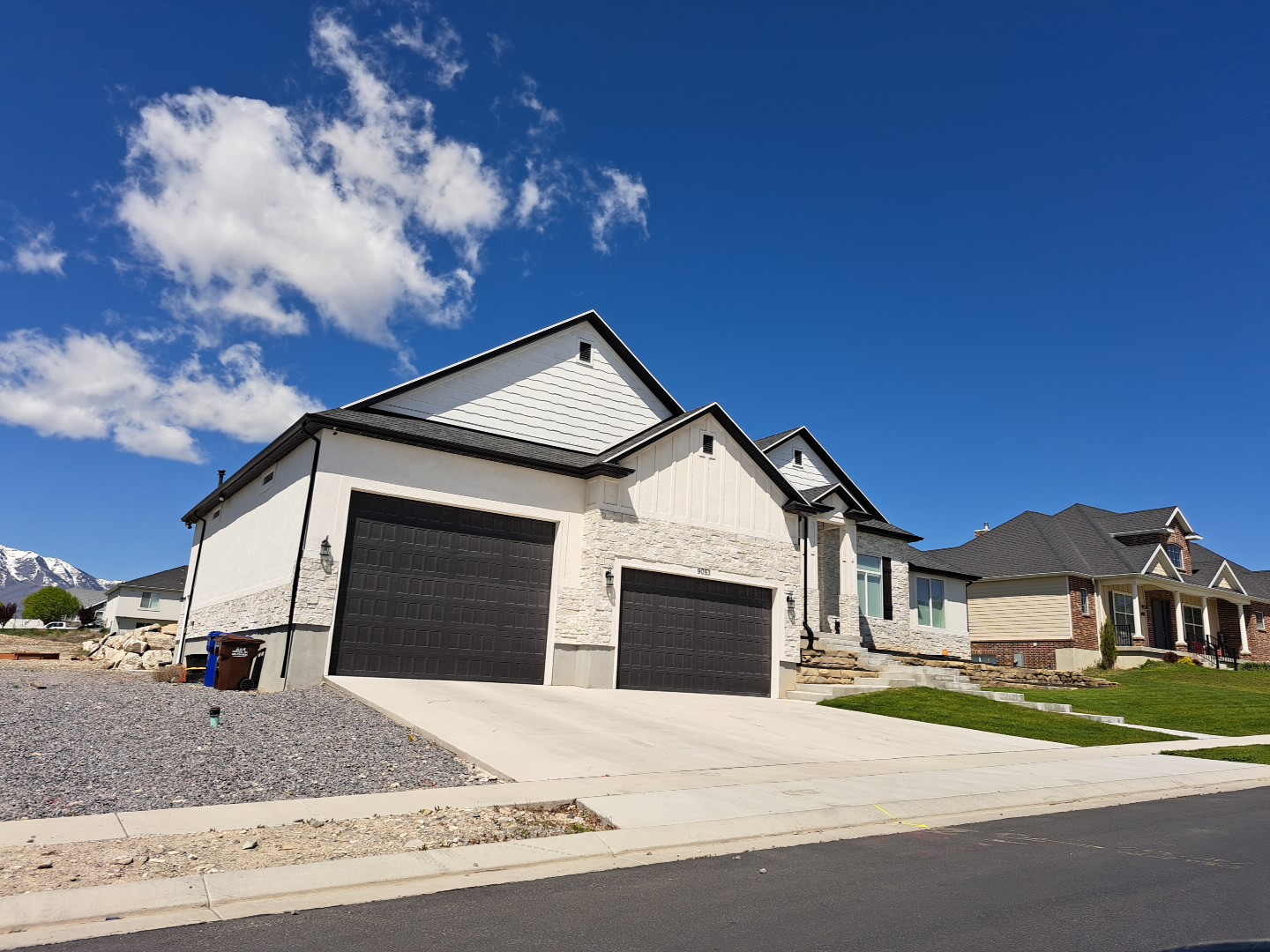
| Property Address: 9053 N LILY LN - EAGLE MOUNTAIN |
|
| Mailing Address: 9053 N LILY LN EAGLE MOUNTAIN, UT 84005 |
|
| Acreage: 0.534857 |
|
| Last Document:
66972-2017
|
|
| Subdivision Map Filing |
|
| Taxing Description:
LOT 107, PLAT 1, LAKE VIEW ESTATES, PHASE A SUB AREA 0.535 AC.
*Taxing description NOT FOR LEGAL DOCUMENTS
|
|
- Owner Names
- Value History
- Tax History
- Location
- Photos
- Documents
- Aerial Image
| |
----- Real Estate Values ----- |
---Improvements--- |
---Greenbelt--- |
Total |
| Year |
Com |
Res |
Agr |
Tot |
Com |
Res |
Agr |
Tot |
Land |
Homesite |
Tot |
Market Value |
| 2024 |
$0 |
$293,200 |
$0 |
$293,200 |
$0 |
$445,400 |
$0 |
$445,400 |
$0 |
$0 |
$0 |
$738,600 |
| 2023 |
$0 |
$293,200 |
$0 |
$293,200 |
$0 |
$437,300 |
$0 |
$437,300 |
$0 |
$0 |
$0 |
$730,500 |
| 2022 |
$0 |
$303,100 |
$0 |
$303,100 |
$0 |
$373,900 |
$0 |
$373,900 |
$0 |
$0 |
$0 |
$677,000 |
| 2021 |
$0 |
$159,500 |
$0 |
$159,500 |
$0 |
$345,900 |
$0 |
$345,900 |
$0 |
$0 |
$0 |
$505,400 |
| 2020 |
$0 |
$145,000 |
$0 |
$145,000 |
$0 |
$0 |
$0 |
$0 |
$0 |
$0 |
$0 |
$145,000 |
| 2019 |
$0 |
$136,800 |
$0 |
$136,800 |
$0 |
$0 |
$0 |
$0 |
$0 |
$0 |
$0 |
$136,800 |
| 2018 |
$0 |
$124,300 |
$0 |
$124,300 |
$0 |
$0 |
$0 |
$0 |
$0 |
$0 |
$0 |
$124,300 |
| Year |
General Taxes |
Adjustments |
Net Taxes |
Fees |
Payments |
Tax Balance* |
Balance Due |
Tax District |
| 2025 |
$0.00 |
$0.00 |
$0.00 |
$0.00 |
|
$0.00
|
$0.00 |
038 - EAGLE MOUNTAIN |
| 2024 |
$3,759.66 |
$0.00 |
$3,759.66 |
$0.00 |
|
$0.00
|
$0.00 |
038 - EAGLE MOUNTAIN |
| 2023 |
$3,442.81 |
$0.00 |
$3,442.81 |
$0.00 |
|
$0.00
|
$0.00 |
038 - EAGLE MOUNTAIN |
| 2022 |
$3,266.25 |
$0.00 |
$3,266.25 |
$0.00 |
|
$0.00
|
$0.00 |
038 - EAGLE MOUNTAIN |
| 2021 |
$2,953.99 |
$0.00 |
$2,953.99 |
$0.00 |
|
$0.00
|
$0.00 |
038 - EAGLE MOUNTAIN |
| 2020 |
$1,578.47 |
$0.00 |
$1,578.47 |
$0.00 |
|
$0.00
|
$0.00 |
038 - EAGLE MOUNTAIN |
| 2019 |
$1,437.49 |
$0.00 |
$1,437.49 |
$0.00 |
|
$0.00
|
$0.00 |
038 - EAGLE MOUNTAIN |
| 2018 |
$1,380.23 |
$0.00 |
$1,380.23 |
$0.00 |
|
$0.00
|
$0.00 |
038 - EAGLE MOUNTAIN |
* Note: Original tax amount (Does not include applicable interest and/or fees).
| Entry # |
Date |
Recorded |
Type |
Party1 (Grantor) |
Party2 (Grantee) |
| 51159-2022 |
04/25/2022 |
04/25/2022 |
WD |
CLARK, ROBIN G & TERYL L TEE (ET AL) |
JONES, JORDAN TERYL |
| 23092-2021 |
02/05/2021 |
02/05/2021 |
WD |
CLARK, ROBIN G & TERYL L |
CLARK, ROBIN G & TERYL L TEE (ET AL) |
| 62684-2018 |
06/29/2018 |
07/03/2018 |
WD |
RCA68 LC BY (ET AL) |
CLARK, ROBIN G & TERYL L |
| 94923-2017 |
09/20/2017 |
09/26/2017 |
REC |
ROCK CANYON BANK TEE |
RCA 68 LC |
| 94921-2017 |
09/20/2017 |
09/26/2017 |
REC |
ROCK CANYON BANK TEE |
RCA 68 LC |
| 67524-2017 |
07/12/2017 |
07/12/2017 |
MOD AGR |
RCA68 LC |
ROCK CANYON BANK |
| 67441-2017 |
07/10/2017 |
07/12/2017 |
DECLCOV |
RCA68 LC |
WHOM OF INTEREST |
| 66972-2017 |
06/29/2017 |
07/11/2017 |
S PLAT |
RCA68 LC |
LAKE VIEW ESTATES PHASE A PLAT 1 |
Main Menu Comments or Concerns on Value/Appraisal - Assessor's Office
Documents/Owner/Parcel information - Recorder's Office
Address Change for Tax Notice
This page was created on 12/23/2024 4:48:39 PM |
