Property Information
mobile view
| Serial Number: 46:091:0037 |
Serial Life: 1980... |
|
|
 Total Photos: 4
|
| |
|
|
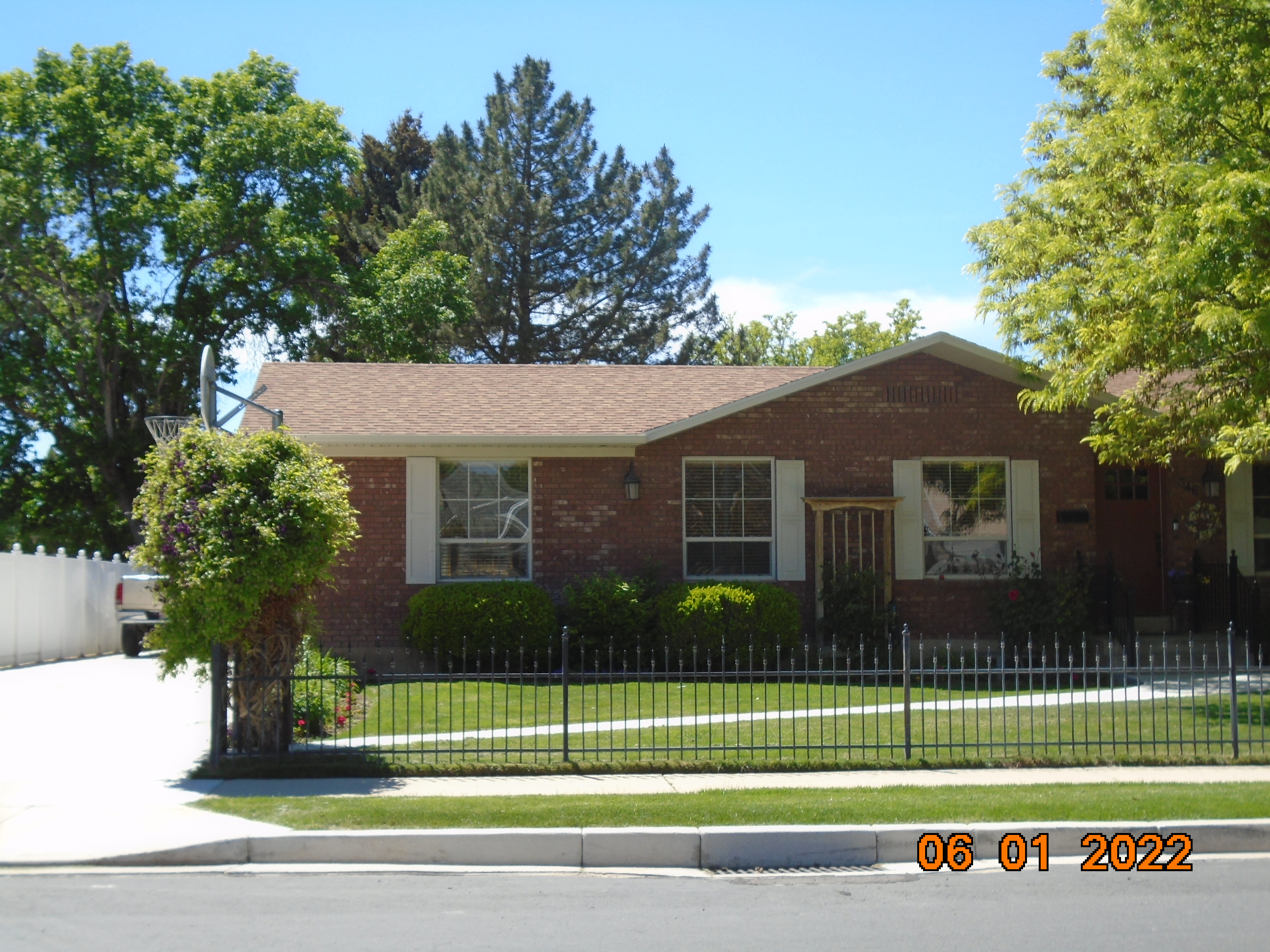
| Property Address: 346 S NEBO DR - SPANISH FORK |
|
| Mailing Address: 346 S NEBO DR SPANISH FORK, UT 84660-2531 |
|
| Acreage: 0.2 |
|
| Last Document:
1969-1989
|
|
| Subdivision Map Filing |
|
| Taxing Description:
COM NW COR LOT 10, BLK 5, MOUNT FLONETTE SUB; N 67 DEG 12'E 121.45 FT TO ARC OF 300 FT RAD CUR R; ALONG CUR 90.90 FT; S 83 DEG 34'W 113.91 FT; N 9 DEG 39'W 10 FT; S 83 DEG 34'W 10; N 9 DEG 39'W 45 FT TO BEG. AREA .20 ACRE. DEF DESC.
*Taxing description NOT FOR LEGAL DOCUMENTS
|
|
- Owner Names
- Value History
- Tax History
- Location
- Photos
- Documents
- Aerial Image
| 1990... |
|
VAN AUSDAL, ANN |
|
| 1990... |
|
VAN AUSDAL, BRET |
|
| 1988-1989 |
|
ROBARGE, CRISTIE O |
|
| 1988-1989 |
|
ROBARGE, JEFFERY K |
|
| 1986-1987 |
|
ROBARGE, CRISTIE O |
|
| 1986-1987 |
|
ROBARGE, JEFFERY K |
|
| 1983-1985 |
|
ROBARGE, CRISTIE O |
|
| 1983-1985 |
|
ROBARGE, JEFFERY K |
|
| 1980-1982 |
|
ROBARGE, CRISTIE O |
|
| 1980-1982 |
|
ROBARGE, JEFFERY K |
|
| |
----- Real Estate Values ----- |
---Improvements--- |
---Greenbelt--- |
Total |
| Year |
Com |
Res |
Agr |
Tot |
Com |
Res |
Agr |
Tot |
Land |
Homesite |
Tot |
Market Value |
| 2024 |
$0 |
$153,900 |
$0 |
$153,900 |
$0 |
$274,400 |
$0 |
$274,400 |
$0 |
$0 |
$0 |
$428,300 |
| 2023 |
$0 |
$153,900 |
$0 |
$153,900 |
$0 |
$267,100 |
$0 |
$267,100 |
$0 |
$0 |
$0 |
$421,000 |
| 2022 |
$0 |
$164,100 |
$0 |
$164,100 |
$0 |
$233,600 |
$0 |
$233,600 |
$0 |
$0 |
$0 |
$397,700 |
| 2021 |
$0 |
$96,500 |
$0 |
$96,500 |
$0 |
$203,300 |
$0 |
$203,300 |
$0 |
$0 |
$0 |
$299,800 |
| 2020 |
$0 |
$87,700 |
$0 |
$87,700 |
$0 |
$179,900 |
$0 |
$179,900 |
$0 |
$0 |
$0 |
$267,600 |
| 2019 |
$0 |
$73,700 |
$0 |
$73,700 |
$0 |
$179,900 |
$0 |
$179,900 |
$0 |
$0 |
$0 |
$253,600 |
| 2018 |
$0 |
$66,700 |
$0 |
$66,700 |
$0 |
$165,800 |
$0 |
$165,800 |
$0 |
$0 |
$0 |
$232,500 |
| 2017 |
$0 |
$52,600 |
$0 |
$52,600 |
$0 |
$156,300 |
$0 |
$156,300 |
$0 |
$0 |
$0 |
$208,900 |
| 2016 |
$0 |
$42,100 |
$0 |
$42,100 |
$0 |
$156,300 |
$0 |
$156,300 |
$0 |
$0 |
$0 |
$198,400 |
| 2015 |
$0 |
$38,600 |
$0 |
$38,600 |
$0 |
$156,300 |
$0 |
$156,300 |
$0 |
$0 |
$0 |
$194,900 |
| 2014 |
$0 |
$38,600 |
$0 |
$38,600 |
$0 |
$139,200 |
$0 |
$139,200 |
$0 |
$0 |
$0 |
$177,800 |
| 2013 |
$0 |
$37,000 |
$0 |
$37,000 |
$0 |
$139,200 |
$0 |
$139,200 |
$0 |
$0 |
$0 |
$176,200 |
| 2012 |
$0 |
$35,300 |
$0 |
$35,300 |
$0 |
$129,700 |
$0 |
$129,700 |
$0 |
$0 |
$0 |
$165,000 |
| 2011 |
$0 |
$41,500 |
$0 |
$41,500 |
$0 |
$133,000 |
$0 |
$133,000 |
$0 |
$0 |
$0 |
$174,500 |
| 2010 |
$0 |
$44,833 |
$0 |
$44,833 |
$0 |
$144,453 |
$0 |
$144,453 |
$0 |
$0 |
$0 |
$189,286 |
| 2009 |
$0 |
$49,700 |
$0 |
$49,700 |
$0 |
$145,400 |
$0 |
$145,400 |
$0 |
$0 |
$0 |
$195,100 |
| 2008 |
$0 |
$62,000 |
$0 |
$62,000 |
$0 |
$151,504 |
$0 |
$151,504 |
$0 |
$0 |
$0 |
$213,504 |
| 2007 |
$0 |
$62,000 |
$0 |
$62,000 |
$0 |
$139,840 |
$0 |
$139,840 |
$0 |
$0 |
$0 |
$201,840 |
| 2006 |
$0 |
$62,000 |
$0 |
$62,000 |
$0 |
$127,900 |
$0 |
$127,900 |
$0 |
$0 |
$0 |
$189,900 |
| 2005 |
$0 |
$45,000 |
$0 |
$45,000 |
$0 |
$102,000 |
$0 |
$102,000 |
$0 |
$0 |
$0 |
$147,000 |
| 2004 |
$0 |
$45,000 |
$0 |
$45,000 |
$0 |
$102,000 |
$0 |
$102,000 |
$0 |
$0 |
$0 |
$147,000 |
| 2003 |
$0 |
$45,000 |
$0 |
$45,000 |
$0 |
$102,000 |
$0 |
$102,000 |
$0 |
$0 |
$0 |
$147,000 |
| 2002 |
$0 |
$45,000 |
$0 |
$45,000 |
$0 |
$102,000 |
$0 |
$102,000 |
$0 |
$0 |
$0 |
$147,000 |
| 2001 |
$0 |
$50,444 |
$0 |
$50,444 |
$0 |
$85,263 |
$0 |
$85,263 |
$0 |
$0 |
$0 |
$135,707 |
| 2000 |
$0 |
$47,144 |
$0 |
$47,144 |
$0 |
$79,722 |
$0 |
$79,722 |
$0 |
$0 |
$0 |
$126,866 |
| 1999 |
$0 |
$47,144 |
$0 |
$47,144 |
$0 |
$79,722 |
$0 |
$79,722 |
$0 |
$0 |
$0 |
$126,866 |
| 1998 |
$0 |
$47,144 |
$0 |
$47,144 |
$0 |
$79,722 |
$0 |
$79,722 |
$0 |
$0 |
$0 |
$126,866 |
| 1997 |
$0 |
$47,144 |
$0 |
$47,144 |
$0 |
$79,722 |
$0 |
$79,722 |
$0 |
$0 |
$0 |
$126,866 |
| 1996 |
$0 |
$43,263 |
$0 |
$43,263 |
$0 |
$73,160 |
$0 |
$73,160 |
$0 |
$0 |
$0 |
$116,423 |
| 1995 |
$0 |
$39,330 |
$0 |
$39,330 |
$0 |
$73,160 |
$0 |
$73,160 |
$0 |
$0 |
$0 |
$112,490 |
| 1994 |
$0 |
$23,000 |
$0 |
$23,000 |
$0 |
$59,000 |
$0 |
$59,000 |
$0 |
$0 |
$0 |
$82,000 |
| 1993 |
$0 |
$23,000 |
$0 |
$23,000 |
$0 |
$59,000 |
$0 |
$59,000 |
$0 |
$0 |
$0 |
$82,000 |
| 1992 |
$0 |
$20,130 |
$0 |
$20,130 |
$0 |
$59,362 |
$0 |
$59,362 |
$0 |
$0 |
$0 |
$79,492 |
| 1991 |
$0 |
$17,658 |
$0 |
$17,658 |
$0 |
$44,171 |
$0 |
$44,171 |
$0 |
$0 |
$0 |
$61,829 |
| 1990 |
$0 |
$17,658 |
$0 |
$17,658 |
$0 |
$44,171 |
$0 |
$44,171 |
$0 |
$0 |
$0 |
$61,829 |
| 1989 |
$0 |
$17,658 |
$0 |
$17,658 |
$0 |
$44,171 |
$0 |
$44,171 |
$0 |
$0 |
$0 |
$61,829 |
| 1988 |
$0 |
$17,658 |
$0 |
$17,658 |
$0 |
$44,375 |
$0 |
$44,375 |
$0 |
$0 |
$0 |
$62,033 |
| 1987 |
$0 |
$17,658 |
$0 |
$17,658 |
$0 |
$51,567 |
$0 |
$51,567 |
$0 |
$0 |
$0 |
$69,225 |
| 1986 |
$0 |
$17,659 |
$0 |
$17,659 |
$0 |
$51,568 |
$0 |
$51,568 |
$0 |
$0 |
$0 |
$69,227 |
| 1985 |
$0 |
$17,658 |
$0 |
$17,658 |
$0 |
$51,566 |
$0 |
$51,566 |
$0 |
$0 |
$0 |
$69,224 |
| 1984 |
$0 |
$17,833 |
$0 |
$17,833 |
$0 |
$52,083 |
$0 |
$52,083 |
$0 |
$0 |
$0 |
$69,916 |
| Year |
General Taxes |
Adjustments |
Net Taxes |
Fees |
Payments |
Tax Balance* |
Balance Due |
Tax District |
| 2025 |
$0.00 |
$0.00 |
$0.00 |
$0.00 |
|
$0.00
|
$0.00 |
150 - SPANISH FORK CITY |
| 2024 |
$2,285.45 |
$0.00 |
$2,285.45 |
$0.00 |
|
$0.00
|
$0.00 |
150 - SPANISH FORK CITY |
| 2023 |
$2,243.95 |
$0.00 |
$2,243.95 |
$0.00 |
|
$0.00
|
$0.00 |
150 - SPANISH FORK CITY |
| 2022 |
$2,161.32 |
$0.00 |
$2,161.32 |
$0.00 |
|
$0.00
|
$0.00 |
150 - SPANISH FORK CITY |
| 2021 |
$1,851.71 |
$0.00 |
$1,851.71 |
$0.00 |
|
$0.00
|
$0.00 |
150 - SPANISH FORK CITY |
| 2020 |
$1,700.08 |
$0.00 |
$1,700.08 |
$0.00 |
|
$0.00
|
$0.00 |
150 - SPANISH FORK CITY |
| 2019 |
$1,531.35 |
$0.00 |
$1,531.35 |
$0.00 |
|
$0.00
|
$0.00 |
150 - SPANISH FORK CITY |
| 2018 |
$1,452.40 |
$0.00 |
$1,452.40 |
$0.00 |
|
$0.00
|
$0.00 |
150 - SPANISH FORK CITY |
| 2017 |
$1,335.31 |
$0.00 |
$1,335.31 |
$0.00 |
|
$0.00
|
$0.00 |
150 - SPANISH FORK CITY |
| 2016 |
$1,285.22 |
$0.00 |
$1,285.22 |
$0.00 |
|
$0.00
|
$0.00 |
150 - SPANISH FORK CITY |
| 2015 |
$1,277.76 |
$0.00 |
$1,277.76 |
$0.00 |
|
$0.00
|
$0.00 |
150 - SPANISH FORK CITY |
| 2014 |
$1,161.45 |
$0.00 |
$1,161.45 |
$0.00 |
|
$0.00
|
$0.00 |
150 - SPANISH FORK CITY |
| 2013 |
$1,206.72 |
$0.00 |
$1,206.72 |
$0.00 |
|
$0.00
|
$0.00 |
150 - SPANISH FORK CITY |
| 2012 |
$1,144.81 |
$0.00 |
$1,144.81 |
$0.00 |
|
$0.00
|
$0.00 |
150 - SPANISH FORK CITY |
| 2011 |
$1,183.76 |
$0.00 |
$1,183.76 |
$0.00 |
|
$0.00
|
$0.00 |
150 - SPANISH FORK CITY |
| 2010 |
$1,251.57 |
$0.00 |
$1,251.57 |
$0.00 |
|
$0.00
|
$0.00 |
150 - SPANISH FORK CITY |
| 2009 |
$1,221.13 |
$0.00 |
$1,221.13 |
$0.00 |
|
$0.00
|
$0.00 |
150 - SPANISH FORK CITY |
| 2008 |
$1,241.67 |
$0.00 |
$1,241.67 |
$0.00 |
|
$0.00
|
$0.00 |
150 - SPANISH FORK CITY |
| 2007 |
$1,176.28 |
$0.00 |
$1,176.28 |
$0.00 |
|
$0.00
|
$0.00 |
150 - SPANISH FORK CITY |
| 2006 |
$1,198.92 |
$0.00 |
$1,198.92 |
$0.00 |
|
$0.00
|
$0.00 |
150 - SPANISH FORK CITY |
| 2005 |
$996.64 |
$0.00 |
$996.64 |
$0.00 |
|
$0.00
|
$0.00 |
150 - SPANISH FORK CITY |
| 2004 |
$998.09 |
$0.00 |
$998.09 |
$0.00 |
|
$0.00
|
$0.00 |
150 - SPANISH FORK CITY |
| 2003 |
$902.21 |
$0.00 |
$902.21 |
$0.00 |
|
$0.00
|
$0.00 |
150 - SPANISH FORK CITY |
| 2002 |
$878.44 |
$0.00 |
$878.44 |
$0.00 |
|
$0.00
|
$0.00 |
150 - SPANISH FORK CITY |
| 2001 |
$823.57 |
$0.00 |
$823.57 |
$0.00 |
|
$0.00
|
$0.00 |
150 - SPANISH FORK CITY |
| 2000 |
$764.54 |
$0.00 |
$764.54 |
$0.00 |
|
$0.00
|
$0.00 |
150 - SPANISH FORK CITY |
| 1999 |
$726.23 |
$0.00 |
$726.23 |
$0.00 |
|
$0.00
|
$0.00 |
150 - SPANISH FORK CITY |
| 1998 |
$711.99 |
$0.00 |
$711.99 |
$0.00 |
|
$0.00
|
$0.00 |
150 - SPANISH FORK CITY |
| 1997 |
$801.31 |
$0.00 |
$801.31 |
$0.00 |
|
$0.00
|
$0.00 |
150 - SPANISH FORK CITY |
| 1996 |
$723.89 |
$0.00 |
$723.89 |
$0.00 |
|
$0.00
|
$0.00 |
150 - SPANISH FORK CITY |
| 1995 |
$691.27 |
$0.00 |
$691.27 |
$0.00 |
|
$0.00
|
$0.00 |
150 - SPANISH FORK CITY |
| 1994 |
$773.06 |
$0.00 |
$773.06 |
$0.00 |
|
$0.00
|
$0.00 |
150 - SPANISH FORK CITY |
| 1993 |
$696.76 |
$0.00 |
$696.76 |
$0.00 |
|
$0.00
|
$0.00 |
150 - SPANISH FORK CITY |
| 1992 |
$669.24 |
$0.00 |
$669.24 |
$0.00 |
|
$0.00
|
$0.00 |
150 - SPANISH FORK CITY |
| 1991 |
$544.60 |
$0.00 |
$544.60 |
$0.00 |
|
$0.00
|
$0.00 |
150 - SPANISH FORK CITY |
| 1990 |
$536.70 |
$0.00 |
$536.70 |
$0.00 |
|
$0.00
|
$0.00 |
150 - SPANISH FORK CITY |
| 1989 |
$555.88 |
$0.00 |
$555.88 |
$0.00 |
|
$0.00
|
$0.00 |
150 - SPANISH FORK CITY |
| 1988 |
$563.25 |
$0.00 |
$563.25 |
$0.00 |
|
$0.00
|
$0.00 |
150 - SPANISH FORK CITY |
| 1987 |
$621.53 |
$0.00 |
$621.53 |
$0.00 |
|
$0.00
|
$0.00 |
150 - SPANISH FORK CITY |
| 1986 |
$593.95 |
$0.00 |
$593.95 |
$0.00 |
|
$0.00
|
$0.00 |
150 - SPANISH FORK CITY |
| 1985 |
$578.08 |
$0.00 |
$578.08 |
$0.00 |
|
$0.00
|
$0.00 |
150 - SPANISH FORK CITY |
| 1984 |
$571.53 |
$0.00 |
$571.53 |
$0.00 |
|
$0.00
|
$0.00 |
150 - SPANISH FORK CITY |
* Note: Original tax amount (Does not include applicable interest and/or fees).
| Entry # |
Date |
Recorded |
Type |
Party1 (Grantor) |
Party2 (Grantee) |
| 25689-2024 |
04/22/2024 |
04/22/2024 |
AF |
SPANISH FORK CITY |
WHOM OF INTEREST |
| 31305-2015 |
04/03/2015 |
04/15/2015 |
REC |
UTAH COMMUNITY CREDIT UNION TEE |
VAN AUSDAL, BRET & ANN |
| 3187-2015 |
12/04/2014 |
01/14/2015 |
QCD |
UNITED STATES OF AMERICA |
SOUTH UTAH VALLEY ELECTRIC SERVICE DISTRICT |
| 114949-2008 |
10/20/2008 |
10/22/2008 |
CT |
STATE OF UTAH |
WHOM OF INTEREST |
| 107508-2008 |
09/30/2008 |
09/30/2008 |
RESOL |
BOARD OF COUNTY COMMISSIONERS UTAH COUNTY |
WHOM OF INTEREST |
| 42607-2003 |
04/19/2002 |
03/21/2003 |
RSUBTEE |
MOUNTAIN AMERICA CREDIT UNION (ET AL) |
VAN AUSDAL, BRET & ANN |
| 27905-2003 |
02/21/2003 |
02/26/2003 |
REC |
UTAH COMMUNITY CREDIT UNION TEE |
VAN AUSDAL, BRET & ANN |
| 39856-2002 |
04/04/2002 |
04/09/2002 |
D TR |
VAN AUSDAL, BRET & ANN |
UTAH COMMUNITY CREDIT UNION |
| 91101-1998 |
08/14/1998 |
09/09/1998 |
REC |
MOUNTAIN AMERICA CREDIT UNION SUCTEE |
VAN AUSDAL, BRET & ANN |
| 91100-1998 |
08/14/1998 |
09/09/1998 |
SUB TEE |
MOUNTAIN AMERICA CREDIT UNION |
MOUNTAIN AMERICA CREDIT UNION SUCTEE |
| 74260-1998 |
07/20/1998 |
07/27/1998 |
D TR |
VAN AUSDAL, BRET & ANN |
UNIVERSAL CAMPUS FEDERAL CREDIT UNION |
| 63241-1998 |
05/27/1998 |
06/24/1998 |
SUB TEE |
MOUNTAIN AMERICA CREDIT UNION |
INWEST TITLE SERVICES INC SUCTEE |
| 5769-1996 |
09/18/1995 |
01/23/1996 |
REC |
INWEST TITLE SERVICES INC TEE |
VAN AUSDAL, BRET & ANN |
| 61329-1995 |
09/06/1995 |
09/14/1995 |
D TR |
VAN AUSDAL, BRET & ANN |
MOUNTAIN AMERICA CREDIT UNION |
| 73799-1993 |
10/14/1993 |
10/19/1993 |
D TR |
VAN AUSDAL, BRET & ANN |
MOUNTAIN AMERICA CREDIT UNION |
| 17707-1993 |
02/09/1993 |
03/29/1993 |
REC |
ASSOCIATED TITLE COMPANY TEE |
VAN AUSDAL, BERT & ANN |
| 17706-1993 |
02/09/1993 |
03/29/1993 |
SUB TEE |
UTAH HOUSING FINANCE AGENCY |
ASSOCIATED TITLE COMPANY SUCTEE |
| 58821-1992 |
10/30/1992 |
11/02/1992 |
AS |
MOUNTAIN AMERICA CREDIT UNION |
RAMAPO BANK THE |
| 58820-1992 |
10/26/1992 |
11/02/1992 |
D TR |
VAN AUSDAL, BRET & ANN |
MOUNTAIN AMERICA CREDIT UNION |
| 58525-1992 |
10/26/1992 |
10/30/1992 |
D TR |
VAN AUSDAL, BRET & ANN |
MOUNTAIN AMERICA CREDIT UNION |
| 58524-1992 |
10/30/1992 |
10/30/1992 |
AS |
MOUNTAIN AMERICA CREDIT UNION |
RAMAPO BANK THE |
| 47955-1992 |
09/10/1992 |
09/14/1992 |
REC |
BATES, MARLON L TEE |
ROBARGE, JEFFREY K & CRISTIE O |
| 47954-1992 |
09/10/1992 |
09/14/1992 |
SUB TEE |
MOUNTAIN AMERICA CREDIT UNION FKA (ET AL) |
BATES, MARLON L SUBTEE |
| 1971-1989 |
01/24/1989 |
01/24/1989 |
AS |
FIRST SECURITY BANK OF UTAH |
UTAH HOUSING FINANCE AGENCY |
| 1970-1989 |
01/24/1989 |
01/24/1989 |
TR D |
VAN AUSDAL, BRET & ANN |
FIRST SECURITY BANK OF UTAH |
| 1969-1989 |
01/23/1989 |
01/24/1989 |
WD |
ROBARGE, JEFFREY K & CRISTIE O |
VAN AUSDAL, BRET & ANN |
| 27819-1985 |
09/15/1985 |
09/25/1985 |
QCD |
ROBARGE, JEFFREY K & CRISTIE O |
MITCHELL, MARGARET |
| 23954-1983 |
08/03/1983 |
08/10/1983 |
RC |
UTAH STATE EMPLOYEES CREDIT UNION |
WHOM OF INTEREST |
| 23953-1983 |
08/03/1983 |
08/10/1983 |
TR D |
ROBARGE, JEFFREY K & CRISTIE O |
UTAH STATE EMPLOYEES CREDIT UNION |
Main Menu Comments or Concerns on Value/Appraisal - Assessor's Office
Documents/Owner/Parcel information - Recorder's Office
Address Change for Tax Notice
This page was created on 3/9/2025 7:32:10 PM |


