Property Information
mobile view
| Serial Number: 46:288:0001 |
Serial Life: 1992... |
|
|
 Total Photos: 8
|
| |
|
|
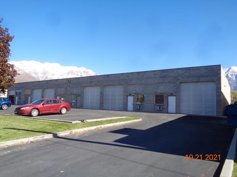
| Property Address: 570 N 100 WEST - OREM |
|
| Mailing Address: 155 W OLYMPIC LN ELK RIDGE, UT 84651-4550 |
|
| Acreage: 0.56 |
|
| Last Document:
25096-1991
|
|
| Subdivision Map Filing |
|
| Taxing Description:
LOT 1, PLAT B, MAACO SUB. AREA .56 ACRE.
*Taxing description NOT FOR LEGAL DOCUMENTS
|
|
- Owner Names
- Value History
- Tax History
- Location
- Photos
- Documents
- Aerial Image
| |
----- Real Estate Values ----- |
---Improvements--- |
---Greenbelt--- |
Total |
| Year |
Com |
Res |
Agr |
Tot |
Com |
Res |
Agr |
Tot |
Land |
Homesite |
Tot |
Market Value |
| 2024 |
$331,400 |
$0 |
$0 |
$331,400 |
$382,300 |
$0 |
$0 |
$382,300 |
$0 |
$0 |
$0 |
$713,700 |
| 2023 |
$313,500 |
$0 |
$0 |
$313,500 |
$357,800 |
$0 |
$0 |
$357,800 |
$0 |
$0 |
$0 |
$671,300 |
| 2022 |
$310,400 |
$0 |
$0 |
$310,400 |
$342,500 |
$0 |
$0 |
$342,500 |
$0 |
$0 |
$0 |
$652,900 |
| 2021 |
$296,300 |
$0 |
$0 |
$296,300 |
$298,400 |
$0 |
$0 |
$298,400 |
$0 |
$0 |
$0 |
$594,700 |
| 2020 |
$296,300 |
$0 |
$0 |
$296,300 |
$275,500 |
$0 |
$0 |
$275,500 |
$0 |
$0 |
$0 |
$571,800 |
| 2019 |
$269,300 |
$0 |
$0 |
$269,300 |
$278,200 |
$0 |
$0 |
$278,200 |
$0 |
$0 |
$0 |
$547,500 |
| 2018 |
$254,200 |
$0 |
$0 |
$254,200 |
$264,300 |
$0 |
$0 |
$264,300 |
$0 |
$0 |
$0 |
$518,500 |
| 2017 |
$242,000 |
$0 |
$0 |
$242,000 |
$236,500 |
$0 |
$0 |
$236,500 |
$0 |
$0 |
$0 |
$478,500 |
| 2016 |
$208,100 |
$0 |
$0 |
$208,100 |
$256,500 |
$0 |
$0 |
$256,500 |
$0 |
$0 |
$0 |
$464,600 |
| 2015 |
$201,200 |
$0 |
$0 |
$201,200 |
$256,500 |
$0 |
$0 |
$256,500 |
$0 |
$0 |
$0 |
$457,700 |
| 2014 |
$191,600 |
$0 |
$0 |
$191,600 |
$256,500 |
$0 |
$0 |
$256,500 |
$0 |
$0 |
$0 |
$448,100 |
| 2013 |
$174,200 |
$0 |
$0 |
$174,200 |
$301,300 |
$0 |
$0 |
$301,300 |
$0 |
$0 |
$0 |
$475,500 |
| 2012 |
$174,200 |
$0 |
$0 |
$174,200 |
$256,800 |
$0 |
$0 |
$256,800 |
$0 |
$0 |
$0 |
$431,000 |
| 2011 |
$174,200 |
$0 |
$0 |
$174,200 |
$282,100 |
$0 |
$0 |
$282,100 |
$0 |
$0 |
$0 |
$456,300 |
| 2010 |
$189,336 |
$0 |
$0 |
$189,336 |
$296,949 |
$0 |
$0 |
$296,949 |
$0 |
$0 |
$0 |
$486,285 |
| 2009 |
$193,200 |
$0 |
$0 |
$193,200 |
$319,300 |
$0 |
$0 |
$319,300 |
$0 |
$0 |
$0 |
$512,500 |
| 2008 |
$245,900 |
$0 |
$0 |
$245,900 |
$161,900 |
$0 |
$0 |
$161,900 |
$0 |
$0 |
$0 |
$407,800 |
| 2007 |
$141,200 |
$0 |
$0 |
$141,200 |
$229,300 |
$0 |
$0 |
$229,300 |
$0 |
$0 |
$0 |
$370,500 |
| 2006 |
$117,691 |
$0 |
$0 |
$117,691 |
$208,455 |
$0 |
$0 |
$208,455 |
$0 |
$0 |
$0 |
$326,146 |
| 2005 |
$117,691 |
$0 |
$0 |
$117,691 |
$208,455 |
$0 |
$0 |
$208,455 |
$0 |
$0 |
$0 |
$326,146 |
| 2004 |
$117,691 |
$0 |
$0 |
$117,691 |
$208,455 |
$0 |
$0 |
$208,455 |
$0 |
$0 |
$0 |
$326,146 |
| 2003 |
$117,691 |
$0 |
$0 |
$117,691 |
$208,455 |
$0 |
$0 |
$208,455 |
$0 |
$0 |
$0 |
$326,146 |
| 2002 |
$117,691 |
$0 |
$0 |
$117,691 |
$208,455 |
$0 |
$0 |
$208,455 |
$0 |
$0 |
$0 |
$326,146 |
| 2001 |
$100,936 |
$0 |
$0 |
$100,936 |
$178,778 |
$0 |
$0 |
$178,778 |
$0 |
$0 |
$0 |
$279,714 |
| 2000 |
$94,333 |
$0 |
$0 |
$94,333 |
$178,778 |
$0 |
$0 |
$178,778 |
$0 |
$0 |
$0 |
$273,111 |
| 1999 |
$94,333 |
$0 |
$0 |
$94,333 |
$178,778 |
$0 |
$0 |
$178,778 |
$0 |
$0 |
$0 |
$273,111 |
| 1998 |
$90,705 |
$0 |
$0 |
$90,705 |
$171,902 |
$0 |
$0 |
$171,902 |
$0 |
$0 |
$0 |
$262,607 |
| 1997 |
$90,705 |
$0 |
$0 |
$90,705 |
$171,902 |
$0 |
$0 |
$171,902 |
$0 |
$0 |
$0 |
$262,607 |
| 1996 |
$90,705 |
$0 |
$0 |
$90,705 |
$171,902 |
$0 |
$0 |
$171,902 |
$0 |
$0 |
$0 |
$262,607 |
| 1995 |
$90,705 |
$0 |
$0 |
$90,705 |
$171,902 |
$0 |
$0 |
$171,902 |
$0 |
$0 |
$0 |
$262,607 |
| 1994 |
$53,044 |
$0 |
$0 |
$53,044 |
$171,902 |
$0 |
$0 |
$171,902 |
$0 |
$0 |
$0 |
$224,946 |
| 1993 |
$53,044 |
$0 |
$0 |
$53,044 |
$171,902 |
$0 |
$0 |
$171,902 |
$0 |
$0 |
$0 |
$224,946 |
| 1992 |
$48,664 |
$0 |
$0 |
$48,664 |
$157,708 |
$0 |
$0 |
$157,708 |
$0 |
$0 |
$0 |
$206,372 |
| Year |
General Taxes |
Adjustments |
Net Taxes |
Fees |
Payments |
Tax Balance* |
Balance Due |
Tax District |
| 2025 |
$0.00 |
$0.00 |
$0.00 |
$0.00 |
|
$0.00
|
$0.00 |
090 - OREM CITY |
| 2024 |
$5,836.64 |
$0.00 |
$5,836.64 |
$0.00 |
|
$0.00
|
$0.00 |
090 - OREM CITY |
| 2023 |
$5,107.92 |
$0.00 |
$5,107.92 |
$0.00 |
|
$0.00
|
$0.00 |
090 - OREM CITY |
| 2022 |
$5,127.88 |
$0.00 |
$5,127.88 |
$0.00 |
|
$0.00
|
$0.00 |
090 - OREM CITY |
| 2021 |
$5,606.83 |
$0.00 |
$5,606.83 |
$0.00 |
|
$0.00
|
$0.00 |
090 - OREM CITY |
| 2020 |
$5,485.28 |
$0.00 |
$5,485.28 |
$0.00 |
|
$0.00
|
$0.00 |
090 - OREM CITY |
| 2019 |
$5,050.69 |
$0.00 |
$5,050.69 |
$0.00 |
|
$0.00
|
$0.00 |
090 - OREM CITY |
| 2018 |
$5,006.12 |
$0.00 |
$5,006.12 |
$0.00 |
|
$0.00
|
$0.00 |
090 - OREM CITY |
| 2017 |
$4,743.37 |
$0.00 |
$4,743.37 |
$0.00 |
|
$0.00
|
$0.00 |
090 - OREM CITY |
| 2016 |
$4,994.45 |
$0.00 |
$4,994.45 |
$0.00 |
|
$0.00
|
$0.00 |
090 - OREM CITY |
| 2015 |
$5,202.68 |
$0.00 |
$5,202.68 |
$0.00 |
|
$0.00
|
$0.00 |
090 - OREM CITY |
| 2014 |
$5,116.85 |
$0.00 |
$5,116.85 |
$0.00 |
|
$0.00
|
$0.00 |
090 - OREM CITY |
| 2013 |
$5,855.31 |
$0.00 |
$5,855.31 |
$0.00 |
|
$0.00
|
$0.00 |
090 - OREM CITY |
| 2012 |
$5,734.78 |
($317.97) |
$5,416.81 |
$0.00 |
|
$0.00
|
$0.00 |
090 - OREM CITY |
| 2011 |
$5,707.40 |
$0.00 |
$5,707.40 |
$0.00 |
|
$0.00
|
$0.00 |
090 - OREM CITY |
| 2010 |
$5,694.40 |
$0.00 |
$5,694.40 |
$0.00 |
|
$0.00
|
$0.00 |
090 - OREM CITY |
| 2009 |
$5,563.19 |
$0.00 |
$5,563.19 |
$0.00 |
|
$0.00
|
$0.00 |
090 - OREM CITY |
| 2008 |
$4,102.06 |
$0.00 |
$4,102.06 |
$0.00 |
|
$0.00
|
$0.00 |
090 - OREM CITY |
| 2007 |
$3,684.25 |
$0.00 |
$3,684.25 |
$0.00 |
|
$0.00
|
$0.00 |
090 - OREM CITY |
| 2006 |
$3,453.56 |
$0.00 |
$3,453.56 |
$0.00 |
|
$0.00
|
$0.00 |
090 - OREM CITY |
| 2005 |
$3,898.10 |
$0.00 |
$3,898.10 |
$0.00 |
|
$0.00
|
$0.00 |
090 - OREM CITY |
| 2004 |
$3,828.95 |
$0.00 |
$3,828.95 |
$0.00 |
|
$0.00
|
$0.00 |
090 - OREM CITY |
| 2003 |
$3,715.46 |
$0.00 |
$3,715.46 |
$0.00 |
|
$0.00
|
$0.00 |
090 - OREM CITY |
| 2002 |
$3,395.51 |
$0.00 |
$3,395.51 |
$0.00 |
|
$0.00
|
$0.00 |
090 - OREM CITY |
| 2001 |
$2,884.13 |
$0.00 |
$2,884.13 |
$0.00 |
|
$0.00
|
$0.00 |
090 - OREM CITY |
| 2000 |
$2,911.64 |
$0.00 |
$2,911.64 |
$0.00 |
|
$0.00
|
$0.00 |
090 - OREM CITY |
| 1999 |
$2,997.67 |
$0.00 |
$2,997.67 |
$0.00 |
|
$0.00
|
$0.00 |
090 - OREM CITY |
| 1998 |
$2,721.66 |
$0.00 |
$2,721.66 |
$0.00 |
|
$0.00
|
$0.00 |
090 - OREM CITY |
| 1997 |
$2,710.37 |
$0.00 |
$2,710.37 |
$0.00 |
|
$0.00
|
$0.00 |
090 - OREM CITY |
| 1996 |
$2,476.12 |
$0.00 |
$2,476.12 |
$0.00 |
|
$0.00
|
$0.00 |
090 - OREM CITY |
| 1995 |
$2,802.02 |
$0.00 |
$2,802.02 |
$0.00 |
|
$0.00
|
$0.00 |
090 - OREM CITY |
| 1994 |
$3,093.01 |
$0.00 |
$3,093.01 |
$0.00 |
|
$0.00
|
$0.00 |
090 - OREM CITY |
| 1993 |
$2,640.25 |
$0.00 |
$2,640.25 |
$0.00 |
|
$0.00
|
$0.00 |
090 - OREM CITY |
| 1992 |
$2,450.87 |
$0.00 |
$2,450.87 |
$0.00 |
|
$0.00
|
$0.00 |
090 - OREM CITY |
* Note: Original tax amount (Does not include applicable interest and/or fees).
| Entry # |
Date |
Recorded |
Type |
Party1 (Grantor) |
Party2 (Grantee) |
| 183630-2021 |
10/27/2021 |
10/28/2021 |
D TR |
GREEN GROUND LLC |
UTAH COMMUNITY FEDERAL CREDIT UNION |
| 183629-2021 |
10/27/2021 |
10/28/2021 |
WD |
ANDERSON, BONNIE A SUCTEE (ET AL) |
GREEN GROUND LLC |
| 183628-2021 |
10/27/2021 |
10/28/2021 |
AF DC |
ANDERSON, DON F DEC (ET AL) |
ANDERSON, BONNIE A SUCTEE (ET AL) |
| 45607-2014 |
06/30/2014 |
07/02/2014 |
SP WD |
ANDERSON, DON F TEE (ET AL) |
ANDERSON, DON F & BONNIE A TEE |
| 2551-1992 |
01/09/1992 |
01/21/1992 |
EAS AGR |
COOPER JACK FAMILY LIMITED PARTNERSHIP (ET AL) |
ANDERSON, DON F & BONNIE A TEE (ET AL) |
| 25096-1991 |
02/06/1991 |
06/27/1991 |
S PLAT |
COOPER, JACK (ET AL) |
MAACO PLAT B |
Main Menu Comments or Concerns on Value/Appraisal - Assessor's Office
Documents/Owner/Parcel information - Recorder's Office
Address Change for Tax Notice
This page was created on 1/12/2025 5:39:51 PM |


