Property Information
mobile view
| Serial Number: 46:388:0006 |
Serial Life: 1996-2024 |
|
|
 Total Photos: 3
|
| |
|
|
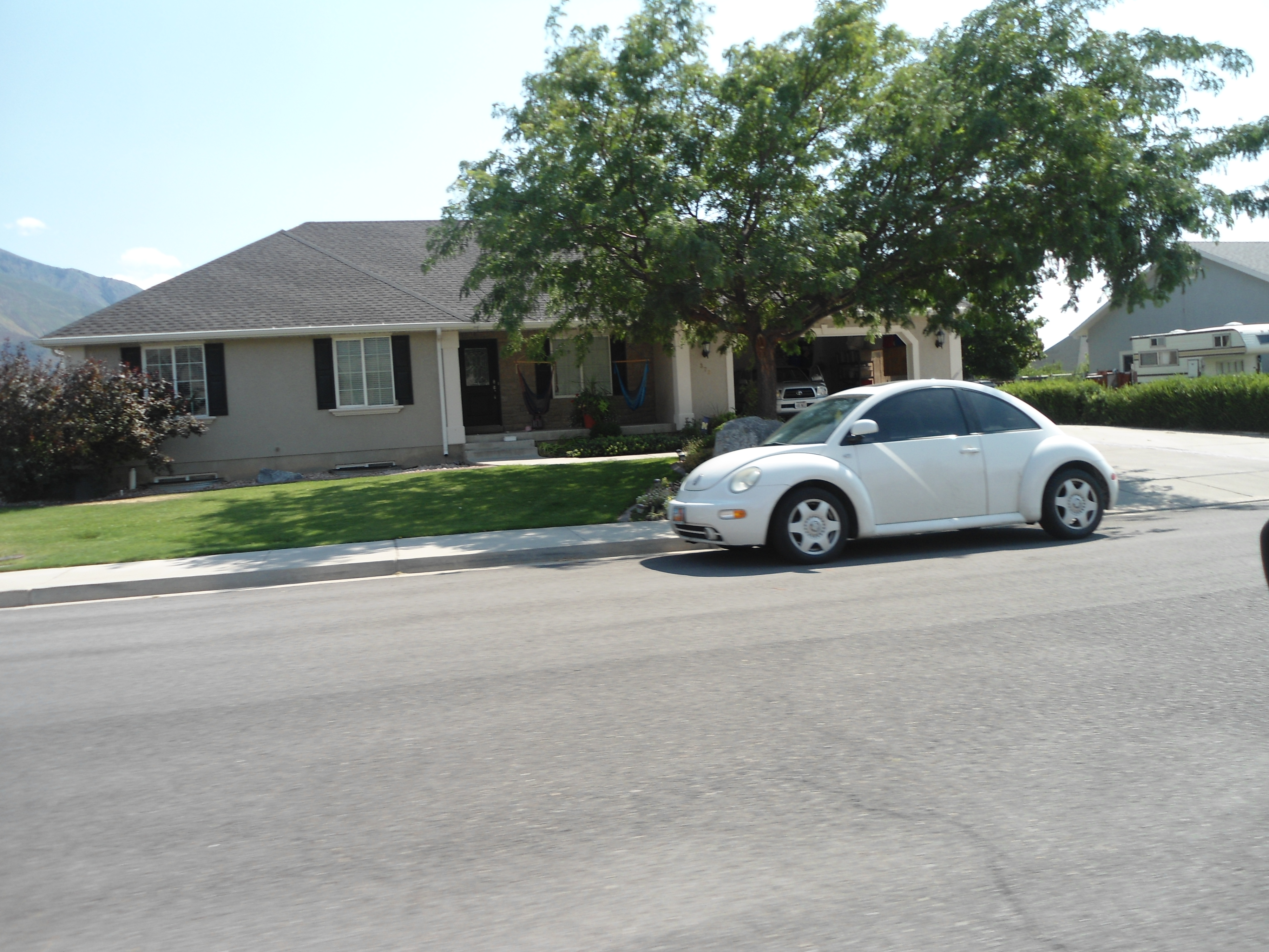
| Property Address: 372 E 1400 NORTH - MAPLETON |
|
| Mailing Address: 372 E 1400 N MAPLETON, UT 84664-3826 |
|
| Acreage: 0.471158 |
|
| Last Document:
44895-2000
|
|
| Subdivision Map Filing |
|
| Taxing Description:
LOT 6, MAPLETON FLATS PHASE I. AREA 0.471 AC.
*Taxing description NOT FOR LEGAL DOCUMENTS
|
|
- Owner Names
- Value History
- Tax History
- Location
- Photos
- Documents
- Aerial Image
| |
----- Real Estate Values ----- |
---Improvements--- |
---Greenbelt--- |
Total |
| Year |
Com |
Res |
Agr |
Tot |
Com |
Res |
Agr |
Tot |
Land |
Homesite |
Tot |
Market Value |
| 2024 |
$0 |
$267,900 |
$0 |
$267,900 |
$0 |
$347,500 |
$0 |
$347,500 |
$0 |
$0 |
$0 |
$615,400 |
| 2023 |
$0 |
$267,900 |
$0 |
$267,900 |
$0 |
$384,800 |
$0 |
$384,800 |
$0 |
$0 |
$0 |
$652,700 |
| 2022 |
$0 |
$285,600 |
$0 |
$285,600 |
$0 |
$377,900 |
$0 |
$377,900 |
$0 |
$0 |
$0 |
$663,500 |
| 2021 |
$0 |
$178,500 |
$0 |
$178,500 |
$0 |
$290,700 |
$0 |
$290,700 |
$0 |
$0 |
$0 |
$469,200 |
| 2020 |
$0 |
$158,000 |
$0 |
$158,000 |
$0 |
$290,700 |
$0 |
$290,700 |
$0 |
$0 |
$0 |
$448,700 |
| 2019 |
$0 |
$151,600 |
$0 |
$151,600 |
$0 |
$252,800 |
$0 |
$252,800 |
$0 |
$0 |
$0 |
$404,400 |
| 2018 |
$0 |
$127,700 |
$0 |
$127,700 |
$0 |
$210,700 |
$0 |
$210,700 |
$0 |
$0 |
$0 |
$338,400 |
| 2017 |
$0 |
$119,700 |
$0 |
$119,700 |
$0 |
$201,400 |
$0 |
$201,400 |
$0 |
$0 |
$0 |
$321,100 |
| 2016 |
$0 |
$111,700 |
$0 |
$111,700 |
$0 |
$201,400 |
$0 |
$201,400 |
$0 |
$0 |
$0 |
$313,100 |
| 2015 |
$0 |
$99,700 |
$0 |
$99,700 |
$0 |
$198,500 |
$0 |
$198,500 |
$0 |
$0 |
$0 |
$298,200 |
| 2014 |
$0 |
$95,700 |
$0 |
$95,700 |
$0 |
$172,600 |
$0 |
$172,600 |
$0 |
$0 |
$0 |
$268,300 |
| 2013 |
$0 |
$79,400 |
$0 |
$79,400 |
$0 |
$150,100 |
$0 |
$150,100 |
$0 |
$0 |
$0 |
$229,500 |
| 2012 |
$0 |
$85,400 |
$0 |
$85,400 |
$0 |
$134,000 |
$0 |
$134,000 |
$0 |
$0 |
$0 |
$219,400 |
| 2011 |
$0 |
$74,100 |
$0 |
$74,100 |
$0 |
$157,800 |
$0 |
$157,800 |
$0 |
$0 |
$0 |
$231,900 |
| 2010 |
$0 |
$77,400 |
$0 |
$77,400 |
$0 |
$169,008 |
$0 |
$169,008 |
$0 |
$0 |
$0 |
$246,408 |
| 2009 |
$0 |
$77,400 |
$0 |
$77,400 |
$0 |
$183,700 |
$0 |
$183,700 |
$0 |
$0 |
$0 |
$261,100 |
| 2008 |
$0 |
$86,100 |
$0 |
$86,100 |
$0 |
$197,400 |
$0 |
$197,400 |
$0 |
$0 |
$0 |
$283,500 |
| 2007 |
$0 |
$86,100 |
$0 |
$86,100 |
$0 |
$197,400 |
$0 |
$197,400 |
$0 |
$0 |
$0 |
$283,500 |
| 2006 |
$0 |
$78,700 |
$0 |
$78,700 |
$0 |
$197,400 |
$0 |
$197,400 |
$0 |
$0 |
$0 |
$276,100 |
| 2005 |
$0 |
$45,424 |
$0 |
$45,424 |
$0 |
$143,014 |
$0 |
$143,014 |
$0 |
$0 |
$0 |
$188,438 |
| 2004 |
$0 |
$45,424 |
$0 |
$45,424 |
$0 |
$143,014 |
$0 |
$143,014 |
$0 |
$0 |
$0 |
$188,438 |
| 2003 |
$0 |
$45,424 |
$0 |
$45,424 |
$0 |
$135,795 |
$0 |
$135,795 |
$0 |
$0 |
$0 |
$181,219 |
| 2002 |
$0 |
$45,424 |
$0 |
$45,424 |
$0 |
$135,795 |
$0 |
$135,795 |
$0 |
$0 |
$0 |
$181,219 |
| 2001 |
$0 |
$45,424 |
$0 |
$45,424 |
$0 |
$0 |
$0 |
$0 |
$0 |
$0 |
$0 |
$45,424 |
| 2000 |
$0 |
$42,452 |
$0 |
$42,452 |
$0 |
$0 |
$0 |
$0 |
$0 |
$0 |
$0 |
$42,452 |
| 1999 |
$0 |
$42,452 |
$0 |
$42,452 |
$0 |
$0 |
$0 |
$0 |
$0 |
$0 |
$0 |
$42,452 |
| 1998 |
$0 |
$42,452 |
$0 |
$42,452 |
$0 |
$0 |
$0 |
$0 |
$0 |
$0 |
$0 |
$42,452 |
| 1997 |
$0 |
$42,452 |
$0 |
$42,452 |
$0 |
$0 |
$0 |
$0 |
$0 |
$0 |
$0 |
$42,452 |
| 1996 |
$0 |
$41,800 |
$0 |
$41,800 |
$0 |
$0 |
$0 |
$0 |
$0 |
$0 |
$0 |
$41,800 |
| Year |
General Taxes |
Adjustments |
Net Taxes |
Fees |
Payments |
Tax Balance* |
Balance Due |
Tax District |
| 2024 |
$3,455.10 |
$0.00 |
$3,455.10 |
$0.00 |
|
$0.00
|
$0.00 |
140 - MAPLETON CITY |
| 2023 |
$3,641.54 |
$0.00 |
$3,641.54 |
$0.00 |
|
$0.00
|
$0.00 |
140 - MAPLETON CITY |
| 2022 |
$3,743.77 |
$0.00 |
$3,743.77 |
$0.00 |
|
$0.00
|
$0.00 |
140 - MAPLETON CITY |
| 2021 |
$3,135.17 |
$0.00 |
$3,135.17 |
$0.00 |
|
$0.00
|
$0.00 |
140 - MAPLETON CITY |
| 2020 |
$3,099.62 |
$0.00 |
$3,099.62 |
$0.00 |
|
$0.00
|
$0.00 |
140 - MAPLETON CITY |
| 2019 |
$2,736.88 |
$0.00 |
$2,736.88 |
$0.00 |
|
$0.00
|
$0.00 |
140 - MAPLETON CITY |
| 2018 |
$2,405.79 |
$0.00 |
$2,405.79 |
$0.00 |
|
$0.00
|
$0.00 |
140 - MAPLETON CITY |
| 2017 |
$2,365.80 |
$0.00 |
$2,365.80 |
$0.00 |
|
$0.00
|
$0.00 |
140 - MAPLETON CITY |
| 2016 |
$2,320.63 |
$0.00 |
$2,320.63 |
$0.00 |
|
$0.00
|
$0.00 |
140 - MAPLETON CITY |
| 2015 |
$2,223.65 |
$0.00 |
$2,223.65 |
$0.00 |
|
$0.00
|
$0.00 |
140 - MAPLETON CITY |
| 2014 |
$2,037.28 |
$0.00 |
$2,037.28 |
$0.00 |
|
$0.00
|
$0.00 |
140 - MAPLETON CITY |
| 2013 |
$1,855.13 |
$0.00 |
$1,855.13 |
$0.00 |
|
$0.00
|
$0.00 |
140 - MAPLETON CITY |
| 2012 |
$1,814.03 |
$0.00 |
$1,814.03 |
$0.00 |
|
$0.00
|
$0.00 |
140 - MAPLETON CITY |
| 2011 |
$1,877.21 |
$0.00 |
$1,877.21 |
$0.00 |
|
$0.00
|
$0.00 |
140 - MAPLETON CITY |
| 2010 |
$1,938.54 |
$0.00 |
$1,938.54 |
$0.00 |
|
$0.00
|
$0.00 |
140 - MAPLETON CITY |
| 2009 |
$1,922.73 |
$0.00 |
$1,922.73 |
$0.00 |
|
$0.00
|
$0.00 |
140 - MAPLETON CITY |
| 2008 |
$1,901.66 |
$0.00 |
$1,901.66 |
$0.00 |
|
$0.00
|
$0.00 |
140 - MAPLETON CITY |
| 2007 |
$1,779.42 |
$0.00 |
$1,779.42 |
$0.00 |
|
$0.00
|
$0.00 |
140 - MAPLETON CITY |
| 2006 |
$1,874.80 |
$0.00 |
$1,874.80 |
$0.00 |
|
$0.00
|
$0.00 |
140 - MAPLETON CITY |
| 2005 |
$1,407.55 |
$0.00 |
$1,407.55 |
$0.00 |
|
$0.00
|
$0.00 |
140 - MAPLETON CITY |
| 2004 |
$1,409.41 |
$0.00 |
$1,409.41 |
$0.00 |
|
$0.00
|
$0.00 |
140 - MAPLETON CITY |
| 2003 |
$1,242.79 |
$0.00 |
$1,242.79 |
$0.00 |
|
$0.00
|
$0.00 |
140 - MAPLETON CITY |
| 2002 |
$1,207.80 |
$0.00 |
$1,207.80 |
$0.00 |
|
$0.00
|
$0.00 |
140 - MAPLETON CITY |
| 2001 |
$554.95 |
$0.00 |
$554.95 |
$0.00 |
|
$0.00
|
$0.00 |
140 - MAPLETON CITY |
| 2000 |
$513.12 |
$0.00 |
$513.12 |
$0.00 |
|
$0.00
|
$0.00 |
140 - MAPLETON CITY |
| 1999 |
$487.48 |
$0.00 |
$487.48 |
$0.00 |
|
$0.00
|
$0.00 |
140 - MAPLETON CITY |
| 1998 |
$478.82 |
$0.00 |
$478.82 |
$0.00 |
|
$0.00
|
$0.00 |
140 - MAPLETON CITY |
| 1997 |
$475.59 |
$0.00 |
$475.59 |
$0.00 |
|
$0.00
|
$0.00 |
140 - MAPLETON CITY |
| 1996 |
$456.67 |
$0.00 |
$456.67 |
$0.00 |
|
$0.00
|
$0.00 |
140 - MAPLETON CITY |
* Note: Original tax amount (Does not include applicable interest and/or fees).
| Entry # |
Date |
Recorded |
Type |
Party1 (Grantor) |
Party2 (Grantee) |
| 78267-2024 |
11/06/2024 |
11/07/2024 |
QCD |
CRANDALL, WADE L |
CRANDALL, WADE L |
| 78712-2023 |
12/05/2023 |
12/06/2023 |
QCD |
CRANDALL, WADE L |
CRANDALL, WADE L |
| 95997-2019 |
09/16/2019 |
09/26/2019 |
D TR |
CRANDALL, WADE L |
PROVIDENT FUNDING ASSOCIATES LP |
| 95324-2019 |
09/24/2019 |
09/24/2019 |
REC |
FIRST AMERICAN TITLE INSURANCE COMPANY TEE |
JONES, GARRISON & VALERI |
| 95323-2019 |
09/24/2019 |
09/24/2019 |
REC |
FIRST AMERICAN TITLE INSURANCE COMPANY TEE |
CRANDALL, WADE L |
| 11714-2014 |
02/20/2014 |
02/20/2014 |
REC |
FIRST AMERICAN TITLE INSURANCE AGENCY LLC TEE |
CRANDALL, WADE L |
| 7316-2014 |
01/24/2014 |
02/03/2014 |
D TR |
CRANDALL, WADE L |
PROVIDENT FUNDING ASSOCIATES LP |
| 45408-2013 |
05/08/2013 |
05/09/2013 |
REC |
FIRST AMERICAN TITLE INSURANCE AGENCY LLC TEE |
CRANDALL, WADE L & SIRI D |
| 38882-2013 |
04/15/2013 |
04/23/2013 |
D TR |
CRANDALL, WADE L |
PROVIDENT FUNDING ASSOCIATES LP |
| 17657-2010 |
02/11/2010 |
03/02/2010 |
QCD |
CRANDALL, WADE L & SIRI D |
CRANDALL, WADE L |
| 15611-2010 |
02/11/2010 |
02/24/2010 |
RSUBTEE |
PNC BANK (ET AL) |
CRANDALL, WADE L & SIRI D |
| 12021-2010 |
02/03/2010 |
02/11/2010 |
D TR |
CRANDALL, WADE L & SIRI D |
PROVIDENT FUNDING ASSOCIATES LP |
| 12020-2010 |
02/09/2010 |
02/11/2010 |
QCD |
CRANDALL, WADE L & SIRI D |
CRANDALL, WADE L & SIRI D |
| 10140-2010 |
01/22/2010 |
02/04/2010 |
QCD |
CRANDALL, WADE & SIRI D |
CRANDALL, WADE |
| 101430-2003 |
06/12/2003 |
07/07/2003 |
REC |
RIVERS, ROD SUCTEE |
CRANDALL, WADE L & SIRI D |
| 101429-2003 |
05/19/2003 |
07/07/2003 |
SUB TEE |
MORTGAGE ELECTRONIC REGISTRATION SYSTEMS INC |
RIVERS, ROD SUCTEE |
| 68984-2003 |
05/06/2003 |
05/07/2003 |
AS |
MORTGAGE ELECTRONIC REGISTRATION SYSTEMS INC |
NATIONAL CITY MORTGAGE CO |
| 63253-2003 |
04/21/2003 |
04/25/2003 |
D TR |
CRANDALL, WADE L & SIRI D |
FIRST COLONY MORTGAGE CORPORATION |
| 98233-2001 |
09/26/2001 |
09/27/2001 |
D TR |
CRANDALL, WADE L & SIRI D |
AMERICAN LENDING NETWORK INC |
| 87018-2000 |
06/12/2000 |
11/02/2000 |
REC |
WESTERN COMMUNITY BANK TEE |
CAMPBELL & SONS INVESTMENT CORPORATION |
| 44895-2000 |
06/06/2000 |
06/07/2000 |
WD |
CAMPBELL & SONS INVESTMENT CORP |
CRANDALL, WADE L & SIRI D |
| 52921-1998 |
05/27/1998 |
05/27/1998 |
REC |
FAR WEST BANK TEE |
CAMPBELL AND SONS INVESTMENT CORPORATION |
| 24508-1997 |
04/02/1997 |
04/02/1997 |
D TR |
CAMPBELL AND SONS INVESTMENT CORP |
WESTERN COMMUNITY BANK |
| 98023-1996 |
12/04/1996 |
12/04/1996 |
P REC |
FAR WEST BANK TEE |
CAMPBELL AND SONS INVESTMENT CORPORATION |
| 17325-1995 |
01/18/1995 |
03/21/1995 |
D TR |
CAMPBELL AND SONS INVESTMENT CORP |
FAR WEST BANK |
| 10222-1995 |
07/05/1994 |
02/21/1995 |
S PLAT |
CAMPBELL & SONS INVESTMENT INC |
MAPLETON FLATS PHASE 1 |
Main Menu Comments or Concerns on Value/Appraisal - Assessor's Office
Documents/Owner/Parcel information - Recorder's Office
Address Change for Tax Notice
This page was created on 3/11/2025 2:57:59 PM |

