Property Information
mobile view
| Serial Number: 46:972:0110 |
Serial Life: 2018... |
|
|
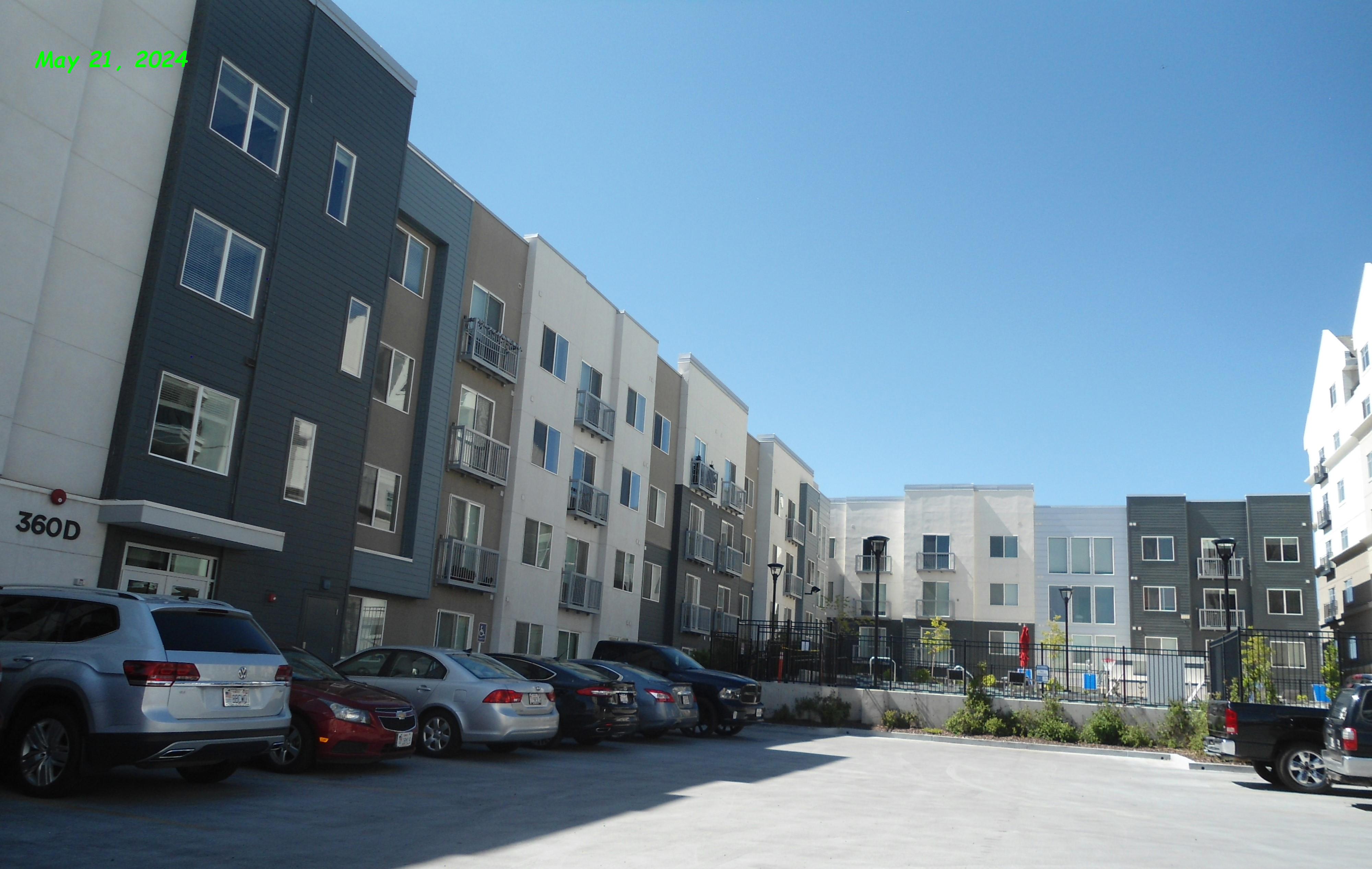 Total Photos: 6
|
| |
|
|
| Property Address: 360 S OREM BLVD Unit# D-201 - OREM |
|
| Mailing Address: %DE ANZA PROPERTIES 960 N SAN ANTONIO RD STE 114 LOS ALTOS, CA 94022 |
|
| Acreage: 0.072047 |
|
| Last Document:
22826-2017
|
|
| Subdivision Map Filing |
|
| Taxing Description:
UNIT D-201, MIDTOWN360 1ST SUPPLEMENTAL CONDOS. AREA 0.072 AC.
*Taxing description NOT FOR LEGAL DOCUMENTS
|
|
- Owner Names
- Value History
- Tax History
- Location
- Photos
- Documents
- Aerial Image
| |
----- Real Estate Values ----- |
---Improvements--- |
---Greenbelt--- |
Total |
| Year |
Com |
Res |
Agr |
Tot |
Com |
Res |
Agr |
Tot |
Land |
Homesite |
Tot |
Market Value |
| 2024 |
$0 |
$104,400 |
$0 |
$104,400 |
$0 |
$475,900 |
$0 |
$475,900 |
$0 |
$0 |
$0 |
$580,300 |
| 2023 |
$0 |
$103,400 |
$0 |
$103,400 |
$0 |
$471,200 |
$0 |
$471,200 |
$0 |
$0 |
$0 |
$574,600 |
| 2022 |
$0 |
$95,300 |
$0 |
$95,300 |
$0 |
$434,300 |
$0 |
$434,300 |
$0 |
$0 |
$0 |
$529,600 |
| 2021 |
$0 |
$48,900 |
$0 |
$48,900 |
$0 |
$272,100 |
$0 |
$272,100 |
$0 |
$0 |
$0 |
$321,000 |
| 2020 |
$0 |
$46,600 |
$0 |
$46,600 |
$0 |
$259,200 |
$0 |
$259,200 |
$0 |
$0 |
$0 |
$305,800 |
| 2019 |
$0 |
$41,400 |
$0 |
$41,400 |
$0 |
$0 |
$0 |
$0 |
$0 |
$0 |
$0 |
$41,400 |
| 2018 |
$0 |
$500 |
$0 |
$500 |
$0 |
$0 |
$0 |
$0 |
$0 |
$0 |
$0 |
$500 |
| Year |
General Taxes |
Adjustments |
Net Taxes |
Fees |
Payments |
Tax Balance* |
Balance Due |
Tax District |
| 2025 |
$0.00 |
$0.00 |
$0.00 |
$0.00 |
|
$0.00
|
$0.00 |
090 - OREM CITY |
| 2024 |
$2,610.13 |
$0.00 |
$2,610.13 |
$0.00 |
|
$0.00
|
$0.00 |
090 - OREM CITY |
| 2023 |
$2,404.67 |
$0.00 |
$2,404.67 |
$0.00 |
|
$0.00
|
$0.00 |
090 - OREM CITY |
| 2022 |
$2,287.71 |
$0.00 |
$2,287.71 |
$0.00 |
|
$0.00
|
$0.00 |
090 - OREM CITY |
| 2021 |
$1,664.51 |
$0.00 |
$1,664.51 |
$0.00 |
|
$0.00
|
$0.00 |
090 - OREM CITY |
| 2020 |
$1,613.45 |
$0.00 |
$1,613.45 |
$0.00 |
|
$0.00
|
$0.00 |
090 - OREM CITY |
| 2019 |
$381.92 |
$0.00 |
$381.92 |
$0.00 |
|
$0.00
|
$0.00 |
090 - OREM CITY |
| 2018 |
$4.83 |
$0.00 |
$4.83 |
$0.00 |
|
$0.00
|
$0.00 |
090 - OREM CITY |
* Note: Original tax amount (Does not include applicable interest and/or fees).
| Entry # |
Date |
Recorded |
Type |
Party1 (Grantor) |
Party2 (Grantee) |
| 13104-2024 |
02/16/2024 |
02/29/2024 |
REC |
ALL INSURANCE INC TEE |
MIDTOWN360 LC |
| 13103-2024 |
02/15/2024 |
02/29/2024 |
SUB TEE |
BANK OF AMERICA |
ALL INSURANCE INC SUCTEE |
| 82976-2023 |
11/21/2023 |
12/26/2023 |
AS |
NORTHMARQ CAPITAL FINANCE LLC |
FANNIE MAE |
| 82966-2023 |
|
12/26/2023 |
FN ST |
MIDTOWN360 LC |
FANNIE MAE |
| 82965-2023 |
12/20/2023 |
12/26/2023 |
D TR |
MIDTOWN360 LC BY (ET AL) |
NORTHMARQ CAPITAL FINANCE LLC |
| 54772-2022 |
03/25/2022 |
05/03/2022 |
AGR |
CITY OF OREM |
MIDTOWN360 LC |
| 13056-2022 |
12/27/2021 |
01/31/2022 |
D TR |
MIDTOWN360 LC BY (ET AL) |
BANK OF AMERICA |
| 116195-2021 |
06/24/2021 |
06/29/2021 |
MOD AGR |
MIDTOWN360 LC BY (ET AL) |
MUFG UNION BANK |
| 22827-2017 |
02/28/2017 |
03/07/2017 |
ADECCON |
MIDTOWN360 LC |
WHOM OF INTEREST |
| 22826-2017 |
10/19/2016 |
03/07/2017 |
C PLAT |
MIDTOWN360 LC |
MIDTOWN360 1ST SUPPLEMENTAL CONDO |
Main Menu Comments or Concerns on Value/Appraisal - Assessor's Office
Documents/Owner/Parcel information - Recorder's Office
Address Change for Tax Notice
This page was created on 1/20/2025 2:29:57 PM |


