Property Information
mobile view
| Serial Number: 48:399:0004 |
Serial Life: 2012... |
|
|
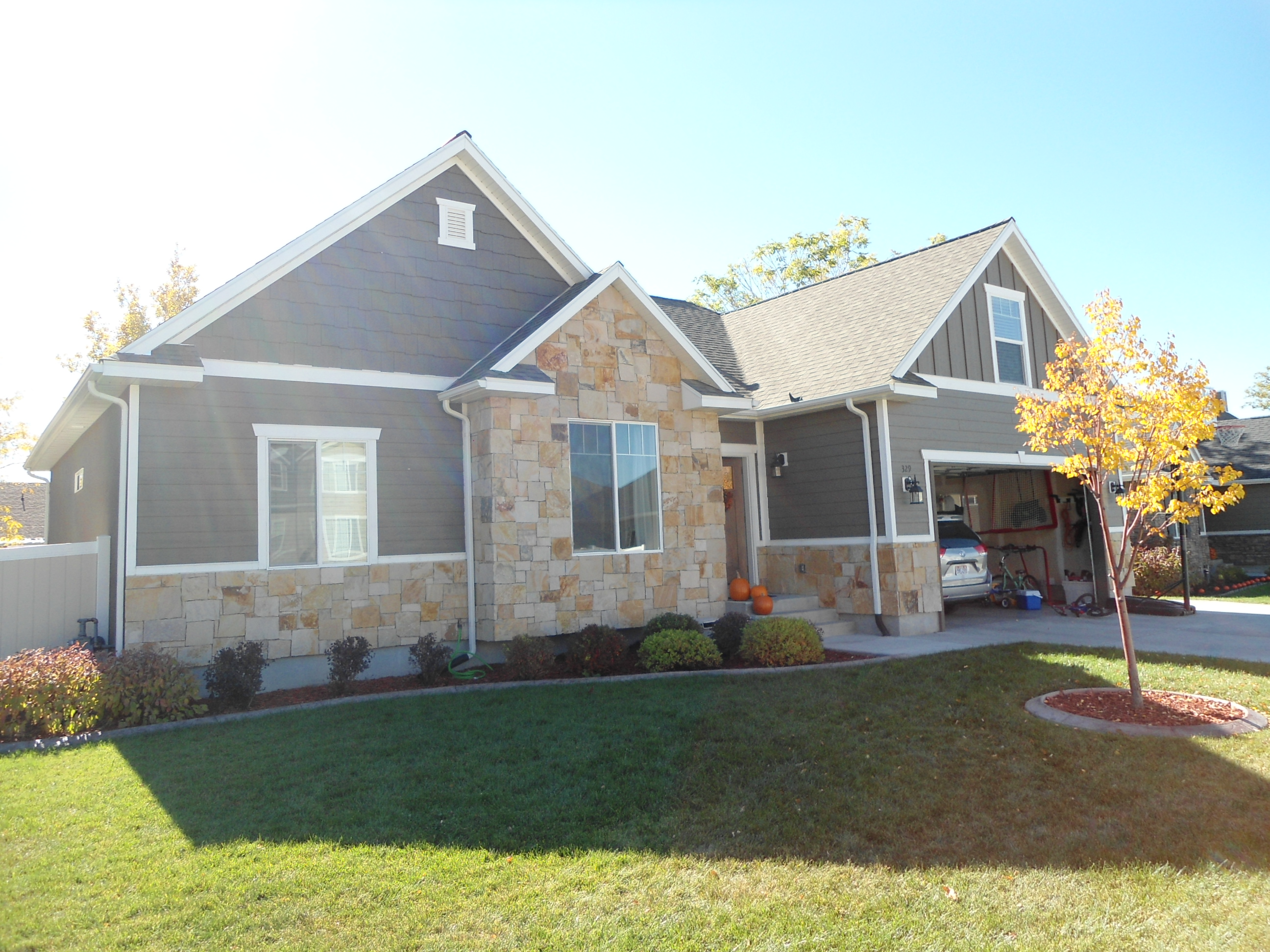 Total Photos: 2
|
| |
|
|
| Property Address: 329 W 1945 NORTH - OREM |
|
| Mailing Address: 329 W 1945 N OREM, UT 84057 |
|
| Acreage: 0.191186 |
|
| Last Document:
45683-2012
|
|
| Subdivision Map Filing |
|
| Taxing Description:
LOT 4, PLAT B, OSTERGAARD ESTATES SUB AREA 0.191 AC.
*Taxing description NOT FOR LEGAL DOCUMENTS
|
|
- Owner Names
- Value History
- Tax History
- Location
- Photos
- Documents
- Aerial Image
| |
----- Real Estate Values ----- |
---Improvements--- |
---Greenbelt--- |
Total |
| Year |
Com |
Res |
Agr |
Tot |
Com |
Res |
Agr |
Tot |
Land |
Homesite |
Tot |
Market Value |
| 2024 |
$0 |
$236,300 |
$0 |
$236,300 |
$0 |
$396,200 |
$0 |
$396,200 |
$0 |
$0 |
$0 |
$632,500 |
| 2023 |
$0 |
$236,300 |
$0 |
$236,300 |
$0 |
$417,200 |
$0 |
$417,200 |
$0 |
$0 |
$0 |
$653,500 |
| 2022 |
$0 |
$251,900 |
$0 |
$251,900 |
$0 |
$502,800 |
$0 |
$502,800 |
$0 |
$0 |
$0 |
$754,700 |
| 2021 |
$0 |
$179,900 |
$0 |
$179,900 |
$0 |
$392,800 |
$0 |
$392,800 |
$0 |
$0 |
$0 |
$572,700 |
| 2020 |
$0 |
$156,400 |
$0 |
$156,400 |
$0 |
$374,100 |
$0 |
$374,100 |
$0 |
$0 |
$0 |
$530,500 |
| 2019 |
$0 |
$156,400 |
$0 |
$156,400 |
$0 |
$286,700 |
$0 |
$286,700 |
$0 |
$0 |
$0 |
$443,100 |
| 2018 |
$0 |
$156,400 |
$0 |
$156,400 |
$0 |
$278,300 |
$0 |
$278,300 |
$0 |
$0 |
$0 |
$434,700 |
| 2017 |
$0 |
$156,400 |
$0 |
$156,400 |
$0 |
$248,000 |
$0 |
$248,000 |
$0 |
$0 |
$0 |
$404,400 |
| 2016 |
$0 |
$139,000 |
$0 |
$139,000 |
$0 |
$265,800 |
$0 |
$265,800 |
$0 |
$0 |
$0 |
$404,800 |
| 2015 |
$0 |
$139,000 |
$0 |
$139,000 |
$0 |
$248,900 |
$0 |
$248,900 |
$0 |
$0 |
$0 |
$387,900 |
| 2014 |
$0 |
$132,000 |
$0 |
$132,000 |
$0 |
$248,900 |
$0 |
$248,900 |
$0 |
$0 |
$0 |
$380,900 |
| 2013 |
$0 |
$94,400 |
$0 |
$94,400 |
$0 |
$240,000 |
$0 |
$240,000 |
$0 |
$0 |
$0 |
$334,400 |
| 2012 |
$0 |
$53,900 |
$0 |
$53,900 |
$0 |
$0 |
$0 |
$0 |
$0 |
$0 |
$0 |
$53,900 |
| Year |
General Taxes |
Adjustments |
Net Taxes |
Fees |
Payments |
Tax Balance* |
Balance Due |
Tax District |
| 2025 |
$0.00 |
$0.00 |
$0.00 |
$0.00 |
|
$0.00
|
$0.00 |
090 - OREM CITY |
| 2024 |
$2,844.92 |
$0.00 |
$2,844.92 |
$0.00 |
|
$0.00
|
$0.00 |
090 - OREM CITY |
| 2023 |
$2,734.86 |
$0.00 |
$2,734.86 |
$0.00 |
|
$0.00
|
$0.00 |
090 - OREM CITY |
| 2022 |
$3,260.08 |
$0.00 |
$3,260.08 |
$0.00 |
|
$0.00
|
$0.00 |
090 - OREM CITY |
| 2021 |
$2,969.68 |
$0.00 |
$2,969.68 |
$0.00 |
|
$0.00
|
$0.00 |
090 - OREM CITY |
| 2020 |
$2,799.00 |
$0.00 |
$2,799.00 |
$0.00 |
|
$0.00
|
$0.00 |
090 - OREM CITY |
| 2019 |
$2,248.18 |
$0.00 |
$2,248.18 |
$0.00 |
|
$0.00
|
$0.00 |
090 - OREM CITY |
| 2018 |
$2,308.37 |
$0.00 |
$2,308.37 |
$0.00 |
|
$0.00
|
$0.00 |
090 - OREM CITY |
| 2017 |
$2,204.85 |
$0.00 |
$2,204.85 |
$0.00 |
|
$0.00
|
$0.00 |
090 - OREM CITY |
| 2016 |
$2,393.38 |
$0.00 |
$2,393.38 |
$0.00 |
|
$0.00
|
$0.00 |
090 - OREM CITY |
| 2015 |
$2,425.09 |
$0.00 |
$2,425.09 |
$0.00 |
|
$0.00
|
$0.00 |
090 - OREM CITY |
| 2014 |
$2,392.22 |
$0.00 |
$2,392.22 |
$0.00 |
|
$0.00
|
$0.00 |
090 - OREM CITY |
| 2013 |
$2,264.79 |
$0.00 |
$2,264.79 |
$0.00 |
|
$0.00
|
$0.00 |
090 - OREM CITY |
| 2012 |
$677.42 |
$0.00 |
$677.42 |
$0.00 |
|
$0.00
|
$0.00 |
090 - OREM CITY |
* Note: Original tax amount (Does not include applicable interest and/or fees).
| Entry # |
Date |
Recorded |
Type |
Party1 (Grantor) |
Party2 (Grantee) |
| 110641-2018 |
11/07/2018 |
11/20/2018 |
D TR |
ANDERSON, DEREK & JENILYN STEED |
WELLS FARGO BANK |
| 46487-2012 |
05/31/2011 |
06/05/2012 |
R LP |
PATTERSON CONSTRUCTION DBA (ET AL) |
BLACK, TIMOTHY J & GAIL O |
| 45685-2012 |
05/31/2012 |
06/01/2012 |
D TR |
ANDERSON, DEREK BY ATY |
PINNACLE CAPITAL MORTGAGE CORPORATION |
| 45684-2012 |
05/30/2012 |
06/01/2012 |
SP PA |
ANDERSON, DEREK |
ANDERSON, JENILYN |
| 45683-2012 |
06/01/2012 |
06/01/2012 |
WD |
PATTERSON CONSTRUCTION INC |
ANDERSON, DEREK |
| 7259-2012 |
01/16/2012 |
01/30/2012 |
DECLCOV |
PATTERSON CONSTRUCTION INC (ET AL) |
WHOM OF INTEREST |
| 88909-2011 |
07/29/2011 |
12/12/2011 |
SP WD |
SUNSET MOUNTAIN PROPERTIES LIMITED PARTNERSHIP BY (ET AL) |
PATTERSON CONSTRUCTION INC |
| 53798-2011 |
07/18/2011 |
07/29/2011 |
S PLAT |
SUNSET MOUNTAIN PROPERTIES LP BY (ET AL) |
OSTERGAARD ESTATES PLAT B |
Main Menu Comments or Concerns on Value/Appraisal - Assessor's Office
Documents/Owner/Parcel information - Recorder's Office
Address Change for Tax Notice
This page was created on 4/1/2025 6:29:23 AM |
