Property Information
mobile view
| Serial Number: 49:443:0001 |
Serial Life: 2003... |
|
|
 Total Photos: 9
|
| |
|
|
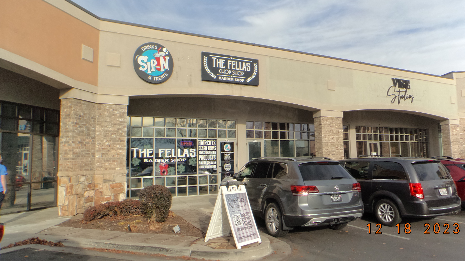
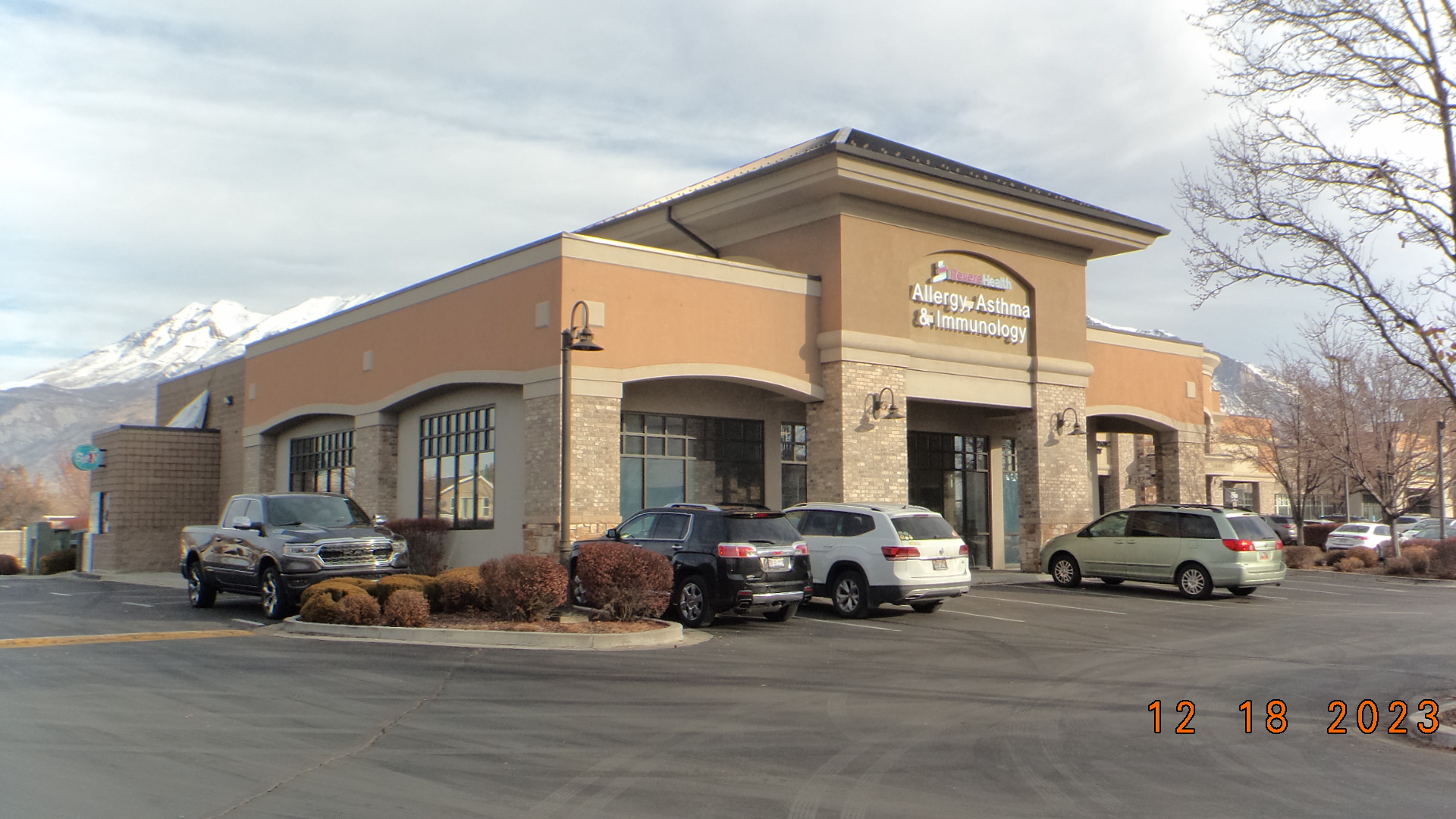
| Property Address: 450 W 800 NORTH - OREM |
|
| Mailing Address: %WARREN, BRENT 118 N MAIN ST SALEM, UT 84653 |
|
| Acreage: 0.053 |
|
| Last Document:
66893-2002
|
|
| Subdivision Map Filing |
|
| Taxing Description:
UNIT B, PINEHURST PLAZA RETAIL CONDOS FIRST SUPPLEMENTAL. AREA 0.053 AC.
*Taxing description NOT FOR LEGAL DOCUMENTS
|
|
- Owner Names
- Value History
- Tax History
- Location
- Photos
- Documents
- Aerial Image
| |
----- Real Estate Values ----- |
---Improvements--- |
---Greenbelt--- |
Total |
| Year |
Com |
Res |
Agr |
Tot |
Com |
Res |
Agr |
Tot |
Land |
Homesite |
Tot |
Market Value |
| 2024 |
$98,400 |
$0 |
$0 |
$98,400 |
$395,100 |
$0 |
$0 |
$395,100 |
$0 |
$0 |
$0 |
$493,500 |
| 2023 |
$93,700 |
$0 |
$0 |
$93,700 |
$376,300 |
$0 |
$0 |
$376,300 |
$0 |
$0 |
$0 |
$470,000 |
| 2022 |
$93,700 |
$0 |
$0 |
$93,700 |
$329,300 |
$0 |
$0 |
$329,300 |
$0 |
$0 |
$0 |
$423,000 |
| 2021 |
$64,900 |
$0 |
$0 |
$64,900 |
$217,100 |
$0 |
$0 |
$217,100 |
$0 |
$0 |
$0 |
$282,000 |
| 2020 |
$64,900 |
$0 |
$0 |
$64,900 |
$217,100 |
$0 |
$0 |
$217,100 |
$0 |
$0 |
$0 |
$282,000 |
| 2019 |
$64,900 |
$0 |
$0 |
$64,900 |
$226,900 |
$0 |
$0 |
$226,900 |
$0 |
$0 |
$0 |
$291,800 |
| 2018 |
$64,900 |
$0 |
$0 |
$64,900 |
$226,900 |
$0 |
$0 |
$226,900 |
$0 |
$0 |
$0 |
$291,800 |
| 2017 |
$64,900 |
$0 |
$0 |
$64,900 |
$226,900 |
$0 |
$0 |
$226,900 |
$0 |
$0 |
$0 |
$291,800 |
| 2016 |
$61,300 |
$0 |
$0 |
$61,300 |
$218,300 |
$0 |
$0 |
$218,300 |
$0 |
$0 |
$0 |
$279,600 |
| 2015 |
$61,300 |
$0 |
$0 |
$61,300 |
$218,300 |
$0 |
$0 |
$218,300 |
$0 |
$0 |
$0 |
$279,600 |
| 2014 |
$61,300 |
$0 |
$0 |
$61,300 |
$218,300 |
$0 |
$0 |
$218,300 |
$0 |
$0 |
$0 |
$279,600 |
| 2013 |
$61,300 |
$0 |
$0 |
$61,300 |
$218,300 |
$0 |
$0 |
$218,300 |
$0 |
$0 |
$0 |
$279,600 |
| 2012 |
$61,300 |
$0 |
$0 |
$61,300 |
$218,300 |
$0 |
$0 |
$218,300 |
$0 |
$0 |
$0 |
$279,600 |
| 2011 |
$57,700 |
$0 |
$0 |
$57,700 |
$233,600 |
$0 |
$0 |
$233,600 |
$0 |
$0 |
$0 |
$291,300 |
| 2010 |
$83,104 |
$0 |
$0 |
$83,104 |
$425,103 |
$0 |
$0 |
$425,103 |
$0 |
$0 |
$0 |
$508,207 |
| 2009 |
$84,800 |
$0 |
$0 |
$84,800 |
$457,100 |
$0 |
$0 |
$457,100 |
$0 |
$0 |
$0 |
$541,900 |
| 2008 |
$84,800 |
$0 |
$0 |
$84,800 |
$457,100 |
$0 |
$0 |
$457,100 |
$0 |
$0 |
$0 |
$541,900 |
| 2007 |
$80,800 |
$0 |
$0 |
$80,800 |
$435,300 |
$0 |
$0 |
$435,300 |
$0 |
$0 |
$0 |
$516,100 |
| 2006 |
$59,000 |
$0 |
$0 |
$59,000 |
$254,000 |
$0 |
$0 |
$254,000 |
$0 |
$0 |
$0 |
$313,000 |
| 2005 |
$59,000 |
$0 |
$0 |
$59,000 |
$254,000 |
$0 |
$0 |
$254,000 |
$0 |
$0 |
$0 |
$313,000 |
| 2004 |
$59,000 |
$0 |
$0 |
$59,000 |
$254,000 |
$0 |
$0 |
$254,000 |
$0 |
$0 |
$0 |
$313,000 |
| 2003 |
$48,000 |
$0 |
$0 |
$48,000 |
$152,000 |
$0 |
$0 |
$152,000 |
$0 |
$0 |
$0 |
$200,000 |
| Year |
General Taxes |
Adjustments |
Net Taxes |
Fees |
Payments |
Tax Balance* |
Balance Due |
Tax District |
| 2025 |
$0.00 |
$0.00 |
$0.00 |
$0.00 |
|
$0.00
|
$0.00 |
090 - OREM CITY |
| 2024 |
$4,035.84 |
$0.00 |
$4,035.84 |
$0.00 |
|
|
Click for Payoff
|
090 - OREM CITY |
| 2023 |
$3,576.23 |
$0.00 |
$3,576.23 |
$0.00 |
|
$0.00
|
$0.00 |
090 - OREM CITY |
| 2022 |
$3,322.24 |
$0.00 |
$3,322.24 |
$0.00 |
|
$0.00
|
$0.00 |
090 - OREM CITY |
| 2021 |
$2,658.70 |
$0.00 |
$2,658.70 |
$0.00 |
|
$0.00
|
$0.00 |
090 - OREM CITY |
| 2020 |
$2,705.23 |
$0.00 |
$2,705.23 |
$0.00 |
|
$0.00
|
$0.00 |
090 - OREM CITY |
| 2019 |
$2,691.86 |
$0.00 |
$2,691.86 |
$0.00 |
|
$0.00
|
$0.00 |
090 - OREM CITY |
| 2018 |
$2,817.33 |
$0.00 |
$2,817.33 |
$0.00 |
|
$0.00
|
$0.00 |
090 - OREM CITY |
| 2017 |
$2,892.61 |
$0.00 |
$2,892.61 |
$0.00 |
|
$0.00
|
$0.00 |
090 - OREM CITY |
| 2016 |
$3,005.70 |
$0.00 |
$3,005.70 |
$0.00 |
|
$0.00
|
$0.00 |
090 - OREM CITY |
| 2015 |
$3,178.21 |
$0.00 |
$3,178.21 |
$0.00 |
|
$0.00
|
$0.00 |
090 - OREM CITY |
| 2014 |
$3,192.75 |
$0.00 |
$3,192.75 |
$0.00 |
|
$0.00
|
$0.00 |
090 - OREM CITY |
| 2013 |
$3,442.99 |
$0.00 |
$3,442.99 |
$0.00 |
|
$0.00
|
$0.00 |
090 - OREM CITY |
| 2012 |
$3,514.01 |
$0.00 |
$3,514.01 |
$0.00 |
|
$0.00
|
$0.00 |
090 - OREM CITY |
| 2011 |
$3,643.58 |
$0.00 |
$3,643.58 |
$0.00 |
|
$0.00
|
$0.00 |
090 - OREM CITY |
| 2010 |
$5,951.10 |
$0.00 |
$5,951.10 |
$0.00 |
|
$0.00
|
$0.00 |
090 - OREM CITY |
| 2009 |
$5,882.32 |
$0.00 |
$5,882.32 |
$0.00 |
|
$0.00
|
$0.00 |
090 - OREM CITY |
| 2008 |
$5,450.97 |
$0.00 |
$5,450.97 |
$0.00 |
|
$0.00
|
$0.00 |
090 - OREM CITY |
| 2007 |
$5,132.10 |
$0.00 |
$5,132.10 |
$0.00 |
|
$0.00
|
$0.00 |
090 - OREM CITY |
| 2006 |
$3,314.36 |
$0.00 |
$3,314.36 |
$0.00 |
|
$0.00
|
$0.00 |
090 - OREM CITY |
| 2005 |
$3,740.98 |
$0.00 |
$3,740.98 |
$0.00 |
|
$0.00
|
$0.00 |
090 - OREM CITY |
| 2004 |
$3,674.62 |
$0.00 |
$3,674.62 |
$0.00 |
|
$0.00
|
$0.00 |
090 - OREM CITY |
| 2003 |
$2,278.40 |
$0.00 |
$2,278.40 |
$0.00 |
|
$0.00
|
$0.00 |
090 - OREM CITY |
* Note: Original tax amount (Does not include applicable interest and/or fees).
| Entry # |
Date |
Recorded |
Type |
Party1 (Grantor) |
Party2 (Grantee) |
| 75162-2019 |
08/01/2019 |
08/08/2019 |
ADECCON |
PINEHURST PLAZA CONDOMINIUMS |
WHOM OF INTEREST |
| 22981-2014 |
04/07/2014 |
04/07/2014 |
AF |
CITY OF OREM |
WHOM OF INTEREST |
| 12010-2012 |
01/09/2012 |
02/15/2012 |
REC |
ZIONS FIRST NATIONAL BANK TEE |
WARREN RX HOLDINGS LLC |
| 44184-2010 |
05/27/2010 |
05/28/2010 |
N |
PINEHURST PLAZA RETAIL CONDOMINIUMS |
WHOM OF INTEREST |
| 132526-2004 |
11/05/2004 |
11/23/2004 |
ADECCON |
PINEHURST AT 800 NORTH LLC |
WHOM OF INTEREST |
| 71788-2002 |
06/20/2002 |
06/25/2002 |
D TR |
WARREN RX HOLDINGS LLC |
ZIONS FIRST NATIONAL BANK |
| 71787-2002 |
06/24/2002 |
06/25/2002 |
WD |
PINEHURST AT 800 NORTH LLC |
WARREN RX HOLDINGS LLC |
| 66894-2002 |
05/30/2002 |
06/13/2002 |
ADECCOV |
PINEHURST AT 800 NORTH LLC |
WHOM OF INTEREST |
| 66893-2002 |
06/11/2002 |
06/13/2002 |
C PLAT |
PINEHURST AT 800 NORTH LLC |
PINEHURST PLAZA RETAIL CONDOMINIUMS FIRST SUP |
Main Menu Comments or Concerns on Value/Appraisal - Assessor's Office
Documents/Owner/Parcel information - Recorder's Office
Address Change for Tax Notice
This page was created on 10/18/2024 2:41:03 PM |