Property Information
mobile view
| Serial Number: 49:680:0003 |
Serial Life: 2012... |
|
|

Total Photos: 7
|
| |
|
|
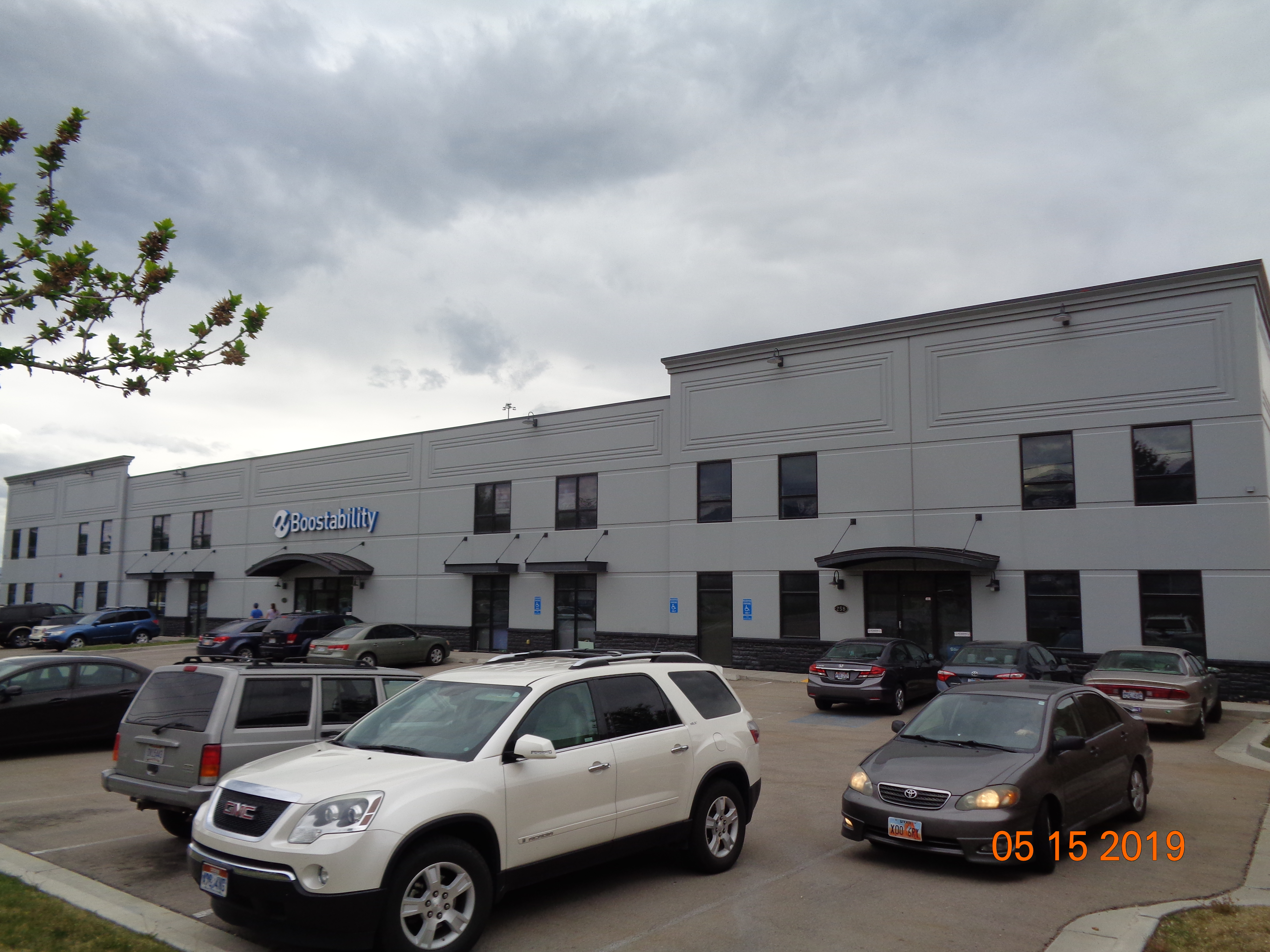
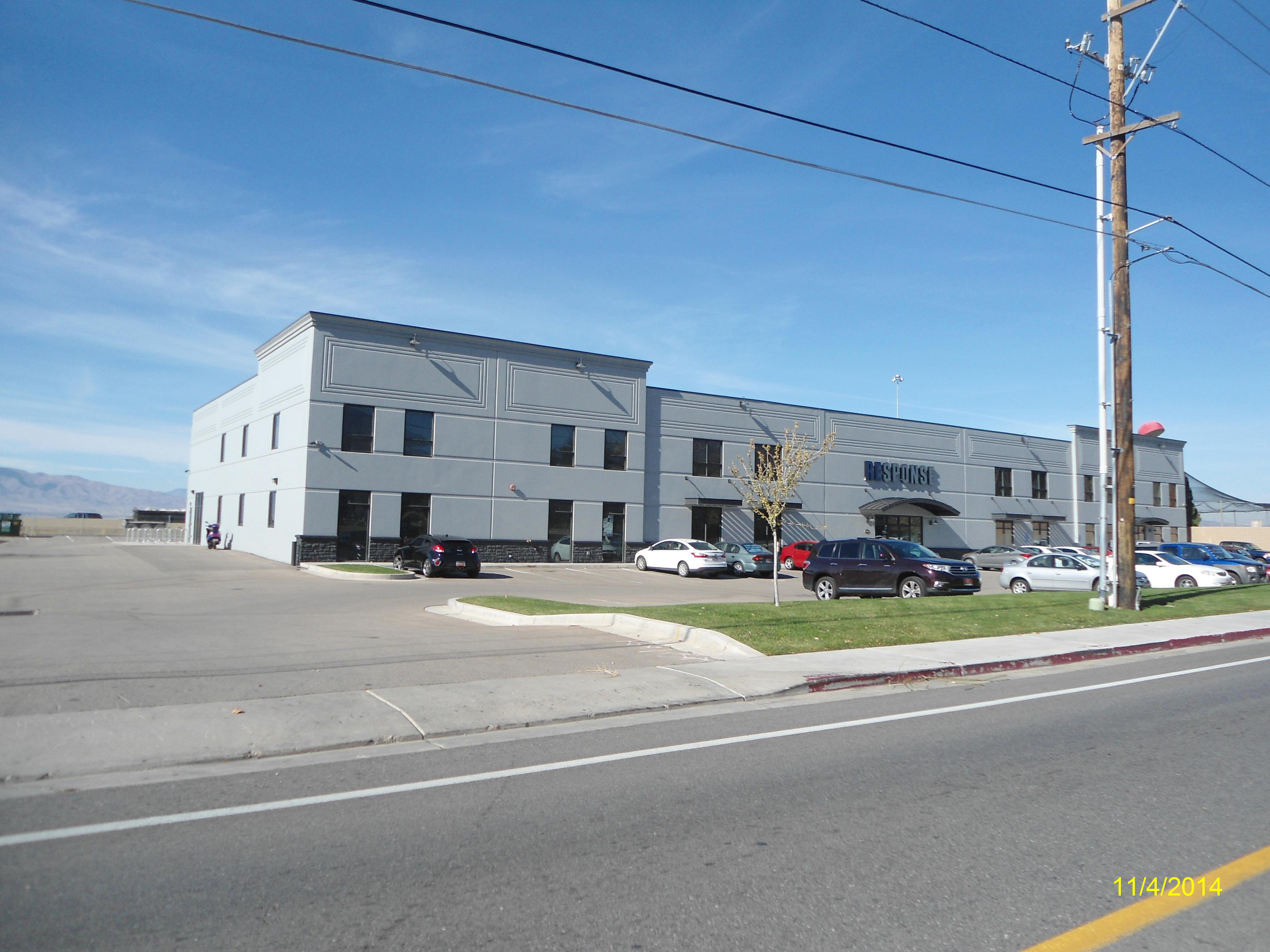
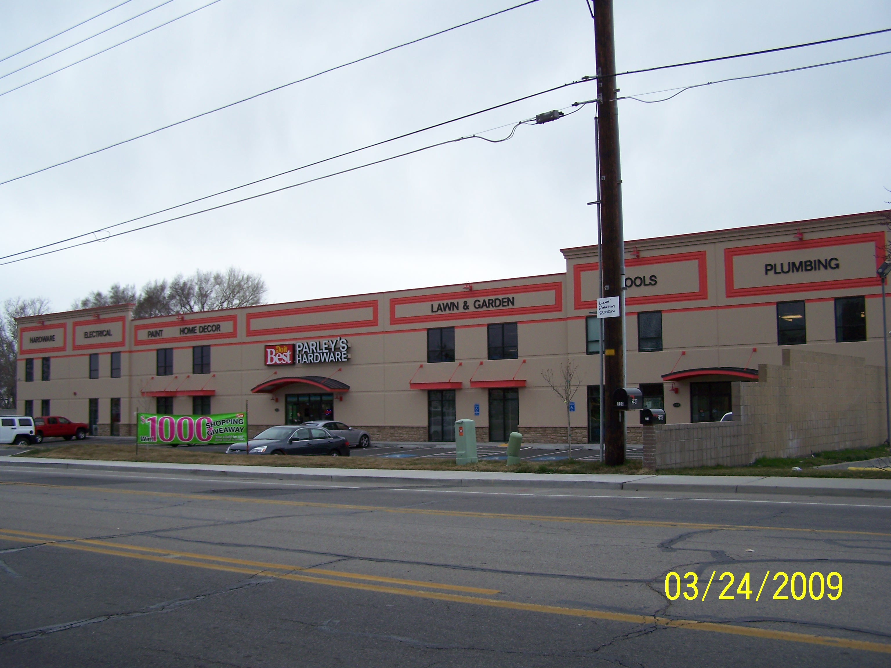
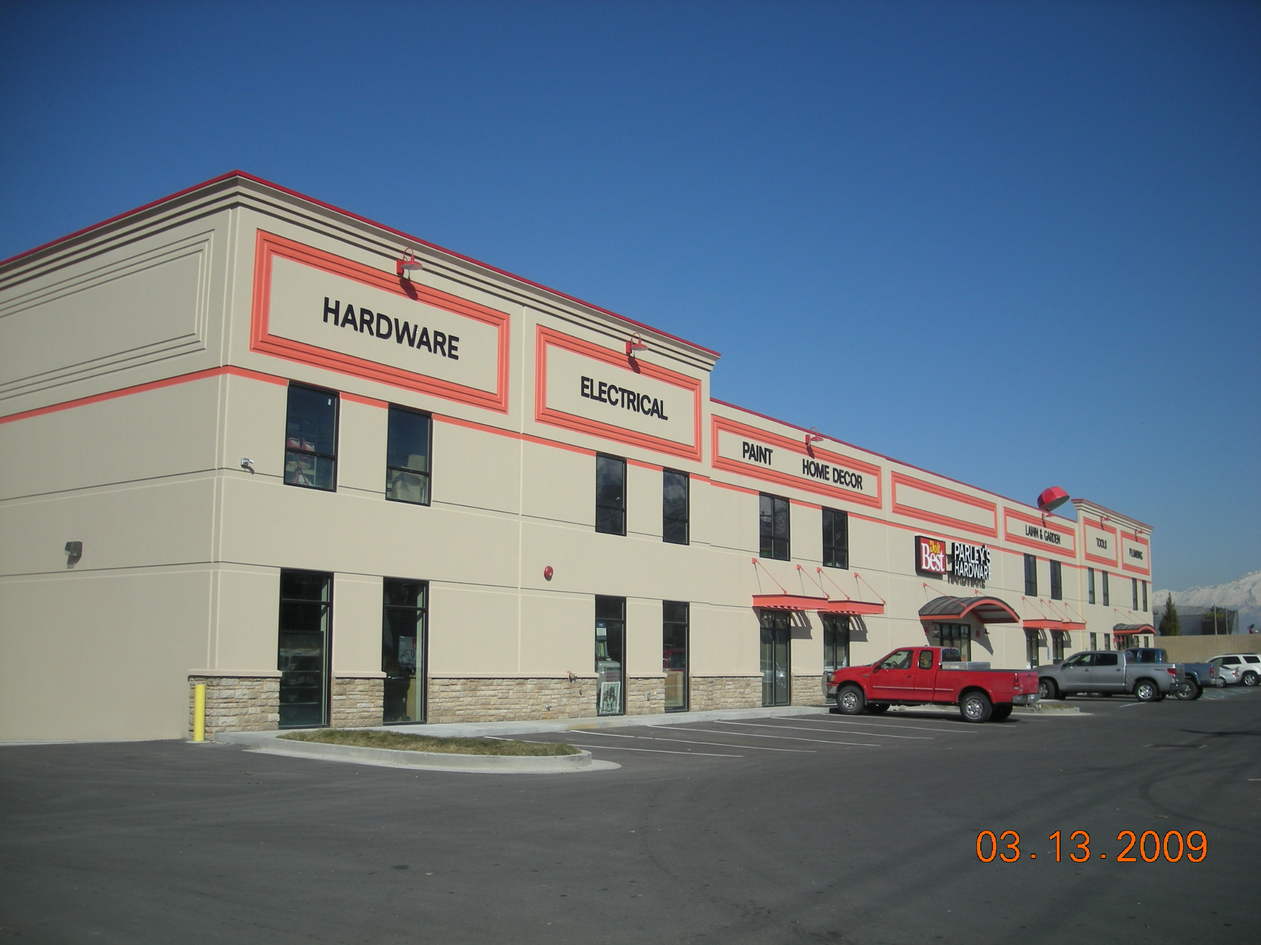
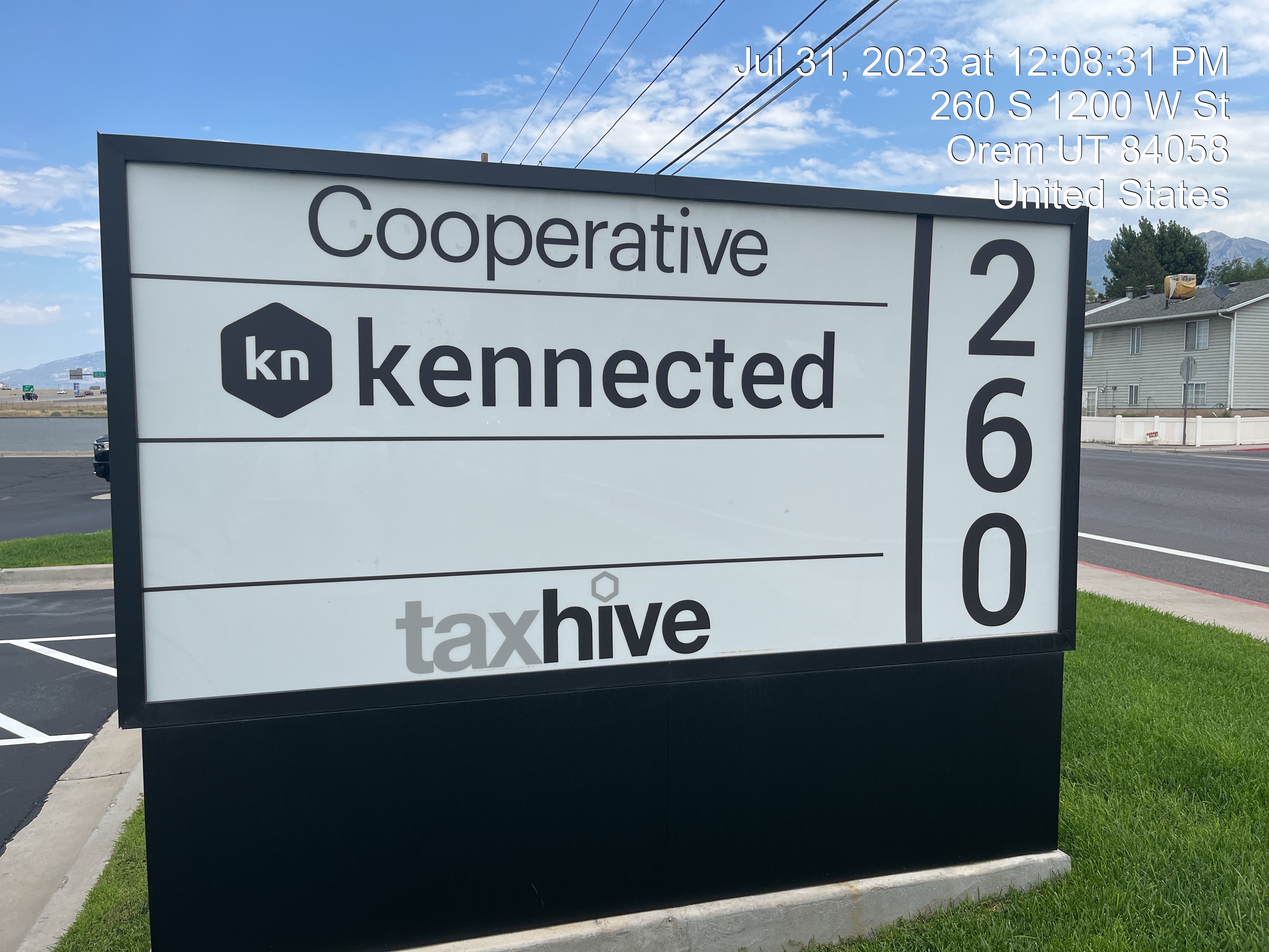
| Property Address: 260 S 1200 WEST - OREM |
|
| Mailing Address: 260 S 1200 W OREM, UT 84058 |
|
| Acreage: 1.452051 |
|
| Last Document:
48059-2011
|
|
| Subdivision Map Filing |
|
| Taxing Description:
PART LOT 1, PLAT A, PPM SUB DESCRIBED AS FOLLOWS; COM N 1133.64 FT & W 247.82 FT FR S 1/4 COR. SEC. 16, T6S, R2E, SLB&M.; N 89 DEG 38' 25" E 212.88 FT; S 0 DEG 11' 35" E 275.62 FT; S 89 DEG 38' 25" W 232.11 FT; N 2 DEG 53' 29" W 23.47 FT; N 2 DEG 50' 37" W 29.35 FT; N 0 DEG 21' 23" E 31.13 FT; N 0 DEG 1' 9" E 29.55 FT; N 0 DEG 5' 47" W 60.31 FT; N 13 DEG 3' 1" E 93.02 FT; N 0 DEG 33' 24" W 5.44 FT; N 1 DEG 3' 31" W 5.93 FT TO BEG. AREA 1.452 AC.
*Taxing description NOT FOR LEGAL DOCUMENTS
|
|
- Owner Names
- Value History
- Tax History
- Location
- Photos
- Documents
- Aerial Image
| |
----- Real Estate Values ----- |
---Improvements--- |
---Greenbelt--- |
Total |
| Year |
Com |
Res |
Agr |
Tot |
Com |
Res |
Agr |
Tot |
Land |
Homesite |
Tot |
Market Value |
| 2024 |
$963,000 |
$0 |
$0 |
$963,000 |
$3,868,400 |
$0 |
$0 |
$3,868,400 |
$0 |
$0 |
$0 |
$4,831,400 |
| 2023 |
$946,500 |
$0 |
$0 |
$946,500 |
$4,006,600 |
$0 |
$0 |
$4,006,600 |
$0 |
$0 |
$0 |
$4,953,100 |
| 2022 |
$935,500 |
$0 |
$0 |
$935,500 |
$3,341,100 |
$0 |
$0 |
$3,341,100 |
$0 |
$0 |
$0 |
$4,276,600 |
| 2021 |
$835,600 |
$0 |
$0 |
$835,600 |
$2,790,900 |
$0 |
$0 |
$2,790,900 |
$0 |
$0 |
$0 |
$3,626,500 |
| 2020 |
$835,600 |
$0 |
$0 |
$835,600 |
$2,864,900 |
$0 |
$0 |
$2,864,900 |
$0 |
$0 |
$0 |
$3,700,500 |
| 2019 |
$773,600 |
$0 |
$0 |
$773,600 |
$2,777,800 |
$0 |
$0 |
$2,777,800 |
$0 |
$0 |
$0 |
$3,551,400 |
| 2018 |
$736,900 |
$0 |
$0 |
$736,900 |
$2,617,400 |
$0 |
$0 |
$2,617,400 |
$0 |
$0 |
$0 |
$3,354,300 |
| 2017 |
$702,100 |
$0 |
$0 |
$702,100 |
$2,556,600 |
$0 |
$0 |
$2,556,600 |
$0 |
$0 |
$0 |
$3,258,700 |
| 2016 |
$669,200 |
$0 |
$0 |
$669,200 |
$2,320,100 |
$0 |
$0 |
$2,320,100 |
$0 |
$0 |
$0 |
$2,989,300 |
| 2015 |
$625,600 |
$0 |
$0 |
$625,600 |
$2,257,600 |
$0 |
$0 |
$2,257,600 |
$0 |
$0 |
$0 |
$2,883,200 |
| 2014 |
$596,000 |
$0 |
$0 |
$596,000 |
$2,257,600 |
$0 |
$0 |
$2,257,600 |
$0 |
$0 |
$0 |
$2,853,600 |
| 2013 |
$541,800 |
$0 |
$0 |
$541,800 |
$2,257,600 |
$0 |
$0 |
$2,257,600 |
$0 |
$0 |
$0 |
$2,799,400 |
| 2012 |
$536,900 |
$0 |
$0 |
$536,900 |
$1,437,300 |
$0 |
$0 |
$1,437,300 |
$0 |
$0 |
$0 |
$1,974,200 |
| Year |
General Taxes |
Adjustments |
Net Taxes |
Fees |
Payments |
Tax Balance* |
Balance Due |
Tax District |
| 2025 |
$0.00 |
$0.00 |
$0.00 |
$0.00 |
|
$0.00
|
$0.00 |
090 - OREM CITY |
| 2024 |
$0.00 |
$0.00 |
$0.00 |
$0.00 |
|
$0.00
|
$0.00 |
090 - OREM CITY |
| 2023 |
$37,688.14 |
$0.00 |
$37,688.14 |
$0.00 |
|
$0.00
|
$0.00 |
090 - OREM CITY |
| 2022 |
$33,588.42 |
$0.00 |
$33,588.42 |
$0.00 |
|
$0.00
|
$0.00 |
090 - OREM CITY |
| 2021 |
$34,190.64 |
$0.00 |
$34,190.64 |
$0.00 |
|
$0.00
|
$0.00 |
090 - OREM CITY |
| 2020 |
$35,498.90 |
$0.00 |
$35,498.90 |
$0.00 |
|
$0.00
|
$0.00 |
090 - OREM CITY |
| 2019 |
$32,761.67 |
$0.00 |
$32,761.67 |
$0.00 |
|
$0.00
|
$0.00 |
090 - OREM CITY |
| 2018 |
$32,385.77 |
$0.00 |
$32,385.77 |
$0.00 |
|
$0.00
|
$0.00 |
090 - OREM CITY |
| 2017 |
$32,303.49 |
$0.00 |
$32,303.49 |
$0.00 |
|
$0.00
|
$0.00 |
090 - OREM CITY |
| 2016 |
$32,134.98 |
$0.00 |
$32,134.98 |
$0.00 |
|
$0.00
|
$0.00 |
090 - OREM CITY |
| 2015 |
$32,773.33 |
$0.00 |
$32,773.33 |
$0.00 |
|
$0.00
|
$0.00 |
090 - OREM CITY |
| 2014 |
$32,585.26 |
$0.00 |
$32,585.26 |
$0.00 |
|
$0.00
|
$0.00 |
090 - OREM CITY |
| 2013 |
$34,471.81 |
$0.00 |
$34,471.81 |
$0.00 |
|
$0.00
|
$0.00 |
090 - OREM CITY |
| 2012 |
$24,811.75 |
$0.00 |
$24,811.75 |
$0.00 |
|
$0.00
|
$0.00 |
090 - OREM CITY |
* Note: Original tax amount (Does not include applicable interest and/or fees).
| Entry # |
Date |
Recorded |
Type |
Party1 (Grantor) |
Party2 (Grantee) |
| 54932-2016 |
06/15/2016 |
06/16/2016 |
ASSIGN |
260 SOUTH LLC |
BANK OF THE WEST |
| 54931-2016 |
06/15/2016 |
06/16/2016 |
D TR |
260 SOUTH LLC |
BANK OF THE WEST |
| 16363-2015 |
02/27/2015 |
03/02/2015 |
D TR |
260 SOUTH LLC |
CENTRAL BANK |
| 31590-2012 |
04/16/2012 |
04/17/2012 |
TEE D |
JACKSON, BLAIR TEE (ET AL) |
260 SOUTH LLC |
| 1698-2012 |
01/09/2011 |
01/09/2012 |
ND |
JACKSON, BLAIR SUCTEE |
HELLEWELL, PARLEY G & MARILYNN |
| 58197-2011 |
08/12/2011 |
08/17/2011 |
SUB TEE |
BANK OF AMERICAN FORK |
JACKSON, BLAIR R SUCTEE |
| 58196-2011 |
08/12/2011 |
08/17/2011 |
AS |
BANK OF AMERICAN FORK |
KEOKUK LEASING LLC |
| 48059-2011 |
06/23/2011 |
07/01/2011 |
QCD |
HELLEWELL, MARILYN |
UTAH DEPARTMENT OF TRANSPORTATION |
Main Menu Comments or Concerns on Value/Appraisal - Assessor's Office
Documents/Owner/Parcel information - Recorder's Office
Address Change for Tax Notice
This page was created on 7/13/2024 6:41:31 PM |

