Property Information
mobile view
| Serial Number: 51:588:0001 |
Serial Life: 2018... |
|
|
 Total Photos: 3
|
| |
|
|
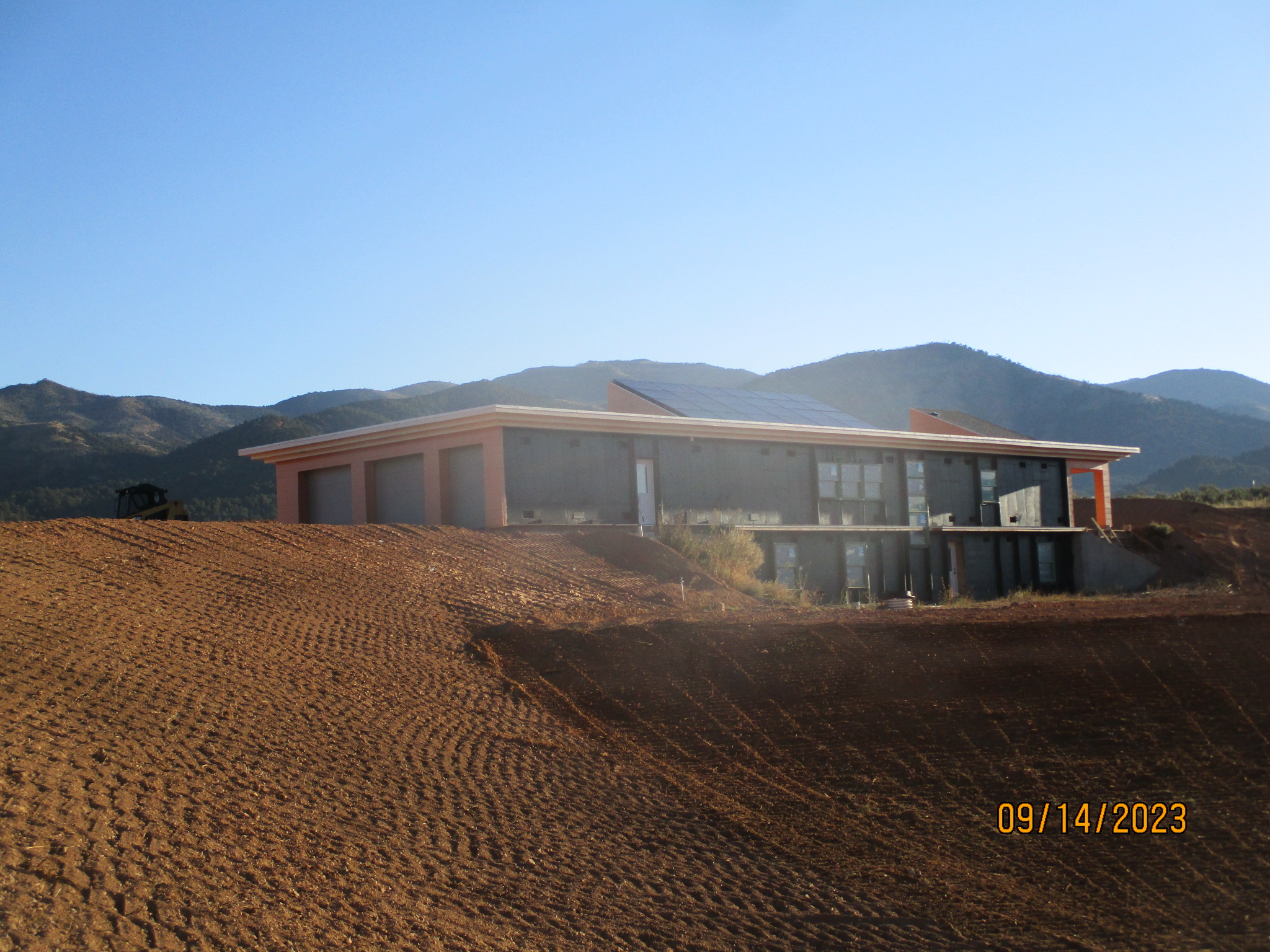
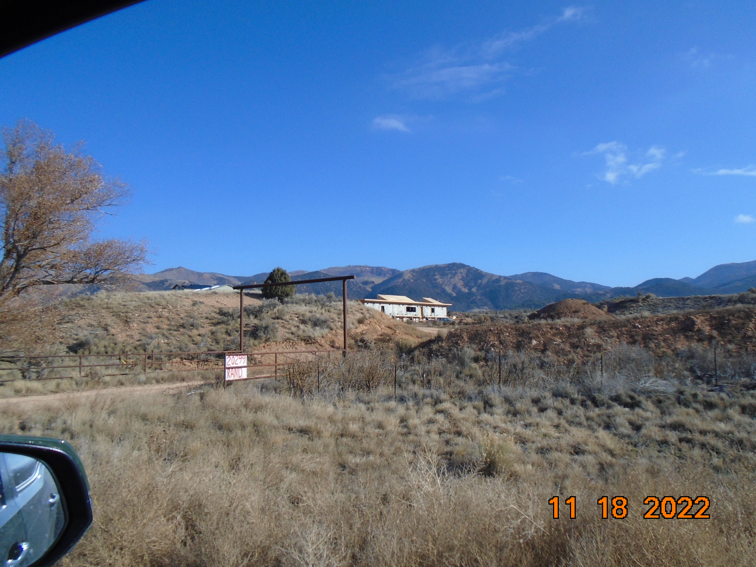
| Property Address: 20299 S HWY 89 - BIRDSEYE |
|
| Mailing Address: 1991 S STATE RD SPRINGVILLE, UT 84663 |
|
| Acreage: 5.297324 |
|
| Last Document:
126756-2022
|
|
| Subdivision Map Filing |
|
| Taxing Description:
LOT 1, PLAT A, RAND SUB AREA 5.297 AC.
*Taxing description NOT FOR LEGAL DOCUMENTS
|
|
- Owner Names
- Value History
- Tax History
- Location
- Photos
- Documents
- Aerial Image
| |
----- Real Estate Values ----- |
---Improvements--- |
---Greenbelt--- |
Total |
| Year |
Com |
Res |
Agr |
Tot |
Com |
Res |
Agr |
Tot |
Land |
Homesite |
Tot |
Market Value |
| 2024 |
$0 |
$84,400 |
$15,500 |
$99,900 |
$0 |
$411,500 |
$0 |
$411,500 |
$0 |
$0 |
$0 |
$511,400 |
| 2023 |
$0 |
$84,400 |
$15,100 |
$99,500 |
$0 |
$17,600 |
$0 |
$17,600 |
$0 |
$0 |
$0 |
$117,100 |
| 2022 |
$0 |
$90,000 |
$16,100 |
$106,100 |
$0 |
$17,600 |
$0 |
$17,600 |
$0 |
$0 |
$0 |
$123,700 |
| 2021 |
$0 |
$60,000 |
$12,900 |
$72,900 |
$0 |
$16,000 |
$0 |
$16,000 |
$0 |
$0 |
$0 |
$88,900 |
| 2020 |
$0 |
$28,000 |
$12,900 |
$40,900 |
$0 |
$16,000 |
$0 |
$16,000 |
$0 |
$0 |
$0 |
$56,900 |
| 2019 |
$0 |
$28,000 |
$12,900 |
$40,900 |
$0 |
$16,000 |
$0 |
$16,000 |
$0 |
$0 |
$0 |
$56,900 |
| 2018 |
$0 |
$28,000 |
$12,900 |
$40,900 |
$0 |
$16,000 |
$0 |
$16,000 |
$0 |
$0 |
$0 |
$56,900 |
| Year |
General Taxes |
Adjustments |
Net Taxes |
Fees |
Payments |
Tax Balance* |
Balance Due |
Tax District |
| 2025 |
$0.00 |
$0.00 |
$0.00 |
$0.00 |
|
$0.00
|
$0.00 |
120 - NEBO SCHOOL DIST S/A 6-7-8 |
| 2024 |
$0.00 |
$0.00 |
$0.00 |
$0.00 |
|
$0.00
|
$0.00 |
120 - NEBO SCHOOL DIST S/A 6-7-8 |
| 2023 |
$1,170.53 |
$0.00 |
$1,170.53 |
$0.00 |
|
$0.00
|
$0.00 |
120 - NEBO SCHOOL DIST S/A 6-7-8 |
| 2022 |
$1,259.14 |
$0.00 |
$1,259.14 |
$0.00 |
|
$0.00
|
$0.00 |
120 - NEBO SCHOOL DIST S/A 6-7-8 |
| 2021 |
$1,053.64 |
$0.00 |
$1,053.64 |
$0.00 |
|
$0.00
|
$0.00 |
120 - NEBO SCHOOL DIST S/A 6-7-8 |
| 2020 |
$694.58 |
$0.00 |
$694.58 |
$0.00 |
|
$0.00
|
$0.00 |
120 - NEBO SCHOOL DIST S/A 6-7-8 |
| 2019 |
$680.69 |
$0.00 |
$680.69 |
$0.00 |
|
$0.00
|
$0.00 |
120 - NEBO SCHOOL DIST S/A 6-7-8 |
| 2018 |
$711.48 |
$0.00 |
$711.48 |
$0.00 |
|
$0.00
|
$0.00 |
120 - NEBO SCHOOL DIST S/A 6-7-8 |
* Note: Original tax amount (Does not include applicable interest and/or fees).
| Entry # |
Date |
Recorded |
Type |
Party1 (Grantor) |
Party2 (Grantee) |
| 126756-2022 |
12/16/2022 |
12/22/2022 |
QCD W |
RAND, GUILFORD A & CONNIE L |
RAND, GUILFORD ALLEN & CONNIE LEWIS TEE (ET AL) |
| 74238-2017 |
08/01/2017 |
08/01/2017 |
PRRESCV |
UTAH COUNTY |
WHOM OF INTEREST |
| 74237-2017 |
08/01/2017 |
08/01/2017 |
PRRESCV |
UTAH COUNTY |
WHOM OF INTEREST |
| 70985-2017 |
04/17/2017 |
07/25/2017 |
W DECL |
RAND, GUILFORD A & GULIFORD A AKA (ET AL) |
WHOM OF INTEREST |
| 70984-2017 |
10/04/2017 |
07/25/2017 |
S PLAT |
RAND, GUILFORD A & CONNIE L |
RAND PLAT A |
Main Menu Comments or Concerns on Value/Appraisal - Assessor's Office
Documents/Owner/Parcel information - Recorder's Office
Address Change for Tax Notice
This page was created on 8/14/2024 10:46:25 AM |