Property Information
mobile view
| Serial Number: 51:666:0001 |
Serial Life: 2021-2023 |
|
|
 Total Photos: 1
|
| |
|
|
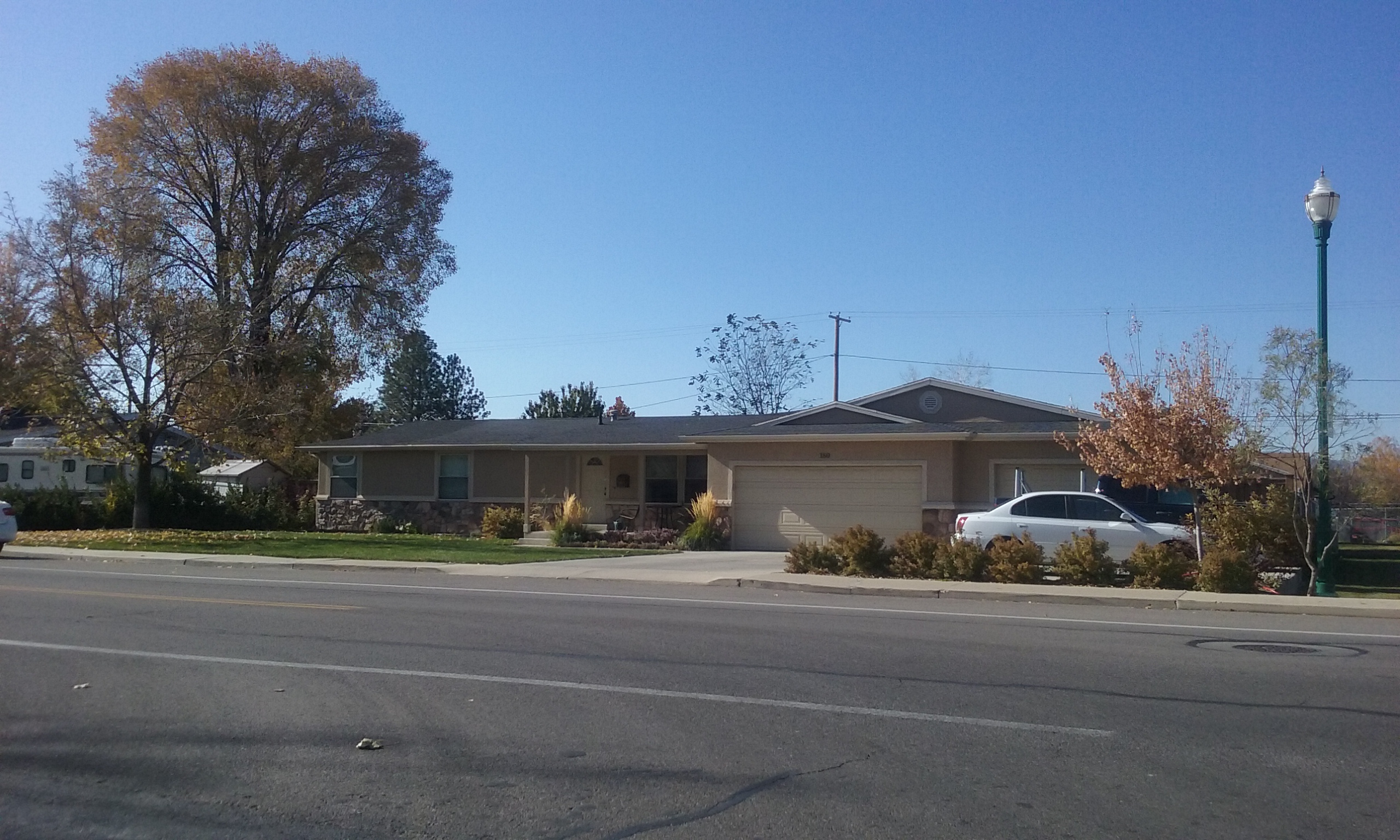
| Property Address: 180 S 800 WEST - OREM |
|
| Mailing Address: 180 S 800 W OREM, UT 84058-5351 |
|
| Acreage: 0.532295 |
|
| Last Document:
192142-2020
|
|
| Subdivision Map Filing |
|
| Taxing Description:
LOT 1, PLAT K, RIDGEWOOD ESTATES SUB AREA 0.532 AC.
*Taxing description NOT FOR LEGAL DOCUMENTS
|
|
- Owner Names
- Value History
- Tax History
- Location
- Photos
- Documents
- Aerial Image
| |
----- Real Estate Values ----- |
---Improvements--- |
---Greenbelt--- |
Total |
| Year |
Com |
Res |
Agr |
Tot |
Com |
Res |
Agr |
Tot |
Land |
Homesite |
Tot |
Market Value |
| 2023 |
$0 |
$318,700 |
$0 |
$318,700 |
$0 |
$264,800 |
$0 |
$264,800 |
$0 |
$0 |
$0 |
$583,500 |
| 2022 |
$0 |
$339,800 |
$0 |
$339,800 |
$0 |
$252,900 |
$0 |
$252,900 |
$0 |
$0 |
$0 |
$592,700 |
| 2021 |
$0 |
$261,400 |
$0 |
$261,400 |
$0 |
$197,600 |
$0 |
$197,600 |
$0 |
$0 |
$0 |
$459,000 |
| Year |
General Taxes |
Adjustments |
Net Taxes |
Fees |
Payments |
Tax Balance* |
Balance Due |
Tax District |
| 2023 |
$2,441.92 |
($173.11) |
$2,268.81 |
$0.00 |
|
$0.00
|
$0.00 |
090 - OREM CITY |
| 2022 |
$2,560.29 |
$0.00 |
$2,560.29 |
$0.00 |
|
$0.00
|
$0.00 |
090 - OREM CITY |
| 2021 |
$2,380.10 |
$0.00 |
$2,380.10 |
$0.00 |
|
$0.00
|
$0.00 |
090 - OREM CITY |
* Note: Original tax amount (Does not include applicable interest and/or fees).
| Entry # |
Date |
Recorded |
Type |
Party1 (Grantor) |
Party2 (Grantee) |
| 62692-2023 |
09/20/2023 |
09/22/2023 |
S PLAT |
RUSSELL, DONALD JAMES JR & KATHRYN LYNN TEE (ET AL) |
RIDGEWOOD ESTATES PLAT L |
| 192142-2020 |
09/30/2020 |
12/03/2020 |
S PLAT |
RUSSELL, DONALD JAMES JR & KATHRYN LYNN TEE (ET AL) |
RIDGEWOOD ESTATES PLAT K |
Main Menu Comments or Concerns on Value/Appraisal - Assessor's Office
Documents/Owner/Parcel information - Recorder's Office
Address Change for Tax Notice
This page was created on 2/9/2025 7:15:47 AM |