Property Information
mobile view
| Serial Number: 51:702:0004 |
Serial Life: 2022... |
|
|
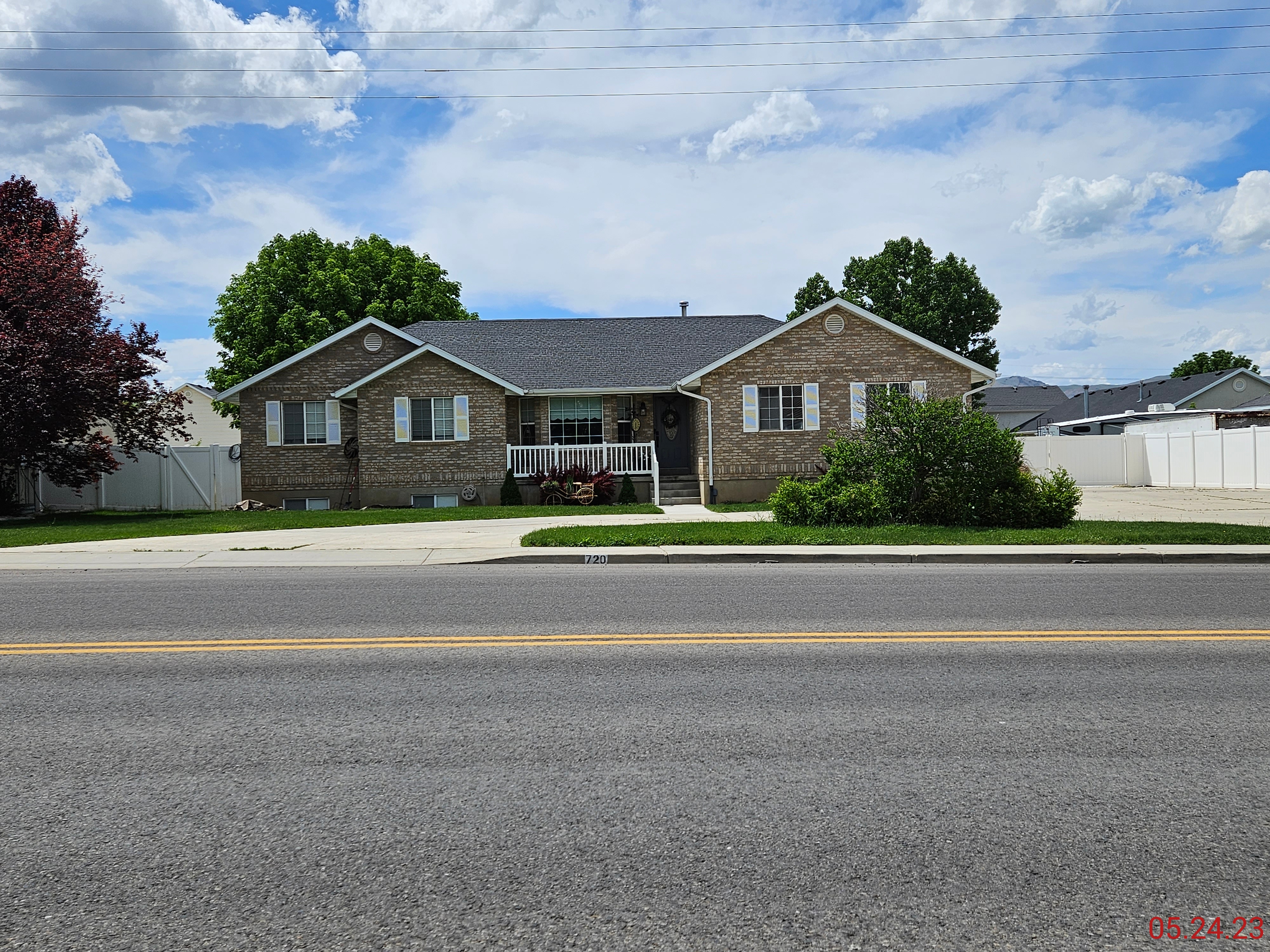 Total Photos: 2
|
| |
|
|
| Property Address: 720 S 600 EAST - PAYSON |
|
| Mailing Address: 720 S 600 E PAYSON, UT 84651-2956 |
|
| Acreage: 0.780906 |
|
| Last Document:
178564-2021
|
|
| Subdivision Map Filing |
|
| Taxing Description:
LOT 4, PLAT B, RED POINT SUB AREA 0.781 AC.
*Taxing description NOT FOR LEGAL DOCUMENTS
|
|
- Owner Names
- Value History
- Tax History
- Location
- Photos
- Documents
- Aerial Image
| |
----- Real Estate Values ----- |
---Improvements--- |
---Greenbelt--- |
Total |
| Year |
Com |
Res |
Agr |
Tot |
Com |
Res |
Agr |
Tot |
Land |
Homesite |
Tot |
Market Value |
| 2024 |
$0 |
$175,100 |
$0 |
$175,100 |
$0 |
$360,900 |
$0 |
$360,900 |
$0 |
$0 |
$0 |
$536,000 |
| 2023 |
$0 |
$175,000 |
$0 |
$175,000 |
$0 |
$370,600 |
$0 |
$370,600 |
$0 |
$0 |
$0 |
$545,600 |
| 2022 |
$0 |
$186,600 |
$0 |
$186,600 |
$0 |
$335,300 |
$0 |
$335,300 |
$0 |
$0 |
$0 |
$521,900 |
| Year |
General Taxes |
Adjustments |
Net Taxes |
Fees |
Payments |
Tax Balance* |
Balance Due |
Tax District |
| 2025 |
$0.00 |
$0.00 |
$0.00 |
$0.00 |
|
$0.00
|
$0.00 |
170 - PAYSON CITY |
| 2024 |
$2,896.70 |
$0.00 |
$2,896.70 |
$0.00 |
|
$0.00
|
$0.00 |
170 - PAYSON CITY |
| 2023 |
$2,940.48 |
$0.00 |
$2,940.48 |
$0.00 |
|
$0.00
|
$0.00 |
170 - PAYSON CITY |
| 2022 |
$2,859.83 |
$0.00 |
$2,859.83 |
$0.00 |
|
$0.00
|
$0.00 |
170 - PAYSON CITY |
* Note: Original tax amount (Does not include applicable interest and/or fees).
| Entry # |
Date |
Recorded |
Type |
Party1 (Grantor) |
Party2 (Grantee) |
| 420-2025 |
12/30/2024 |
01/03/2025 |
RSUBTEE |
MORTGAGE ELECTRONIC REGISTRATION SYSTEMS INC (ET AL) |
BARNEY, THOMAS J & APRIL D |
| 178564-2021 |
04/21/2021 |
10/20/2021 |
S PLAT |
BROWN, WILLIAM MICHAEL (ET AL) |
RED POINT PLAT B |
Main Menu Comments or Concerns on Value/Appraisal - Assessor's Office
Documents/Owner/Parcel information - Recorder's Office
Address Change for Tax Notice
This page was created on 1/21/2025 8:22:18 PM |
