Property Information
mobile view
| Serial Number: 52:082:0015 |
Serial Life: 1981... |
|
|
 Total Photos: 2
|
| |
|
|
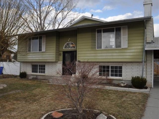
| Property Address: 650 N 420 WEST - LEHI |
|
| Mailing Address: 650 N 420 W LEHI, UT 84043-1545 |
|
| Acreage: 0.18 |
|
| Last Document:
127226-2007
|
|
| Subdivision Map Filing |
|
| Taxing Description:
A PORTION OF LOTS 16 & 17, STEWART SUB. PLAT A: COM. 30 FT S FR NE COR LOT 16, STEWART SUB, SITUATED IN SEC 8, T 5 S, R 1 E, SLM; W 112.79 FT; S 70 FT; E 115.60 FT M OR L TO PT 40 FT S OF NE COR OF LOT 17 OF SD STEWART SUB; N 24' E 24.55 FT; N 3 18' W 45.45 FT M OR L TO BEG.
*Taxing description NOT FOR LEGAL DOCUMENTS
|
|
- Owner Names
- Value History
- Tax History
- Location
- Photos
- Documents
- Aerial Image
| 2021... |
|
COUSER, SCOTT |
|
| 2021... |
|
HULL, JAMES EDWARD |
|
| 2012-2020 |
|
HEITZ, JOHN W |
|
| 2012-2020 |
|
HEITZ, SARA A |
|
| 2011 |
|
FANNIE MAE |
|
| 2008-2010 |
|
SAMPSON, LISA |
|
| 2008-2010 |
|
SAMPSON, RYAN J |
|
| 1983-2007 |
|
SAMPSON, GARRY RAY |
|
| 1983-2007 |
|
SAMPSON, KAY S |
|
| 1981-1982 |
|
SAMPSON, GARRY RAY |
|
| 1981-1982 |
|
SAMPSON, KAY S |
|
| |
----- Real Estate Values ----- |
---Improvements--- |
---Greenbelt--- |
Total |
| Year |
Com |
Res |
Agr |
Tot |
Com |
Res |
Agr |
Tot |
Land |
Homesite |
Tot |
Market Value |
| 2024 |
$0 |
$196,500 |
$0 |
$196,500 |
$0 |
$305,700 |
$0 |
$305,700 |
$0 |
$0 |
$0 |
$502,200 |
| 2023 |
$0 |
$190,800 |
$0 |
$190,800 |
$0 |
$319,900 |
$0 |
$319,900 |
$0 |
$0 |
$0 |
$510,700 |
| 2022 |
$0 |
$165,900 |
$0 |
$165,900 |
$0 |
$307,400 |
$0 |
$307,400 |
$0 |
$0 |
$0 |
$473,300 |
| 2021 |
$0 |
$103,700 |
$0 |
$103,700 |
$0 |
$250,500 |
$0 |
$250,500 |
$0 |
$0 |
$0 |
$354,200 |
| 2020 |
$0 |
$96,000 |
$0 |
$96,000 |
$0 |
$234,100 |
$0 |
$234,100 |
$0 |
$0 |
$0 |
$330,100 |
| 2019 |
$0 |
$96,000 |
$0 |
$96,000 |
$0 |
$203,600 |
$0 |
$203,600 |
$0 |
$0 |
$0 |
$299,600 |
| 2018 |
$0 |
$87,800 |
$0 |
$87,800 |
$0 |
$177,000 |
$0 |
$177,000 |
$0 |
$0 |
$0 |
$264,800 |
| 2017 |
$0 |
$72,000 |
$0 |
$72,000 |
$0 |
$171,600 |
$0 |
$171,600 |
$0 |
$0 |
$0 |
$243,600 |
| 2016 |
$0 |
$57,300 |
$0 |
$57,300 |
$0 |
$149,700 |
$0 |
$149,700 |
$0 |
$0 |
$0 |
$207,000 |
| 2015 |
$0 |
$54,700 |
$0 |
$54,700 |
$0 |
$130,200 |
$0 |
$130,200 |
$0 |
$0 |
$0 |
$184,900 |
| 2014 |
$0 |
$54,900 |
$0 |
$54,900 |
$0 |
$113,200 |
$0 |
$113,200 |
$0 |
$0 |
$0 |
$168,100 |
| 2013 |
$0 |
$45,600 |
$0 |
$45,600 |
$0 |
$98,400 |
$0 |
$98,400 |
$0 |
$0 |
$0 |
$144,000 |
| 2012 |
$0 |
$37,700 |
$0 |
$37,700 |
$0 |
$100,500 |
$0 |
$100,500 |
$0 |
$0 |
$0 |
$138,200 |
| 2011 |
$0 |
$29,900 |
$0 |
$29,900 |
$0 |
$109,700 |
$0 |
$109,700 |
$0 |
$0 |
$0 |
$139,600 |
| 2010 |
$0 |
$30,000 |
$0 |
$30,000 |
$0 |
$121,386 |
$0 |
$121,386 |
$0 |
$0 |
$0 |
$151,386 |
| 2009 |
$0 |
$75,000 |
$0 |
$75,000 |
$0 |
$85,800 |
$0 |
$85,800 |
$0 |
$0 |
$0 |
$160,800 |
| 2008 |
$0 |
$79,800 |
$0 |
$79,800 |
$0 |
$88,000 |
$0 |
$88,000 |
$0 |
$0 |
$0 |
$167,800 |
| 2007 |
$0 |
$82,300 |
$0 |
$82,300 |
$0 |
$90,700 |
$0 |
$90,700 |
$0 |
$0 |
$0 |
$173,000 |
| 2006 |
$0 |
$47,700 |
$0 |
$47,700 |
$0 |
$85,900 |
$0 |
$85,900 |
$0 |
$0 |
$0 |
$133,600 |
| 2005 |
$0 |
$45,000 |
$0 |
$45,000 |
$0 |
$81,000 |
$0 |
$81,000 |
$0 |
$0 |
$0 |
$126,000 |
| 2004 |
$0 |
$42,879 |
$0 |
$42,879 |
$0 |
$91,436 |
$0 |
$91,436 |
$0 |
$0 |
$0 |
$134,315 |
| 2003 |
$0 |
$42,879 |
$0 |
$42,879 |
$0 |
$91,436 |
$0 |
$91,436 |
$0 |
$0 |
$0 |
$134,315 |
| 2002 |
$0 |
$42,879 |
$0 |
$42,879 |
$0 |
$91,436 |
$0 |
$91,436 |
$0 |
$0 |
$0 |
$134,315 |
| 2001 |
$0 |
$42,879 |
$0 |
$42,879 |
$0 |
$91,436 |
$0 |
$91,436 |
$0 |
$0 |
$0 |
$134,315 |
| 2000 |
$0 |
$40,074 |
$0 |
$40,074 |
$0 |
$85,494 |
$0 |
$85,494 |
$0 |
$0 |
$0 |
$125,568 |
| 1999 |
$0 |
$40,074 |
$0 |
$40,074 |
$0 |
$85,494 |
$0 |
$85,494 |
$0 |
$0 |
$0 |
$125,568 |
| 1998 |
$0 |
$35,464 |
$0 |
$35,464 |
$0 |
$75,658 |
$0 |
$75,658 |
$0 |
$0 |
$0 |
$111,122 |
| 1997 |
$0 |
$35,464 |
$0 |
$35,464 |
$0 |
$75,658 |
$0 |
$75,658 |
$0 |
$0 |
$0 |
$111,122 |
| 1996 |
$0 |
$31,749 |
$0 |
$31,749 |
$0 |
$67,733 |
$0 |
$67,733 |
$0 |
$0 |
$0 |
$99,482 |
| 1995 |
$0 |
$28,863 |
$0 |
$28,863 |
$0 |
$67,733 |
$0 |
$67,733 |
$0 |
$0 |
$0 |
$96,596 |
| 1994 |
$0 |
$16,879 |
$0 |
$16,879 |
$0 |
$54,623 |
$0 |
$54,623 |
$0 |
$0 |
$0 |
$71,502 |
| 1993 |
$0 |
$16,879 |
$0 |
$16,879 |
$0 |
$54,623 |
$0 |
$54,623 |
$0 |
$0 |
$0 |
$71,502 |
| 1992 |
$0 |
$15,485 |
$0 |
$15,485 |
$0 |
$50,113 |
$0 |
$50,113 |
$0 |
$0 |
$0 |
$65,598 |
| 1991 |
$0 |
$13,583 |
$0 |
$13,583 |
$0 |
$39,240 |
$0 |
$39,240 |
$0 |
$0 |
$0 |
$52,823 |
| 1990 |
$0 |
$13,583 |
$0 |
$13,583 |
$0 |
$39,240 |
$0 |
$39,240 |
$0 |
$0 |
$0 |
$52,823 |
| 1989 |
$0 |
$13,583 |
$0 |
$13,583 |
$0 |
$39,240 |
$0 |
$39,240 |
$0 |
$0 |
$0 |
$52,823 |
| 1988 |
$0 |
$13,583 |
$0 |
$13,583 |
$0 |
$42,498 |
$0 |
$42,498 |
$0 |
$0 |
$0 |
$56,081 |
| 1987 |
$0 |
$13,583 |
$0 |
$13,583 |
$0 |
$38,625 |
$0 |
$38,625 |
$0 |
$0 |
$0 |
$52,208 |
| 1986 |
$0 |
$13,584 |
$0 |
$13,584 |
$0 |
$38,626 |
$0 |
$38,626 |
$0 |
$0 |
$0 |
$52,210 |
| 1985 |
$0 |
$13,583 |
$0 |
$13,583 |
$0 |
$38,625 |
$0 |
$38,625 |
$0 |
$0 |
$0 |
$52,208 |
| 1984 |
$0 |
$13,717 |
$0 |
$13,717 |
$0 |
$39,017 |
$0 |
$39,017 |
$0 |
$0 |
$0 |
$52,734 |
| Year |
General Taxes |
Adjustments |
Net Taxes |
Fees |
Payments |
Tax Balance* |
Balance Due |
Tax District |
| 2025 |
$0.00 |
$0.00 |
$0.00 |
$0.00 |
|
$0.00
|
$0.00 |
010 - LEHI CITY |
| 2024 |
$2,360.21 |
$0.00 |
$2,360.21 |
$0.00 |
|
$0.00
|
$0.00 |
010 - LEHI CITY |
| 2023 |
$2,210.56 |
$0.00 |
$2,210.56 |
$0.00 |
|
$0.00
|
$0.00 |
010 - LEHI CITY |
| 2022 |
$2,113.24 |
$0.00 |
$2,113.24 |
$0.00 |
|
$0.00
|
$0.00 |
010 - LEHI CITY |
| 2021 |
$1,901.93 |
$0.00 |
$1,901.93 |
$0.00 |
|
$0.00
|
$0.00 |
010 - LEHI CITY |
| 2020 |
$1,793.22 |
$0.00 |
$1,793.22 |
$0.00 |
|
$0.00
|
$0.00 |
010 - LEHI CITY |
| 2019 |
$1,565.57 |
$0.00 |
$1,565.57 |
$0.00 |
|
$0.00
|
$0.00 |
010 - LEHI CITY |
| 2018 |
$1,463.68 |
$0.00 |
$1,463.68 |
$0.00 |
|
$0.00
|
$0.00 |
010 - LEHI CITY |
| 2017 |
$1,392.99 |
$0.00 |
$1,392.99 |
$0.00 |
|
$0.00
|
$0.00 |
010 - LEHI CITY |
| 2016 |
$1,275.80 |
$0.00 |
$1,275.80 |
$0.00 |
|
$0.00
|
$0.00 |
010 - LEHI CITY |
| 2015 |
$1,200.51 |
$0.00 |
$1,200.51 |
$0.00 |
|
$0.00
|
$0.00 |
010 - LEHI CITY |
| 2014 |
$1,097.90 |
$0.00 |
$1,097.90 |
$0.00 |
|
$0.00
|
$0.00 |
010 - LEHI CITY |
| 2013 |
$1,019.78 |
$0.00 |
$1,019.78 |
$0.00 |
|
$0.00
|
$0.00 |
010 - LEHI CITY |
| 2012 |
$1,005.92 |
$0.00 |
$1,005.92 |
$0.00 |
|
$0.00
|
$0.00 |
010 - LEHI CITY |
| 2011 |
$1,009.66 |
$0.00 |
$1,009.66 |
$0.00 |
|
$0.00
|
$0.00 |
010 - LEHI CITY |
| 2010 |
$1,027.70 |
$0.00 |
$1,027.70 |
$0.00 |
|
$0.00
|
$0.00 |
010 - LEHI CITY |
| 2009 |
$969.83 |
$0.00 |
$969.83 |
$0.00 |
|
$0.00
|
$0.00 |
010 - LEHI CITY |
| 2008 |
$957.88 |
$0.00 |
$957.88 |
$0.00 |
|
$0.00
|
$0.00 |
010 - LEHI CITY |
| 2007 |
$961.30 |
$0.00 |
$961.30 |
$0.00 |
|
$0.00
|
$0.00 |
010 - LEHI CITY |
| 2006 |
$818.93 |
$0.00 |
$818.93 |
$0.00 |
|
$0.00
|
$0.00 |
010 - LEHI CITY |
| 2005 |
$871.79 |
$0.00 |
$871.79 |
$0.00 |
|
$0.00
|
$0.00 |
010 - LEHI CITY |
| 2004 |
$916.32 |
$0.00 |
$916.32 |
$0.00 |
|
$0.00
|
$0.00 |
010 - LEHI CITY |
| 2003 |
$904.43 |
$0.00 |
$904.43 |
$0.00 |
|
$0.00
|
$0.00 |
010 - LEHI CITY |
| 2002 |
$826.93 |
$0.00 |
$826.93 |
$0.00 |
|
$0.00
|
$0.00 |
010 - LEHI CITY |
| 2001 |
$823.24 |
$0.00 |
$823.24 |
$0.00 |
|
$0.00
|
$0.00 |
010 - LEHI CITY |
| 2000 |
$780.90 |
$0.00 |
$780.90 |
$0.00 |
|
$0.00
|
$0.00 |
010 - LEHI CITY |
| 1999 |
$751.68 |
$0.00 |
$751.68 |
$0.00 |
|
$0.00
|
$0.00 |
010 - LEHI CITY |
| 1998 |
$639.53 |
$0.00 |
$639.53 |
$0.00 |
|
$0.00
|
$0.00 |
010 - LEHI CITY |
| 1997 |
$633.48 |
$0.00 |
$633.48 |
$0.00 |
|
$0.00
|
$0.00 |
010 - LEHI CITY |
| 1996 |
$532.32 |
$0.00 |
$532.32 |
$0.00 |
|
$0.00
|
$0.00 |
010 - LEHI CITY |
| 1995 |
$577.45 |
$0.00 |
$577.45 |
$0.00 |
|
$0.00
|
$0.00 |
010 - LEHI CITY |
| 1994 |
$682.75 |
$0.00 |
$682.75 |
$0.00 |
|
$0.00
|
$0.00 |
010 - LEHI CITY |
| 1993 |
$608.19 |
$0.00 |
$608.19 |
$0.00 |
|
$0.00
|
$0.00 |
010 - LEHI CITY |
| 1992 |
$555.19 |
$0.00 |
$555.19 |
$0.00 |
|
$0.00
|
$0.00 |
010 - LEHI CITY |
| 1991 |
$473.55 |
$0.00 |
$473.55 |
$0.00 |
|
$0.00
|
$0.00 |
010 - LEHI CITY |
| 1990 |
$460.01 |
$0.00 |
$460.01 |
$0.00 |
|
$0.00
|
$0.00 |
010 - LEHI CITY |
| 1989 |
$474.40 |
$0.00 |
$474.40 |
$0.00 |
|
$0.00
|
$0.00 |
010 - LEHI CITY |
| 1988 |
$503.96 |
$0.00 |
$503.96 |
$0.00 |
|
$0.00
|
$0.00 |
010 - LEHI CITY |
| 1987 |
$466.55 |
$0.00 |
$466.55 |
$0.00 |
|
$0.00
|
$0.00 |
010 - LEHI CITY |
| 1986 |
$461.10 |
$0.00 |
$461.10 |
$0.00 |
|
$0.00
|
$0.00 |
010 - LEHI CITY |
| 1985 |
$466.43 |
$0.00 |
$466.43 |
$0.00 |
|
$0.00
|
$0.00 |
010 - LEHI CITY |
| 1984 |
$459.73 |
$0.00 |
$459.73 |
$0.00 |
|
$0.00
|
$0.00 |
010 - LEHI CITY |
* Note: Original tax amount (Does not include applicable interest and/or fees).
| Entry # |
Date |
Recorded |
Type |
Party1 (Grantor) |
Party2 (Grantee) |
| 191635-2020 |
11/12/2020 |
12/03/2020 |
REC |
FIRST AMERICAN TITLE INSURANCE COMPANY TEE |
HEITZ, JOHN W & SARA A |
| 191634-2020 |
11/12/2020 |
12/03/2020 |
SUB TEE |
MORTGAGE ELECTRONIC REGISTRATION SYSTEMS INC |
FIRST AMERICAN TITLE INSURANCE COMPANY SUBTEE |
| 166503-2020 |
10/23/2020 |
10/23/2020 |
WD |
HULL, JAMES EDWARD (ET AL) |
HULL, JAMES EDWARD (ET AL) |
| 166502-2020 |
10/23/2020 |
10/23/2020 |
D TR |
HULL, JAMES EDWARD (ET AL) |
INTERCAP LENDING INC |
| 166501-2020 |
10/23/2020 |
10/23/2020 |
WD |
HEITZ, JOHN W & SARA A |
HULL, JAMES EDWARD (ET AL) |
| 159747-2020 |
10/07/2020 |
10/14/2020 |
REC |
REAL ADVANTAGE TITLE INSURANCE AGENCY TEE |
HEITZ, JOHN W & SARA A |
| 147213-2020 |
09/18/2020 |
09/25/2020 |
TR D |
HEITZ, JOHN W & SARA A |
CAB FUNDING AND REAL ESTATE LLC |
| 145772-2020 |
09/16/2020 |
09/23/2020 |
TR D |
HEITZ, JOHN W & SARAH A |
SANDY HEALTH AND REHAB |
| 43437-2016 |
05/09/2016 |
05/17/2016 |
REC |
RIVERS, ROD TEE |
HEITZ, JOHN W & SARA A |
| 43436-2016 |
05/04/2016 |
05/17/2016 |
SUB TEE |
MORTGAGE ELECTRONIC REGISTRATION SYSTEMS INC |
RIVERS, ROD SUCTEE |
| 24960-2016 |
03/21/2016 |
03/25/2016 |
D TR |
HEITZ, JOHN W & SARA A |
FLAGSHIP FINANCIAL GROUP LLC |
| 65470-2013 |
05/03/2013 |
07/08/2013 |
REC |
MORAN, KEVIN P TEE |
HEITZ, JOHN W & SARA A |
| 65469-2013 |
06/21/2013 |
07/08/2013 |
SUB TEE |
MORTGAGE ELECTRONIC REGISTRATION SYSTEMS INC |
MORAN, KEVIN P SUCTEE |
| 95012-2012 |
10/27/2012 |
10/31/2012 |
D TR |
HEITZ, JOHN W & SARA A |
SUN WEST MORTGAGE COMPANY INC |
| 88271-2011 |
10/25/2011 |
12/08/2011 |
REC |
WELLS FARGO FINANCIAL NATIONAL BANK TEE |
HEITZ, JOHN W & SARA A |
| 88270-2011 |
10/25/2011 |
12/08/2011 |
SUB TEE |
MORTGAGE ELECTRONIC REGISTRATION SYSTEMS INC |
WELLS FARGO FINANCIAL NATIONAL BANK SUCTEE |
| 74442-2011 |
10/13/2011 |
10/19/2011 |
D TR |
HEITZ, JOHN W & SARA A |
UNITED SECURITY FINANCIAL |
| 34066-2011 |
04/29/2011 |
05/05/2011 |
D TR |
HEITZ, JOHN W & SARA A |
AXIOM FINANCIAL LLC |
| 34065-2011 |
05/02/2011 |
05/05/2011 |
SP WD |
FANNIE MAE AKA (ET AL) |
HEITZ, JOHN W & SARA A |
| 107682-2010 |
12/07/2010 |
12/09/2010 |
TEE D |
BOYCE, DAVID B SUCTEE (ET AL) |
FANNIE MAE |
| 114949-2008 |
10/20/2008 |
10/22/2008 |
CT |
STATE OF UTAH |
WHOM OF INTEREST |
| 107508-2008 |
09/30/2008 |
09/30/2008 |
RESOL |
BOARD OF COUNTY COMMISSIONERS UTAH COUNTY |
WHOM OF INTEREST |
| 127228-2007 |
08/27/2007 |
08/29/2007 |
D TR |
SAMPSON, RYAN J & LISA |
HIGHPOINT FINANCIAL CORPORATION |
| 127227-2007 |
08/27/2007 |
08/29/2007 |
D TR |
SAMPSON, RYAN J & LISA |
FIRST HORIZON HOME LOANS |
| 127226-2007 |
08/27/2007 |
08/29/2007 |
WD |
SAMPSON, GARRY R & KAY S (ET AL) |
SAMPSON, RYAN J & LISA |
| 25344-2003 |
02/05/2003 |
02/20/2003 |
REC |
ZIONS FIRST NATIONAL BANK TEE |
RUFF, LYNN W & JOY D |
| 30844-1996 |
04/09/1996 |
04/12/1996 |
D TR |
SAMPSON, GARRY RAY & KAY S |
ZIONS FIRST NATIONAL BANK |
| 76846-1995 |
11/06/1995 |
11/08/1995 |
RESOL |
UTAH COUNTY COMMISSIONERS |
WHOM OF INTEREST |
| 1184-1991 |
01/11/1991 |
01/11/1991 |
REC |
EMPIRE LAND TITLE COMPANY TEE |
YATES, ROBERT & DOUG (ET AL) |
Main Menu Comments or Concerns on Value/Appraisal - Assessor's Office
Documents/Owner/Parcel information - Recorder's Office
Address Change for Tax Notice
This page was created on 3/3/2025 6:02:59 PM |
