Property Information
mobile view
| Serial Number: 54:331:0100 |
Serial Life: 2017... |
|
|
Total Photos: 2
|
| |
|
|
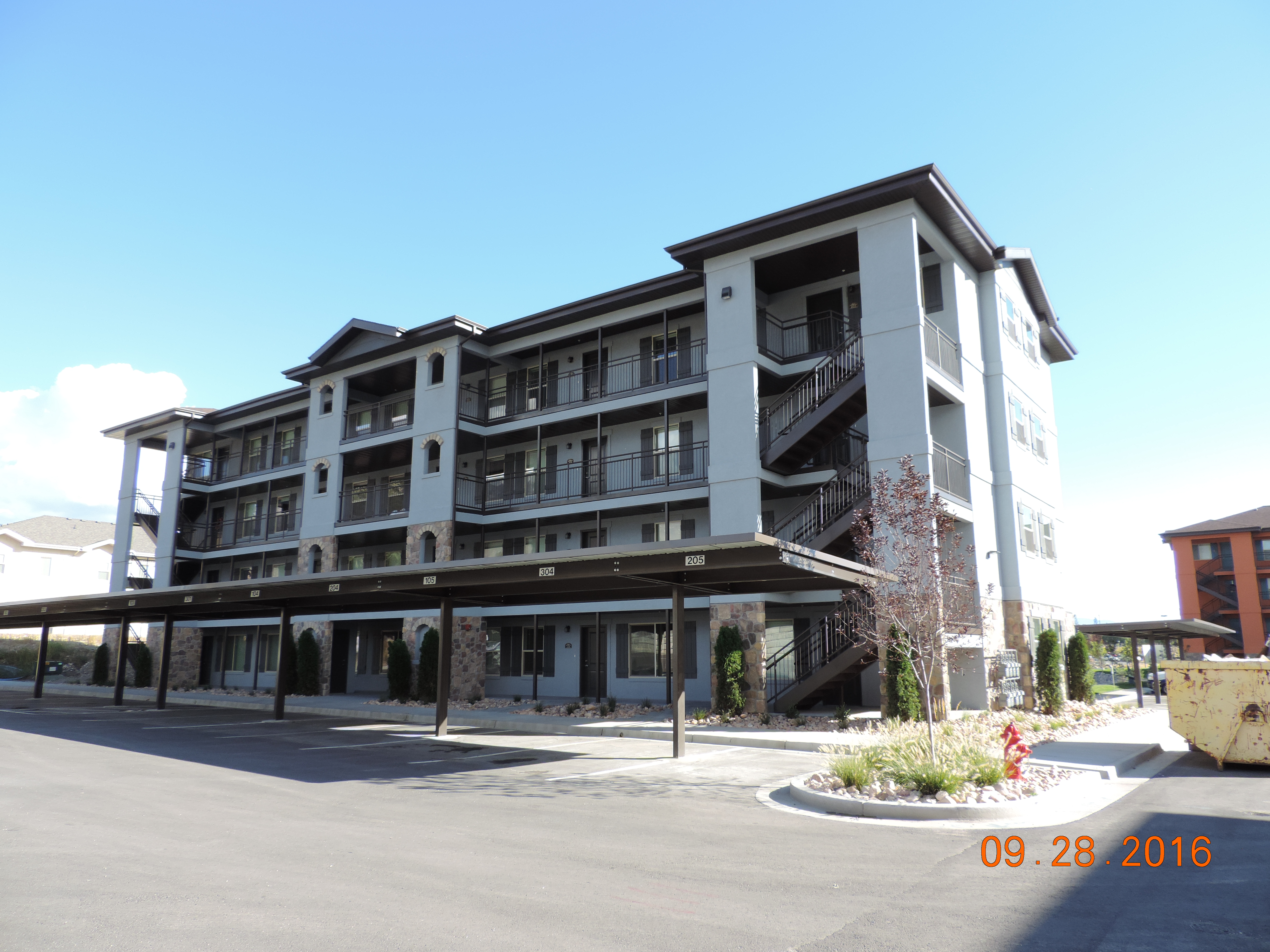
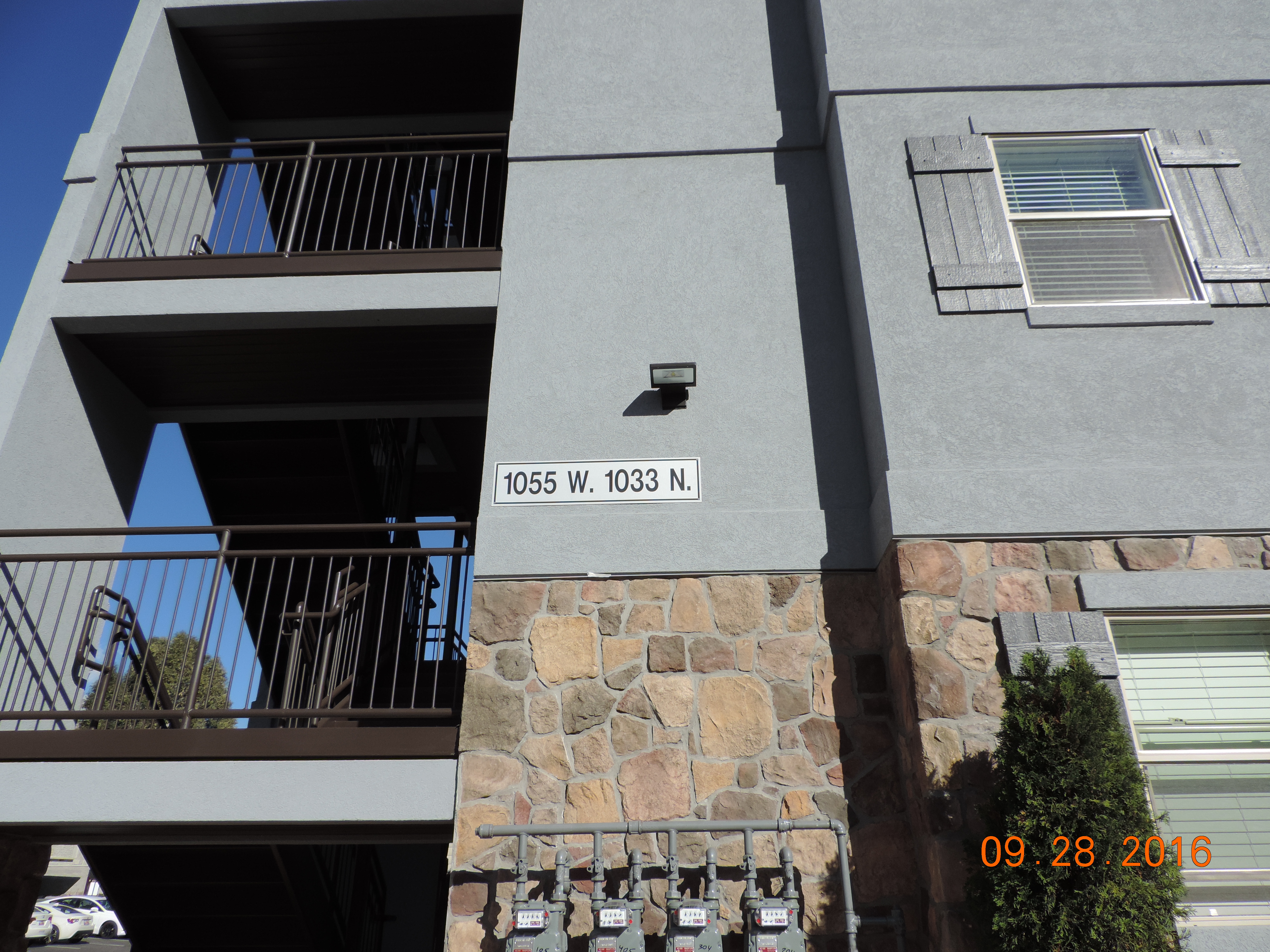
| Property Address: 1055 W 1033 NORTH Unit# 104 - OREM |
|
| Mailing Address: 116 E HIDDEN RIDGE LN MAPLETON, UT 84664 |
|
| Acreage: 0.017971 |
|
| Last Document:
107994-2016
|
|
| Subdivision Map Filing |
|
| Taxing Description:
UNIT 100, BUILDING 6, VILLA D'ESTE , PHASE 5 CONDOS. AREA 0.018 AC.
*Taxing description NOT FOR LEGAL DOCUMENTS
|
|
- Owner Names
- Value History
- Tax History
- Location
- Photos
- Documents
- Aerial Image
| |
----- Real Estate Values ----- |
---Improvements--- |
---Greenbelt--- |
Total |
| Year |
Com |
Res |
Agr |
Tot |
Com |
Res |
Agr |
Tot |
Land |
Homesite |
Tot |
Market Value |
| 2024 |
$0 |
$28,500 |
$0 |
$28,500 |
$0 |
$227,600 |
$0 |
$227,600 |
$0 |
$0 |
$0 |
$256,100 |
| 2023 |
$0 |
$27,700 |
$0 |
$27,700 |
$0 |
$221,700 |
$0 |
$221,700 |
$0 |
$0 |
$0 |
$249,400 |
| 2022 |
$0 |
$24,200 |
$0 |
$24,200 |
$0 |
$217,900 |
$0 |
$217,900 |
$0 |
$0 |
$0 |
$242,100 |
| 2021 |
$0 |
$22,800 |
$0 |
$22,800 |
$0 |
$167,100 |
$0 |
$167,100 |
$0 |
$0 |
$0 |
$189,900 |
| 2020 |
$0 |
$20,300 |
$0 |
$20,300 |
$0 |
$149,200 |
$0 |
$149,200 |
$0 |
$0 |
$0 |
$169,500 |
| 2019 |
$0 |
$24,500 |
$0 |
$24,500 |
$0 |
$138,500 |
$0 |
$138,500 |
$0 |
$0 |
$0 |
$163,000 |
| 2018 |
$0 |
$21,000 |
$0 |
$21,000 |
$0 |
$133,000 |
$0 |
$133,000 |
$0 |
$0 |
$0 |
$154,000 |
| 2017 |
$0 |
$18,000 |
$0 |
$18,000 |
$0 |
$121,000 |
$0 |
$121,000 |
$0 |
$0 |
$0 |
$139,000 |
| Year |
General Taxes |
Adjustments |
Net Taxes |
Fees |
Payments |
Tax Balance* |
Balance Due |
Tax District |
| 2025 |
$0.00 |
$0.00 |
$0.00 |
$0.00 |
|
$0.00
|
$0.00 |
090 - OREM CITY |
| 2024 |
$0.00 |
$0.00 |
$0.00 |
$0.00 |
|
$0.00
|
$0.00 |
090 - OREM CITY |
| 2023 |
$1,043.73 |
$0.00 |
$1,043.73 |
$0.00 |
|
$0.00
|
$0.00 |
090 - OREM CITY |
| 2022 |
$1,045.80 |
$0.00 |
$1,045.80 |
$0.00 |
|
$0.00
|
$0.00 |
090 - OREM CITY |
| 2021 |
$984.71 |
$0.00 |
$984.71 |
$0.00 |
|
$0.00
|
$0.00 |
090 - OREM CITY |
| 2020 |
$894.31 |
$0.00 |
$894.31 |
$0.00 |
|
$0.00
|
$0.00 |
090 - OREM CITY |
| 2019 |
$827.02 |
$0.00 |
$827.02 |
$0.00 |
|
$0.00
|
$0.00 |
090 - OREM CITY |
| 2018 |
$817.78 |
$0.00 |
$817.78 |
$0.00 |
|
$0.00
|
$0.00 |
090 - OREM CITY |
| 2017 |
$757.85 |
$0.00 |
$757.85 |
$0.00 |
|
$0.00
|
$0.00 |
090 - OREM CITY |
* Note: Original tax amount (Does not include applicable interest and/or fees).
| Entry # |
Date |
Recorded |
Type |
Party1 (Grantor) |
Party2 (Grantee) |
| 31681-2021 |
02/19/2021 |
02/19/2021 |
REC |
ALTABANK TEE |
RG DEVELOPMENT LC |
| 92198-2020 |
07/01/2020 |
07/01/2020 |
REC |
BARTLETT TITLE INSURANCE AGENCY INC TEE |
CARTER CONSTRUCTION COMPANY |
| 92197-2020 |
07/01/2020 |
07/01/2020 |
REC |
BARTLETT TITLE INSURANCE AGENCY INC TEE |
NORTHGATE VILLAGE DEVELOPMENT LC |
| 27620-2019 |
04/03/2019 |
04/03/2019 |
REC |
UNITED WEST TITLE INSURANCE AGENCY INC TEE |
CLYDE-HOPEFUL LLC |
| 75245-2018 |
08/09/2018 |
08/09/2018 |
P REC |
BANK OF AMERICAN FORK TEE |
RG DEVELOMENT LC |
| 16019-2017 |
02/14/2017 |
02/15/2017 |
MOD AGR |
RG DEVELOPMENT LC |
BANK OF AMERICAN FORK |
| 5524-2017 |
01/18/2017 |
01/19/2017 |
D TR |
RG DEVELOPMENT LC BY (ET AL) |
BANK OF AMERICAN FORK DIV OF (ET AL) |
| 107994-2016 |
10/11/2016 |
10/27/2016 |
WD |
CLYDE-HOPEFUL LLC ATA (ET AL) |
RG DEVELOPMENT LC |
| 101791-2016 |
10/12/2016 |
10/13/2016 |
C DECL |
CLYDE HOPEFUL LLC |
WHOM OF INTEREST |
| 80290-2016 |
04/27/2016 |
08/23/2016 |
ADECCON |
CLYDE HOPEFUL L L C |
WHOM OF INTEREST |
| 80289-2016 |
08/19/2016 |
08/23/2016 |
C PLAT |
CLYDE HOPEFUL LLC |
VILLA D'ESTE CONDO PHASE 5 |
Main Menu Comments or Concerns on Value/Appraisal - Assessor's Office
Documents/Owner/Parcel information - Recorder's Office
Address Change for Tax Notice
This page was created on 7/13/2024 2:48:03 PM |