Property Information
mobile view
| Serial Number: 55:378:0019 |
Serial Life: 2000... |
|
|
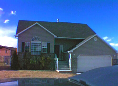 Total Photos: 1
|
| |
|
|
| Property Address: 915 N 150 WEST - AMERICAN FORK |
|
| Mailing Address: 915 N 150 W AMERICAN FORK, UT 84003-2710 |
|
| Acreage: 0.233969 |
|
| Last Document:
93686-2005
|
|
| Subdivision Map Filing |
|
| Taxing Description:
LOT 1, PLAT A, WEST MEADOWS SUBDV. AREA 0.233 AC. ALSO COM N 1158.66 FT & W 490.35 FT FR S 1/4 COR. SEC. 11, T5S, R1E, SLB&M.; S 57 DEG 5' 22" E 1.1 FT; S 88 DEG 50' 43" E 106.21 FT; ALONG A CURVE TO R (CHORD BEARS: N 13 DEG 2' 3" W .32 FT, RADIUS = 298.61 FT); N 88 DEG 41' 57" W 107.07 FT TO BEG. AREA 0.001 AC. TOTAL AREA .234 AC.
*Taxing description NOT FOR LEGAL DOCUMENTS
|
|
- Owner Names
- Value History
- Tax History
- Location
- Photos
- Documents
- Aerial Image
| |
----- Real Estate Values ----- |
---Improvements--- |
---Greenbelt--- |
Total |
| Year |
Com |
Res |
Agr |
Tot |
Com |
Res |
Agr |
Tot |
Land |
Homesite |
Tot |
Market Value |
| 2024 |
$0 |
$216,000 |
$0 |
$216,000 |
$0 |
$273,900 |
$0 |
$273,900 |
$0 |
$0 |
$0 |
$489,900 |
| 2023 |
$0 |
$215,900 |
$0 |
$215,900 |
$0 |
$279,900 |
$0 |
$279,900 |
$0 |
$0 |
$0 |
$495,800 |
| 2022 |
$0 |
$227,800 |
$0 |
$227,800 |
$0 |
$285,600 |
$0 |
$285,600 |
$0 |
$0 |
$0 |
$513,400 |
| 2021 |
$0 |
$162,700 |
$0 |
$162,700 |
$0 |
$214,700 |
$0 |
$214,700 |
$0 |
$0 |
$0 |
$377,400 |
| 2020 |
$0 |
$145,300 |
$0 |
$145,300 |
$0 |
$197,000 |
$0 |
$197,000 |
$0 |
$0 |
$0 |
$342,300 |
| 2019 |
$0 |
$134,400 |
$0 |
$134,400 |
$0 |
$186,000 |
$0 |
$186,000 |
$0 |
$0 |
$0 |
$320,400 |
| 2018 |
$0 |
$127,100 |
$0 |
$127,100 |
$0 |
$168,000 |
$0 |
$168,000 |
$0 |
$0 |
$0 |
$295,100 |
| 2017 |
$0 |
$109,000 |
$0 |
$109,000 |
$0 |
$168,000 |
$0 |
$168,000 |
$0 |
$0 |
$0 |
$277,000 |
| 2016 |
$0 |
$74,800 |
$0 |
$74,800 |
$0 |
$174,800 |
$0 |
$174,800 |
$0 |
$0 |
$0 |
$249,600 |
| 2015 |
$0 |
$74,800 |
$0 |
$74,800 |
$0 |
$152,900 |
$0 |
$152,900 |
$0 |
$0 |
$0 |
$227,700 |
| 2014 |
$0 |
$69,000 |
$0 |
$69,000 |
$0 |
$144,000 |
$0 |
$144,000 |
$0 |
$0 |
$0 |
$213,000 |
| 2013 |
$0 |
$56,900 |
$0 |
$56,900 |
$0 |
$141,100 |
$0 |
$141,100 |
$0 |
$0 |
$0 |
$198,000 |
| 2012 |
$0 |
$45,000 |
$0 |
$45,000 |
$0 |
$152,700 |
$0 |
$152,700 |
$0 |
$0 |
$0 |
$197,700 |
| 2011 |
$0 |
$45,000 |
$0 |
$45,000 |
$0 |
$158,800 |
$0 |
$158,800 |
$0 |
$0 |
$0 |
$203,800 |
| 2010 |
$0 |
$50,000 |
$0 |
$50,000 |
$0 |
$158,007 |
$0 |
$158,007 |
$0 |
$0 |
$0 |
$208,007 |
| 2009 |
$0 |
$92,200 |
$0 |
$92,200 |
$0 |
$118,500 |
$0 |
$118,500 |
$0 |
$0 |
$0 |
$210,700 |
| 2008 |
$0 |
$104,800 |
$0 |
$104,800 |
$0 |
$130,300 |
$0 |
$130,300 |
$0 |
$0 |
$0 |
$235,100 |
| 2007 |
$0 |
$110,300 |
$0 |
$110,300 |
$0 |
$137,200 |
$0 |
$137,200 |
$0 |
$0 |
$0 |
$247,500 |
| 2006 |
$0 |
$49,100 |
$0 |
$49,100 |
$0 |
$147,100 |
$0 |
$147,100 |
$0 |
$0 |
$0 |
$196,200 |
| 2005 |
$0 |
$49,118 |
$0 |
$49,118 |
$0 |
$105,417 |
$0 |
$105,417 |
$0 |
$0 |
$0 |
$154,535 |
| 2004 |
$0 |
$49,118 |
$0 |
$49,118 |
$0 |
$105,417 |
$0 |
$105,417 |
$0 |
$0 |
$0 |
$154,535 |
| 2003 |
$0 |
$49,118 |
$0 |
$49,118 |
$0 |
$105,417 |
$0 |
$105,417 |
$0 |
$0 |
$0 |
$154,535 |
| 2002 |
$0 |
$49,118 |
$0 |
$49,118 |
$0 |
$105,417 |
$0 |
$105,417 |
$0 |
$0 |
$0 |
$154,535 |
| 2001 |
$0 |
$49,118 |
$0 |
$49,118 |
$0 |
$105,417 |
$0 |
$105,417 |
$0 |
$0 |
$0 |
$154,535 |
| 2000 |
$0 |
$45,905 |
$0 |
$45,905 |
$0 |
$73,450 |
$0 |
$73,450 |
$0 |
$0 |
$0 |
$119,355 |
| Year |
General Taxes |
Adjustments |
Net Taxes |
Fees |
Payments |
Tax Balance* |
Balance Due |
Tax District |
| 2025 |
$0.00 |
$0.00 |
$0.00 |
$0.00 |
|
$0.00
|
$0.00 |
060 - AMERICAN FORK CITY |
| 2024 |
$2,425.01 |
$0.00 |
$2,425.01 |
$0.00 |
|
$0.00
|
$0.00 |
060 - AMERICAN FORK CITY |
| 2023 |
$2,314.87 |
$0.00 |
$2,314.87 |
$0.00 |
|
$0.00
|
$0.00 |
060 - AMERICAN FORK CITY |
| 2022 |
$2,428.95 |
$0.00 |
$2,428.95 |
$0.00 |
|
$0.00
|
$0.00 |
060 - AMERICAN FORK CITY |
| 2021 |
$2,078.40 |
$0.00 |
$2,078.40 |
$0.00 |
|
$0.00
|
$0.00 |
060 - AMERICAN FORK CITY |
| 2020 |
$1,943.65 |
$0.00 |
$1,943.65 |
$0.00 |
|
$0.00
|
$0.00 |
060 - AMERICAN FORK CITY |
| 2019 |
$1,759.03 |
$0.00 |
$1,759.03 |
$0.00 |
|
$0.00
|
$0.00 |
060 - AMERICAN FORK CITY |
| 2018 |
$1,694.46 |
$0.00 |
$1,694.46 |
$0.00 |
|
$0.00
|
$0.00 |
060 - AMERICAN FORK CITY |
| 2017 |
$1,620.85 |
$0.00 |
$1,620.85 |
$0.00 |
|
$0.00
|
$0.00 |
060 - AMERICAN FORK CITY |
| 2016 |
$1,571.99 |
$0.00 |
$1,571.99 |
$0.00 |
|
$0.00
|
$0.00 |
060 - AMERICAN FORK CITY |
| 2015 |
$1,511.09 |
$0.00 |
$1,511.09 |
$0.00 |
|
$0.00
|
$0.00 |
060 - AMERICAN FORK CITY |
| 2014 |
$1,432.98 |
$0.00 |
$1,432.98 |
$0.00 |
|
$0.00
|
$0.00 |
060 - AMERICAN FORK CITY |
| 2013 |
$1,435.52 |
$0.00 |
$1,435.52 |
$0.00 |
|
$0.00
|
$0.00 |
060 - AMERICAN FORK CITY |
| 2012 |
$1,462.27 |
$0.00 |
$1,462.27 |
$0.00 |
|
$0.00
|
$0.00 |
060 - AMERICAN FORK CITY |
| 2011 |
$1,503.35 |
$0.00 |
$1,503.35 |
$0.00 |
|
$0.00
|
$0.00 |
060 - AMERICAN FORK CITY |
| 2010 |
$1,440.46 |
$0.00 |
$1,440.46 |
$0.00 |
|
$0.00
|
$0.00 |
060 - AMERICAN FORK CITY |
| 2009 |
$1,343.22 |
$0.00 |
$1,343.22 |
$0.00 |
|
$0.00
|
$0.00 |
060 - AMERICAN FORK CITY |
| 2008 |
$1,408.91 |
$0.00 |
$1,408.91 |
$0.00 |
|
$0.00
|
$0.00 |
060 - AMERICAN FORK CITY |
| 2007 |
$1,425.77 |
$0.00 |
$1,425.77 |
$0.00 |
|
$0.00
|
$0.00 |
060 - AMERICAN FORK CITY |
| 2006 |
$1,215.17 |
$0.00 |
$1,215.17 |
$0.00 |
|
$0.00
|
$0.00 |
060 - AMERICAN FORK CITY |
| 2005 |
$1,035.40 |
$0.00 |
$1,035.40 |
$0.00 |
|
$0.00
|
$0.00 |
060 - AMERICAN FORK CITY |
| 2004 |
$1,039.48 |
$0.00 |
$1,039.48 |
$0.00 |
|
$0.00
|
$0.00 |
060 - AMERICAN FORK CITY |
| 2003 |
$1,022.82 |
$0.00 |
$1,022.82 |
$0.00 |
|
$0.00
|
$0.00 |
060 - AMERICAN FORK CITY |
| 2002 |
$943.94 |
$0.00 |
$943.94 |
$0.00 |
|
$0.00
|
$0.00 |
060 - AMERICAN FORK CITY |
| 2001 |
$908.93 |
$0.00 |
$908.93 |
$0.00 |
|
$0.00
|
$0.00 |
060 - AMERICAN FORK CITY |
| 2000 |
$729.66 |
$0.00 |
$729.66 |
$0.00 |
|
$0.00
|
$0.00 |
060 - AMERICAN FORK CITY |
* Note: Original tax amount (Does not include applicable interest and/or fees).
| Entry # |
Date |
Recorded |
Type |
Party1 (Grantor) |
Party2 (Grantee) |
| 87416-2021 |
05/10/2021 |
05/10/2021 |
RSUBTEE |
WELLS FARGO BANK (ET AL) |
FADELY, KELLY A |
| 79782-2021 |
04/23/2021 |
04/28/2021 |
D TR |
FADELY, KELLY A |
WELLS FARGO BANK |
| 85716-2019 |
08/27/2019 |
09/03/2019 |
RSUBTEE |
MORTGAGE ELECTRONIC REGISTRATION SYSTEMS INC (ET AL) |
FADELY, KELLY A |
| 71260-2019 |
07/25/2019 |
07/30/2019 |
D TR |
FADELY, KELLY A & JOSEPH |
WELLS FARGO BANK |
| 67272-2013 |
05/30/2013 |
07/12/2013 |
RSUBTEE |
MORTGAGE ELECTRONIC REGISTRATION SYSTEMS INC (ET AL) |
CRANDALL, KELLY A |
| 42487-2013 |
04/22/2013 |
05/01/2013 |
D TR |
FADELY, KELLY A |
NATIONSTAR MORTGAGE LLC |
| 42486-2013 |
04/22/2013 |
05/01/2013 |
QCD |
FADELY, KELLY A FKA (ET AL) |
FADELY, KELLY A |
| 114949-2008 |
10/20/2008 |
10/22/2008 |
CT |
STATE OF UTAH |
WHOM OF INTEREST |
| 107508-2008 |
09/30/2008 |
09/30/2008 |
RESOL |
BOARD OF COUNTY COMMISSIONERS UTAH COUNTY |
WHOM OF INTEREST |
| 145785-2005 |
11/15/2005 |
12/16/2005 |
C D TR |
CRANDALL, KELLY A |
PRIME LENDING |
| 108999-2005 |
09/12/2005 |
09/27/2005 |
RSUBTEE |
WASHINGTON MUTUAL BANK (ET AL) |
RICH, LANCE D JR & L MICHELLE |
| 93687-2005 |
08/18/2005 |
08/24/2005 |
D TR |
CRANDALL, KELLY A |
PRIME LENDING |
| 93686-2005 |
08/18/2005 |
08/24/2005 |
WD |
RICH, LANCE S JR & L MICHELLE |
CRANDALL, KELLY A |
| 195819-2003 |
12/02/2003 |
12/12/2003 |
REC |
PRINCIPAL LIFE INSURANCE COMPANY TEE |
RICH, LANCE S & MICHELLE |
| 195818-2003 |
12/02/2003 |
12/12/2003 |
SUB TEE |
PRINCIPAL RESIDENTIAL MORTGAGE INC |
PRINCIPAL LIFE INSURANCE COMPANY SUCTEE |
| 177248-2003 |
10/31/2003 |
11/05/2003 |
D TR |
RICH, LANCE S JR & L MICHELLE |
WASHINGTON MUTUAL BANK |
| 16437-2003 |
11/25/2002 |
02/03/2003 |
AS |
DIRECT MORTGAGE CORPORATION |
PRINCIPAL RESIDENTIAL MORTGAGE INC |
| 3586-2003 |
12/06/2002 |
01/09/2003 |
REC |
LAWYERS TITLE INSURANCE CORPORATION TEE |
RICH, LANCE S JR & L MICHELLE |
| 3585-2003 |
12/06/2002 |
01/09/2003 |
SUB TEE |
AMERIQUEST MORTGAGE COMPANY |
LAWYERS TITLE INSURANCE CORPORATION SUBTEE |
| 139902-2002 |
11/12/2002 |
11/20/2002 |
D TR |
RICH, LANCE S & L MICHELLE |
DIRECT MORTGAGE CORPORATION |
| 17680-2001 |
02/14/2001 |
02/27/2001 |
REC |
LUNDBERG, J SCOTT TEE |
RICH, LANCE S JR & L MICHELLE |
| 17679-2001 |
01/29/2001 |
02/27/2001 |
SUB TEE |
WELLS FARGO HOME MORTGAGE INC FKA (ET AL) |
LUNDBERG, J SCOTT SUCTEE |
| 3170-2001 |
11/30/2000 |
01/12/2001 |
REC |
ASSOCIATED TITLE COMPANY TEE |
RICH, LANCE S JR & L MICHELLE |
| 86513-2000 |
10/25/2000 |
10/31/2000 |
D TR |
RICH, LANCE S JR & L MICHELLE |
AMERIQUEST MORTGAGE COMPANY |
| 101889-1999 |
09/13/1999 |
09/16/1999 |
BLA |
F D M H ROBERTS TRUST (ET AL) |
RICH, LANCE S JR & L MICHELLE (ET AL) |
Main Menu Comments or Concerns on Value/Appraisal - Assessor's Office
Documents/Owner/Parcel information - Recorder's Office
Address Change for Tax Notice
This page was created on 4/1/2025 1:06:25 PM |