Property Information
mobile view
| Serial Number: 55:830:0011 |
Serial Life: 2018... |
|
|
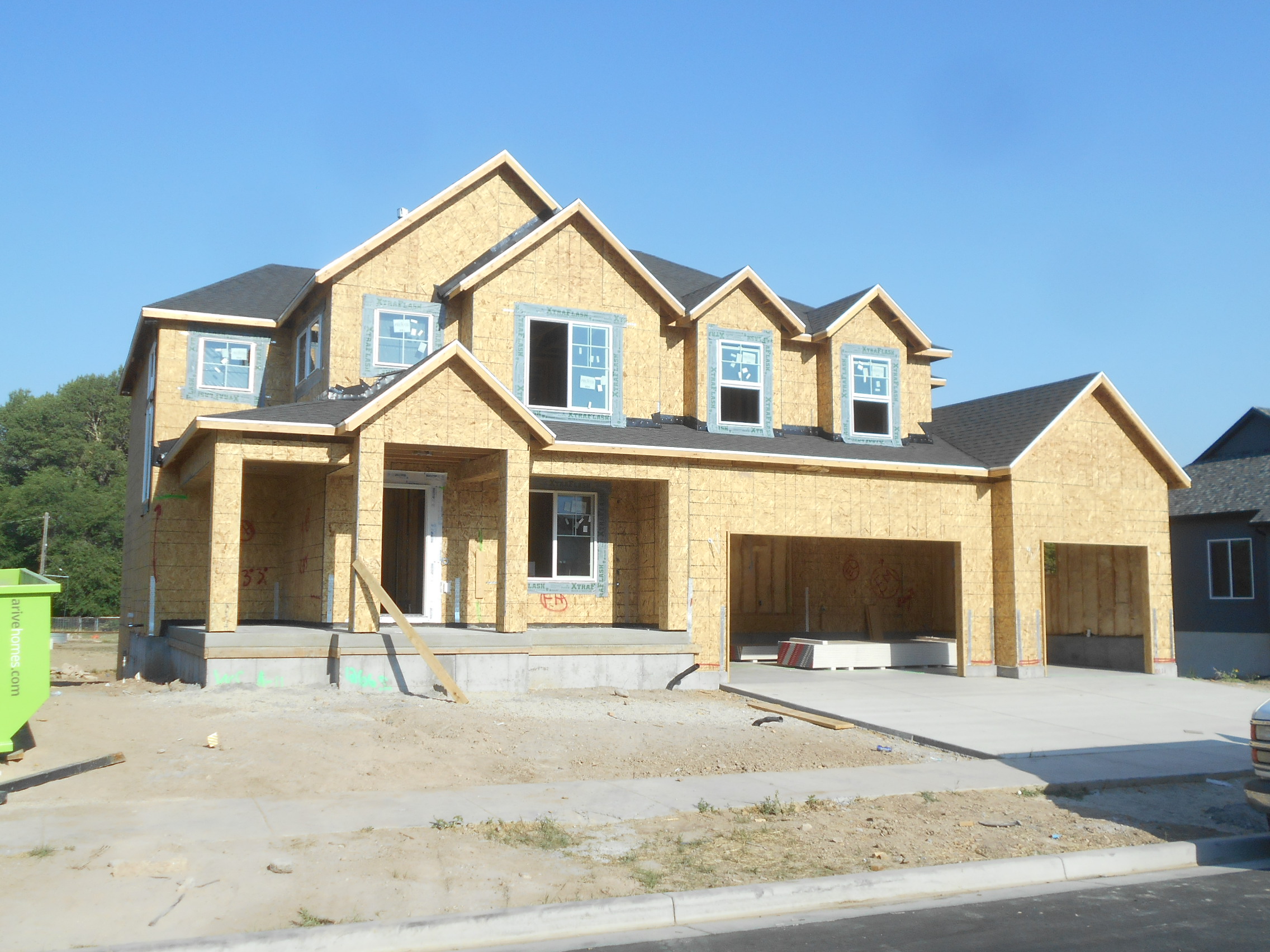 Total Photos: 1
|
| |
|
|
| Property Address: 1266 S 1450 WEST - MAPLETON |
|
| Mailing Address: 1266 S 1450 W MAPLETON, UT 84664 |
|
| Acreage: 0.335275 |
|
| Last Document:
146760-2020
|
|
| Subdivision Map Filing |
|
| Taxing Description:
LOT 11, PLAT A, WHITING COVE SUB AREA 0.335 AC.
*Taxing description NOT FOR LEGAL DOCUMENTS
|
|
- Owner Names
- Value History
- Tax History
- Location
- Photos
- Documents
- Aerial Image
| |
----- Real Estate Values ----- |
---Improvements--- |
---Greenbelt--- |
Total |
| Year |
Com |
Res |
Agr |
Tot |
Com |
Res |
Agr |
Tot |
Land |
Homesite |
Tot |
Market Value |
| 2024 |
$0 |
$284,100 |
$0 |
$284,100 |
$0 |
$523,600 |
$0 |
$523,600 |
$0 |
$0 |
$0 |
$807,700 |
| 2023 |
$0 |
$284,100 |
$0 |
$284,100 |
$0 |
$570,000 |
$0 |
$570,000 |
$0 |
$0 |
$0 |
$854,100 |
| 2022 |
$0 |
$302,900 |
$0 |
$302,900 |
$0 |
$505,000 |
$0 |
$505,000 |
$0 |
$0 |
$0 |
$807,900 |
| 2021 |
$0 |
$195,400 |
$0 |
$195,400 |
$0 |
$444,100 |
$0 |
$444,100 |
$0 |
$0 |
$0 |
$639,500 |
| 2020 |
$0 |
$172,900 |
$0 |
$172,900 |
$0 |
$0 |
$0 |
$0 |
$0 |
$0 |
$0 |
$172,900 |
| 2019 |
$0 |
$172,900 |
$0 |
$172,900 |
$0 |
$0 |
$0 |
$0 |
$0 |
$0 |
$0 |
$172,900 |
| 2018 |
$0 |
$147,700 |
$0 |
$147,700 |
$0 |
$0 |
$0 |
$0 |
$0 |
$0 |
$0 |
$147,700 |
| Year |
General Taxes |
Adjustments |
Net Taxes |
Fees |
Payments |
Tax Balance* |
Balance Due |
Tax District |
| 2025 |
$0.00 |
$0.00 |
$0.00 |
$0.00 |
|
$0.00
|
$0.00 |
140 - MAPLETON CITY |
| 2024 |
$0.00 |
$0.00 |
$0.00 |
$0.00 |
|
$0.00
|
$0.00 |
140 - MAPLETON CITY |
| 2023 |
$4,765.19 |
$0.00 |
$4,765.19 |
$0.00 |
|
$0.00
|
$0.00 |
140 - MAPLETON CITY |
| 2022 |
$4,558.54 |
$0.00 |
$4,558.54 |
$0.00 |
|
$0.00
|
$0.00 |
140 - MAPLETON CITY |
| 2021 |
$4,273.11 |
$0.00 |
$4,273.11 |
$0.00 |
|
$0.00
|
$0.00 |
140 - MAPLETON CITY |
| 2020 |
$2,171.62 |
$0.00 |
$2,171.62 |
$0.00 |
|
$0.00
|
$0.00 |
140 - MAPLETON CITY |
| 2019 |
$2,127.53 |
$0.00 |
$2,127.53 |
$0.00 |
|
$0.00
|
$0.00 |
140 - MAPLETON CITY |
| 2018 |
$1,909.17 |
$0.00 |
$1,909.17 |
$0.00 |
|
$0.00
|
$0.00 |
140 - MAPLETON CITY |
* Note: Original tax amount (Does not include applicable interest and/or fees).
| Entry # |
Date |
Recorded |
Type |
Party1 (Grantor) |
Party2 (Grantee) |
| 70755-2023 |
10/27/2023 |
10/27/2023 |
RSUBTEE |
SMITH, RANDALL (ET AL) |
WHITING, SHERRI LYNN |
| 123153-2022 |
11/19/2022 |
12/07/2022 |
RSUBTEE |
MORTGAGE ELECTRONIC REGISTRATION SYSTEMS INC (ET AL) |
YOUNG, ROBB THOMAS |
| 55341-2022 |
05/04/2022 |
05/04/2022 |
QCD |
YOUNG, ROBB THOMAS |
YOUNG, ROBB THOMAS & ANGELA CLARK TEE (ET AL) |
| 153107-2021 |
07/15/2021 |
09/02/2021 |
WATER D |
YOUNG, ROBB THOMAS |
SHUMWAY, RICKY (ET AL) |
| 197388-2020 |
12/08/2020 |
12/11/2020 |
REC |
PROVO LAND TITLE COMPANY TEE |
ARIVE HOMES LLC |
| 146761-2020 |
09/22/2020 |
09/24/2020 |
D TR |
YOUNG, ROBB THOMAS |
SECURITYNATIONAL MORTGAGE COMPANY |
| 146760-2020 |
09/17/2020 |
09/24/2020 |
WD |
ARIVE HOMES LLC |
YOUNG, ROBB THOMAS |
| 138543-2020 |
09/09/2020 |
09/11/2020 |
D TR |
ARIVE HOMES LLC BY (ET AL) |
SECURITY NATIONAL LIFE INSURANCE COMPANY |
| 138542-2020 |
09/11/2020 |
09/11/2020 |
WD |
DIAMOND CREEK DEVELOPMENT LLC |
ARIVE HOMES LLC |
| 138541-2020 |
09/09/2020 |
09/11/2020 |
WD |
SNA-WC LLC BY (ET AL) |
DIAMOND CREEK DEVELOPMENT LLC |
| 81262-2020 |
06/11/2020 |
06/12/2020 |
WD |
WHITING COVE DEVELOPMENT LLC |
SNA-WC LLC |
| 80516-2020 |
04/09/2020 |
06/11/2020 |
GEO HAZ |
SCOVILLE, MIKE |
WHOM OF INTEREST |
| 78044-2020 |
06/05/2020 |
06/08/2020 |
REC |
CENTRAL BANK TEE |
WHITING COVE DEVELOPMENT LLC |
| 27123-2018 |
03/13/2018 |
03/22/2018 |
REC |
CENTRAL BANK TEE |
WHITE TIE MANAGEMENT LLC |
| 10255-2018 |
01/31/2018 |
01/31/2018 |
D TR |
WHITING COVE DEVELOPMENT LLC |
CENTRAL BANK |
| 21080-2017 |
12/20/2016 |
03/02/2017 |
REC |
CENTRAL BANK TEE |
WHITE TIE MANAGEMENT LLC |
| 6981-2017 |
01/10/2017 |
01/24/2017 |
S PLAT |
WHITING COVE DEVELOPMENT LLC |
WHITING COVE FINAL PLAT A |
Main Menu Comments or Concerns on Value/Appraisal - Assessor's Office
Documents/Owner/Parcel information - Recorder's Office
Address Change for Tax Notice
This page was created on 8/14/2024 10:15:34 AM |