Property Information
mobile view
| Serial Number: 55:959:0001 |
Serial Life: 2023... |
|
|
 Total Photos: 1
|
| |
|
|
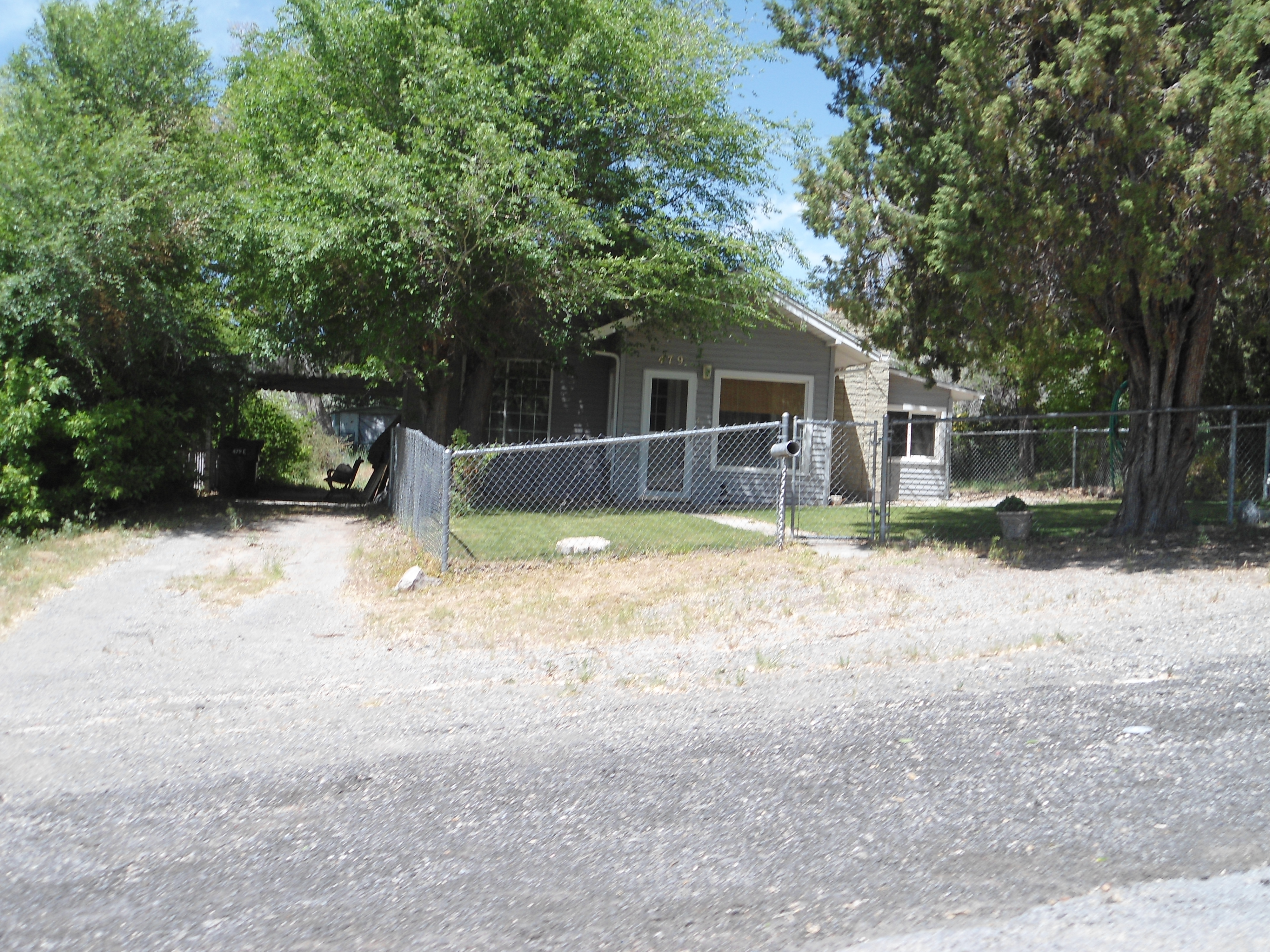
| Property Address: 479 E 300 NORTH - PAYSON |
|
| Mailing Address: 479 E 300 N PAYSON, UT 84651-1911 |
|
| Acreage: 0.239495 |
|
| Last Document:
46106-2024
|
|
| Subdivision Map Filing |
|
| Taxing Description:
LOT 1, PLAT A, WHATCOTT SUB AREA 0.239 AC.
*Taxing description NOT FOR LEGAL DOCUMENTS
|
|
- Owner Names
- Value History
- Tax History
- Location
- Photos
- Documents
- Aerial Image
| |
----- Real Estate Values ----- |
---Improvements--- |
---Greenbelt--- |
Total |
| Year |
Com |
Res |
Agr |
Tot |
Com |
Res |
Agr |
Tot |
Land |
Homesite |
Tot |
Market Value |
| 2024 |
$0 |
$110,300 |
$0 |
$110,300 |
$0 |
$168,100 |
$0 |
$168,100 |
$0 |
$0 |
$0 |
$278,400 |
| 2023 |
$0 |
$110,300 |
$0 |
$110,300 |
$0 |
$169,300 |
$0 |
$169,300 |
$0 |
$0 |
$0 |
$279,600 |
| Year |
General Taxes |
Adjustments |
Net Taxes |
Fees |
Payments |
Tax Balance* |
Balance Due |
Tax District |
| 2025 |
$0.00 |
$0.00 |
$0.00 |
$0.00 |
|
$0.00
|
$0.00 |
170 - PAYSON CITY |
| 2024 |
$1,504.56 |
$0.00 |
$1,504.56 |
$0.00 |
|
$0.00
|
$0.00 |
170 - PAYSON CITY |
| 2023 |
$1,506.89 |
$0.00 |
$1,506.89 |
$0.00 |
|
$0.00
|
$0.00 |
170 - PAYSON CITY |
* Note: Original tax amount (Does not include applicable interest and/or fees).
| Entry # |
Date |
Recorded |
Type |
Party1 (Grantor) |
Party2 (Grantee) |
| 46106-2024 |
06/26/2024 |
07/11/2024 |
C WD |
WHATCOTT, TRACE & BROOKE |
INGRAM, TRISTAN & KELSEA (ET AL) |
| 15986-2024 |
03/13/2024 |
03/13/2024 |
CORR AF |
GRIFFITHS & TURNER / GT TITLE SERVICES INC |
WHOM OF INTEREST |
| 27128-2022 |
02/24/2022 |
03/02/2022 |
S PLAT |
COYLE, MARYANN R (ET AL) |
WHATCOTT PLAT A |
Main Menu Comments or Concerns on Value/Appraisal - Assessor's Office
Documents/Owner/Parcel information - Recorder's Office
Address Change for Tax Notice
This page was created on 2/22/2025 10:20:48 PM |