Property Information
mobile view
| Serial Number: 65:525:0038 |
Serial Life: 2018... |
|
|

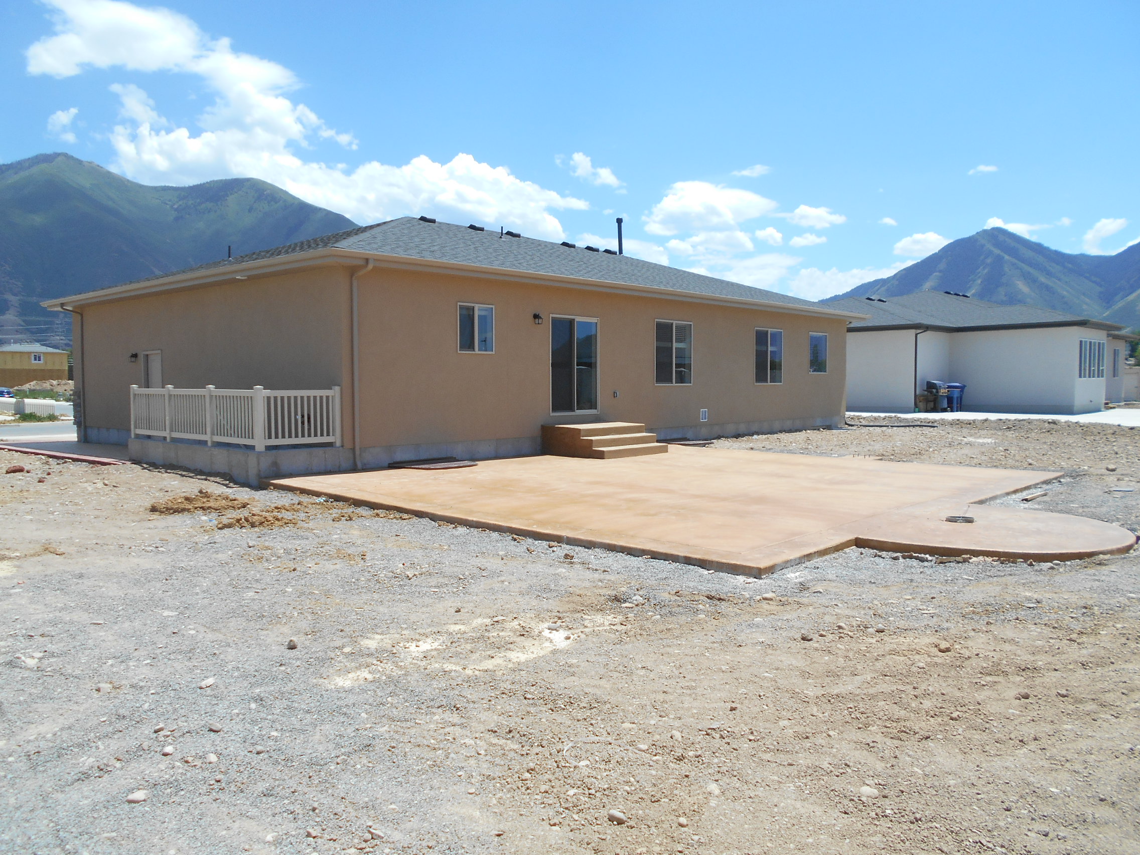
Total Photos: 1
|
| |
|
|
| Property Address: 8 S 2560 EAST - SPANISH FORK |
|
| Mailing Address: 8 S 2560 E SPANISH FORK, UT 84660 |
|
| Acreage: 0.259879 |
|
| Last Document:
64205-2018
|
|
| Subdivision Map Filing |
|
| Taxing Description:
LOT 38, PLAT D, CANYON VISTA ESTATES SUB AREA 0.260 AC.
*Taxing description NOT FOR LEGAL DOCUMENTS
|
|
- Owner Names
- Value History
- Tax History
- Location
- Photos
- Documents
- Aerial Image
| |
----- Real Estate Values ----- |
---Improvements--- |
---Greenbelt--- |
Total |
| Year |
Com |
Res |
Agr |
Tot |
Com |
Res |
Agr |
Tot |
Land |
Homesite |
Tot |
Market Value |
| 2024 |
$0 |
$226,800 |
$0 |
$226,800 |
$0 |
$320,800 |
$0 |
$320,800 |
$0 |
$0 |
$0 |
$547,600 |
| 2023 |
$0 |
$226,800 |
$0 |
$226,800 |
$0 |
$339,400 |
$0 |
$339,400 |
$0 |
$0 |
$0 |
$566,200 |
| 2022 |
$0 |
$241,800 |
$0 |
$241,800 |
$0 |
$310,500 |
$0 |
$310,500 |
$0 |
$0 |
$0 |
$552,300 |
| 2021 |
$0 |
$161,200 |
$0 |
$161,200 |
$0 |
$270,200 |
$0 |
$270,200 |
$0 |
$0 |
$0 |
$431,400 |
| 2020 |
$0 |
$146,500 |
$0 |
$146,500 |
$0 |
$243,400 |
$0 |
$243,400 |
$0 |
$0 |
$0 |
$389,900 |
| 2019 |
$0 |
$133,800 |
$0 |
$133,800 |
$0 |
$220,800 |
$0 |
$220,800 |
$0 |
$0 |
$0 |
$354,600 |
| 2018 |
$0 |
$119,000 |
$0 |
$119,000 |
$0 |
$0 |
$0 |
$0 |
$0 |
$0 |
$0 |
$119,000 |
| Year |
General Taxes |
Adjustments |
Net Taxes |
Fees |
Payments |
Tax Balance* |
Balance Due |
Tax District |
| 2025 |
$0.00 |
$0.00 |
$0.00 |
$0.00 |
|
$0.00
|
$0.00 |
150 - SPANISH FORK CITY |
| 2024 |
$0.00 |
$0.00 |
$0.00 |
$0.00 |
|
$0.00
|
$0.00 |
150 - SPANISH FORK CITY |
| 2023 |
$3,017.87 |
$0.00 |
$3,017.87 |
$0.00 |
|
$0.00
|
$0.00 |
150 - SPANISH FORK CITY |
| 2022 |
$3,001.50 |
$0.00 |
$3,001.50 |
$0.00 |
|
$0.00
|
$0.00 |
150 - SPANISH FORK CITY |
| 2021 |
$2,664.54 |
$0.00 |
$2,664.54 |
$0.00 |
|
$0.00
|
$0.00 |
150 - SPANISH FORK CITY |
| 2020 |
$2,477.05 |
$0.00 |
$2,477.05 |
$0.00 |
|
$0.00
|
$0.00 |
150 - SPANISH FORK CITY |
| 2019 |
$2,141.23 |
$0.00 |
$2,141.23 |
$0.00 |
|
$0.00
|
$0.00 |
150 - SPANISH FORK CITY |
| 2018 |
$1,351.60 |
$0.00 |
$1,351.60 |
$0.00 |
|
$0.00
|
$0.00 |
150 - SPANISH FORK CITY |
* Note: Original tax amount (Does not include applicable interest and/or fees).
| Entry # |
Date |
Recorded |
Type |
Party1 (Grantor) |
Party2 (Grantee) |
| 171020-2020 |
10/27/2020 |
10/29/2020 |
D TR |
ARELLANO, ANNAROSA ELIZABETH |
SECURITYNATIONAL MORTGAGE COMPANY |
| 170977-2020 |
10/29/2020 |
10/29/2020 |
WD |
MINER, KEVIN & BEVERLY JEAN |
ARELLANO, ANNAROSA ELIZABETH |
| 74605-2019 |
08/06/2019 |
08/06/2019 |
REC |
COTTONWOOD TITLE INSURANCE AGENCY INC TEE |
SALISBURY DEVELOPERS INC |
| 105807-2018 |
11/01/2018 |
11/05/2018 |
REC |
COTTONWOOD TITLE INSURANCE AGENCY INC |
SALISBURY DEVELOPERS INC |
| 64205-2018 |
07/05/2018 |
07/09/2018 |
WD |
SALISBURY DEVELOPERS INC |
MINER, KEVIN & BEVERLY JEAN |
| 43484-2018 |
04/23/2018 |
05/09/2018 |
REC |
COTTONWOOD TITLE INSURANCE AGENCY INC TEE |
SALISBURY DEVELOPERS INC |
| 42666-2018 |
05/01/2018 |
05/08/2018 |
P REC |
COTTONWOOD TITLE INSURANCE AGENCY INC TEE |
SALISBURY DEVELOPERS INC |
| 24247-2018 |
03/13/2018 |
03/14/2018 |
D TR |
SALISBURY DEVELOPERS INC |
M & T BANK |
| 122953-2017 |
11/16/2017 |
12/12/2017 |
SUB TEE |
M & T BANK |
COTTONWOOD TITLE INSURANCE AGENCY INC SUCTEE |
| 103799-2017 |
08/02/2017 |
10/19/2017 |
S PLAT |
SALISBURY DEVELOPERS INC |
CANYON VISTA ESTATES PLAT D |
Main Menu Comments or Concerns on Value/Appraisal - Assessor's Office
Documents/Owner/Parcel information - Recorder's Office
Address Change for Tax Notice
This page was created on 8/11/2024 12:03:22 PM |